SE TX / SW LA - Heavy rains this week-Tues. and Fri???

U.S. & Caribbean Weather Discussions and Severe Weather Events

Moderator: S2k Moderators

Forum rules

The posts in this forum are NOT official forecast and should not be used as such. They are just the opinion of the poster and may or may not be backed by sound meteorological data. They are NOT endorsed by any professional institution or STORM2K.

Help Support Storm2K
Message
Author
User avatar
southerngale
Retired Staff
Retired Staff
Posts: 27418
Joined: Thu Oct 10, 2002 1:27 am
Location: Southeast Texas (Beaumont area)

SE TX / SW LA - Heavy rains this week-Tues. and Fri???

#1 Postby southerngale » Fri Jan 19, 2007 6:22 am

It's been raining every day and the ground is already saturated, with a pretty good chance of rain before this possible event as well. We haven't seen the sun in a while either, but there's a rumor floating aruond that perhaps we will by the middle of next week. I hope I recognize it.

Special Weather Statement

SPECIAL WEATHER STATEMENT
NATIONAL WEATHER SERVICE LAKE CHARLES LA
500 AM CST FRI JAN 19 2007

LAZ027>033-041>045-051>055-TXZ180>182-201-215-216-192200-
VERNON-RAPIDES-AVOYELLES-BEAUREGARD-ALLEN-EVANGELINE-ST. LANDRY-
CALCASIEU-JEFFERSON DAVIS-ACADIA-LAFAYETTE-UPPER ST. MARTIN-
CAMERON-VERMILION-IBERIA-ST. MARY-LOWER ST. MARTIN-TYLER-JASPER-
NEWTON-HARDIN-JEFFERSON-ORANGE-
INCLUDING THE CITIES OF...LEESVILLE...ALEXANDRIA...MARKSVILLE...
DERIDDER...OAKDALE...VILLE PLATTE...OPELOUSAS...LAKE CHARLES...
JENNINGS...CROWLEY...LAFAYETTE...ST. MARTINVILLE...CAMERON...
ABBEVILLE...NEW IBERIA...MORGAN CITY...WOODVILLE...JASPER...
NEWTON...LUMBERTON...BEAUMONT/PORT ARTHUR...ORANGE
500 AM CST FRI JAN 19 2007

...SIGNIFICANT RAINFALL EXPECTED LATE SATURDAY INTO SUNDAY...

A SIGNIFICANT UPPER LEVEL TROUGH OF LOW PRESSURE WILL AFFECT THE REGION
THIS WEEKEND. THIS, COUPLED WITH INCREASING GULF MOISTURE, WILL BRING
A GOOD CHANCE OF SHOWERS AND THUNDERSTORMS BY LATE SATURDAY NIGHT
THROUGH SUNDAY AFTERNOON. BECAUSE THE UPPER LEVEL FLOW WILL REMAIN
OUT OF THE SOUTHWEST, THE POSSIBILITY EXISTS FOR FLOODING RAINFALL
FROM TRAINING THUNDERSTORMS. PRELIMINARY STORM TOTALS WILL LIKELY
AVERAGE BETWEEN 2 TO 3 INCHES...WITH ISOLATED AMOUNTS UP TO 5 OR 6
INCHES POSSIBLE.

STAY TUNED TO NOAA WEATHER RADIO AND LOCAL MEDIA OUTLETS FOR
FURTHER UPDATES ON THIS DEVELOPING WEATHER SITUATION.


AREA FORECAST DISCUSSION
NATIONAL WEATHER SERVICE LAKE CHARLES LA
446 AM CST FRI JAN 19 2007

.DISCUSSION...
CLOUDY CONDITIONS WILL CONTINUE THROUGH EARLY NEXT WEEK...AS WE
REMAIN UNDER A PERSISTENT SW FLOW ALOFT. WITH THE EMBEDDED
PERTURBATIONS TO CONTINUE STREAMING OVER THE AREA...THE CHANCE
FOR RAIN AND/OR DRIZZLE WILL CONTINUE THROUGH TONIGHT.

BY SAT...A MORE SIGNIFICANT STORM SYSTEM WILL AFFECT THE REGION
WITH INCREASED MOISTURE AND LIFT. THE GFS IS A BIT FASTER THAN THE
NAM IN BRINGING THE SIGNIFICANT THUNDERSTORMS TO THE REGION...THE
6Z GFS IS STALLING THE ENDING OF THE PRECIPITATION FOR SUN AFTERNOON
AND EVENING FOR MOST OF THE AREA. THIS IS NOT GOOD NEWS...AS THE
GROUND IS COMPLETELY SATURATED. PRELIMINARY STORM TOTALS WILL
LIKELY AVERAGE BETWEEN 2-3 INCHES...WITH ISOLATED AMOUNTS UP TO
5-6 INCHES POSSIBLE.

EXPECT A LINGERING CHANCE OF PRECIPITATION FOR MON AND EARLY
TUE...UNTIL THE FLOW ALOFT FINALLY SHIFTS MORE NW...BRINGING
COOLER AND DRIER AIR INTO THE REGION. HOWEVER...THIS EXTENDED
PORTION OF THE FORECAST IS LOW CONFIDENCE AS SUCCESSIVE GFS RUNS
ARE NOT CONSISTENT.

DML
Last edited by southerngale on Fri Mar 16, 2007 4:06 pm, edited 3 times in total.
0 likes   

User avatar
southerngale
Retired Staff
Retired Staff
Posts: 27418
Joined: Thu Oct 10, 2002 1:27 am
Location: Southeast Texas (Beaumont area)

#2 Postby southerngale » Sat Jan 20, 2007 10:54 am

Hey Frick, do you remember what the sun looks like? I believe you have a similar forecast from the NWS.

Today: A 50 percent chance of showers. Cloudy, with a high near 52. East wind between 10 and 15 mph.

Tonight: Periods of rain and possibly a thunderstorm. Low around 47. East wind 5 to 15 mph becoming northwest. Chance of precipitation is 90%.

Sunday: Rain likely and possibly a thunderstorm. Cloudy, with a high near 56. Northwest wind around 5 mph becoming calm. Chance of precipitation is 70%.

Sunday Night: A 50 percent chance of rain. Mostly cloudy, with a low around 41. Calm wind becoming north around 5 mph.

Monday: A 30 percent chance of rain. Mostly cloudy, with a high near 54. North wind between 5 and 10 mph.

Monday Night: A 50 percent chance of rain. Mostly cloudy, with a low around 38. North wind around 10 mph.

Tuesday: A 50 percent chance of rain. Cloudy, with a high near 49. North wind around 10 mph.

Tuesday Night: Showers likely. Cloudy, with a low around 33. North wind around 10 mph. Chance of precipitation is 60%.

Wednesday: Rain likely. Mostly cloudy, with a high near 54. North wind between 5 and 10 mph. Chance of precipitation is 60%.

At first we were supposed to see the sun on Tuesday or Wednesday. Now it's backed up until Thursday. We'll all have drowned by then!! All of this rain is starting to get annoying...I'm tired of a wet, muddy yard. I want to do something outside without getting muddy.... like walk to my car. lol
Fortunately, a lot of it has been light so there's no flooding issues, at least yet.

Anyway, this is how the NWS morning discussion started... :lol:

.DISCUSSION...

RAIN RAIN GO AWAY...COME AGAIN ANOTHER WEEK TO TWO...PLEASE...
0 likes   

CajunMama
Retired Staff
Retired Staff
Posts: 10791
Joined: Thu Feb 06, 2003 9:57 pm
Location: 30.22N, 92.05W Lafayette, LA

#3 Postby CajunMama » Sat Jan 20, 2007 11:47 am

Gray isn't the natural color of the sky? :lol:
0 likes   

User avatar
KatDaddy
Category 5
Category 5
Posts: 2815
Joined: Mon Oct 21, 2002 6:23 pm
Location: League City, Texas

#4 Postby KatDaddy » Sat Jan 20, 2007 1:27 pm

Grounds are saturated across SE TX and SW LA. More rain will bring problems to the rivers. If the southern jet continues bring multiple disturbances through the next month or so look out if heavy Spring rains occur. River flooding could become a major concern. The last time river flooding was severe occurred in Jan-Feb 1997.
0 likes   
The following post is NOT an official forecast and should not be used as such. It is just the opinion of the poster and may or may not be backed by sound meteorological data. It is NOT endorsed by any professional institution including storm2k.org For Official Information please refer to the NHC and NWS products.

CajunMama
Retired Staff
Retired Staff
Posts: 10791
Joined: Thu Feb 06, 2003 9:57 pm
Location: 30.22N, 92.05W Lafayette, LA

#5 Postby CajunMama » Sat Jan 20, 2007 2:29 pm

It's nice to see us starting out the year in + amount for rainfall.
0 likes   

User avatar
Ptarmigan
Category 5
Category 5
Posts: 5313
Joined: Wed Aug 16, 2006 9:06 pm

#6 Postby Ptarmigan » Sat Jan 20, 2007 4:34 pm

So far no rain has fallen.
0 likes   

CajunMama
Retired Staff
Retired Staff
Posts: 10791
Joined: Thu Feb 06, 2003 9:57 pm
Location: 30.22N, 92.05W Lafayette, LA

#7 Postby CajunMama » Sat Jan 20, 2007 6:32 pm

ptarmigan...please put your location in your avatar box or whatever it's called. I can never remember where everyone's from and so i have to cheat and look at the location. Anyone else is welcome to do this too if you haven't already done so. :D
0 likes   

User avatar
PTrackerLA
Category 5
Category 5
Posts: 5277
Age: 41
Joined: Thu Oct 10, 2002 8:40 pm
Location: Lafayette, LA

#8 Postby PTrackerLA » Sat Jan 20, 2007 9:10 pm

CajunMama wrote:It's nice to see us starting out the year in + amount for rainfall.


I second that. It will be nice not to slip into a drought this spring like the last few years too. I don't mind the rain since we're just coming out of a 2 year drought.
0 likes   

User avatar
JenBayles
Category 5
Category 5
Posts: 3461
Age: 62
Joined: Tue Aug 26, 2003 3:27 pm
Location: Houston, TX
Contact:

#9 Postby JenBayles » Mon Feb 05, 2007 8:16 pm

Hmmm... I'm wondering when everyone will wander back here from the Winter Weather forum? I see some small signs of Spring here in West Houston with the maple trees budding, saucer magnolias and dogwoods blooming, and live oak leaf-drop barely beginning. Wonder when our spring super-cell storms will pop up this year? I'm OVER winter! :lol:
0 likes   

User avatar
jasons2k
Storm2k Executive
Storm2k Executive
Posts: 8245
Age: 51
Joined: Wed Jul 06, 2005 12:32 pm
Location: The Woodlands, TX

#10 Postby jasons2k » Tue Feb 06, 2007 5:27 pm

Hey Jen, I came over here today wondering the same thing. I think it's time to start thinking spring :bday:
0 likes   

User avatar
AnnularCane
S2K Supporter
S2K Supporter
Posts: 2862
Joined: Thu Jun 08, 2006 9:18 am
Location: Wytheville, VA

#11 Postby AnnularCane » Tue Feb 06, 2007 5:29 pm

No. It's only early February. Spring isn't allowed to show up until next month. Go away.

Sorry, I'm a bit of a stickler. :wink:
0 likes   

User avatar
jasons2k
Storm2k Executive
Storm2k Executive
Posts: 8245
Age: 51
Joined: Wed Jul 06, 2005 12:32 pm
Location: The Woodlands, TX

#12 Postby jasons2k » Tue Feb 06, 2007 5:46 pm

I don't go by the equinox, which is a contrived arbitrary date. I go by the more traditional definition: Spring begins after the last freeze; it varies by location.
0 likes   

User avatar
Extremeweatherguy
Category 5
Category 5
Posts: 11095
Joined: Mon Oct 10, 2005 8:13 pm
Location: Florida

#13 Postby Extremeweatherguy » Tue Feb 06, 2007 5:54 pm

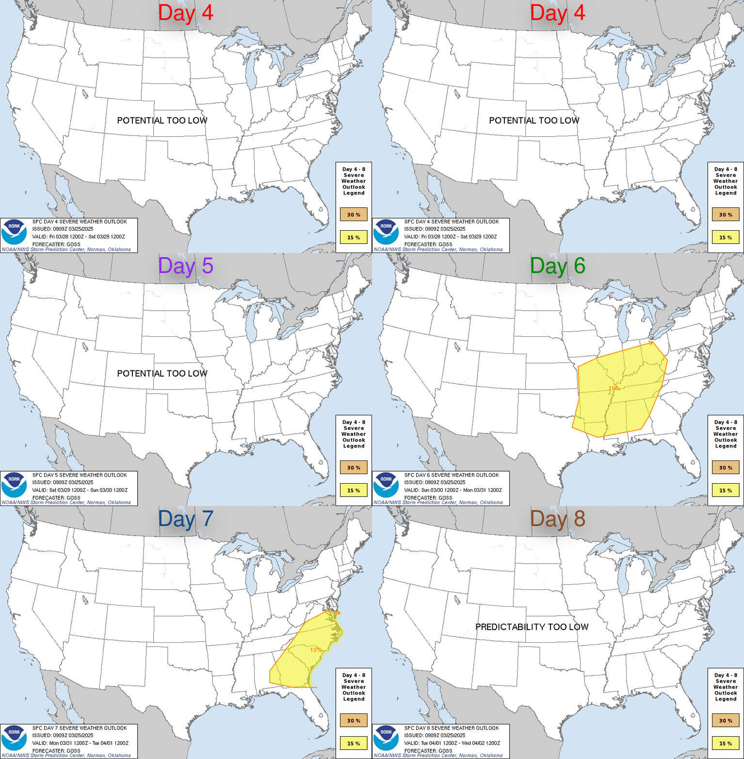
First round of springtime severe weather early next week?

Image

...DISCUSSION...

MEDIUM RANGE MODEL GUIDANCE CONTINUES TO INDICATE A STRENGTHENING
SRN BRANCH OF WESTERLIES THROUGH THE EXTENDED FORECAST WITH AN
EMBEDDED LOWER AMPLITUDE TROUGH MOVING THROUGH TX ON MON FEB 12TH
AND ACROSS THE GULF COAST STATES TUE FEB 13TH. ATTENDANT SURFACE
LOW WILL GENERALLY DEVELOP SEWD FROM THE CNTRL OR SRN HIGH PLAINS
THROUGH THE ARKLATEX TO OFF THE SC OR GA COAST BY 14/12Z.

THERE IS SOME CONCERN ABOUT THE QUALITY OF MOISTURE RETURN WITHIN
WARM SECTOR AIR MASS GIVEN PRIOR PASSAGE OF LARGE SURFACE HIGH.
HOWEVER...GIVEN CLOSE PROXIMITY TO THE GULF OF MEXICO...
STRENGTHENING TROPOSPHERIC WIND FIELDS AND FORCING FOR ASCENT...
THERE APPEARS TO BE SUFFICIENT POTENTIAL FOR AN ORGANIZED SEVERE
WEATHER EVENT TO WARRANT INCLUSION OF A REGIONAL THREAT AREA.
0 likes   

User avatar
jasons2k
Storm2k Executive
Storm2k Executive
Posts: 8245
Age: 51
Joined: Wed Jul 06, 2005 12:32 pm
Location: The Woodlands, TX

#14 Postby jasons2k » Tue Feb 06, 2007 5:57 pm

Maybe so...the return flow should be better for us in TX since we are further west. It is getting to be that time of year. Today even the sky looks "springy" with those puffy cumulus clouds....first time I've seen that in awhile.
0 likes   

User avatar
PTrackerLA
Category 5
Category 5
Posts: 5277
Age: 41
Joined: Thu Oct 10, 2002 8:40 pm
Location: Lafayette, LA

#15 Postby PTrackerLA » Tue Feb 06, 2007 5:58 pm

Looks like we'll be turning wet and colder once again this weekend. Today sure felt great though, I forgot how warm 66 degrees and sunshine feels. It definately had me thinking of spring!
0 likes   

User avatar
Extremeweatherguy
Category 5
Category 5
Posts: 11095
Joined: Mon Oct 10, 2005 8:13 pm
Location: Florida

#16 Postby Extremeweatherguy » Wed Feb 07, 2007 12:06 am

The 0z GFS is showing a few different interesting storm systems effecting the area next week...

http://www.nco.ncep.noaa.gov/pmb/nwprod ... _144.shtml
^^First one Monday evening^^

http://www.nco.ncep.noaa.gov/pmb/nwprod ... _192.shtml
^^The second one Wednesday evening^^

http://www.nco.ncep.noaa.gov/pmb/nwprod ... _264.shtml
^^And a third one next weekend^^
0 likes   

User avatar
southerngale
Retired Staff
Retired Staff
Posts: 27418
Joined: Thu Oct 10, 2002 1:27 am
Location: Southeast Texas (Beaumont area)

#17 Postby southerngale » Wed Feb 07, 2007 12:31 am

Yay...bring on spring and sunshine. We need lots and lots of sunshine! Image


Please don't post about rain. If you ignore it, it might go away. heh
0 likes   

User avatar
Extremeweatherguy
Category 5
Category 5
Posts: 11095
Joined: Mon Oct 10, 2005 8:13 pm
Location: Florida

#18 Postby Extremeweatherguy » Wed Feb 07, 2007 7:21 am

Latest SPC discussion for the long range:

DAY 4-8 CONVECTIVE OUTLOOK
NWS STORM PREDICTION CENTER NORMAN OK
0252 AM CST WED FEB 07 2007

VALID 101200Z - 151200Z

...DISCUSSION...

LATEST MEDIUM RANGE GUIDANCE REMAINS CONSISTENT IN SUGGESTING THAT
MID LEVEL WIND FIELDS WILL STRENGTHEN THROUGH THE EXTENDED PERIOD
FROM NRN MEXICO ACROSS TX AND THE GULF COAST STATES. A LOW
AMPLITUDE IMPULSE IS STILL EXPECTED TO TRANSLATE THROUGH TX MONDAY
FEB 12TH AND THE GULF COAST STATES TUE FEB 13TH WITH ATTENDANT
SURFACE LOW GENERALLY MOVING FROM E-CNTRL TX EWD THROUGH CNTRL MS/AL
TO OFF THE GA OR SC COAST.

THE QUALITY OF LOW LEVEL MOISTURE RETURN AND RESULTING INSTABILITY
STILL REMAIN A CONCERN. HOWEVER...THE CO-LOCATION OF RELATIVELY
STRONG WIND FIELDS AND FORCING FOR ASCENT ACROSS THE DEVELOPING
SYSTEM WARM SECTOR SUGGEST THAT POTENTIAL WILL EXIST FOR AN
ORGANIZED SEVERE WEATHER EVENT FEB 12TH AND 13TH.
0 likes   

User avatar
jasons2k
Storm2k Executive
Storm2k Executive
Posts: 8245
Age: 51
Joined: Wed Jul 06, 2005 12:32 pm
Location: The Woodlands, TX

#19 Postby jasons2k » Wed Feb 07, 2007 10:07 am

This is from Jeff Lindner:

Warming trend continues ahead of cold front slated for Thursday night.

Discussion:
Lowering pressures over NW TX and high pressure off to our east is producing a SE low level flow across the area creating warm conditions and gradually deepening moisture levels. Warm air advection pattern will be in full swing today with surface dewpoints getting well into the 50’s by this afternoon. Tonight will only see lows in the 50’s for the first time in quite a while. Surface dewpoints may start to exceed nearshore water temperatures creating sea fog problems along the coast and in the bays. Will likely need a dense fog advisory tonight for all locations as sea fog spreads inland and radiation fog develops over inland sections.

Cold front should limp into the area Thursday afternoon and evening and slowly progress toward the coast bringing temps. back to seasonal levels. Isentropic lift develops above the frontal slope with chances of rain increasing Friday through the weekend likely peaking Saturday night. Overall moisture is not that impressive and lift is fairly weak until Saturday night when a short wave ejects across in the sub-tropical flow. Feel most of the period from Thursday night through Sunday will be cloudy and cool with only scattered light rains.

Frontal boundary returns northward Sunday as a warm front as stronger short wave digs into the SW US and produces surface low pressure over NW TX. Area should get warm sectored and vertical profiles due show some instability by Monday across the region. Limiting factor at this time appears to be quality of Gulf moisture feed as SE flow may entrain dry air from the SE US. Dry line sets up over C TX and strong to possible severe thunderstorms will be possible Monday afternoon into early Tuesday as strong short wave moves across. Main dynamics will be just N of SE TX over N TX and this is where a greater severe threat may lie. It is getting to be that time of year!

Jeff Lindner
0 likes   

User avatar
Extremeweatherguy
Category 5
Category 5
Posts: 11095
Joined: Mon Oct 10, 2005 8:13 pm
Location: Florida

#20 Postby Extremeweatherguy » Thu Feb 08, 2007 7:01 am

Latest SPC discussion:

...DISCUSSION...

MEDIUM RANGE GUIDANCE REMAINS CONSISTENT IN SHIFTING LOW AMPLITUDE
SHORT WAVE TROUGH AND ACCOMPANYING 50-60 KT MID-LEVEL JET STREAK EWD
THROUGH TX AND THE GULF COAST STATES MONDAY FEB 12TH AND TUESDAY FEB
13TH. IN THE LOW LEVELS...THESE DATA INDICATE A NWD SHIFT IN TRACK
OF ATTENDANT SURFACE LOW WITH THIS FEATURE DEVELOPING FROM THE
ARKLATEX NEWD TO OFF THE NC COAST THROUGH THIS TIME PERIOD.

CURRENTLY...IT APPEARS THE GREATEST POTENTIAL FOR A MORE ORGANIZED
SEVERE WEATHER THREAT /FEB 12TH AND 13TH/ WILL EXIST ALONG AND S OF
THE I-20 CORRIDOR
WHERE STRENGTHENING WIND FIELDS WILL BECOME
CO-LOCATED WITH NRN EXTENT OF DEEPER AND MORE MOIST BOUNDARY LAYER
AIR MASS ADVECTING NWD FROM THE GULF OF MEXICO.

THEREAFTER...FRONTAL INCURSION INTO THE NRN GULF OF MEXICO WILL
LIKELY SUPPRESS MOIST AND UNSTABLE LOW-LEVEL AIR MASS SWD. SOME
SEVERE STORM POTENTIAL WILL EXIST TOWARD THE END OF THE PERIOD ALONG
THE IMMEDIATE GULF COAST IN ASSOCIATION WITH NEXT SHORT WAVE TROUGH
MOVING THROUGH THE REGION. CONFIDENCE IN THIS LATTER SYSTEM IS TOO
LOW ATTM TO INCLUDE IN GRAPHICAL PRODUCT.
0 likes   


Return to “USA & Caribbean Weather”

Who is online

Users browsing this forum: Cpv17 and 23 guests