Tornado outbreak February 28-March 2, 20 dead, EF4 in Kansas
Moderator: S2k Moderators
Forum rules

The posts in this forum are NOT official forecast and should not be used as such. They are just the opinion of the poster and may or may not be backed by sound meteorological data. They are NOT endorsed by any professional institution or STORM2K.
-
ncupsscweather

- Category 1

- Posts: 321
- Age: 38
- Joined: Tue Jan 02, 2007 8:05 pm
- Location: Hickory,North Carolina
-
HurricaneBill
- Category 5

- Posts: 3419
- Joined: Sun Apr 11, 2004 5:51 pm
- Location: East Longmeadow, MA, USA
-
therock1811

- Category 5
- Posts: 5163
- Age: 40
- Joined: Thu May 15, 2003 2:15 pm
- Location: Kentucky
- Contact:

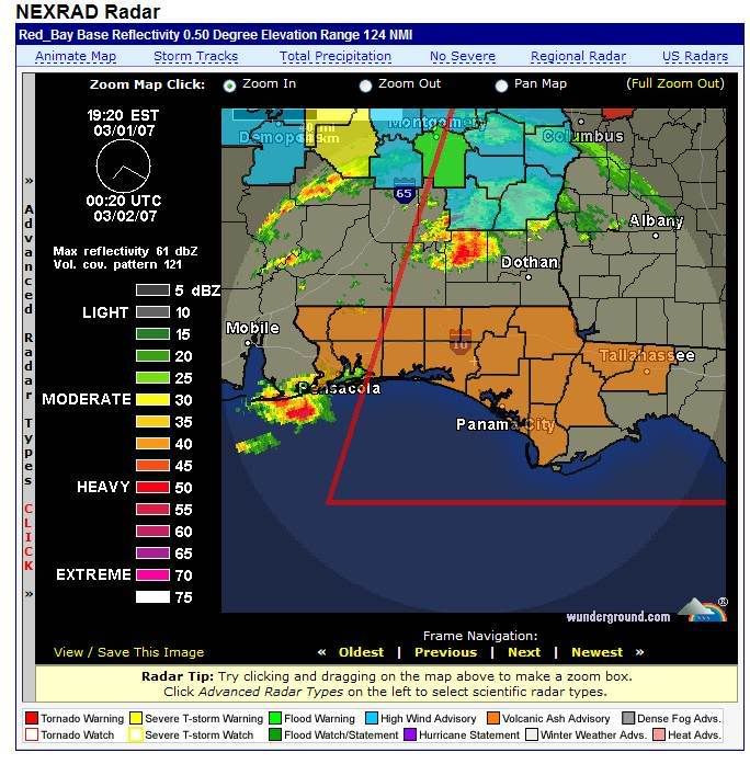
Volcanic ash in this tornado outbreak. Flordia is under the gun from volcanic ash
The system that brought all those tornadoes have also effected a large amount of people in Ontario. There has been hours of freezing rain and unusal winter precipitation falling at certain times. Quite windy too.
0 likes

TORNADO WARNING
GAC027-275-020730-
/O.NEW.KTAE.TO.W.0019.070302T0656Z-070302T0730Z/
BULLETIN - EAS ACTIVATION REQUESTED
TORNADO WARNING
NATIONAL WEATHER SERVICE TALLAHASSEE FL
156 AM EST FRI MAR 2 2007
THE NATIONAL WEATHER SERVICE IN TALLAHASSEE HAS ISSUED A
* TORNADO WARNING FOR...
BROOKS COUNTY IN SOUTH CENTRAL GEORGIA
SOUTHERN THOMAS COUNTY IN SOUTH CENTRAL GEORGIA
* UNTIL 230 AM EST
* AT 154 AM EST...NATIONAL WEATHER SERVICE DOPPLER RADAR INDICATED A
DEVELOPING TORNADO 10 MILES SOUTHWEST OF BOSTON...OR ABOUT 9 MILES
SOUTH OF THOMASVILLE...MOVING NORTHEAST AT 45 MPH.
* THE TORNADO WILL BE NEAR...
BOSTON BY 205 AM EST...
SCC003-020745-
/O.NEW.KCAE.TO.W.0007.070302T0700Z-070302T0745Z/
BULLETIN - EAS ACTIVATION REQUESTED
TORNADO WARNING
NATIONAL WEATHER SERVICE COLUMBIA SC
200 AM EST FRI MAR 2 2007
THE NATIONAL WEATHER SERVICE IN COLUMBIA HAS ISSUED A
* TORNADO WARNING FOR...
NORTHERN AIKEN COUNTY IN CENTRAL SOUTH CAROLINA
* UNTIL 245 AM EST
* AT 156 AM EST...NATIONAL WEATHER SERVICE DOPPLER RADAR INDICATED A
SEVERE THUNDERSTORM CAPABLE OF PRODUCING A TORNADO 2 MILES
SOUTHEAST OF AIKEN...OR ABOUT OVER AIKEN...MOVING EAST AT 45 MPH.
0 likes
-
ncupsscweather
- Category 1
- Posts: 321
- Age: 38
- Joined: Tue Jan 02, 2007 8:05 pm
- Location: Hickory,North Carolina
?
Here's a Story from WMAZ 13 in Macon, GA.
http://www.13wmaz.com/news/top_story.aspx?storyid=36027
This story is about the 9 deaths in GA.
http://www.13wmaz.com/news/top_story.aspx?storyid=36027
This story is about the 9 deaths in GA.
0 likes
-
Category 5

- Category 5
- Posts: 10074
- Age: 36
- Joined: Sun Feb 11, 2007 10:00 pm
- Location: New Brunswick, NJ
- Contact:
-
ncupsscweather
- Category 1
- Posts: 321
- Age: 38
- Joined: Tue Jan 02, 2007 8:05 pm
- Location: Hickory,North Carolina
?
03/02/2007 0230 am
Cherry Lake, Madison County.
Tornado, reported by Emergency Mngr.
Brief tornado touchdown near Cherry Lake. Numerous trees
down all around County Road 471.
0 likes
-
therock1811
- Category 5
- Posts: 5163
- Age: 40
- Joined: Thu May 15, 2003 2:15 pm
- Location: Kentucky
- Contact:
CajunMama wrote:Here's an article on the enterprise tornado that killed 15 studentsTornadoes Kill 18 in Alabama, Including 15 at High School, and 1 Missouri Girl
By BOB JOHNSON, Associated Press Writer
ENTERPRISE, Ala. (Associated Press) -- Tornadoes ripped through Alabama and killed at least 18 people Thursday, including 15 at a high school where students became pinned under debris when a roof collapsed, state officials said. As night fell, crews dug through piles of rubble beneath portable lights at Enterprise High School, looking for other victims.
"The number could very well increase as the search effort continues through the night," state emergency management spokeswoman Yasamie Richardson said.
The storm struck about 1:15 p.m., and Richardson said some students were still trapped three hours later. Erin Garcia, a 17-year-old senior, said students had gathered in hallways around 11 a.m. as a precaution. School officials wanted to send them home around 1 p.m., she said, but the weather turned bad and sirens wailed.
Then, she said, the lights went out.
"I was just sitting there praying the whole time," she said.
After the storm passed, she found the hallway she was in was spared, but a roof and wall collapsed on students in another hallway.
"It was scary. It sounded like a bunch of people trying to beat the wall down. It was complete chaos out in the hallway," she said.
"People didn't know where to go. They were trying to lead us out of the building. I kept seeing people with blood on their faces," Garcia said.
More than 50 people were hospitalized as the violent storm front crossed the state. Two died elsewhere in Enterprise and one in rural Millers Ferry, where a separate storm wrecked mobile homes, Richardson said.
The burst of tornadoes was part of a larger line of thunderstorms and snowstorms that stretched from Minnesota to the Gulf Coast. Authorities blamed a tornado for the death of a 7-year-old girl in Missouri, and twisters also were reported in Kansas.
The high school, about 75 miles south of Montgomery, "appears to have been right in the path," said Paul Duval, a meteorologist with National Weather Service in Tallahassee, Fla., which monitors southeast Alabama.
Martha Rodriguez, a 15-year-old sophomore, said she had left the school about five minutes before the storm hit. When she returned, a hall at the school had collapsed, she said.
"The stadium was destroyed and there were cars tipped over in the parking lot and trees were ripped out. There were trees and wood everywhere. It was just horrible," she said.
At Millers Ferry, 66 miles west of Montgomery, trailer homes were flipped over and trees downed, said Bernadine Williams in the Wilcox County emergency management office.
Several school systems across Alabama closed or dismissed students early as the storm front approached from the west, extending the length of the state.
"The clouds were so dark that all the lights out here came on," said Walter Thornton, who works at the airport in Enterprise, 75 miles south of Montgomery.
President Bush, who visited New Orleans on Thursday, was briefed on the tornadoes by senior staff and called Alabama Gov. Bob Riley and Missouri Gov. Matt Blunt, White House spokeswoman Dana Perrino said aboard Air Force One.
The Federal Emergency Management Agency was working with officials in both states, she said.
In Caulfield, Mo., resident Rick Jarvis heard the storm ripping through his gas station around dawn. His home next door suffered just minor damage, but the twister, described by witnesses as a fat black column, shredded the business, ripping down its roof and back wall.
"It sounded like a herd of horses tearing up stuff. When I came out, it was done," said Jarvis, 48.
http://tinyurl.com/28muy9
Were any of our members from alabama and areas in the path of todays storms? Have we heard from them?
I hope by now we've heard from all of them.
0 likes

A few radar images I gathered from the KS/MO storms near the KC area:
VIL from one of the major hail producers in KS. This is one of the storms that eventually shot up to 5" estimated hail in the storm.

This is the supercell that was bearing down on Adrian, MO. I put my mouse over the marker for the shear indicator, just to give you an idea of what radar was picking up. Very classic looking storm.

Another classic looking supercell. This one was taken roughly around 8:13pm CST as it tracked through Linn County, KS. If I'm not mistaken, this storm has a nice hook, along with radar estimation of 3" or greater hail (designated by the white diamond).

--snoopj
0 likes
-
TexasStooge

- Category 5
- Posts: 38127
- Joined: Tue Mar 25, 2003 1:22 pm
- Location: Irving (Dallas County), TX
- Contact:

-
Brent
- S2K Supporter

- Posts: 38757
- Age: 37
- Joined: Sun May 16, 2004 10:30 pm
- Location: Tulsa Oklahoma
- Contact:
WOW! Americus Tornado was at times a mile wide and was on the ground for 38 miles! 
PUBLIC INFORMATION STATEMENT...UPDATED TO ADD COUNTY NAMES
NATIONAL WEATHER SERVICE PEACHTREE CITY GA
433 PM EST FRI MAR 2 2007
...PRELIMINARY DAMAGE REPORT FOR 1 MARCH 2007 TORNADO OUTBREAK...
AT LEAST 5 TORNADOES TOUCHED DOWN IN CENTRAL GEORGIA ON 1
MARCH 2007. THREE FATALITIES WERE REPORTED IN THE COUNTY WARNING
AREA OF THE PEACHTREE CITY WEATHER FORECAST OFFICE. PRELIMINARY
DAMAGE SURVEYS HAVE BEEN CONDUCTED BY FIVE NWS TEAM FROM PEACHTREE
CITY. THE PRELIMINARY REPORTS FOLLOW:
TORNADO 1...
IN STEWART COUNTY...NEAR THE RICHLAND AREA. RATED EF1. LENGTH
APPROXIMATELY 1.5 MILES AND MAXIMUM WIDTH OF 200 YARDS. HEAVIEST
DAMAGE IN THE CITY OF RICHLAND.
TORNADO 2...
IN TAYLOR COUNTY...FROM 5 MILES SOUTHWEST OF POTTERVILLE TO 6 MILES
WEST OF FORT VALLEY. RATED EF2. LENGTH APPROXIMATELY 12 MILES AND
MAXIMUM WIDTH OF A QUARTER MILE. HEAVIEST DAMAGE WAS SOUTHWEST OF
POTTERVILLE WHERE ONE DEATH OCCURRED.
TORNADO 3...
IN CRAWFORD COUNTY...APPROXIMATELY 5 MILES EAST OF KNOXVILLE. RATED
EF3. LENGTH APPROXIMATELY 5 MILES AND MAXIMUM WIDTH OF A QUARTER
MILE. HEAVIEST DAMAGE OCCURRED ALONG SANDY POINT ROAD.
TORNADO 4...
IN MUSCOGEE COUNTY...ON THE NORTH SIDE OF COLUMBUS. RATED EF2.
LENGTH 7 MILES AND MAXIMUM WIDTH OF 300 YARDS. HEAVIEST DAMAGE IN
THE 6200 BLOCK OF BROOKSTONE BLVD IN COLUMBUS.
TORNADO 5...
TRACKED ACROSS WEBSTER...SUMTER...AND MACON COUNTIES...FROM
CHAMBLISS TO ABOUT 17 MILES NORTHEAST OF AMERICUS. RATED EF3.
LENGTH APPROXIMATELY 38 MILES AND MAXIMUM WIDTH OF ONE MILE.
HEAVIEST DAMAGE WAS IN THE CITY OF AMERICUS NEAR THE HOSPITAL. AT
LEAST TWO DEATHS WERE ASSOCIATED WITH THIS STORM IN AMERICUS. THREE
INJURIES ALSO OCCURRED NORTHEAST OF CHAMBLISS.
0 likes
#neversummer
Return to “USA & Caribbean Weather”
Who is online
Users browsing this forum: Brushcountry, Cpv17, Greener, txtwister78 and 54 guests