March 16-23, 2007 Idea: A Generally Zonal Pattern

Winter Weather Discussion

Moderator: S2k Moderators

Forum rules

The posts in this forum are NOT official forecast and should not be used as such. They are just the opinion of the poster and may or may not be backed by sound meteorological data. They are NOT endorsed by any professional institution or STORM2K.

Help Support Storm2K
Message
Author
donsutherland1
S2K Analyst
S2K Analyst
Posts: 2718
Joined: Mon Sep 15, 2003 8:49 pm
Location: New York

March 16-23, 2007 Idea: A Generally Zonal Pattern

#1 Postby donsutherland1 » Mon Mar 05, 2007 10:26 am

At this time, it appears that the March 16-23 timeframe could see an NAO that fluctuates in the 0 to +1 range and a PNA that remains in the -1 to 0, but could begin to rise late in the timeframe. Historically, such a setup has led to an expansive area of above normal height anomalies across the southern half of the United States:

Image

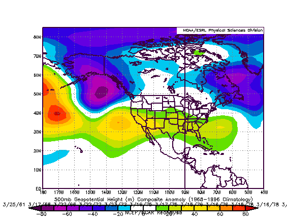
The 8-10-day averages for the 3/5 0z runs of the ECMWF and GFS point to a reasonably similar situation. The ensemble guidance also lends reasonable support to such an outcome. However, the 3/3 run of the GSM is quite different, with much more expansive cold. In contrast, the objective ECM analogs are much warmer.

Given the general agreement among the historic experience, 8-10-day height anomalies forecast by the GFS and ECMWF, and the ensemble guidance, I’ll generally rely on the data that is in consensus. I do believe that the area of much above normal readings in the Southwest could begin to progress more to the East, but nowhere near as fast as shown on the ECM’s objective analogs.

My thinking for the average temperature anomalies during the 3/16-23 period is as follows:

Average Regional Temperature Anomalies (3/16-23):
Northeast: Somewhat below normal to near normal
Mid-Atlantic: Near normal to somewhat above normal
Southeast: Somewhat above normal
Great Lakes: Near normal to somewhat above normal
Northern Plains: Near normal
Central Plains: Somewhat above normal
Southern Plains: Above normal
Pacific Northwest: Near normal to somewhat above normal
Southwest/Rest of West Coast: Above normal to much above normal

For the major cities from Washington, DC to Boston, the 3/16-23 period is likely to feature:

- Nights generally in the 30s in Boston and 30s and 40s in New York City, Philadelphia, and Washington, DC.
- Days mainly in the 40s and 50s in Boston, New York City and Philadelphia, and 50s and 60s in Washington, DC.
- One or two days with a high temperature of 65° or above in Washington, DC and possibly 60° or above in Philadelphia and New York City.

In the Southeast, Atlanta will likely see highs generally in the 60s and 70s. Lows should generally be in the 40s and 50s. Elsewhere, Burlington will likely see highs mainly in the 30s and 40s. Lows should be mainly in the 20s. However, at least one night with a low in the teens is possible.

Toronto: Most days will likely see highs in the 4°C to 9°C range (upper 30s and 40s). Nights will generally be in the -5°C to 2°C range (lower 20s to middle 30s). The temperature could exceed 10°C (50°F) on at least one day.

Occasional Historic Tidbit: The March 8-11, 1856 Arctic Attack:

On March 8, 1856, a powerful Arctic cold front roared into the eastern United States. At 6 pm, the temperature in New York City dropped below 32°. It continued to plummet, reaching 14° by Midnight. By the morning of March 9, the thermometer registered 8°. At Hartford, Connecticut, the temperature fell to 0°.

March 10, proved to be the coldest day, as the temperature fell to amazingly low levels for the season. At the same time, a strong wind created even more severe wind chill readings. Low temperatures included:

Albany: -7° (-21.7°C)
Boston: 0° (-17.8°C)
Buffalo: -15° (-26.1°C)
Cleveland: -10° (-23.3°C)
Hartford: -2° (-18.9°C)
Montreal: -12° (-24.4°C)
New Hartford, CT: -12° to -16° (-24.4°C to -26.7°C)
New York City: 4° (-15.6°C)
Philadelphia: 0° (-17.8°)
White River Junction, VT: -26° (-32.2°C)

On March 11, the cold began to ease. Nonetheless, New York City saw a low temperature of 11°. In the wake of the period of extreme cold, The New York Daily Times [now The New York Times] wrote, “It is not always March, and happily for us, every March is not like the one we are now tasting the signs of. There may have been as cold weather before in this spring month, but we doubt it.” The Hartford Daily Courant noted the subzero cold at New Hartford, CT and challenged, “Put it on the record and beat it who can!”
0 likes   

hcaeb
Tropical Low
Tropical Low
Posts: 24
Joined: Tue Sep 20, 2005 10:34 am

Is this Still On

#2 Postby hcaeb » Tue Mar 13, 2007 7:36 pm

Don,
Do you still support this forecast?
0 likes   

donsutherland1
S2K Analyst
S2K Analyst
Posts: 2718
Joined: Mon Sep 15, 2003 8:49 pm
Location: New York

Re: Is this Still On

#3 Postby donsutherland1 » Tue Mar 13, 2007 10:16 pm

Hcaeb,

I believe the warmth that will come eastward in the 3/20-23 timeframe will largely offset the cool anomalies that will build up in the Northeast prior to that time. The Mid-Atlantic/Southeast/Great Lakes look good. The Northern Plains might wind up above normal. The Central Plains, Southern Plains, Pacific Northwest, and Southwest/California all look to be warmer than normal. In fact, there is real potential for record-setting heat in the March 16-18 timeframe in the Southwest. That warmth will come eastward. Later, the warmth will likely begin to build anew in the Southwest toward the close of the month.

So, all in all, I think most of the areas depicted as warmer than normal will wind up warmer than normal, though the warmth will be more impressive than what I had first thought. The Northern Plains might wind up on the warm side of normal, too, even as I thought it would be near normal. New England is still a toss-up.
0 likes   

donsutherland1
S2K Analyst
S2K Analyst
Posts: 2718
Joined: Mon Sep 15, 2003 8:49 pm
Location: New York

Re: Is this Still On

#4 Postby donsutherland1 » Mon Mar 26, 2007 8:24 am

Verification:

Given the general agreement among the historic experience, 8-10-day height anomalies forecast by the GFS and ECMWF, and the ensemble guidance, I’ll generally rely on the data that is in consensus. I do believe that the area of much above normal readings in the Southwest could begin to progress more to the East, but nowhere near as fast as shown on the ECM’s objective analogs.

A small piece of the warmth in the Southwest came eastward, but the whole body of warmth did not.

My thinking for the average temperature anomalies during the 3/16-23 period is as follows:

Average Regional Temperature Anomalies (3/16-23):
Northeast: Somewhat below normal to near normal; Actual: Below normal
Mid-Atlantic: Near normal to somewhat above normal; Actual: Somewhat below normal to near normal
Southeast: Somewhat above normal; Actual: Near normal to somewhat above normal
Great Lakes: Near normal to somewhat above normal; Actual: Near normal to somewhat above normal
Northern Plains: Near normal; Actual: Near normal
Central Plains: Somewhat above normal; Actual: Above normal to much above normal
Southern Plains: Above normal; Actual: Above normal
Pacific Northwest: Near normal to somewhat above normal; Actual: Somewhat above normal
Southwest/Rest of West Coast: Above normal to much above normal; Actual: Above normal to much above normal

For the major cities from Washington, DC to Boston, the 3/16-23 period is likely to feature:

- Nights generally in the 30s in Boston and 30s and 40s in New York City, Philadelphia, and Washington, DC.
- Days mainly in the 40s and 50s in Boston, New York City and Philadelphia, and 50s and 60s in Washington, DC.
- One or two days with a high temperature of 65° or above in Washington, DC and possibly 60° or above in Philadelphia and New York City.

Nights:
Boston: 20s: 6; 30s: 1; 40s: 1
New York City: 20s: 4; 30s: 2; 40s: 1; 50s: 1
Philadelphia: 20s: 5; 30s: 1; 40s: 1; 50s: 1
Washington, DC: 20s: 3; 30s: 2; 40s: 2; 50s: 1

Days:
Boston: 30s: 4; 50s: 2; 60s: 2
New York City: 30s: 3; 40s: 2; 50s: 1; 60s: 2
Philadelphia: 30s: 1; 40s: 4; 50s: 1; 60s: 1; 70s: 1
Washington, DC: 30s: 1; 40s: 3; 50s: 1; 60s: 1; 70s: 2

In the Southeast, Atlanta will likely see highs generally in the 60s and 70s. Lows should generally be in the 40s and 50s. Elsewhere, Burlington will likely see highs mainly in the 30s and 40s. Lows should be mainly in the 20s. However, at least one night with a low in the teens is possible.

Atlanta (high temperatures):
50s: 2; 60s: 1; 70s: 5

Atlanta (low temperatures):
30s: 2; 40s: 2; 50s: 4

Burlington (high temperatures):
20s: 2; 30s: 4; 40s: 1; 50s: 1

Burlington (low temperatures):
-0s: 1; 0s: 2; 10s: 3; 30s: 2

Toronto: Most days will likely see highs in the 4°C to 9°C range (upper 30s and 40s). Nights will generally be in the -5°C to 2°C range (lower 20s to middle 30s). The temperature could exceed 10°C (50°F) on at least one day.

Toronto (high temperatures):
20s: 2; 30s: 4; 50s: 2

Toronto (low temperatures):
10s: 3; 20s: 4; 30s: 1


-17.8°C to -12.3°C = 0s
-12.2°C to -6.8°C=10s
-6.7°C to -1.2°C=20s
-1.1°C to 4.3°C=30s
4.4°C to 9.9°C=40s
10.0°C to 15.5°=50s
15.6°C to 21.0°C=60s
21.1°C to 26.6°C=70s
0 likes   


Return to “Winter Weather”

Who is online

Users browsing this forum: No registered users and 7 guests