The posts in this forum are NOT official forecast and should not be used as such. They are just the opinion of the poster and may or may not be backed by sound meteorological data. They are NOT endorsed by any professional institution or

Several factors signal such potential for more sustained warmth:
- Consistent ensemble forecasts for the departure of the cold air from eastern Canada.
- A persistently positive NAO
- A moderate MJO passing into and through Phase(s) 1 and possibly 2. This has often been correlated with a spreading of warmer anomalies eastward in late March.
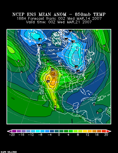
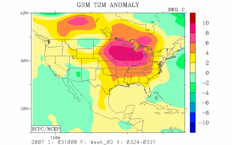
The 3/10 run of the GSM puts the core of the warm anomalies for the 3/24-31 period south of the Great Lakes region. That centering of the warmth is consistent with the likely 500 mb anomalies consistent with the PNA and NAO readings likely to prevail during the timeframe.
GSM Forecast for 3/24-31/2007:
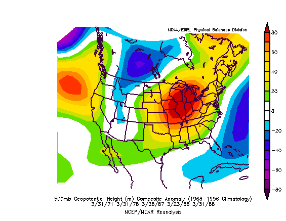
Composite 500 mb Anomalies:
Hence, unlike recent runs of the GSM in which I lacked much confidence, I believe the GSM has the right idea. Given that the NCEP ensembles are faster in bringing the warmth eastward, my general thinking is a compromise between the GSM, general idea implied by the MJO, and the faster guidance with respect to the spreading of the warmth. It should be noted that there is a possibility that a modest but transient push of cold air could occur during the latter part of the timeframe. On account of this possibility, I have erred on the side of conservatism in keeping the Northern Plains and Northeast somewhat cooler than I might otherwise have expected. It is possible that a small portion of Northern New England could have a somewhat cooler-than-normal anomaly for the 3/24-31 period.
Some past patterns similar to the current one have seen a trough evolve in the Southeast/Gulf region and remain stuck there for days. That’s something that might need to be watched for as the ridge over the Southwest rebuilds with a vengeance. The Southwest could be scorched with 90° or above readings at some point during the 3/24-31 period.
My thinking for the average temperature anomalies during the 3/24-31 period is as follows:
Average Regional Temperature Anomalies (3/24-31):
Northeast: Above normal
Mid-Atlantic: Above normal
Southeast: Somewhat above normal
Great Lakes: Above normal
Northern Plains: Somewhat above normal
Central Plains: Somewhat above normal
Southern Plains: Somewhat above normal
Pacific Northwest: Near normal to somewhat above normal
Southwest/Rest of West Coast: Above normal to much above normal
For the major cities from Washington, DC to Boston, the 3/24-31 period is likely to feature:
- Nights generally in the 30s and 40s in Boston and 40s in New York City, Philadelphia, and Washington, DC.
- Days mainly in the 50s in Boston, and 50s and 60s in New York City, Philadelphia, and Washington, DC.
- One or two days with a high temperature of 70° or above in Washington, DC and possibly 65° or above in Philadelphia and New York City.
In the Southeast, Atlanta will likely see highs generally in the 70s. Lows should generally be in the 40s and 50s. Elsewhere, Burlington will likely see highs mainly in the 40s. Lows should be mainly in the 20s and 30s.
Toronto: Most days will likely see highs in the 4.4°C to 10.0°C range (40s to near 50°). Nights will generally be in the -2.8°C to +2.8°C range (upper 20s to upper 30s). The temperature will likely exceed 10°C (50°F) on at least one day.
Occasional Historic Tidbit: Highlights from the March 5-9, 2007 Cold Period:
During the afternoon and evening of March 5, 2007, a powerful Arctic cold front moved across the eastern United States. It produced a number of briefly heavy snow squalls.
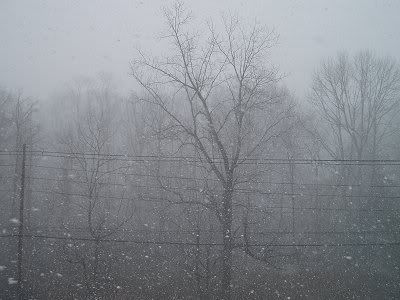
Greenwich, Connecticut
Afterward, a reinforcing shot of Arctic air arrived late on March 7. That was a dry frontal passage in most areas.
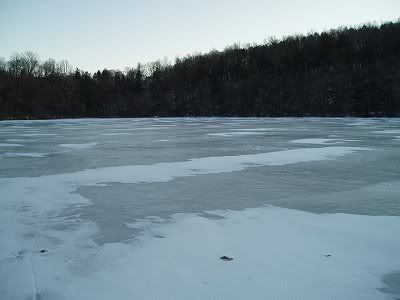
Wampus Pond (Armonk, New York)
Overall, the March 5-9, 2007 timeframe saw some of the coldest readings in a decade or longer in much of the northern Mid-Atlantic region, along with the New England States, and Ontario and Quebec.
Some quick highlights follow:
Coldest March Readings:
Boston: 5°, 3/9 (coldest since 3/4/1950 when the temperature fell to 2°)
Burlington: -18°, 3/7 (coldest since 3/2/1980 when the temperature fell to -18°)
New York City: 11°, 3/6 (coldest since 3/11/2003 when the temperature fell to 11°)
Philadelphia: 16°, 3/7-8 (coldest since 3/10/1996 when the temperature fell to 13°)
Toronto: -8°F/-22.1°C, 3/6 (coldest since 3/2/1980 when the temperature fell to -9°F/-23°C)
Washington, DC (DCA): 20° (coldest since 3/9/2005 when the temperature fell to 20°)
Coldest High Temperatures in March:
Boston: 23°, 3/6 (coldest since 3/7/1989 when the high reached 23°)
Burlington: 5°, 3/6 (coldest since 3/7/1989 when the high reached 1°)
New York City: 21°, 3/6 (coldest since 3/18/1967 when the high reached 20°)
Philadelphia: 24°, 3/7 (coldest since 3/9/1996 when the high reached 23°)
Toronto: 10°F/-12.2°C, 3/6 (coldest since 3/3/2003 when the high reached 9°F/-12.8°C)
Washington, DC (DCA): 29°, 3/7 (coldest since 3/8/1996 when the high reached 28°)
Additional March Temperature Highlights:
Burlington: Record low temperatures of -18° on 3/7 and -15° on 3/9.
Boston: Four consecutive lows < 10° (has not occurred for at least 87 years). Record low temperatures of 7° on 3/8 and 5° on 3/9.
New York City: 4 consecutive days with lows < 20° (first time since 3/8-12/1984); 2 consecutive days with mean temperatures in the teens (first time since 3/8-9/1996).
Philadelphia: 2 consecutive days with highs in the 20s (first time since 3/8-9/1996); 4 consecutive days with lows < 20° (first time since 3/8-12/1984).
Toronto: Record low temperatures of -1°F (-18.3°C) on 3/5 and -8°F (-22.1°C) on 3/6.
New York City Metro Area: A March Snowfall with Temperatures in the Teens:
In New York City, the temperature ranged from 12° to 16° during the snowfall on March 7. In White Plains, the mercury ranged from 9° to 14° during that snowfall.
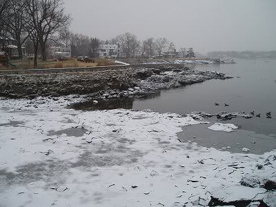
Larchmont, New York
Extreme Cold:
Saranac Lake, New York
March 6: -27° (daily record low)
March 7: -35° (all-time March record low)
March 8: -26° (daily record low)
March 9: -29° (daily record low)
Whitefield, New Hampshire:
March 6: -13° (daily record low)
March 7: -33° (all-time March record low)
March 8: -25° (daily record low)
March 9: -31° (daily record low)
In response to the siege of cold, ice recovered on many water bodies in the Northeast.
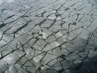
Near White Plains, New York
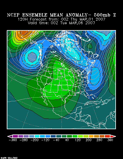
Finally, in terms of the computer guidance, the outbreak of extreme cold was handled very well.
3/1 0z NCEP Mean 500 mb Anomaly forecast for 120 hours:
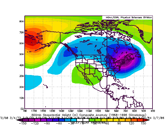
Classic signature for extreme cold (1950-present) in the 3/1-10 timeframe: