The posts in this forum are NOT official forecast and should not be used as such. They are just the opinion of the poster and may or may not be backed by sound meteorological data. They are NOT endorsed by any professional institution or

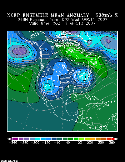
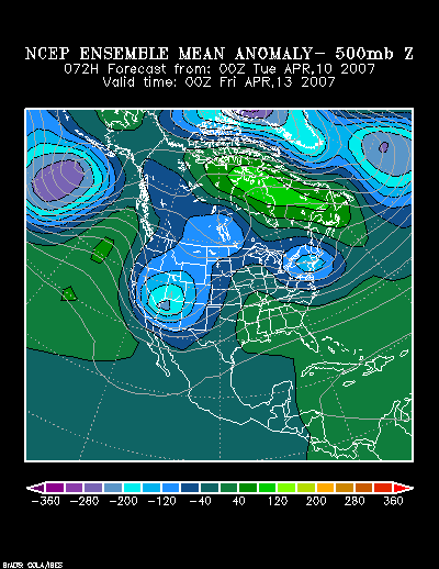
NCEP ensemble 500 mb anomalies: 72 hours:
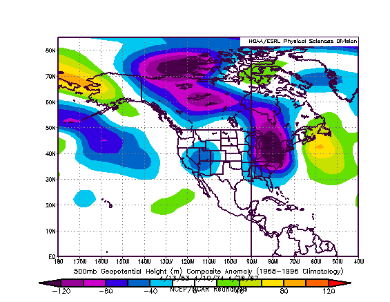
Composite 500 mb anomalies:
At this point in time, especially considering the recent trends in the modeling, I believe the highest risk of a significant snowfall (6” or more) covers portions of northern New York State, Vermont, including Burlington, and portions of New Hampshire and Maine. There, if historic experience with some late-season snowstorms is representative, some locations might have the potential to pick up 10” or more of heavy wet snow. Higher elevations should do particularly well. There is still a small chance that Boston could pick up 4” or more snow, but odds increasingly favor the heavier snow staying well to the north and west of Boston.
In terms of weather history, although late-season snowstorms subsequent to April 10 have not produced more than 5.0” of snow at Boston since regular recordkeeping commenced in 1872 (5.0” on 4/13/1933 is the highest figure), such storms have occurred prior to 1872. For example, on April 11-12, 1841, a massive snowstorm dumped 18” at Boston, 12” in New York City, and 10”-12” at Philadelphia. During that storm, the New York Express wrote on April 12 8 pm, “[T]he snow is falling fast, and nearly as heavy as during any period of the past winter. The ground is covered eight to ten inches deep. The housetops, trees, and the forest of masts are all covered with a coat of snow… It is rare indeed to see the peach blossom and the snow at the same time, but such is the fact at the present time.”
At this point in time, my initial estimates are as follows:
Albany: 2”-5”
Boston: 1”-3”
Burlington: 5”-10”
Caribou: 3”-7”
Concord: 3”-7”
Portland: 2”-4”
Worcester: 2”-4”