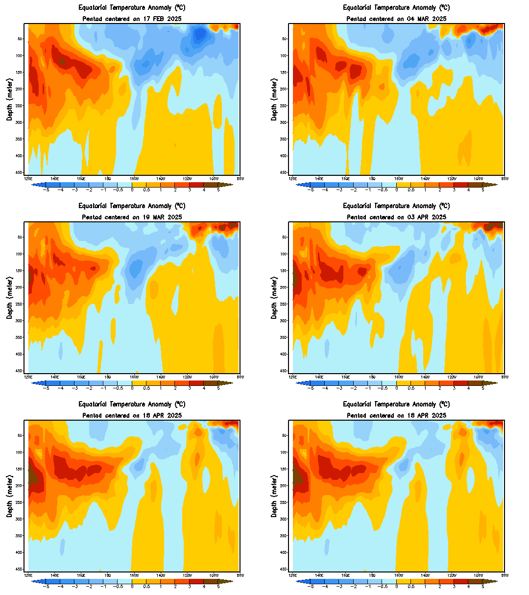
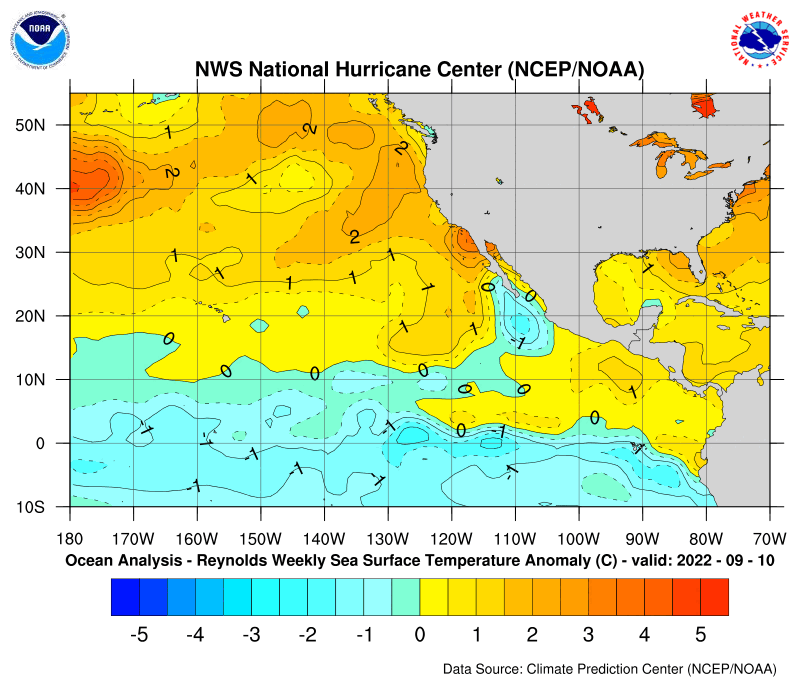
Above is the Climate Prediction Center weekly update and they have the conditions in the Pacific as Neutral.They say it's still possible to have La Nina in the next 3 months.Time will tell what will be the conditions of ENSO when hurricane season arrives and the peak comes on August,September and on the first half of October.I am leaning towards Neutral to maybe weak La Nina.
ENSO Updates (2007 thru 2023)
Moderator: S2k Moderators
Forum rules
The posts in this forum are NOT official forecasts and should not be used as such. They are just the opinion of the poster and may or may not be backed by sound meteorological data. They are NOT endorsed by any professional institution or STORM2K. For official information, please refer to products from the National Hurricane Center and National Weather Service.
- cycloneye
- Admin

- Posts: 149395
- Age: 69
- Joined: Thu Oct 10, 2002 10:54 am
- Location: San Juan, Puerto Rico
CPC April 23 Update


Above is the Climate Prediction Center weekly update and they have the conditions in the Pacific as Neutral.They say it's still possible to have La Nina in the next 3 months.Time will tell what will be the conditions of ENSO when hurricane season arrives and the peak comes on August,September and on the first half of October.I am leaning towards Neutral to maybe weak La Nina.
Above is the Climate Prediction Center weekly update and they have the conditions in the Pacific as Neutral.They say it's still possible to have La Nina in the next 3 months.Time will tell what will be the conditions of ENSO when hurricane season arrives and the peak comes on August,September and on the first half of October.I am leaning towards Neutral to maybe weak La Nina.
0 likes
- cycloneye
- Admin

- Posts: 149395
- Age: 69
- Joined: Thu Oct 10, 2002 10:54 am
- Location: San Juan, Puerto Rico
In a few hours the Aussies (BoM) will release their April 25th update.Let's see what will their comments be about the latest data for ENSO.
0 likes
Visit the Caribbean-Central America Weather Thread where you can find at first post web cams,radars
and observations from Caribbean basin members Click Here
and observations from Caribbean basin members Click Here
-
MiamiensisWx
Here is the latest update from the BOM (April 25 in Australia). Conditions remain within neutral status.
http://www.bom.gov.au/climate/enso/
http://www.bom.gov.au/climate/enso/
0 likes
-
JonathanBelles
- Professional-Met

- Posts: 11430
- Age: 35
- Joined: Sat Dec 24, 2005 9:00 pm
- Location: School: Florida State University (Tallahassee, FL) Home: St. Petersburg, Florida
- Contact:
- cycloneye
- Admin

- Posts: 149395
- Age: 69
- Joined: Thu Oct 10, 2002 10:54 am
- Location: San Juan, Puerto Rico
In Brief
Negative SST anomalies persist in the eastern equatorial Pacific.
Negative subsurface anomalies have strengthened in the central-eastern equatorial Pacific.
The SOI has a current (22nd April) 30-day value of approximately −12.
Trade Winds have generally been close to average in the equatorial Pacific in recent weeks, they are currently slightly stronger than average in the central Pacific.
Cloudiness near the date-line has recently been close to or slightly below average.
Many computer models predict further cooling of the Pacific during the first half of 2007, with some of the better ones predicting the development of La Niña conditions.
Above is the summary of the BoM 4/25/07 update that is posted two posts above this one.I am leaning towards Neutral ENSO during the summer with maybe a weak La Nina by fall.
0 likes
Visit the Caribbean-Central America Weather Thread where you can find at first post web cams,radars
and observations from Caribbean basin members Click Here
and observations from Caribbean basin members Click Here
-
MiamiensisWx
Lately, I have been wondering if we may not see a La Nina event form by the end of 2007. In the following graphic, note the persistent warm pool at the surface and subsurface west of 140W. In addition, note the relatively weak Kelvin Waves and weaker cool subsurface west of 115W. The coolest subsurface anomalies (and SSTs) are restricted to the eastern equatorial Pacific. The persistent negative SOI and other factors might be the symptoms or instigators of a weaker or non-existant cool ENSO event than originally prognosticated.
The cooler subsurface has been incapable of spreading west of 115W. Every Kelvin Wave has weakened as it pulsed eastward, and each westward push of cooler subsurface anomalies along the equator has been stunted further west.
[web]http://www.osdpd.noaa.gov/PSB/EPS/SST/data/anomnight.4.23.2007.gif[/web]
In the next chart for subsurface depth anomalies, note the growing warm pool in the western portions of the equatorial Pacific.
http://www.cpc.ncep.noaa.gov/products/a ... eq_anm.gif
Does anyone believe it is plausible that La Nina may not form?
0 likes
- AussieMark
- Category 5

- Posts: 5857
- Joined: Tue Sep 02, 2003 6:36 pm
- Location: near Sydney, Australia
-
Coredesat
- cycloneye
- Admin

- Posts: 149395
- Age: 69
- Joined: Thu Oct 10, 2002 10:54 am
- Location: San Juan, Puerto Rico

I dont see any progress towards La Nina by looking at the subsurface.El Nino 3-4 continues to be warm.Really La Nina is taking it's time to show up.As I said in my 2007 forecast that you can read at Tropical Analysis forum,I am not on La Nina bandwagon for next summer.
0 likes
Visit the Caribbean-Central America Weather Thread where you can find at first post web cams,radars
and observations from Caribbean basin members Click Here
and observations from Caribbean basin members Click Here
- SouthFloridawx
- S2K Supporter

- Posts: 8346
- Age: 47
- Joined: Tue Jul 26, 2005 1:16 am
- Location: Sarasota, FL
- Contact:
-
HURRICANELONNY
- Category 5

- Posts: 1392
- Joined: Wed May 07, 2003 6:48 am
- Location: HOLLYWOOD.FL
No real cooling trend from a month earlier?
April 3
http://www.osdpd.noaa.gov/PSB/EPS/SST/d ... 3.2007.gif
May 3
http://www.osdpd.noaa.gov/PSB/EPS/SST/d ... 3.2007.gif
April 3
http://www.osdpd.noaa.gov/PSB/EPS/SST/d ... 3.2007.gif
May 3
http://www.osdpd.noaa.gov/PSB/EPS/SST/d ... 3.2007.gif
0 likes
- Grease Monkey
- Category 2

- Posts: 727
- Joined: Fri Jun 09, 2006 9:25 pm
Re: SST
HURRICANELONNY wrote:After looking at that SST map. I think I'm moving to kansas.
Don't take this personally, but i'm always all for someone leaving SE florida. Way too many people here.
0 likes
- flightwxman
- Tropical Depression

- Posts: 65
- Joined: Wed Apr 18, 2007 6:45 pm
- Location: Disney's Backyard, FL
- Contact:
Nimbus wrote:No real cooling trend from a month earlier?
April 3
http://www.osdpd.noaa.gov/PSB/EPS/SST/d ... 3.2007.gif
May 3
http://www.osdpd.noaa.gov/PSB/EPS/SST/d ... 3.2007.gif
The atlantic seems to be warming up quite nicely
Also, anomalies are considered departures from normal, right? So less of a cooler anomaly in the EPAC doesnt necessarily mean that SST's are not cooling down, wouldnt it mean that they are just returning to the average "cooling rate"?
Please correct me if Im wrong...
0 likes
- cycloneye
- Admin

- Posts: 149395
- Age: 69
- Joined: Thu Oct 10, 2002 10:54 am
- Location: San Juan, Puerto Rico
http://www.bom.gov.au/climate/ahead/ENSO-summary.shtml


All the ENSO Models are forecasting La Nina conditions thru November.To note,the period from March thru June is the most difficult one to predict due to the variables that occur at this time.
All the ENSO Models are forecasting La Nina conditions thru November.To note,the period from March thru June is the most difficult one to predict due to the variables that occur at this time.
0 likes
- cycloneye
- Admin

- Posts: 149395
- Age: 69
- Joined: Thu Oct 10, 2002 10:54 am
- Location: San Juan, Puerto Rico

Still not a clear picture about if La Nina will be dominating during the summer months as the data shows Neutral conditions in the Pacific.El Nino 1-2 area is cool,while El Nino 3-4 is a little bit warmer.Let's see what the Aussies say later tonight when they will release their latest outlook for ENSO.
0 likes
Visit the Caribbean-Central America Weather Thread where you can find at first post web cams,radars
and observations from Caribbean basin members Click Here
and observations from Caribbean basin members Click Here
Who is online
Users browsing this forum: Kingarabian and 85 guests

