Moderate Tornado Risk and High Severe Risk Today
Moderator: S2k Moderators
Forum rules

The posts in this forum are NOT official forecast and should not be used as such. They are just the opinion of the poster and may or may not be backed by sound meteorological data. They are NOT endorsed by any professional institution or STORM2K.
-
MississippiHurricane

- ChatStaff

- Posts: 648
- Age: 41
- Joined: Sat Jul 16, 2005 12:20 am
- Location: Hanover, Maryland
- Contact:
-
Category 5

- Category 5

- Posts: 10074
- Age: 36
- Joined: Sun Feb 11, 2007 10:00 pm
- Location: New Brunswick, NJ
- Contact:
-
Category 5
- Category 5
- Posts: 10074
- Age: 36
- Joined: Sun Feb 11, 2007 10:00 pm
- Location: New Brunswick, NJ
- Contact:
-
Category 5
- Category 5
- Posts: 10074
- Age: 36
- Joined: Sun Feb 11, 2007 10:00 pm
- Location: New Brunswick, NJ
- Contact:
-
JonathanBelles
- Professional-Met

- Posts: 11430
- Age: 35
- Joined: Sat Dec 24, 2005 9:00 pm
- Location: School: Florida State University (Tallahassee, FL) Home: St. Petersburg, Florida
- Contact:
-
Category 5
- Category 5
- Posts: 10074
- Age: 36
- Joined: Sun Feb 11, 2007 10:00 pm
- Location: New Brunswick, NJ
- Contact:

-
JonathanBelles
- Professional-Met
- Posts: 11430
- Age: 35
- Joined: Sat Dec 24, 2005 9:00 pm
- Location: School: Florida State University (Tallahassee, FL) Home: St. Petersburg, Florida
- Contact:
-
Category 5
- Category 5
- Posts: 10074
- Age: 36
- Joined: Sun Feb 11, 2007 10:00 pm
- Location: New Brunswick, NJ
- Contact:
-
simplykristi
- S2K Supporter

- Posts: 1220
- Joined: Sat May 10, 2003 1:59 pm
- Location: Near KCMO
- Contact:
-
JonathanBelles
- Professional-Met
- Posts: 11430
- Age: 35
- Joined: Sat Dec 24, 2005 9:00 pm
- Location: School: Florida State University (Tallahassee, FL) Home: St. Petersburg, Florida
- Contact:
-
simplykristi
- S2K Supporter
- Posts: 1220
- Joined: Sat May 10, 2003 1:59 pm
- Location: Near KCMO
- Contact:
-
Category 5
- Category 5
- Posts: 10074
- Age: 36
- Joined: Sun Feb 11, 2007 10:00 pm
- Location: New Brunswick, NJ
- Contact:
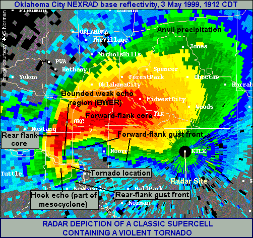
fact789 wrote:Is the tornado/Hook Ecko always on the SWern part on the cell?
It usually forms on the upwind side of the storm from the flow aloft. So, with a typical southwest flow setup (the most common), the updraft and circulation will form on the SW side of the storm. However, occasionally there are northwest flow storms, in which case the updraft and mesocyclone would form on the northwest side of the storm.
Last night the tornadoes were cycing; that is, one tornado would occlude back into the storm (and thus appear to be "inside" the storm) while the next would form to the southeast of the old meso.
0 likes

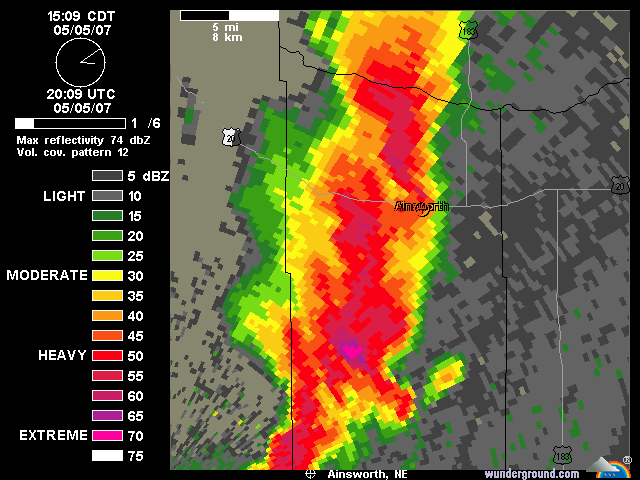
I'm sitting in Lincoln, Nebraska right now (have to work today) and am actually getting slightly worried. There's a cell that's getting its act together and rightmoving right in our direction now. VIL is pegged, so I'm guessing it's hailing something nice. Went outside for a sec to move my car into a parking garage and the mammatus is brilliant.
0 likes
-
simplykristi
- S2K Supporter
- Posts: 1220
- Joined: Sat May 10, 2003 1:59 pm
- Location: Near KCMO
- Contact:
-
CrazyC83
- Professional-Met
- Posts: 34315
- Joined: Tue Mar 07, 2006 11:57 pm
- Location: Deep South, for the first time!
Aquawind wrote:CrazyC83 wrote:This being Saturday, there are probably a lot of storm chasers out there - including some that shouldn't be out there (a HIGH risk day with a major outbreak likely is not a good time for beginners or curious onlookers).
Well said. Yesterday was a close call..
My thinking was that most people are off work and school so they might think chasing storms is something to try out...a SLGT risk with weak tornadoes expected would be a better time to experiment than this explosive situation...
0 likes
-
simplykristi
- S2K Supporter
- Posts: 1220
- Joined: Sat May 10, 2003 1:59 pm
- Location: Near KCMO
- Contact:
Return to “USA & Caribbean Weather”
Who is online
Users browsing this forum: wxman22 and 158 guests