Sorry was not thinking, but still 37 mph would mean theres a very high chance of 40 mph winds.
Heck 4-5 more threads like this one we might have more large discussions then all of last season.
Remnants of Andrea-Thread 2
Moderator: S2k Moderators
Forum rules

The posts in this forum are NOT official forecasts and should not be used as such. They are just the opinion of the poster and may or may not be backed by sound meteorological data. They are NOT endorsed by any professional institution or STORM2K. For official information, please refer to products from the National Hurricane Center and National Weather Service.

Matt-hurricanewatcher wrote:Darn it convection is weaking again big time.
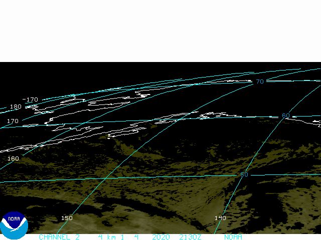
Haha! That's first thing I saw when I woke up a couple mins ago. Pretty impressive blowup over night. Pressures dropped and winds increased and it could probably be upgraded to a TD now. However TPC probably wants to wait until convection persists longer and until the plane gets in there this afternoon.
0 likes


Matt-hurricanewatcher wrote:Darn it convection is weaking again big time.
To my surprise it is still getting some light 10-15 knot NE shear that I would had thought it was going to be gone this morning, as well as some mid level dry air intrussion that keeps knocking down the convections, but not as bad windshearwise as the last couple of days.
0 likes

-
Matt-hurricanewatcher
Matt-hurricanewatcher wrote:I thought it was a shoe in for a a short time, for a upgrade. But things are not that favorable, in I don't think the nhc will upgrade a system that doe's not have convection/cdo over the LLC.
Not just that, but the system is starting to move NE slowly away from the warmer waters of the gulfstream into waters in the mid 70s and eventually low 70s, not warm enough for further tropical development.
0 likes
There are some thunderstorms forming on the west side of the center again:
http://radar.weather.gov/ridge/radar.ph ... 1&loop=yes
http://radar.weather.gov/ridge/radar.ph ... 1&loop=yes
0 likes
8:05 TWD :
...SPECIAL FEATURE...
SMALL 1004 MB LOW...REMNANTS OF SUBTROPICAL STORM ANDREA...IS
CENTERED OFF THE COAST OF FLORIDA BETWEEN CAPE CANAVERAL AND
DAYTONA BEACH NEAR 29N79W. THE PRESSURE OF THIS LOW HAS DROPPED
DURING THE NIGHT BUT CONTINUES TO GENERATE SCATTERED SHOWERS/
THUNDERSTORMS FROM 27N-30N BETWEEN 74W-80W. WHILE SIGNIFICANT
DEVELOPMENT IS NOT ANTICIPATED...THIS SYSTEM WILL BE MONITORED
FOR SIGNS OF TROPICAL CYCLONE FORMATION.
0 likes
-
HurricaneHunter914
- Category 5

- Posts: 4439
- Age: 32
- Joined: Fri Mar 10, 2006 7:36 pm
- Location: College Station, TX
http://www.ssd.noaa.gov/goes/flt/t1/avn.jpg
Convection blow up to the west of Andrea and to the east, a nice line of convection has formed.
Edit: Question, If these remnants were to reform, would they be named Andrea or Barry?
Convection blow up to the west of Andrea and to the east, a nice line of convection has formed.
Edit: Question, If these remnants were to reform, would they be named Andrea or Barry?
0 likes
Personal Forecast Disclaimer:
The posts in this forum are NOT official forecast and should not be used as such. They are just the opinion of the poster and may or may not be backed by sound meteorological data. They are NOT endorsed by any professional institution or storm2k.org. For official information, please refer to the NHC and NWS products.
The posts in this forum are NOT official forecast and should not be used as such. They are just the opinion of the poster and may or may not be backed by sound meteorological data. They are NOT endorsed by any professional institution or storm2k.org. For official information, please refer to the NHC and NWS products.


I think they will fly out today. Andrea is looking slowly better organized on radar and satellite images this morning. And the pressure has fallen overnight. Latest high resolution QS shows a well-defined low-level center with uncontaminated 25kt to 30kt wind barbs west of the center:
http://manati.orbit.nesdis.noaa.gov/dat ... MBas75.png
The flight should go out around noon time.
http://manati.orbit.nesdis.noaa.gov/dat ... MBas75.png
The flight should go out around noon time.
Last edited by Thunder44 on Sat May 12, 2007 7:54 am, edited 1 time in total.
0 likes
-
cycloneye

- Admin

- Posts: 148755
- Age: 69
- Joined: Thu Oct 10, 2002 10:54 am
- Location: San Juan, Puerto Rico
DISTURBANCE ANDREA (AL012007) 20070512 1200 UTC
...00 HRS... ...12 HRS... ...24 HRS. .. ...36 HRS...
070512 1200 070513 0000 070513 1200 070514 0000
LAT LON LAT LON LAT LON LAT LON
BAMS 29.0N 78.6W 29.5N 77.5W 29.7N 75.6W 29.6N 72.4W
BAMD 29.0N 78.6W 30.0N 77.5W 31.0N 74.9W 31.9N 69.1W
BAMM 29.0N 78.6W 29.8N 77.6W 30.4N 75.5W 30.7N 70.7W
...48 HRS... ...72 HRS... ...96 HRS. .. ..120 HRS...
070514 1200 070515 1200 070516 1200 070517 1200
LAT LON LAT LON LAT LON LAT LON
BAMS 28.7N 69.3W 26.6N 64.0W 26.4N 63.7W 30.8N 65.0W
BAMD 33.7N 59.8W 43.2N 48.7W 51.4N 42.2W 59.6N 29.6W
BAMM 30.9N 62.7W 37.7N 45.6W 47.1N 40.6W 55.7N 26.1W
...INITIAL CONDITIONS...
LATCUR = 29.0N LONCUR = 78.6W DIRCUR = 45DEG SPDCUR = 4KT
LATM12 = 28.5N LONM12 = 79.2W DIRM12 = 69DEG SPDM12 = 3KT
LATM24 = 28.7N LONM24 = 79.7W
WNDCUR = 25KT RMAXWD = 25NM WNDM12 = 25KT
CENPRS = 1005MB OUTPRS = 1012MB OUTRAD = 150NM SDEPTH = M
RD34NE = 0NM RD34SE = 0NM RD34SW = 0NM RD34NW = 0NM
1005 mbs and 25kts the maximun winds the tropical models have at 12:00z.
0 likes
Visit the Caribbean-Central America Weather Thread where you can find at first post web cams,radars
and observations from Caribbean basin members Click Here
and observations from Caribbean basin members Click Here

Now I'm looking at the surronding buoys at the top of the hour, pressures are rising and winds are slacking off:
http://ndbc.noaa.gov/maps/Florida.shtml
So now I'm wondering if this system is really getting better organized.
Hold a second, buoy 41010 winds the have switched to west, which means the has moved to the north of that bouy.
http://ndbc.noaa.gov/maps/Florida.shtml
So now I'm wondering if this system is really getting better organized.
Hold a second, buoy 41010 winds the have switched to west, which means the has moved to the north of that bouy.
Last edited by Thunder44 on Sat May 12, 2007 8:27 am, edited 2 times in total.
0 likes