Couldn't help thinking of this classic from The Sanford Townsend Band...
You left me here on your way to paradise
You pulled the rug right out from under my life
I know where you goin’ to I knew when you came home last night
'Cause your eyes had a mist from the smoke of a distant fire
Lord, I was stung shoulda' seen it come a long time ago
When I realized the reality gave me a roll
If things are the same then explain why your kiss is so cold
And that mist in your eyes feels like rain on the fire in my soul
This lying, and cryin', is upsettin' and gettin' ya no where
It don't stack up, so slack up and pack up
I just don't care
Don't let the screen door hit you, on your way out
Don't you drown when your dream boat runs onto the ground
(BREAK)
I'd just like to know do you love him or just making time
by filling his glass with your fast flowing bitter-sweet wine
He'll taste the aftertaste when you come home late some night
With your eyes all a mist from the smoke of a distant fire
Girl your eyes have a mist from the smoke of a distant fire
(Girl your eyes have a mist from the smoke of a distant fire)
Girl your eyes have the mist from the smoke of a distant fire
(Girl your eyes have a mist from the smoke of a distant fire)
Girl your eyes have a mist from the smoke of a distant fire
(Mist in your eyes from a distant fire)
Girl your eyes have a mist from the smoke of a distant..........
A distant fire
Smoke in GA/FL
Moderator: S2k Moderators
Forum rules

The posts in this forum are NOT official forecast and should not be used as such. They are just the opinion of the poster and may or may not be backed by sound meteorological data. They are NOT endorsed by any professional institution or STORM2K.
-
TampaSteve

- Tropical Storm

- Posts: 210
- Joined: Sat Sep 02, 2006 4:05 pm
- Location: Riverview, FL
-
MiamiensisWx
The latest Miami NWS skycam frames indicate the arrival of thicker smoke into Miami-Dade and Broward counties. It is very impressive!
0 likes


-
brunota2003

- S2K Supporter

- Posts: 9476
- Age: 35
- Joined: Sat Jul 30, 2005 9:56 pm
- Location: Stanton, KY...formerly Havelock, NC
- Contact:
Hopefully this works, here is a radar loop I put together from earlier today:
http://media.putfile.com/Wildfires-In-Georgia-On-Radar
The video thing hates me...so there is the link.
http://media.putfile.com/Wildfires-In-Georgia-On-Radar
The video thing hates me...so there is the link.
0 likes
-
Cookiely

- S2K Supporter
- Posts: 3211
- Age: 75
- Joined: Fri Aug 13, 2004 7:31 am
- Location: Tampa, Florida
Air Stagnation Advisory
URGENT - WEATHER MESSAGE
NATIONAL WEATHER SERVICE TAMPA BAY AREA - RUSKIN FL
1023 PM EDT FRI MAY 11 2007
...POOR AIR QUALITY EXPECTED THROUGH AT LEAST MIDDAY SATURDAY IN
THE TAMPA BAY AREA...
.AREAS OF SMOKE FROM THE LARGE WILDFIRE COMPLEX IN EXTREME NORTH
FLORIDA WILL CONTINUE TO AFFECT THE TAMPA BAY AREA INTO THE
WEEKEND AS TRANSPORT WINDS FUNNEL THE SMOKE PLUMES INTO THE
NORTHEAST GULF THEN SOUTHWARD INTO THE HIGH POPULATION CENTERS OF
HILLSBOROUGH AND PINELLAS COUNTY.
FLZ050-051-121600-
/O.NEW.KTBW.AS.Y.0001.070512T0223Z-070512T1600Z/
PINELLAS-HILLSBOROUGH-
INCLUDING THE CITIES OF...CLEARWATER...ST. PETERSBURG...BRANDON...
TAMPA
1023 PM EDT FRI MAY 11 2007
...AIR STAGNATION ADVISORY IN EFFECT UNTIL 12 PM EDT SATURDAY...
THE NATIONAL WEATHER SERVICE IN TAMPA BAY AREA - RUSKIN FL HAS
ISSUED AN AIR STAGNATION ADVISORY...WHICH IS IN EFFECT UNTIL
12 PM EDT SATURDAY.
AIR QUALITY ACROSS ALL OF PINELLAS COUNTY AND THE WESTERN TWO
THIRDS OF HILLSBOROUGH COUNTY BECAME VERY UNHEALTHY TO HAZARDOUS
FOR MUCH OF FRIDAY MORNING AS DENSE SMOKE AND EVEN FINE ASH
OVERSPREAD THE MOST POPULATED AREAS INCLUDING
TAMPA...CLEARWATER...AND ST. PETERSBURG. SMOKE WILL CONTINUE TO
HANG OVER THE AREA OVERNIGHT INTO EARLY SATURDAY MORNING...BUT
ANOTHER PLUME OF DENSE SMOKE IS EXPECTED TO MOVE ACROSS THE REGION
AFTER SUNRISE AND CONTINUE UNTIL AROUND NOON.
A SLIGHTLY DEEPER WESTERLY FLOW IS EXPECTED TO DISSIPATE THE SMOKE
A BIT MORE...AT LEAST TEMPORARILY...ON SATURDAY AFTERNOON.
WHILE SATURDAY MORNING`S SMOKE MAY NOT BE QUITE AS DENSE AS
FRIDAY`S...THE POTENTIAL EXISTS FOR PARTICULATE LEVELS TO EXCEED
250 PARTS PER BILLION...WHICH IS CONSIDERED THE VERY UNHEALTHY
RANGE.
ALL RESIDENTS OF THE IMMEDIATE TAMPA BAY METROPOLITAN AREA SHOULD
CONSIDER STAYING INDOORS THROUGH MIDDAY SATURDAY...PREFERABLY IN AIR
CONDITIONED LOCATIONS WHERE INSIDE AIR IS RECIRCULATED. THIS IS
MORE IMPERATIVE ON A SATURDAY MORNING IN MAY...WHEN PEOPLE ARE MORE
LIKELY TO PARTAKE IN OUTDOOR ACTIVITIES. THOSE WITH RESPIRATORY
AILMENTS SUCH AS ASTHMA...EMPHYSEMA...OR ALLERGIES...ARE URGED TO
REMAIN INDOORS. IF YOU MUST BE OUTDOORS DURING THE HEAVIEST SMOKE...CONSIDER
WEARING A MASK OVER YOUR NOSE AND MOUTH AS PROTECTION FROM THE PARTICULATES.
AIR POLLUTION ADVISORIES HAVE ALREADY BEEN ISSUED BY HILLSBOROUGH
AND PINELLAS COUNTIES. FOR MORE DETAILS...GO TO THE FOLLOWING WEBSITE:
HTTP://WWW.DEP.STATE.FL.US/AIR/WILDFIRE.HTM
AND CLICK ON THE LINK FOR HILLSBOROUGH OR PINELLAS COUNTY.
&&
AN AIR STAGNATION ADVISORY INDICATES THAT DUE TO LIMITED MOVEMENT
OF AN AIRMASS ACROSS THE ADVISORY AREA...POLLUTION WILL INCREASE
TO DANGEROUS LEVELS. PERSONS WITH RESPIRATORY ILLNESS SHOULD
FOLLOW THEIR PHYSICIANS ADVICE FOR DEALING WITH HIGH LEVELS OF
AIR POLLUTION.
$$
BSG
0 likes
-
TampaSteve
- Tropical Storm
- Posts: 210
- Joined: Sat Sep 02, 2006 4:05 pm
- Location: Riverview, FL
-
JonathanBelles
- Professional-Met

- Posts: 11430
- Age: 35
- Joined: Sat Dec 24, 2005 9:00 pm
- Location: School: Florida State University (Tallahassee, FL) Home: St. Petersburg, Florida
- Contact:
-
Extremeweatherguy

- Category 5

- Posts: 11095
- Joined: Mon Oct 10, 2005 8:13 pm
- Location: Florida
It is really amazing how far this smoke is traveling. Looking at the satellite I can see smoke as far west as the coastal waters off of LA and as far south as the Florida keys and as far north as parts of GA. That is incredible!
http://www.ssd.noaa.gov/goes/east/gmex/vis-l.jpg
I wonder if any of this smoke will eventually make for hazy skies over here in SE Texas? If that plume south of LA is pushed northwestward (which it looks like it is), then it might just be a possiblity.
http://www.ssd.noaa.gov/goes/east/gmex/vis-l.jpg
I wonder if any of this smoke will eventually make for hazy skies over here in SE Texas? If that plume south of LA is pushed northwestward (which it looks like it is), then it might just be a possiblity.
0 likes


Nimbus wrote:Doesn't look like any serious rain from a front any time soon.
Have the fire crews been successfull surrounding the largest fires with wide fire lines?
Not really. The Bugaboo fire is nowhere near contained.
Florida Department of Transportation has announced that Interstate 10, from US 90 (Sanderson, FL) to US 129 (Live Oak, FL), is closed due to smoke and fog. The fire is still north of I-10 and east of US 441.
Interstate 75, from the Florida/ Georgia border, south to Lake City, Florida, is also closed.
Bugaboo Scrub Fire (Georgia)
Fire crews working for Georgia Forestry Commission, along with private timber companies, are working along the flanks of the fire where conditions allow and are working to protect structures in the area. Fire crews and forest industry personnel are also strengthening lines on the southwest edge of the Okefenokee Swamp near Fargo. Crews have been successful in holding the fire inside the refuge with the exception of three small areas that have been contained. A community protection plan has been implemented and crews are continuing structure protection in Fargo. The break in the weather has aided crews in preparations in that community.
Florida Bugaboo Wildfire (Florida)
This is the south portion of the Bugaboo Scrub Fire that began in Georgia. The portion of the fire in Florida is reported at over 101,000 acres. Crews report good progress made Friday due to lighter winds. Despite the best efforts of firefighters however, 9 outbuildings were destroyed and one damaged in a hunting camp near Deep Creek. The same lighter winds are expected to keep fire behavior down today, giving firefighters a chance to complete more containment line. Burnout operations were conducted late into the night Friday and went well. This morning, crews are having difficulty working on the line due to a heavy inversion that's holding thick smoke and fog near the ground.
Its going to be a long summer.
0 likes
-
TampaSteve
- Tropical Storm
- Posts: 210
- Joined: Sat Sep 02, 2006 4:05 pm
- Location: Riverview, FL

Civil Emergency Message
FLC017-053-057-075-101-103-119-130000-
BULLETIN - EAS ACTIVATION REQUESTED
CIVIL EMERGENCY MESSAGE
FLORIDA EMERGENCY MANAGEMENT AGENCY TAMPA BAY RUSKIN FLORIDA
RELAYED BY NATIONAL WEATHER SERVICE TAMPA BAY RUSKIN FL
303 PM EDT SAT MAY 12 2007
THE FOLLOWING MESSAGE IS TRANSMITTED AT THE REQUEST OF THE
FLORIDA EMERGENCY MANAGEMENT AGENCY.
PORTIONS OF INTERSTATE 10 AND INTERSTATE 75 NORTH OF EXIT 427 NEAR
LAKE CITY IN COLUMBIA COUNTY REMAIN CLOSED AND OTHER AREA ROUTES
ARE HEAVILY CONGESTED. PLEASE AVOID TRAVEL INTO THE AREA.
http://www.srh.noaa.gov/forecast/MapCli ... &map.y=111
0 likes
-
Tampa Bay Hurricane

- Category 5
- Posts: 5597
- Age: 38
- Joined: Fri Jul 22, 2005 7:54 pm
- Location: St. Petersburg, FL
-
O Town
- S2K Supporter
- Posts: 5205
- Age: 52
- Joined: Wed Sep 07, 2005 9:37 pm
- Location: Orlando, Florida 28°35'35"N 81°22'55"W
MiamiensisWx wrote:The latest Miami NWS skycam frames indicate the arrival of thicker smoke into Miami-Dade and Broward counties. It is very impressive!
The skycams are awesome. Too bad they don't have them for our neck of the woods.
0 likes
-
JonathanBelles
- Professional-Met
- Posts: 11430
- Age: 35
- Joined: Sat Dec 24, 2005 9:00 pm
- Location: School: Florida State University (Tallahassee, FL) Home: St. Petersburg, Florida
- Contact:
-
Stratusxpeye

- Category 2

- Posts: 686
- Joined: Tue Jun 07, 2005 10:40 am
- Location: Tampa, Florida
- Contact:
-
TampaSteve
- Tropical Storm
- Posts: 210
- Joined: Sat Sep 02, 2006 4:05 pm
- Location: Riverview, FL
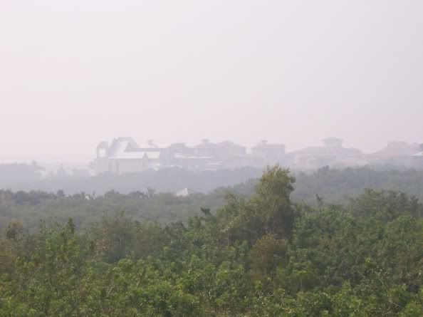
Stratusxpeye wrote:fact789 wrote:It was very hazy today. Not a lot of ground smoke today though.
Agree. The sun right now is just a hazey orange glow. Very gray hazy smokey skys but not much of anything on the ground. Hopefully after a week it will b e moving out now.
Even better this morning than yesterday...c'mon, RAIN...we miss ya!
0 likes
Return to “USA & Caribbean Weather”
Who is online
Users browsing this forum: No registered users and 162 guests