Wave in Caribbean Sea

This is the general tropical discussion area. Anyone can take their shot at predicting a storms path.

Moderator: S2k Moderators

Forum rules

The posts in this forum are NOT official forecasts and should not be used as such. They are just the opinion of the poster and may or may not be backed by sound meteorological data. They are NOT endorsed by any professional institution or STORM2K. For official information, please refer to products from the National Hurricane Center and National Weather Service.

Help Support Storm2K
Message
Author
JonathanBelles
Professional-Met
Professional-Met
Posts: 11430
Age: 35
Joined: Sat Dec 24, 2005 9:00 pm
Location: School: Florida State University (Tallahassee, FL) Home: St. Petersburg, Florida
Contact:

Re:

#21 Postby JonathanBelles » Sun Jun 17, 2007 10:44 am

abajan wrote:Oops... seems like I was looking at the wrong inverted V! (I thought it was that stuff just east of the Lesser Antilles.)


You're not the only one...oops.
0 likes   

canes04
Category 1
Category 1
Posts: 302
Joined: Sat May 22, 2004 5:41 pm
Location: Miami, FL

Re: Inverted-V signature of Atlantic Wave

#22 Postby canes04 » Sun Jun 17, 2007 6:54 pm

This wave at 46w looks pretty good, if it can pull up a few degrees it may be a player.
0 likes   

User avatar
cycloneye
Admin
Admin
Posts: 145934
Age: 69
Joined: Thu Oct 10, 2002 10:54 am
Location: San Juan, Puerto Rico

Re: Inverted-V signature of Atlantic Wave

#23 Postby cycloneye » Sun Jun 17, 2007 7:02 pm

TROPICAL WEATHER DISCUSSION
NWS TPC/NATIONAL HURRICANE CENTER MIAMI FL
805 PM EDT SUN JUN 17 2007

TROPICAL WEATHER DISCUSSION FOR NORTH AMERICA...CENTRAL
AMERICA...THE GULF OF MEXICO...THE CARIBBEAN SEA...NORTHERN
SECTIONS OF SOUTH AMERICA...AND THE ATLANTIC OCEAN TO THE
AFRICAN COAST FROM THE EQUATOR TO 32N. THE FOLLOWING INFORMATION
IS BASED ON SATELLITE IMAGERY...METEOROLOGICAL ANALYSIS...
WEATHER OBSERVATIONS...AND RADAR.

BASED ON 1800 UTC SURFACE ANALYSIS AND SATELLITE IMAGERY THROUGH
2300 UTC.

...TROPICAL WAVES...

ATLC TROPICAL WAVE IS ALONG 46W S OF 15N MOVING W 15-20 KT. WAVE
REMAINS WELL DEFINED WITH A BROAD INVERTED-V SIGNATURE.
CLUSTERS OF SCATTERED MODERATE TO STRONG CONVECTION ARE FROM
5N-9N BETWEEN 40W-43W. A CLUSTER OF MODERATE CONVECTION IS FROM
8N-10N BETWEEN 46W-49W.


http://www.storm2k.org/wx/modules.php?n ... ge&pid=109

The above is from the 8:05 PM EDT discussion from TPC.At least this wave will bring some squally weather to the Lesser Antilles,Virgin Islands and Puerto Rico in the next couple of days.But the enviroment is not ideal for it to organize into a cyclone.
0 likes   

MiamiensisWx

Re: Inverted-V signature of Atlantic Wave

#24 Postby MiamiensisWx » Sun Jun 17, 2007 8:21 pm

Personally, I believe upper-level shear is too hostile; thus, I think it is premature to call for short-term development. While the wave's signature is impressive, I have not noticed a well-defined low-level circulation. Sfc convergence is robust, but mid-level divergence is quite significant; dry air has impeded convection, too. There is a sharp trough axis ahead of the possible weak sfc low, and shear is intense. The low-level steering may carry the wave axis to the west, so I would not rule out development in the western Caribbean Sea. At the same time, I think conditions may improve over the next one to two weeks.

On another note, I do detect the presence of a possible sfc ridge building over the western Caribbean area. As the sfc front (and low over Texas/Oklahoma) moves away from the area, the sfc trough in the southern Gulf of Mexico may produce lower pressures. This could serve as a focusing mechanism, especially as low-level shear relaxes. Look at this loop. I know that this may be regarded as a dead horse, but I do think the possibility for Caribbean development might emerge soon. As the wave axis transverses the Caribbean, it could set the stage for sfc low formation. Note that the western Atlantic front is leaving energy over the Bahamas and southern Gulf of Mexico.

It is interesting to note that ensembles are latching on to this solution; they notice that the synoptic environment supports the development of a 500 mbar ridge over the southern United States by next week. This appears to support my synopsis. This might set the stage for development by the start of July (although I expect Chantal during the middle of the month).
0 likes   

User avatar
windstorm99
S2K Supporter
S2K Supporter
Posts: 1578
Age: 47
Joined: Sat May 26, 2007 8:10 am
Location: Miami, Florida
Contact:

Re: Inverted-V signature of Wave East of Windwards

#25 Postby windstorm99 » Sun Jun 17, 2007 9:08 pm

There's a good amount of dry air across most of the caribbean right now.

Image
0 likes   

User avatar
windstorm99
S2K Supporter
S2K Supporter
Posts: 1578
Age: 47
Joined: Sat May 26, 2007 8:10 am
Location: Miami, Florida
Contact:

Re: Inverted-V signature of Wave East of Windwards

#26 Postby windstorm99 » Sun Jun 17, 2007 9:30 pm

Right now the entire altlantic looks quite unfavorable with shear,dry air,cool sst's, and ULL's in various places.Basically nothing out of the norm for mid june.Adrian
0 likes   

User avatar
cycloneye
Admin
Admin
Posts: 145934
Age: 69
Joined: Thu Oct 10, 2002 10:54 am
Location: San Juan, Puerto Rico

Re: Inverted-V signature of Atlantic Wave

#27 Postby cycloneye » Sun Jun 17, 2007 9:57 pm

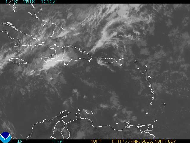
MiamiensisWx wrote:Personally, I believe upper-level shear is too hostile; thus, I think it is premature to call for short-term development. While the wave's signature is impressive, I have not noticed a well-defined low-level circulation. Sfc convergence is robust, but mid-level divergence is quite significant; dry air has impeded convection, too. There is a sharp trough axis ahead of the possible weak sfc low, and shear is intense. The low-level steering may carry the wave axis to the west, so I would not rule out development in the western Caribbean Sea. At the same time, I think conditions may improve over the next one to two weeks.

On another note, I do detect the presence of a possible sfc ridge building over the western Caribbean area. As the sfc front (and low over Texas/Oklahoma) moves away from the area, the sfc trough in the southern Gulf of Mexico may produce lower pressures. This could serve as a focusing mechanism, especially as low-level shear relaxes. Look at this loop. I know that this may be regarded as a dead horse, but I do think the possibility for Caribbean development might emerge soon. As the wave axis transverses the Caribbean, it could set the stage for sfc low formation. Note that the western Atlantic front is leaving energy over the Bahamas and southern Gulf of Mexico.

It is interesting to note that ensembles are latching on to this solution; they notice that the synoptic environment supports the development of a 500 mbar ridge over the southern United States by next week. This appears to support my synopsis. This might set the stage for development by the start of July (although I expect Chantal during the middle of the month).


Good analysis there.Now let's see how all plays out in reality to see if things turn more favorable in the next week or two,or it stays like it's now.
0 likes   

User avatar
NDG
S2K Supporter
S2K Supporter
Posts: 15456
Joined: Sun Jul 09, 2006 10:14 pm
Location: Orlando, FL

Re: Inverted-V signature of Wave East of Windwards

#28 Postby NDG » Sun Jun 17, 2007 10:01 pm

This tropical wave has an upper level ridge right on top of it, moving right along with it, so windshear is not so bad, some of the dry air to its north might be keeping it at bay but as it moves westward it should leave some of the dry air behind.
Image
Image
Upper level conditions ahead of it are hostile but according to the GFS the upper level ridge will just about move a long with it all the way to the eastern Caribbean.
Image
It should feel the weakness both at surface and mid levels once it gets to the eastern Caribbean so I expect for the wave to split with some of the energy to recurve north of P.R.
Given that conditions are not so bad for mid June, I am giving it a small chance of development as it nears the eastern Caribbean, the only problem that I see is that is moving at a fairly good clip due to a fairly strong ridge to its north that might not give the chance for a LLC center to get established.
0 likes   

User avatar
SouthFloridawx
S2K Supporter
S2K Supporter
Posts: 8346
Age: 46
Joined: Tue Jul 26, 2005 1:16 am
Location: Sarasota, FL
Contact:

Re: Inverted-V signature of Wave East of Windwards

#29 Postby SouthFloridawx » Sun Jun 17, 2007 11:16 pm

I agree NDG... Looks like th UPH and good conditions should persist, throughout the longevity. Only thing is, gfs isn't all that great for upper level winds long range, but good analysis and I agree.

Additionally, I feel that if this does develop down the road, it will be a E. Gulf Event, anywhere from AL to SW FL.

The 500mb looks to set up, although long range... still may get some shortwaves to break it down enough to keep it from moving westward.

Image
0 likes   

User avatar
Nimbus
Category 5
Category 5
Posts: 5334
Joined: Mon Jul 19, 2004 10:54 am

Re: Inverted-V signature of Wave East of Windwards

#30 Postby Nimbus » Mon Jun 18, 2007 5:14 am

There is dry air and a ULL dropping south just ahead of it.
0 likes   

User avatar
cycloneye
Admin
Admin
Posts: 145934
Age: 69
Joined: Thu Oct 10, 2002 10:54 am
Location: San Juan, Puerto Rico

Re: Inverted-V signature of Wave East of Windwards

#31 Postby cycloneye » Mon Jun 18, 2007 6:27 am

Nimbus wrote:There is dry air and a ULL dropping south just ahead of it.


That trough will interact with the wave causing some squally weather in the Eastern Caribbean but not let it organize.
0 likes   

User avatar
cycloneye
Admin
Admin
Posts: 145934
Age: 69
Joined: Thu Oct 10, 2002 10:54 am
Location: San Juan, Puerto Rico

Re: Inverted-V signature of Wave East of Windwards

#32 Postby cycloneye » Mon Jun 18, 2007 1:10 pm

AXNT20 KNHC 181758
TWDAT

TROPICAL WEATHER DISCUSSION
NWS TPC/NATIONAL HURRICANE CENTER MIAMI FL
205 PM EDT MON JUN 18 2007

TROPICAL WEATHER DISCUSSION FOR NORTH AMERICA...CENTRAL
AMERICA...THE GULF OF MEXICO...THE CARIBBEAN SEA...NORTHERN
SECTIONS OF SOUTH AMERICA...AND THE ATLANTIC OCEAN TO THE
AFRICAN COAST FROM THE EQUATOR TO 32N. THE FOLLOWING INFORMATION
IS BASED ON SATELLITE IMAGERY...METEOROLOGICAL ANALYSIS...
WEATHER OBSERVATIONS...AND RADAR.

BASED ON 1200 UTC SURFACE ANALYSIS AND SATELLITE IMAGERY
THROUGH 1715 UTC.

...TROPICAL WAVES...

A TROPICAL WAVE IS ALONG THE LINE 15N51W 8N53W 2N55W MOVING WEST
15 KT. THIS IS A WELL DEFINED BROAD WAVE APPROACHING THE
WINDWARD ISLANDS. CLUSTERS OF WIDELY SCATTERED MODERATE
CONVECTION ARE FROM 8N-12N BETWEEN 45W-48W...AND FROM 7N-12N
BETWEEN 55W-60W.

http://www.storm2k.org/wx/modules.php?n ... ge&pid=109

Above is the 2:05 PM EDT discussion of wave by TPC.

As I said before here,no development,but some squally weather for the islands of the Eastern Caribbean.
0 likes   

User avatar
cycloneye
Admin
Admin
Posts: 145934
Age: 69
Joined: Thu Oct 10, 2002 10:54 am
Location: San Juan, Puerto Rico

#33 Postby cycloneye » Mon Jun 18, 2007 5:41 pm

000
FXCA62 TJSJ 181913
AFDSJU

AREA FORECAST DISCUSSION
NATIONAL WEATHER SERVICE SAN JUAN PR
313 PM AST MON JUN 18 2007

.SYNOPSIS...A 1022 MB HIGH PRESSURE SYSTEM WAS CENTERED OVER THE
CENTRAL ATLANTIC THIS AFTERNOON...AND IS EXPECTED TO REMAIN
NEARLY STATIONARY THROUGH THE MIDDLE OF THE WEEK. A TROPICAL WAVE
IS EXPECTED TO MOVE ACROSS THE LOCAL AREA WEDNESDAY AND WEDNESDAY
NIGHT...ACCOMPANIED BY ACTIVE WEATHER AND GUSTY WINDS.

&&

.DISCUSSION...12Z SOUNDING IN SAN JUAN INDICATED A DRIER LOCAL
AIRMASS THAN YESTERDAY...IN AGREEMENT WITH SATELLITE IMAGERY THAT
SHOWED ONLY PATCHY LOW LEVEL CLOUDINESS. DOPPLER RADAR ALSO
INDICATED LIMITED SHOWER ACTIVITY OVER THE CARIBBEAN WATERS AND
WES-SOUTHWEST SECTIONS OF PUERTO RICO WITH NO SIGNIFICANT
PRECIPITATION OBSERVED ACROSS THE U.S. VIRGIN ISLANDS. THE WEATHER
PATTERN WILL BE MAINLY DRY WITH ONLY SMALL VARIATIONS EXPECTED
UNTIL THE ADVENT OF A TROPICAL WAVE WHOSE EFFECTS ARE EXPECTED TO
BE NOTICED SINCE EARLY WEDNESDAY. A TREND TO A WETTER WEATHER
PATTERN IS WILL TAKE PLACE WITH LATEST MODEL GUIDANCE SUGGESTING
IT HIGHER EFFECTS DAYTIME WEDNESDAY. THE TIMING OF THIS WAVE MAY
VARY SOMETHING DUE TO UNCERTAINTIES INHERENT TO THE FORECAST
PROCESS. A RETURN TO A MORE STABLE AND DRIER WEATHER REGIME IS
EXPECTED AFTER THE EXIT OF THE WAVE.

&&

.MARINE...SEAS WILL BECOME CHOPPY WHILE THE WAVE MOVES ACROSS THE
AREA WITH STRONGER WINDS OVER THE CARIBBEAN WATERS. BESIDE THE
WINDS THE HEAVY PRECIPITATION EXPECTED AND THE LIGHTNING WILL
CREATE HAZARDOUS SEA CONDITIONS ESPECIALLY OVER THE CARIBBEAN
WATERS.

&&

.HYDROLOGY...THERE ARE CHANCES FOR HEAVY PRECIPITATION WEDNESDAY
AND THIS MAY LEAD TO URBAN AND FLASH FLOODING EVENTS. THERE ARE ALWAYS
UNCERTAINTIES ABOUT WHERE AND HOW MUCH MEASURABLE PRECIPITATION WE
ARE GOING TO RECEIVE. HOWEVER NOTE THAT THERE IS THE POTENTIAL
FOR ACTIVE WEATHER WITH THIS WAVE.

&&

.CLIMATE...ADDITIONAL WAVES ARE NOTED IN SATELLITE IMAGERY THAT
MAY AFFECT THE LOCAL AREA FARTHER IN THE FUTURE. THIS IS NORMAL
DURING THE HURRICANE SEASON. RAINFALL AMOUNTS YEAR TO DATE AND
MONTH TO DATE ARE BOTH MORE THAN ONE INCH ABOVE THE NORMAL VALUE.


Above is the AFD of the San Juan NWS.A normal wave passage with this one,nothing stronger thanks to the upper trough nearby.In other words our friends in the islands MJ (caribepr),abajan,HUC,msbee,Dynamic,Fego,Cycloman,PR,HurricaneMasterPR and many more,we dont have to put the shutters at this time. :D
0 likes   

User avatar
caribepr
Category 5
Category 5
Posts: 1794
Joined: Fri Sep 05, 2003 10:43 pm
Location: Culebra, PR 18.33 65.33

#34 Postby caribepr » Mon Jun 18, 2007 7:01 pm

Glad to read it Luis, as I only housesit in this house of 100 windows (ok, not really but there ARE about 35 windows that would need shuttering) until Thursday and I do NOT want to have to do that!
0 likes   

User avatar
cycloneye
Admin
Admin
Posts: 145934
Age: 69
Joined: Thu Oct 10, 2002 10:54 am
Location: San Juan, Puerto Rico

Re: Wave East of Windward islands

#35 Postby cycloneye » Mon Jun 18, 2007 7:04 pm

A LARGE AMPLITUDE TROPICAL WAVE EXTENDS FROM 15N53W TO SURINAME
MOVING WEST 15 KT. THIS IS A WELL DEFINED BROAD WAVE APPROACHING
THE WINDWARD ISLANDS. SCATTERED MODERATE CONVECTION IS WITHIN
200 NM EITHER SIDE OF THE WAVE AXIS FROM 9N-12N. CLUSTERS OF
MODERATE CONVECTION ARE ALONG THE SURINAME/FRENCH GUIANA BORDER.
MOISTURE FROM THIS WAVE SHOULD BEGIN TO AFFECT THE WINDWARD
ISLANDS EARLY TUE...AND PUERTO RICO AND THE VIRGIN ISLANDS ON
WED.

Storm2k TWD page

Above is the 8:05 PM EDT discussion of wave from TPC.
0 likes   

User avatar
msbee
S2K Supporter
S2K Supporter
Posts: 3029
Joined: Wed Jun 11, 2003 10:11 am
Location: St. Maarten

Re: Large Amplitud Wave East of Windward islands

#36 Postby msbee » Mon Jun 18, 2007 7:31 pm

Good news Luis
we can handle this one blowing through!
Barbara
0 likes   

User avatar
cycloneye
Admin
Admin
Posts: 145934
Age: 69
Joined: Thu Oct 10, 2002 10:54 am
Location: San Juan, Puerto Rico

Re: Wave in Eastern Caribbean

#37 Postby cycloneye » Tue Jun 19, 2007 10:16 am

Image

Wave axis is now in the Eastern Caribbean.A normal wave passage with some scattered showers and a few gusty winds but that is about it.Puerto Rico,Culebra and Vieques will get some rain starting tonight going thru Wednesday.To abajan,how has been the weather today in Barbados as the sat pics haved showed plenty of cloud cover over that island?
0 likes   

JonathanBelles
Professional-Met
Professional-Met
Posts: 11430
Age: 35
Joined: Sat Dec 24, 2005 9:00 pm
Location: School: Florida State University (Tallahassee, FL) Home: St. Petersburg, Florida
Contact:

#38 Postby JonathanBelles » Tue Jun 19, 2007 10:25 am

What exactly is a wave axis?
0 likes   

User avatar
cycloneye
Admin
Admin
Posts: 145934
Age: 69
Joined: Thu Oct 10, 2002 10:54 am
Location: San Juan, Puerto Rico

Re:

#39 Postby cycloneye » Tue Jun 19, 2007 10:28 am

fact789 wrote:What exactly is a wave axis?


Is the center of a wave where the winds shift from NE in front of the axis and to SE in the baskside.
0 likes   

JonathanBelles
Professional-Met
Professional-Met
Posts: 11430
Age: 35
Joined: Sat Dec 24, 2005 9:00 pm
Location: School: Florida State University (Tallahassee, FL) Home: St. Petersburg, Florida
Contact:

Re: Re:

#40 Postby JonathanBelles » Tue Jun 19, 2007 10:29 am

cycloneye wrote:
fact789 wrote:What exactly is a wave axis?


Is the center of a wave where the winds shift from NE in front of the axis and to SE in the baskside.


So its basically like a front?
0 likes   


Return to “Talkin' Tropics”

Who is online

Users browsing this forum: Hurrilurker, lolitx, Sunnydays and 57 guests