ENSO Updates (2007 thru 2023)

This is the general tropical discussion area. Anyone can take their shot at predicting a storms path.

Moderator: S2k Moderators

Forum rules

The posts in this forum are NOT official forecasts and should not be used as such. They are just the opinion of the poster and may or may not be backed by sound meteorological data. They are NOT endorsed by any professional institution or STORM2K. For official information, please refer to products from the National Hurricane Center and National Weather Service.

Help Support Storm2K
Message
Author
User avatar
cycloneye
Admin
Admin
Posts: 145299
Age: 68
Joined: Thu Oct 10, 2002 10:54 am
Location: San Juan, Puerto Rico

Re: ENSO Updates=BoM 6/27/07 Update=Renewed signs of La Niña

#361 Postby cycloneye » Wed Jun 27, 2007 7:10 pm

GeneratorPower wrote::roll:

I need some time off.


What do you mean by that and the rolling eyes?
0 likes   

User avatar
boca
Category 5
Category 5
Posts: 6367
Age: 60
Joined: Mon Dec 15, 2003 8:49 am
Location: Boca Raton,FL

Re: ENSO Updates=BoM 6/27/07 Update=Renewed signs of La Niña

#362 Postby boca » Wed Jun 27, 2007 8:50 pm

I think he means that it will be a busy season and he needs a break from it.
0 likes   

User avatar
Aquawind
Category 5
Category 5
Posts: 6714
Age: 62
Joined: Mon Jun 16, 2003 10:41 pm
Location: Salisbury, NC
Contact:

Re: CPC 6/25/07 Update=Very Slim La Nina chance for rest of 2007

#363 Postby Aquawind » Thu Jun 28, 2007 7:12 am

miamicanes177 wrote:
MWatkins wrote:This is going to be a late-starting season...and I am going to be watching Atlantic SST anoms very, very closely. That...to me...is the bigger story. If they continue to cool...everyone is going to lower their numbers a little in the next forecast.

MW
First, the season is off to an extremely rapid start as we are not even out of June and we have 2 named storms. Second, Atlantic SST's are warming, not cooling. Compare SST's month by month and tell me if you see they are warmer June 27 than they were May 27. That is not a cooling trend. I predict the gray/klotchbach forecast will be at least kept the same. SST's are warmer than you think and come August/September I expect them to warm enough in the Caribbean/GOM to support a hurricane of category 5 intensity. SAL, wind shear, and dry air will be the things to monitor, not SST's.


While I agree the current recent trend of warm SST anomalies in both basins has actually increased recently as evident from my prior posts. I would assume this trend is going to be temporary. According to the update Luis posted it seems all of the models are suggesting a cooling Pacific at least. It's certainly not happening in the current pattern. I tend to think we will be warmer in the Atl basin than expected, but to have all the forecast models say cooling..it's a wait and see deal. Basically the current warming pattern is short lived and we will see how long it persists.

The naming of the first 2 systems while in the technical eyes may have seemed like tropical development was really marginal. Subtropical-- they are naming everything now. Total time of a true tropical sytem was like what a few hours for Barry? It was very brief and transitioned almost imeadiately. While I agree with most of what your saying there is a chance the SST forecasts verify and yet we don't see another system until August..then people will be thinking slow.
0 likes   

User avatar
skysummit
S2K Supporter
S2K Supporter
Posts: 5305
Age: 49
Joined: Tue Aug 31, 2004 11:09 pm
Location: Ponchatoula, LA
Contact:

Re: CPC 6/25/07 Update=Very Slim La Nina chance for rest of 2007

#364 Postby skysummit » Thu Jun 28, 2007 7:18 am

Aquawind wrote:
The naming of the first 2 systems while in the technical eyes may have seemed like tropical development was really marginal. Subtropical-- they are naming everything now. Total time of a true tropical sytem was like what a few hours for Barry? It was very brief and transitioned almost imeadiately. While I agree with most of what your saying there is a chance the SST forecasts verify and yet we don't see another system until August..then people will be thinking slow.


LOL...people are already thinking slow.
0 likes   

User avatar
boca
Category 5
Category 5
Posts: 6367
Age: 60
Joined: Mon Dec 15, 2003 8:49 am
Location: Boca Raton,FL

Re: ENSO Updates=BoM 6/27/07 Update=Renewed signs of La Niña

#365 Postby boca » Thu Jun 28, 2007 7:19 am

Is one of the reason for the cooldown of the eastern pacific due to the easterly trade winds kicking in instead of the west winds we had earlier in the year.I guess like an upwelling effect.Maybe the warm waters are being pushed back west away from the South American coast of the cool down there.
0 likes   

User avatar
Aquawind
Category 5
Category 5
Posts: 6714
Age: 62
Joined: Mon Jun 16, 2003 10:41 pm
Location: Salisbury, NC
Contact:

Re: ENSO Updates=BoM 6/27/07 Update=Renewed signs of La Niña

#366 Postby Aquawind » Thu Jun 28, 2007 7:22 am

LOL...people are already thinking slow.


LOL..well then we will have a consensus.. :wink:
0 likes   

User avatar
cycloneye
Admin
Admin
Posts: 145299
Age: 68
Joined: Thu Oct 10, 2002 10:54 am
Location: San Juan, Puerto Rico

Re: ENSO Updates=BoM 6/27/07 Update=Renewed signs of La Niña

#367 Postby cycloneye » Thu Jun 28, 2007 6:43 pm

6/28/07 Anomalies

:uarrow: :uarrow: :uarrow: :uarrow: :uarrow:

Here are the latest readings of the anomalies in the Pacific as well in the Atlantic.Now is the time to pay close attention to the Anomalies as the 2007 Atlantic Hurricane season's peak time draws closer.In the Pacific,let's see if the Equatorial Pacific waters cool,or they stay in a Neutral stage.And in the Atlantic,let's see if the recent trend of warmer anomalies is only a fluctuation or is the start of a trend towards more warmer waters and I know that our friend Mike Watkins is watching this very closely. :)
0 likes   

User avatar
benny
Category 2
Category 2
Posts: 593
Joined: Sun Mar 19, 2006 8:09 am
Location: Miami

Re: ENSO Updates=BoM 6/27/07 Update=Renewed signs of La Niña

#368 Postby benny » Thu Jun 28, 2007 7:17 pm

cycloneye wrote:6/28/07 Anomalies

:uarrow: :uarrow: :uarrow: :uarrow: :uarrow:

Here are the latest readings of the anomalies in the Pacific as well in the Atlantic.Now is the time to pay close attention to the Anomalies as the 2007 Atlantic Hurricane season's peak time draws closer.In the Pacific,let's see if the Equatirial Pacific waters cool,or they stay in a Neutral stage.And in the Atlantic,let's see if the recent trend of warmer anomalies is only a fluctuation or is the start of a trend towards more warmer waters and I know that our friend Mike Watkins is watching this very closely. :)


Comparing to a week ago...6/21/07

The eastern Pacific is cooling significantly due to the easterly wind surge. The Atlantic remains warmer than average in general. The problem with this site is that dust can contaminate the SST retrievals... such that the tropical Atlantic temps can fluctuate wildly. I prefer to look at the weekly Reynolds averages for a better comparison.

I'm watching the tropical Pacific with some interest as the thermocline gotten significantly cooler at subsurface at the TAO array under assorted plots. Anomalies of up to 4C have formed near 155w... and after the warm anomalies in the eastern pacific dissipate (from a recent downwelling Kelvin wave from a westerly wind burst in May)...the cooler water will be free to come up. Of course... we have seen this before... but I think the atmosphere has changed since May. The SOI has gone very positive.. and should stay above +5 for a while. Additionally... the strongest convection is centered near Indonesia or westward in the Indian Ocean.. another La Nina-like signal. The stage is set... just have to see if the trades stay near or above average from the east which would bring up all this cooler water...
0 likes   

User avatar
cycloneye
Admin
Admin
Posts: 145299
Age: 68
Joined: Thu Oct 10, 2002 10:54 am
Location: San Juan, Puerto Rico

Re: ENSO Updates=BoM 6/27/07 Update=Renewed signs of La Niña

#369 Postby cycloneye » Thu Jun 28, 2007 7:34 pm

Image

It's easy to see how the blue or cooler waters are creeping westward as the trade winds are strong.
0 likes   

User avatar
cycloneye
Admin
Admin
Posts: 145299
Age: 68
Joined: Thu Oct 10, 2002 10:54 am
Location: San Juan, Puerto Rico

Re: CPC Weekly Update=Neutral now,Weak La Nina maybe later

#370 Postby cycloneye » Mon Jul 02, 2007 2:51 pm

CPC 7/2/07 update

No change from their last weeks update in which they made an about face in terms of not declaring La Nina in 1-3 months as they had said in the past few months.

Below is the latest subsurface data in which shows some expansion of the cool pool in the Central Pacific.The Eastern Pacific cool pool mantains.

Image
0 likes   

User avatar
wxmann_91
Category 5
Category 5
Posts: 8013
Age: 34
Joined: Fri Jul 15, 2005 2:49 pm
Location: Southern California
Contact:

Re: ENSO Updates=BoM 6/27/07 Update=Renewed signs of La Niña

#371 Postby wxmann_91 » Mon Jul 02, 2007 3:03 pm

benny wrote:
cycloneye wrote:6/28/07 Anomalies

:uarrow: :uarrow: :uarrow: :uarrow: :uarrow:

Here are the latest readings of the anomalies in the Pacific as well in the Atlantic.Now is the time to pay close attention to the Anomalies as the 2007 Atlantic Hurricane season's peak time draws closer.In the Pacific,let's see if the Equatirial Pacific waters cool,or they stay in a Neutral stage.And in the Atlantic,let's see if the recent trend of warmer anomalies is only a fluctuation or is the start of a trend towards more warmer waters and I know that our friend Mike Watkins is watching this very closely. :)


Comparing to a week ago...6/21/07

The eastern Pacific is cooling significantly due to the easterly wind surge. The Atlantic remains warmer than average in general. The problem with this site is that dust can contaminate the SST retrievals... such that the tropical Atlantic temps can fluctuate wildly. I prefer to look at the weekly Reynolds averages for a better comparison.

I'm watching the tropical Pacific with some interest as the thermocline gotten significantly cooler at subsurface at the TAO array under assorted plots. Anomalies of up to 4C have formed near 155w... and after the warm anomalies in the eastern pacific dissipate (from a recent downwelling Kelvin wave from a westerly wind burst in May)...the cooler water will be free to come up. Of course... we have seen this before... but I think the atmosphere has changed since May. The SOI has gone very positive.. and should stay above +5 for a while. Additionally... the strongest convection is centered near Indonesia or westward in the Indian Ocean.. another La Nina-like signal. The stage is set... just have to see if the trades stay near or above average from the east which would bring up all this cooler water...

Well, the latest SOI readings have tanked again... down near -40 the past few days...
0 likes   

User avatar
cycloneye
Admin
Admin
Posts: 145299
Age: 68
Joined: Thu Oct 10, 2002 10:54 am
Location: San Juan, Puerto Rico

#372 Postby cycloneye » Sat Jul 07, 2007 7:37 pm

I consider the next two ENSO updates,from BoM (the Aussies) on July 11th and from CPC (Climate Prediction Center) on July 12th very important as they will show us how is ENSO doing as the Atlantic Peak of the Hurricane season draws closer. In the past few weeks there has been some mixed signals for a La Nina appearance but other signs dont point that far and stay in the Neutral status.
0 likes   

User avatar
P.K.
Professional-Met
Professional-Met
Posts: 5149
Joined: Thu Sep 23, 2004 5:57 pm
Location: Watford, England
Contact:

Re: ENSO Updates=Next BoM Update,7/11/07,Next CPC Update,7/12/07

#373 Postby P.K. » Sun Jul 08, 2007 4:53 pm

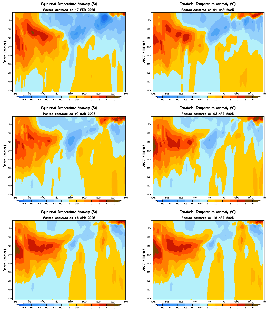
The subsurface anomalies look to have cooled a fair bit in the last week or so between 180W and 120W Luis.
0 likes   

User avatar
cycloneye
Admin
Admin
Posts: 145299
Age: 68
Joined: Thu Oct 10, 2002 10:54 am
Location: San Juan, Puerto Rico

Re: ENSO Updates=Next BoM Update,7/11/07,Next CPC Update,7/12/07

#374 Postby cycloneye » Sun Jul 08, 2007 5:00 pm

P.K. wrote:The subsurface anomalies look to have cooled a fair bit in the last week or so between 180W and 120W Luis.


Image

Yes Peter.It looks more coolish in the Central Pacific.Maybe after all La Nina will wake up.
0 likes   

User avatar
P.K.
Professional-Met
Professional-Met
Posts: 5149
Joined: Thu Sep 23, 2004 5:57 pm
Location: Watford, England
Contact:

Re: ENSO Updates=Next BoM Update,7/11/07,Next CPC Update,7/12/07

#375 Postby P.K. » Mon Jul 09, 2007 7:09 am

It has become even cooler since then.

The Nino 3.4 weekly anomaly has dropped a lot this week from +0.11C to -0.18C. All regions except Nino 2 have dropped this week and even Nino 4 is only at +0.11C for the weekly anomaly.
0 likes   

User avatar
Aquawind
Category 5
Category 5
Posts: 6714
Age: 62
Joined: Mon Jun 16, 2003 10:41 pm
Location: Salisbury, NC
Contact:

Re: ENSO Updates=Next BoM Update,7/11/07,Next CPC Update,7/12/07

#376 Postby Aquawind » Mon Jul 09, 2007 5:12 pm

That's interesting Peter.. After looking at the latest MJO update for the CPC is continues to show more warm upper ocean heat content..

http://www.cpc.ncep.noaa.gov/products/i ... tlon.shtml

They even mention a recent Kelvin wave adding to the warm anomalies it in the update and the anomalies in the west continue to grow Bigger since late March..

http://www.cpc.ncep.noaa.gov/products/p ... /mjo.shtml

Looking at the profile graphic in the posts above above the cool anomalies have weakened and the warm has expanded darn near as much as the cool..seems like conflicting analysis...
0 likes   

User avatar
cycloneye
Admin
Admin
Posts: 145299
Age: 68
Joined: Thu Oct 10, 2002 10:54 am
Location: San Juan, Puerto Rico

Re: ENSO Updates=BoM Update in a few hours

#377 Postby cycloneye » Tue Jul 10, 2007 6:28 pm

In a few hours (Night in Western Hemisphere and day (July 11th) in Australia,the Aussies (BoM) ENSO Update will be out.This will be a very important update in the sense that is almost prior to the ramp up or the peak of the Atlantic Hurricane season and what they will say will be key to what the equatorial Pacific will be comming the heart of the Atlantic season.Neutral or La Nina? We shall see.
0 likes   

miamicanes177
Category 5
Category 5
Posts: 1131
Joined: Tue Aug 01, 2006 10:53 pm

Re: ENSO Updates=BoM (Australians) Update in a few hours

#378 Postby miamicanes177 » Tue Jul 10, 2007 6:55 pm

where is the link to this report cycloneye? Thanks
0 likes   

User avatar
cycloneye
Admin
Admin
Posts: 145299
Age: 68
Joined: Thu Oct 10, 2002 10:54 am
Location: San Juan, Puerto Rico

Re: ENSO Updates=BoM (Australians) Update in a few hours

#379 Postby cycloneye » Tue Jul 10, 2007 6:56 pm

miamicanes177 wrote:where is the link to this report cycloneye? Thanks


http://www.bom.gov.au/climate/enso/index.shtml
0 likes   

Aric Dunn
Category 5
Category 5
Posts: 21238
Age: 42
Joined: Sun Sep 19, 2004 9:58 pm
Location: Ready for the Chase.
Contact:

Re: ENSO Updates=BoM (Australians) Update in a few hours

#380 Postby Aric Dunn » Tue Jul 10, 2007 9:22 pm

Image


looks like cooler ssts are still extending further west.. since the last update
0 likes   


Return to “Talkin' Tropics”

Who is online

Users browsing this forum: Ulf and 20 guests