SE TX / SW LA Discussion - Hot! Hot! Hot!
Moderator: S2k Moderators
Forum rules

The posts in this forum are NOT official forecast and should not be used as such. They are just the opinion of the poster and may or may not be backed by sound meteorological data. They are NOT endorsed by any professional institution or STORM2K.
-
jasons2k

- Storm2k Executive

- Posts: 8290
- Age: 52
- Joined: Wed Jul 06, 2005 12:32 pm
- Location: The Woodlands, TX
Re: SE TX / SW LA Discussion - Heavy Rain Threat
It looked real promising on radar, but I just got a few drops - a trace at most - up here.
0 likes
-
southerngale

- Retired Staff

- Posts: 27418
- Joined: Thu Oct 10, 2002 1:27 am
- Location: Southeast Texas (Beaumont area)
-
jasons2k
- Storm2k Executive
- Posts: 8290
- Age: 52
- Joined: Wed Jul 06, 2005 12:32 pm
- Location: The Woodlands, TX
That sign is great!! Almost as good as one in Georgia that reads "Road is wet when raining".
Oh, yes, the sign is the result of a lawsuit. Someone wrecked their car in a rainstorm and sued the city for not placing a warning sign on the road that it would be WET if it's raining outside. Tax money well spent....
Oh, yes, the sign is the result of a lawsuit. Someone wrecked their car in a rainstorm and sued the city for not placing a warning sign on the road that it would be WET if it's raining outside. Tax money well spent....
0 likes

Re: SE TX / SW LA Discussion - Decent Chance of Rain
After two days of water in our garage, garage apartment and storage unit it has finally receeded. Amazingly the parish came out and cleaned out the culverts last week so that this type of flooding would NOT occur. The garage and apartment are already totaled but what was left in the storage unit is now toast as well. At least now the rain is down to a couple of storms passing through each day with a rest in between so it's able to drain off a little. Our forcaster just keeps repeating, "Be thankful that these rains are keeping the temps down and the ground moist because elsewhere people are begging for it".
0 likes
Re: SE TX / SW LA Discussion - Decent Chance of Rain
The radar is looking very quiet right now. That's a first in a very long time! I think we might be drying out for awhile. YeeeeHaaaawwwww!!!! 
0 likes
-
CajunMama
- Retired Staff
- Posts: 10791
- Joined: Thu Feb 06, 2003 9:57 pm
- Location: 30.22N, 92.05W Lafayette, LA
Nice little storm just went throught here. Lots of lightning strikes close to my house. I was going out into the garage, i saw a huge flash of lightning. I never knew i could move so fast to get back in the house! My daughter and I were sitting together...we'd see the flash and tense up waiting for the thunder. My poor dogs were scared. It was exciting though but a little too close for me.
I checked 911 calls (our 911 has internet access so you can see where wrecks, fires, road hazards and traffic light malfunctions are). There was a fire call 3 houses from Bre! I'm guessing they were struck by lightning.
I checked 911 calls (our 911 has internet access so you can see where wrecks, fires, road hazards and traffic light malfunctions are). There was a fire call 3 houses from Bre! I'm guessing they were struck by lightning.
0 likes
-
southerngale
- Retired Staff
- Posts: 27418
- Joined: Thu Oct 10, 2002 1:27 am
- Location: Southeast Texas (Beaumont area)


Re: SE TX / SW LA Discussion - Decent Chance of Rain
I have finished my yard work and am totally ready for rain again. Is this a REAL chance this weekend?
0 likes
-
crazycajuncane

- S2K Supporter

- Posts: 1097
- Joined: Sun Aug 15, 2004 2:51 pm
- Location: Lafayette, Louisiana
- Contact:
Re: SE TX / SW LA Discussion - Decent Chance of Rain
Mets callin for some stormy weather Sunday, Monday and Tuesday! Boy was it like an oven this evening.
We got a good thunderstorm in town on Monday. The last two days have been nice and dry. It's getting humid again though!
We got a good thunderstorm in town on Monday. The last two days have been nice and dry. It's getting humid again though!
0 likes
Re: SE TX / SW LA Discussion - Decent Chance of Rain
HPC is forecast a lot of rain in northeast Texas the next five days. Up to 7 inches possibly. Also, I saw on the local weather, they are calling for a high chance of rain for Monday and Tuesday. Possible flooding event.
QPF Model
QPF Model
0 likes

Re: SE TX / SW LA Discussion - Decent Chance of Rain
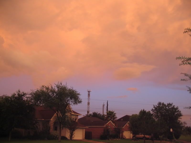
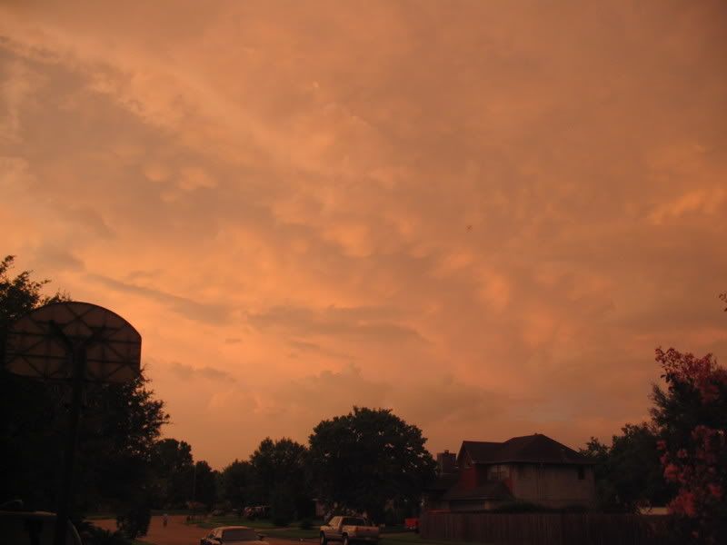
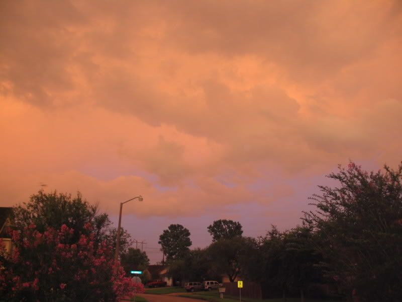
Weather images from tonight after the passing storms. Very nice.
IMG]http://img.photobucket.com/albums/v338/bflanakin/July01_2007104.jpg[/IMG]

IMG]http://img.photobucket.com/albums/v338/bflanakin/July01_2007104.jpg[/IMG]
0 likes
Re: SE TX / SW LA Discussion - Decent Chance of Rain
Ptarmigan wrote:HPC is forecast a lot of rain in northeast Texas the next five days. Up to 7 inches possibly. Also, I saw on the local weather, they are calling for a high chance of rain for Monday and Tuesday. Possible flooding event.
QPF Model
The QPF model has updated and does not bode to well. Up to 7 inches of rain could fall in East Texas in the next 5 days.
0 likes
-
southerngale
- Retired Staff
- Posts: 27418
- Joined: Thu Oct 10, 2002 1:27 am
- Location: Southeast Texas (Beaumont area)
Re: SE TX / SW LA Discussion - Decent Chance of Rain
It looks like you'll get your wish, Frick.
High rain chances starting this weekend... didn't the rain just end? lol
Nice pics, Kat!
High rain chances starting this weekend... didn't the rain just end? lol
Nice pics, Kat!
0 likes
-
srainhoutx

- S2K Supporter
- Posts: 6919
- Age: 68
- Joined: Sun Jan 14, 2007 11:34 am
- Location: Haywood County, NC
- Contact:
Re: SE TX / SW LA Discussion - Decent Chance of Rain
FYI, Special Weather Statement out AUS/SAN WFO this afternoon. Very interesting to note the we are nearing wettest yearly rainfall records todate this year in TX...
SPECIAL WEATHER STATEMENT
NATIONAL WEATHER SERVICE AUSTIN/SAN ANTONIO TX
307 PM CDT FRI JUL 13 2007
TXZ171>173-183>194-202>209-217>225-228-140400-
LLANO-BURNET-WILLIAMSON-VAL VERDE-EDWARDS-REAL-KERR-BANDERA-
GILLESPIE-KENDALL-BLANCO-HAYS-TRAVIS-BASTROP-LEE-KINNEY-UVALDE-
MEDINA-BEXAR-COMAL-GUADALUPE-CALDWELL-FAYETTE-MAVERICK-ZAVALA-
FRIO-ATASCOSA-WILSON-KARNES-GONZALES-DE WITT-LAVACA-DIMMIT-
INCLUDING THE CITIES OF...LLANO...BURNET...GEORGETOWN...DEL RIO...
ROCKSPRINGS...LEAKEY...KERRVILLE...BANDERA...FREDERICKSBURG...
BOERNE...BLANCO...SAN MARCOS...AUSTIN...BASTROP...GIDDINGS...
BRACKETTVILLE...UVALDE...HONDO...SAN ANTONIO...NEW BRAUNFELS...
SEGUIN...LOCKHART...LA GRANGE...EAGLE PASS...CRYSTAL CITY...
PEARSALL...PLEASANTON...FLORESVILLE...KARNES CITY...GONZALES...
CUERO...HALLETTSVILLE...CARRIZO SPRINGS
307 PM CDT FRI JUL 13 2007
...INCREASING CHANCE OF RAIN IS EXPECTED IN THE NEXT FEW DAYS...
AN AREA OF LOW PRESSURE ALOFT IS EXPECTED TO FORM AGAIN
THIS AFTERNOON AND TONIGHT...AND CONTINUE OVER SOUTH
CENTRAL TEXAS THIS WEEKEND TO THE EARLY AND MID TO LATE
PART OF NEXT WEEK. THIS WILL CAUSE AN INCREASING CHANCE
OF RAIN AGAIN. THERE WILL BE A CHANCE OF SHOWERS AND
THUNDERSTORMS FORMING OVER THE AREA FROM THE WEST AND
NORTH LATER THIS AFTERNOON OR TONIGHT...AND A CHANCE OF
MAINLY DAYTIME TO EVENING SHOWERS AND THUNDERSTORMS OVER
SOUTH CENTRAL TEXAS SATURDAY THROUGH THE MID TO LATE PART
OF NEXT WEEK.
THESE SHOWERS AND THUNDERSTORMS COULD PRODUCE LOCALLY HEAVY
RAINS...SOME WIND GUSTS OF 25 TO 40 MPH AND FREQUENT DANGEROUS
LIGHTNING. RUNOFF FROM LOCALLY HEAVY RAIN MAY CAUSE SOME FLOODING
ON FLOOD PRONE STREETS AND HIGHWAYS...AT LOW WATER CROSSINGS...
AND ALONG CREEKS AND STREAMS.
THE RAINFALL FROM JANUARY TO MID JULY OF 2007 IS ONE OF THE
WETTER JANUARY TO MID JULY PERIODS OF RECORD. THE ABUNDANT SOIL
MOISTURE WILL MODERATE DAYTIME HIGHS AND HELP RAIN INCREASE
RUNOFF FROM LOCALLY HEAVY RAINS.
ADDITIONAL STATEMENTS WILL BE ISSUED AS CONDITIONS WARRANT. THE
LATEST WEATHER INFORMATION FOR SOUTH CENTRAL TEXAS FROM THE
NATIONAL WEATHER SERVICE AUSTIN/SAN ANTONIO IS POSTED ON LINE AT
http://WWW.SRH.WEATHER.GOV/EWX
0 likes
-
PTrackerLA

- Category 5

- Posts: 5281
- Age: 42
- Joined: Thu Oct 10, 2002 8:40 pm
- Location: Lafayette, LA
Re: SE TX / SW LA Discussion - Decent Chance of Rain
Looks like a heavy rain event possible in this area over the weekend.
AREA FORECAST DISCUSSION
NATIONAL WEATHER SERVICE LAKE CHARLES LA
300 PM CDT FRI JUL 13 2007
.SYNOPSIS...AS MS ANNIE SAYS, "HERE COMES THE RAIN AGAIN". THIS
TIME ITS COURTESY OF THE BOUNDARY OVER THE ARKLATEX SEPARATING
TROPICAL CARRIBBEAN AIR FROM CONTINENTAL AIR CARRIED DOWN THE
LEEWARD SIDE OF A MASSIVE RIDGE OVER THE WEST. A WEAKENING UPPER
LEVEL RIDGE ACROSS THE SOUTH WILL ALLOW THIS BOUNDARY TO SAG INTO
OUR AREA TONIGHT AND SATURDAY. DEVELOPING LOW PRESSURE OVER
NORTHEAST TEXAS AT THE BASE OF A BROAD TROUGH FROM THE GREAT
LAKES IS EXPECTED TO STALL OVER OUR AREA. THE RESULT WILL BE HEAVY
RAINFALL OVER THE REGION STARTING LATE SATURDAY AND EXTENDING INTO MONDAY.
HIGHER THAN CLIMO RAINS WILL LINGER INTO TUESDAY. THE BERMUDA
RIDGE RESPONSIBLE FOR BOTTLING UP THIS SYSTEM OVER OUR AREA WILL
EVENTUALLY BUILD WEST INTO EAST TEXAS, BRINGING SUMMER BACK TO THE
GULF COAST OVER THE LATTER PORTION OF NEXT WEEK.
&&
.SHORT TERM...THUNDERSTORMS ASSOCIATED WITH A SHORT WAVE OVER THE
TEXAS HILL COUNTRY WILL SWING THROUGH LATE TONIGHT, FINALLY
TRIGGERING THUNDERSTORMS FROM A PRIMED ATMOSPHERE. GFS AND NAM HAS THIS.
WENT SLIGHTLY UNDER GUIDANCE ON POPS FOR SATURDAY BUT STILL
CONSIDERABLY LIKELY. THE SOUTHWESTLY SURFACE FLOW SHOULD HELP KEEP
THE LOWER LEVELS DRIER THAN MID AND UPPER LEVELS AND SHOULD DELAY
THE ONSET OF THE HEAVY RAINS UNTIL LATER IN THE AFTERNOON. WENT
COOLER THAN GUIDANCE FOR SATURDAY DUE TO EXPECTED RAIN COOLED AIR.
.LONG TERM...THE GFS UNFORTUNATELY LOOKS PRETTY GOOD FOR PRECIP
SUNDAY AND MONDAY. NCEP HAS A LARGE 24HR 2 INCH PRECIP BULLSEYE
CENTERED OVER SABINE PASS FOR MONDAY MORNING, WHILE STEADILY
INCREASING HEAVY PRECIP FROM THE NORTH LATE FRIDAY INTO SATURDAY.
IF THIS PROG REMAINS, LOOK FOR FLOOD WATCHES BY THIS TIME ON SATURDAY.
WENT BELOW MEX GUIDANCE FOR MUCH OF THE REMAINDER OF THE WEEK AS
RIDGING BEGINS TO BUILD IN FROM THE EAST.
0 likes
-
southerngale
- Retired Staff
- Posts: 27418
- Joined: Thu Oct 10, 2002 1:27 am
- Location: Southeast Texas (Beaumont area)
Re: SE TX / SW LA Discussion - Decent Chance of Rain
I did get a chuckle out of that opening line of the discussion. That's also one of the songs I put on Storm2k's MySpace. lol
0 likes

Return to “USA & Caribbean Weather”
Who is online
Users browsing this forum: Google [Bot], HockeyTx82, opticsguy and 57 guests