SEVERE WEATHER STATEMENT
NATIONAL WEATHER SERVICE MELBOURNE FL
459 PM EDT SUN JUL 15 2007
FLC009-152130-
/O.CON.KMLB.TO.W.0017.000000T0000Z-070715T2130Z/
BREVARD FL-
459 PM EDT SUN JUL 15 2007
...A TORNADO WARNING REMAINS IN EFFECT UNTIL 530 PM EDT FOR NORTHERN
BREVARD COUNTY...
AT 455 PM EDT...NATIONAL WEATHER SERVICE DOPPLER RADAR CONTINUED TO
INDICATE A TORNADO. THIS TORNADO WAS LOCATED OVER MERRITT ISLAND
WILDLIFE REFUGE...MOVING SOUTHEAST AT 10 MPH.
THE TORNADO WILL BE NEAR...
KENNEDY SPACE CENTER BY 530 PM EDT...
SEEK SHELTER ON THE LOWEST FLOOR OF THE BUILDING IN AN INTERIOR
HALLWAY OR ROOM SUCH AS A CLOSET. USE BLANKETS OR PILLOWS TO COVER
YOUR BODY AND ALWAYS STAY AWAY FROM WINDOWS.
IF IN MOBILE HOMES OR VEHICLES...EVACUATE THEM AND GET INSIDE A
SUBSTANTIAL SHELTER. IF NO SHELTER IS AVAILABLE...LIE FLAT IN THE
NEAREST DITCH OR OTHER LOW SPOT AND COVER YOUR HEAD WITH YOUR HANDS.
LAT...LON 2870 8080 2858 8081 2847 8072 2842 8055
2867 8055
$$
KELLY
http://www.srh.weather.gov/mlb/
Florida Weather
Moderator: S2k Moderators
Forum rules

The posts in this forum are NOT official forecast and should not be used as such. They are just the opinion of the poster and may or may not be backed by sound meteorological data. They are NOT endorsed by any professional institution or STORM2K.
-
Category 5

- Category 5

- Posts: 10074
- Age: 36
- Joined: Sun Feb 11, 2007 10:00 pm
- Location: New Brunswick, NJ
- Contact:
Re: Florida Seabreeze Thread
Drove through a waterfall on I-10 near Lake City
See for yourself.
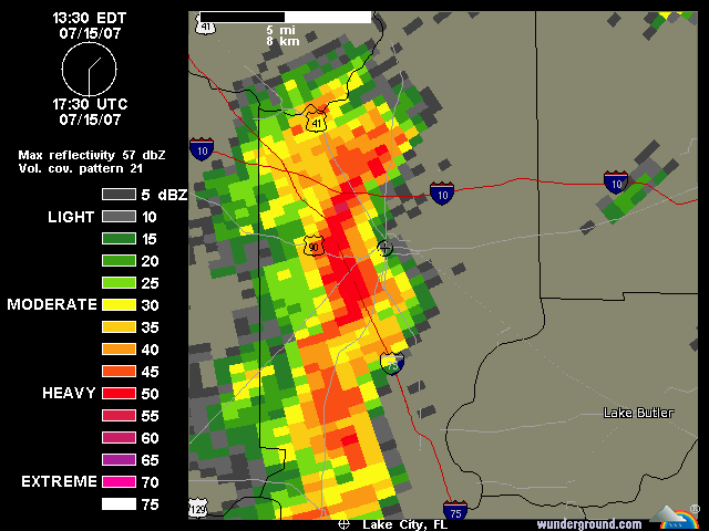
See for yourself.
0 likes
-
Category 5
- Category 5
- Posts: 10074
- Age: 36
- Joined: Sun Feb 11, 2007 10:00 pm
- Location: New Brunswick, NJ
- Contact:
Re: Florida Seabreeze Thread
I wished we had weather like this in NJ. Down here I find myself surrounded by thunderstorms daily.
0 likes
-
Aquawind

- Category 5
- Posts: 6714
- Age: 62
- Joined: Mon Jun 16, 2003 10:41 pm
- Location: Salisbury, NC
- Contact:
Re:
fact789 wrote:Finally...
AREA FORECAST DISCUSSION
NATIONAL WEATHER SERVICE TAMPA BAY - RUSKIN FL
145 PM EDT SUN JUL 15 2007
.SHORT TERM...U/L RIDGE OVER THE WESTERN ATLANTIC WILL BUILD OVER
WEST CENTRAL AND SOUTHWEST FLORIDA THROUGH TUESDAY...WHICH WILL
INCREASE SUBSIDENCE A BIT OVER THE AREA. SIGNIFICANT CHANGE IN
LOWER LEVELS AS SURFACE RIDGE AXIS LIFTS NORTH OF THE AREA WHICH
WILL SHIFT BOUNDARY LAYER WINDS FROM THE SOUTHWEST TO THE
EAST/SOUTHEAST. THIS WILL KEEP AFTERNOON WEST COAST SEABREEZE
BOUNDARY OVER THE COASTAL COUNTIES...AND COLLISION OF EAST COAST
SEABREEZE WITH THE WEST COAST SEABREEZE WILL OCCUR OVER THE COAST
COUNTIES OF WEST CENTRAL AND SOUTHWEST FLORIDA DURING THE MID TO LATE
AFTERNOON WHICH WILL INCREASE AREAL COVERAGE OF THUNDERSTORMS FROM
TAMPA TO FORT MYERS. MOS GUIDANCE APPEARS UNDERDONE IN ALL MODELS AS
THIS IS TYPICALLY A WET PATTERN ALONG COASTAL AREAS. DEEP MOISTURE
WILL REMAIN IN PLACE SO ONLY HINDRANCE WILL BE THE INCREASED
SUBSIDENCE ALOFT...BUT DON`T BELIEVE IT WILL BE ENOUGH TO KEEP POPS
BELOW CLIMO.
That sounds great. I will be watching for the change in motion today.
I have noticed some pretty weak discussions from that office recently. I don't know if they are training, frustrated, confused, or bored..
0 likes
-
Opal storm
Re: Florida Seabreeze Thread
Much like yesterday, more stoms coming out of the Gulf this afternoon. 
0 likes
-
Category 5
- Category 5
- Posts: 10074
- Age: 36
- Joined: Sun Feb 11, 2007 10:00 pm
- Location: New Brunswick, NJ
- Contact:
Re: Florida Seabreeze Thread
Nasty storm just west of me. Lots of lightning and thunder and gusty winds.
0 likes
-
JonathanBelles
- Professional-Met

- Posts: 11430
- Age: 35
- Joined: Sat Dec 24, 2005 9:00 pm
- Location: School: Florida State University (Tallahassee, FL) Home: St. Petersburg, Florida
- Contact:
-
Category 5
- Category 5
- Posts: 10074
- Age: 36
- Joined: Sun Feb 11, 2007 10:00 pm
- Location: New Brunswick, NJ
- Contact:
Re:
fact789 wrote:Stongest cell all year moving through Tampa right now. T-Storm Warning and an Urban Flood Watch out for Hillsborough.
Thats one big cell.
0 likes
-
Tampa Bay Hurricane

- Category 5
- Posts: 5597
- Age: 38
- Joined: Fri Jul 22, 2005 7:54 pm
- Location: St. Petersburg, FL
Re: Re:
Category 5 wrote:fact789 wrote:Stongest cell all year moving through Tampa right now. T-Storm Warning and an Urban Flood Watch out for Hillsborough.
Thats one big cell.
It put out an outflow boundary that produced very strong
howling winds for about 15 minutes earlier near Tampa
Bay (on the eastern side)...that wind had to
be like 30+ mph gusts...
0 likes
-
JonathanBelles
- Professional-Met
- Posts: 11430
- Age: 35
- Joined: Sat Dec 24, 2005 9:00 pm
- Location: School: Florida State University (Tallahassee, FL) Home: St. Petersburg, Florida
- Contact:
-
feederband

- S2K Supporter

- Posts: 3423
- Joined: Wed Oct 01, 2003 6:21 pm
- Location: Lakeland Fl
Re:
fact789 wrote:Stongest cell all year moving through Tampa right now. T-Storm Warning and an Urban Flood Watch out for Hillsborough.
Yeah I was watching that on radar...Nothing here though...
0 likes
-
Extremeweatherguy

- Category 5
- Posts: 11095
- Joined: Mon Oct 10, 2005 8:13 pm
- Location: Florida
Re: Florida Seabreeze Thread
Driving to the Orlando Intl. airport the other day I hit a huge storm. The wind was blowing and the rain was coming down sideways. When I got to the airport I also noticed many tree limbs down everywhere. I did not think much of it until just now when I heard that they recieved 61mph gusts at the airport minutes before I got there. That storm was pretty intense!
0 likes
-
JonathanBelles
- Professional-Met
- Posts: 11430
- Age: 35
- Joined: Sat Dec 24, 2005 9:00 pm
- Location: School: Florida State University (Tallahassee, FL) Home: St. Petersburg, Florida
- Contact:
-
feederband
- S2K Supporter
- Posts: 3423
- Joined: Wed Oct 01, 2003 6:21 pm
- Location: Lakeland Fl

Re: Florida Seabreeze ThreadI
I know how you feel feederband. We have had storms literally all around us for two days now. One was even close enought to smell the rain! Alas, not a drop here. 
0 likes
-
Category 5
- Category 5
- Posts: 10074
- Age: 36
- Joined: Sun Feb 11, 2007 10:00 pm
- Location: New Brunswick, NJ
- Contact:
Re: Florida Seabreeze Thread
Had a heavy downpour for about 15 minutes yesterday at about 3:30
0 likes
-
feederband
- S2K Supporter
- Posts: 3423
- Joined: Wed Oct 01, 2003 6:21 pm
- Location: Lakeland Fl
-
Category 5
- Category 5
- Posts: 10074
- Age: 36
- Joined: Sun Feb 11, 2007 10:00 pm
- Location: New Brunswick, NJ
- Contact:
Re: Florida Seabreeze Thread
Not much on radar just a small blip in southern Gilchrist county. But the cloud is very high.
0 likes
-
feederband
- S2K Supporter
- Posts: 3423
- Joined: Wed Oct 01, 2003 6:21 pm
- Location: Lakeland Fl
Re: Florida Seabreeze Thread
I got one getting close...It might get me... 
Edit: Its here......
Edit: Its here......
0 likes
-
feederband
- S2K Supporter
- Posts: 3423
- Joined: Wed Oct 01, 2003 6:21 pm
- Location: Lakeland Fl
Return to “USA & Caribbean Weather”
Who is online
Users browsing this forum: HockeyTx82 and 92 guests