Invest 99L in Central Atlantic
Moderator: S2k Moderators
Forum rules

The posts in this forum are NOT official forecasts and should not be used as such. They are just the opinion of the poster and may or may not be backed by sound meteorological data. They are NOT endorsed by any professional institution or STORM2K. For official information, please refer to products from the National Hurricane Center and National Weather Service.
-
cycloneye

- Admin

- Posts: 149508
- Age: 69
- Joined: Thu Oct 10, 2002 10:54 am
- Location: San Juan, Puerto Rico
Re: Wave with well defined mid level circulation off Africa
57,thanks for that complete analysis of what is going on in the 2007 season.This was needed to calm down some of the peeps that were going nuts with developing any cluster out there.  It's not about the numbers but about where will they go.That is why we have to be prepared every season,because it only takes one to ruin your life.(Remember Andrew)
0 likes


-
CourierPR

- Category 5

- Posts: 1336
- Age: 72
- Joined: Tue Aug 31, 2004 7:53 pm
- Location: Pompano Beach, Florida
Re: Wave with well defined mid level circulation off Africa
WXMAN57, thank you for that short course in hurricane meteorology. You have a knack for condensing important information into a few fact-filled paragraphs.
0 likes

Re: Wave with well defined mid level circulation off Africa
Thank you wxman57.
FASCINATING reading and certainly told of what to expect when written 5-6 years ago.
Viola; storms struck Florida as the pattern combination you cited came true.
(and you weren't predicting a pattern AFTER the fact!)
Question:
What do the combinations of the PDO and NAO look like this season?
(Hope I am asking the question correctly; given what your charts on the web page article show when there is a cold phase PDO and warm Atlanitc SST's)
Thanks again for the post and the link and all that you contribute for us Hurricane Enthusiasts to learn from!!!
Last edited by fci on Sat Jul 21, 2007 9:39 am, edited 1 time in total.
0 likes
Re: Wave with well defined mid level circulation off Africa
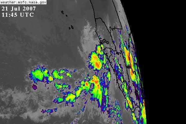
A large area of dust can be seen to the north of the disturbance this morning...
0 likes
-
windstorm99

- S2K Supporter

- Posts: 1578
- Age: 48
- Joined: Sat May 26, 2007 8:10 am
- Location: Miami, Florida
- Contact:
Re: Wave with well defined mid level circulation off Africa
Indeed florida was hit very oftern back in 1940's and the 1960's....Here is a piece of an article i found on how lucky we have been in south florida.
It is important that Floridians view this terribly damaging landfall season from a longer period perspective. Overall Florida has been extremely fortunate in recent years. Between 1966-2003 (38 years) the Florida Peninsula has experienced the landfall of only one major hurricane (Andrew, 1992) (Fig. 13). But in this long major hurricane lull period since the mid-1960s, Florida's population and coastal development has exploded. Few of the new Floridians have experienced a major hurricane hit. Most Floridians were not prepared for this unusual onslaught of four devastating storms in such a short period of time. But old-timers who lived in Florida in the 1930s through the 1950s well remember that Florida used to be hit by many intense storms. Between 1928-1965 (41 years) the Florida Peninsula experienced 14 major hurricane landfalls (1 per 3 years).

It is important that Floridians view this terribly damaging landfall season from a longer period perspective. Overall Florida has been extremely fortunate in recent years. Between 1966-2003 (38 years) the Florida Peninsula has experienced the landfall of only one major hurricane (Andrew, 1992) (Fig. 13). But in this long major hurricane lull period since the mid-1960s, Florida's population and coastal development has exploded. Few of the new Floridians have experienced a major hurricane hit. Most Floridians were not prepared for this unusual onslaught of four devastating storms in such a short period of time. But old-timers who lived in Florida in the 1930s through the 1950s well remember that Florida used to be hit by many intense storms. Between 1928-1965 (41 years) the Florida Peninsula experienced 14 major hurricane landfalls (1 per 3 years).
0 likes
-
Aric Dunn
- Category 5
- Posts: 21238
- Age: 43
- Joined: Sun Sep 19, 2004 9:58 pm
- Location: Ready for the Chase.
- Contact:
Re: Wave with well defined mid level circulation off Africa
windstorm99 wrote:Indeed florida was hit very oftern back in 1940's and the 1960's....Here is a piece of an article i found on how lucky we have been in south florida.
It is important that Floridians view this terribly damaging landfall season from a longer period perspective. Overall Florida has been extremely fortunate in recent years. Between 1966-2003 (38 years) the Florida Peninsula has experienced the landfall of only one major hurricane (Andrew, 1992) (Fig. 13). But in this long major hurricane lull period since the mid-1960s, Florida's population and coastal development has exploded. Few of the new Floridians have experienced a major hurricane hit. Most Floridians were not prepared for this unusual onslaught of four devastating storms in such a short period of time. But old-timers who lived in Florida in the 1930s through the 1950s well remember that Florida used to be hit by many intense storms. Between 1928-1965 (41 years) the Florida Peninsula experienced 14 major hurricane landfalls (1 per 3 years).
one thing to remember and puts tells a huge story..
since the start of the new present active cycle.. florida has been hit by how many major hurricanes...
well lets count... jeanne,charlie,ivan,opal,wilma, ... can we add some.. i know there is...
any way whole point.. the last 12 years has seen more
land falling major hurricanes than any other 10 to 12 year period in history.. and south florida has already seen 1/3 of major landfall in 12 years.. verses that 41 year period.
and so on.. this active period.. has so far turned out to be far worse than the last one..
just for florida.. not counting the every where else
0 likes
-
windstorm99
- S2K Supporter
- Posts: 1578
- Age: 48
- Joined: Sat May 26, 2007 8:10 am
- Location: Miami, Florida
- Contact:
Re: Wave with well defined mid level circulation off Africa
Iam reffering to miami dade and broward counties.
0 likes
-
Aric Dunn
- Category 5
- Posts: 21238
- Age: 43
- Joined: Sun Sep 19, 2004 9:58 pm
- Location: Ready for the Chase.
- Contact:
Re: Wave with well defined mid level circulation off Africa
windstorm99 wrote:Iam reffering to miami dade and broward counties.
yeah .. i put in there .. that you have already seen 3 major storms in 12 year... and 9 major in that 41 year period..
you just want actaul landfalls in those counties..
well that no fun lol
0 likes
Re: Wave with well defined mid level circulation off Africa
Wouldn't these last few posts be better under the "State with highest hurricane frequency" thread?
Last edited by Frank2 on Sat Jul 21, 2007 10:17 am, edited 1 time in total.
0 likes
-
'CaneFreak

- Category 5
- Posts: 1487
- Joined: Mon Jun 05, 2006 10:50 am
- Location: New Bern, NC
Re: Wave with well defined mid level circulation off Africa
BENIGN UPPER LEVEL FEATURES WITH
DRY STABLE AIR DOMINATES THE REMAINDER OF THE ATLC WITH A STRONG
SURFACE RIDGE ANCHORED BY A 1035 MB HIGH CENTERED WELL N OF THE
REGION. THE FIRST VISIBLE SATELLITE IMAGES OF THE DAY SHOW AN
AREA OF AFRICAN DUST FROM 15N-30W E OF 35W.
This is from the 8:05 AM Discussion. This is not good. If that ridge does not weaken soon, you can kiss this season goodbye. That same ridge destroyed last season. It is just not looking good.
0 likes

Re: Wave with well defined mid level circulation off Africa
A strong Azores Bermuda high is a very common feature in these June and july month.At this time,it is a period with increasing trade winds over the Eastern carribean,rather classic ! Where is the problem??
0 likes
-
Tampa Bay Hurricane

- Category 5
- Posts: 5597
- Age: 38
- Joined: Fri Jul 22, 2005 7:54 pm
- Location: St. Petersburg, FL
-
'CaneFreak
- Category 5
- Posts: 1487
- Joined: Mon Jun 05, 2006 10:50 am
- Location: New Bern, NC
-
Blown Away

- S2K Supporter
- Posts: 10253
- Joined: Wed May 26, 2004 6:17 am
Re: Wave with well defined mid level circulation off Africa
Please correct me if I'm wrong:
1. The Atlantic has been in an active hurricane cycle since @1995.
2. The PDO has been in a warm cycle since the Atlantic active hurricane cycle began, resulting in a weaker Bermuda high and more recurvatures.
3. But recently, like the past few years, the PDO is moving towards a cold cycle and Atlantic SST's are still above average.
4. With Cold PDO, Warm Atlantic SST's, Stronger Bermuda High & fewer El Nino's due to cold PDO = The perfect combination for FL/Gulf landfall hurricanes.
5. This is just beginning??
6. The PDO Phases last decades, correct? So assuming the PDO is cold for a few decades the one factor that will determine how long we are in this current "Perfect Scenerio" for landfall FL/Gulf hurricanes will be how long Atlantic SST's are above average.
0 likes
-
hurricanetrack

- HurricaneTrack.com
- Posts: 1781
- Joined: Tue Dec 02, 2003 10:46 pm
- Location: Wilmington, NC
- Contact:
2007 season
That post is so on the money. Best one of the year. Period. Excellent job.
EDIT: I was referencing the post from wxman57 as seen below.
EDIT: I was referencing the post from wxman57 as seen below.
Last edited by hurricanetrack on Sat Jul 21, 2007 11:15 am, edited 1 time in total.
0 likes
-
hurricanetrack
- HurricaneTrack.com
- Posts: 1781
- Joined: Tue Dec 02, 2003 10:46 pm
- Location: Wilmington, NC
- Contact:
Re: Wave with well defined mid level circulation off Africa
wxman57 wrote:It certainly does look like one of the stronger waves that's moved off the west coast of Africa this season. But as has been said, they often look like tropical storms as they move offshore, only to fall apart a day or two later. Most likely, this wave will not develop due to the still-hostile conditions in the region. But it won't be very long before a wave moves offshore there and DOESN'T fall apart. Probably the first week of August.
As for the 2007 season, I think it's going along just as I had expected. The same models that had predicted a full-blown La Nina by the end of May were the same models that had predicted La Nina last season. But the models were 180 degrees off in 2006 and a moderate El Nino developed near peak season. The European model had been saying that any La Nina would not develop until September or October, so it wasn't going to be a factor early this season. This would lead to a normal start of the real action (1st or 2nd week of August).
I explained in another thread (about what an active cycle is) that the "active" phase of the Atlantic Multidecadal Oscillation (warm-phase AMO) does not mean more named storms will develop. In fact, the Bermuda high tends to be a bit stronger during this warm phase, leading to a little stronger low-level shear in the deep tropics. I did a great deal of research into the numbers of named storms in warm vs. cool-phase AMO, thinking I'd find more named storms when the water was warmer. But that wasn't the case. I did find just slightly fewer named storms when the Atlantic heats up. But I did find that there was a higher percentage of hurricanes with warmer water, and the number of major hurricanes more than doubled with greater heat content (1.5-2.0 per season for cool phase, 5-6 for warm phase). So don't expect as many named storms each season as we've seen in the past 5-10 years. The average number of named storms in the Atlantic basin is close to 12. This accounts for the estimated 3.2 missed per season prior to satellite (research by Chris Landsea/Roger Pielke Jr.). You might remember that near the start of the last warm-phase AMO (began in 1926), there were some seasons with a tremendous number of named storms (1933). But, soon after, the numbers dropped. However, that's the period when the U.S. was pummeled by many big hurricanes (1940s-1960s). We're now approaching the same pattern as back in the 1940s-1960s. Less named storms, greater landfall risk is what climatology would suggest.
I'd made a web page about 5-6 years ago concerning the AMO and possible future impacts. It's still up:
http://myweb.cableone.net/nolasue/Florida/
What do I expect this year? I think Dr. Gray/Phil Klotzback will cut back their predicted number of named storms to 14-15 in early August. That's still above normal, but only because of STS Andrea and the very short-lived Barry. There is tremendous heat content across the Gulf and NW Caribbean (greater than 2005) Anything moving into that region by mid to late August could well become a BIG problem for the northern Gulf coast. Climatology still suggests a strong correlation between this current pattern and a significant increase in the probability of a major hurricane impact between Florida and the Carolinas as well.
Don't focus on the numbers, look at the similarity of the pattern to what was observed during the 1940s-1960s. Many devastating hurricanes hit during seasons of normal to below-normal activity.
Best post of the year. Excellent job.
0 likes
-
'CaneFreak
- Category 5
- Posts: 1487
- Joined: Mon Jun 05, 2006 10:50 am
- Location: New Bern, NC
Who is online
Users browsing this forum: ouragans and 130 guests