My forecast.
Tonight: Scattered showers and thunderstorms before midnight. Partly cloudy, with a low around 66. South wind around 5 mph becoming calm. Chance of precipitation is 40%. New rainfall amounts of less than a tenth of an inch, except higher amounts possible in thunderstorms.
Tuesday: Mostly sunny, with a high near 89. Calm wind becoming north between 5 and 8 mph.
Tuesday Night: Mostly clear, with a low around 65. South wind around 6 mph becoming calm.
Wednesday: Mostly sunny, with a high near 91. North wind between 3 and 8 mph.
Wednesday Night: Mostly clear, with a low around 63. East wind between 4 and 7 mph becoming calm.
Thursday: Mostly sunny, with a high near 92.
Thursday Night: Mostly clear, with a low around 68.
Friday: Partly cloudy, with a high near 94.
Friday Night: Partly cloudy, with a low around 69.
Saturday: Partly cloudy, with a high near 94.
Saturday Night: Partly cloudy, with a low around 69.
Sunday: Partly cloudy, with a high near 92.
Sunday Night: Partly cloudy, with a low around 70.
Monday: Partly cloudy, with a high near 91.
Long Heatwave Coming PA/NJ
Moderator: S2k Moderators
Forum rules

The posts in this forum are NOT official forecast and should not be used as such. They are just the opinion of the poster and may or may not be backed by sound meteorological data. They are NOT endorsed by any professional institution or STORM2K.
-
Category 5

- Category 5

- Posts: 10074
- Age: 36
- Joined: Sun Feb 11, 2007 10:00 pm
- Location: New Brunswick, NJ
- Contact:
Long Heatwave Coming PA/NJ
0 likes
-
tropicana

- Category 5
- Posts: 8056
- Joined: Sat Sep 27, 2003 6:48 pm
- Location: Niagara Falls, Ontario, Canada
- Contact:
Re: Long Heatwave Coming PA/NJ
Hot here too in Toronto, with highs near 32C (90F) for days and days to come. Geez 
-justin-
-justin-
0 likes


-
Category 5
- Category 5
- Posts: 10074
- Age: 36
- Joined: Sun Feb 11, 2007 10:00 pm
- Location: New Brunswick, NJ
- Contact:
Re:
TexasSam wrote:I know that's hot for you up there, but the normals for Houston are about:
Days: Hazy Hot & humid with high's in the mid - upper 90's, and a 30% chance of rain, South East winds 5 - 10 MPH
Nights: Skys clearing around Midnight, low near 75, near 100% humidity, and calm winds...
I could never live in that constantly.
0 likes
-
Category 5
- Category 5
- Posts: 10074
- Age: 36
- Joined: Sun Feb 11, 2007 10:00 pm
- Location: New Brunswick, NJ
- Contact:
Re: Long Heatwave Coming PA/NJ
Forecast for Philly
Overnight: Mostly clear, with a low around 69. Calm wind.
Tuesday: Mostly sunny, with a high near 89. Calm wind becoming north between 5 and 8 mph.
Tuesday Night: Mostly clear, with a low around 70. South wind around 6 mph becoming calm.
Wednesday: Mostly sunny, with a high near 91. North wind between 3 and 8 mph.
Wednesday Night: Mostly clear, with a low around 68. South wind between 4 and 7 mph becoming calm.
Thursday: Mostly sunny, with a high near 92.
Thursday Night: Mostly clear, with a low around 70.
Friday: Partly cloudy, with a high near 93.
Friday Night: Partly cloudy, with a low around 73.
Saturday: Partly cloudy, with a high near 94.
Saturday Night: Partly cloudy, with a low around 72.
Sunday: Partly cloudy, with a high near 92.
Sunday Night: Partly cloudy, with a low around 72.
Monday: Partly cloudy, with a high near 91.
0 likes

-
Category 5
- Category 5
- Posts: 10074
- Age: 36
- Joined: Sun Feb 11, 2007 10:00 pm
- Location: New Brunswick, NJ
- Contact:
-
Category 5
- Category 5
- Posts: 10074
- Age: 36
- Joined: Sun Feb 11, 2007 10:00 pm
- Location: New Brunswick, NJ
- Contact:
-
tropicana
- Category 5
- Posts: 8056
- Joined: Sat Sep 27, 2003 6:48 pm
- Location: Niagara Falls, Ontario, Canada
- Contact:
Re: Long Heatwave Coming PA/NJ
93F 34C yesterday in Toronto and also today, quite humid, dewpoints to around 19C 66F. Hard night to sleep for those that have no air conditioners.
-justin-
-justin-
0 likes
-
Category 5
- Category 5
- Posts: 10074
- Age: 36
- Joined: Sun Feb 11, 2007 10:00 pm
- Location: New Brunswick, NJ
- Contact:
Re: Long Heatwave Coming PA/NJ
The humidity is expected to increase here over the next few days.
0 likes
-
tropicana
- Category 5
- Posts: 8056
- Joined: Sat Sep 27, 2003 6:48 pm
- Location: Niagara Falls, Ontario, Canada
- Contact:
Re: Long Heatwave Coming PA/NJ
Very humid and uncomfortably hot day in Toronto, a record high was set of 35C 95F (beating the old record of 34.3C 94F set ironically just 1 year ago in 2006).
Still a very oppresive evening tonight, 10pm temps. hovering around 29C - 30C (85F to 86F), not taking into account the humidity. Our heatwave began on Tuesday.
-justin-
Still a very oppresive evening tonight, 10pm temps. hovering around 29C - 30C (85F to 86F), not taking into account the humidity. Our heatwave began on Tuesday.
-justin-
0 likes
-
Category 5
- Category 5
- Posts: 10074
- Age: 36
- Joined: Sun Feb 11, 2007 10:00 pm
- Location: New Brunswick, NJ
- Contact:
Re: Long Heatwave Coming PA/NJ
95 today, not TOO humid, but the humidity has been worse at night.
The heatwave might break sunday, then pick back up monday and last through at least thursday.
The heatwave might break sunday, then pick back up monday and last through at least thursday.
0 likes
-
Category 5
- Category 5
- Posts: 10074
- Age: 36
- Joined: Sun Feb 11, 2007 10:00 pm
- Location: New Brunswick, NJ
- Contact:
-
angelwing

- S2K Supporter

- Posts: 4462
- Age: 64
- Joined: Tue Jan 18, 2005 3:06 pm
- Location: Kulpsville, PA
Re: Long Heatwave Coming PA/NJ
I think I'm losing wieght in my van driving from NJ-PA every day, tried the AC and the "service engine light" comes on then the speedometer cable goes to zero, so I have to shut off the AC. It's been a fun ride....NOT
0 likes
-
Stephanie

- S2K Supporter
- Posts: 23843
- Age: 63
- Joined: Thu Feb 06, 2003 9:53 am
- Location: Glassboro, NJ
Re: Long Heatwave Coming PA/NJ
This is pretty scary. We MAY get some scattered thundershowers, if we're lucky. We're going to get super dry, super fast with the temps being in the 90's for a week or more.
I don't ever remember a heat wave that has lasted as long as this one is predicted to do.
I don't ever remember a heat wave that has lasted as long as this one is predicted to do.
0 likes
-
Category 5
- Category 5
- Posts: 10074
- Age: 36
- Joined: Sun Feb 11, 2007 10:00 pm
- Location: New Brunswick, NJ
- Contact:
Re: Long Heatwave Coming PA/NJ
Stephanie wrote:This is pretty scary. We MAY get some scattered thundershowers, if we're lucky. We're going to get super dry, super fast with the temps being in the 90's for a week or more.
I don't ever remember a heat wave that has lasted as long as this one is predicted to do.
I do
Last year actually, 11 days 90+ including 2 of 100+
0 likes
-
Category 5
- Category 5
- Posts: 10074
- Age: 36
- Joined: Sun Feb 11, 2007 10:00 pm
- Location: New Brunswick, NJ
- Contact:
Re: Long Heatwave Coming PA/NJ
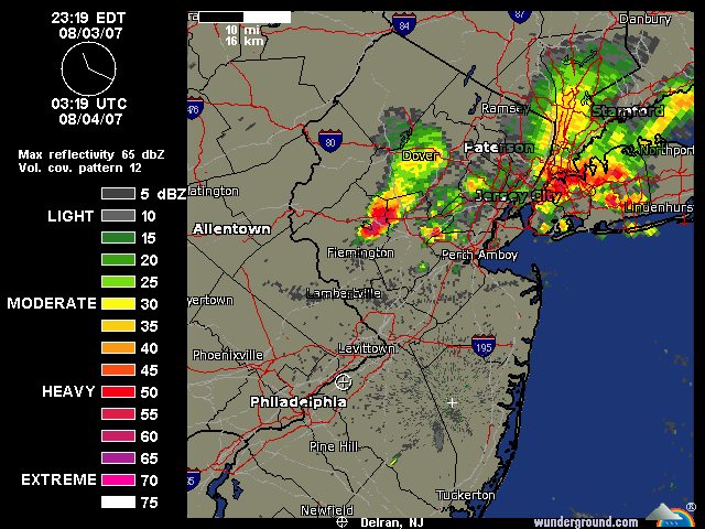
I can see flashes from this storm moving into Somerset County. Looks intense.
0 likes
-
Category 5
- Category 5
- Posts: 10074
- Age: 36
- Joined: Sun Feb 11, 2007 10:00 pm
- Location: New Brunswick, NJ
- Contact:
Re: Long Heatwave Coming PA/NJ
95 yesterday, looks like we're gonna get a short break from it.
0 likes
-
Stephanie
- S2K Supporter
- Posts: 23843
- Age: 63
- Joined: Thu Feb 06, 2003 9:53 am
- Location: Glassboro, NJ
Re: Long Heatwave Coming PA/NJ
I don't think that we broke 90 today and the humidity is down - slightly.
We have rain right now, Thank God!
Tomorrow is supposed to be in the mid 80's with potential showers and thundershowers and then we have an excessive heat advisory for Tuesday and Wednesday;
Excessive Heat Watch
/O.NEW.KPHI.EH.A.0004.070807T1600Z- 070809T0000Z/ NEW CASTLE-MERCER- GLOUCESTER-CAMDEN-NORTHWESTERN BURLINGTON- CHESTER-MONTGOMERY-BUCKS- DELAWARE-PHILADELPHIA- INCLUDING THE CITIES OF...WILMINGTON...TRENTON... GLASSBORO... CAMDEN...CHERRY HILL... MOORESTOWN...MOUNT HOLLY...WEST CHESTER... NORRISTOWN...DOYLESTOWN... MEDIA 350 PM EDT SUN AUG 5 2007
...EXCESSIVE HEAT WATCH IN EFFECT FROM TUESDAY AFTERNOON THROUGH WEDNESDAY EVENING...
THE NATIONAL WEATHER SERVICE IN MOUNT HOLLY HAS ISSUED AN EXCESSIVE HEAT WATCH...WHICH IS IN EFFECT FROM TUESDAY AFTERNOON THROUGH WEDNESDAY EVENING FOR THE HIGHLY URBANIZED AREAS.
HIGH PRESSURE WILL REMAIN OVER THE REGION THROUGH MIDWEEK AND WARM AND INCREASINGLY HUMID SOUTHWESTERLY FLOW WILL KEEP VERY HOT TEMPERATURES OVER THE AREA.
TEMPERATURES ARE EXPECTED TO TOP OUT IN THE MID 90S BOTH TUESDAY AND WEDNESDAY AFTERNOON. THESE HOT TEMPERATURES COMBINED WITH AN INCREASE IN HUMIDITY WILL PRODUCE HEAT INDEX VALUES OF 98 TO 103 ON TUESDAY. THE HUMIDITY WILL BE HIGHER ON WEDNESDAY WHICH WILL ALLOW FOR HEAT INDEX VALUES IN THE 100 TO 105 DEGREE RANGE IN THE HIGHLY URBANIZED AREAS.
HEAT INDEX VALUES AT OR ABOVE 100 DEGREES CAN CREATE A SITUATION IN WHICH HEAT ILLNESSES ARE POSSIBLE, ESPECIALLY IF THIS OCCURS OVER A NUMBER OF DAYS. ADDITIONALLY, OVERNIGHT LOW TEMPERATURES WILL REMAIN QUITE WARM, WITH MID 70S STARTING TONIGHT IN THE URBAN AREAS AND AROUND 70 ELSEWHERE.
TO STAY SAFE DURING THE HOT AND HUMID WEATHER, FOLLOW SOME COMMON SENSE SAFETY RULES TO AVOID HEALTH PROBLEMS. WEAR LIGHT-COLORED AND LOOSE-FITTING CLOTHING, DRINK PLENTY OF NON- ALCOHOLIC FLUIDS, STAY OUT OF THE SUNSHINE, STAY IN AN AIR CONDITIONED OR WELL VENTILATED PLACE, AND CHECK ON ELDERLY RELATIVES AND NEIGHBORS. BOTH THE ELDERLY AND YOUNG CHILDREN ARE GENERALLY AT A HIGHER RISK FOR HEAT RELATED ILLNESSES. ALSO, AVOID STRENUOUS OR PROLONGED WORK IN THE SUNSHINE OR IN POORLY VENTILATED AREAS. DO NEVER LEAVE ANY PERSON OR ANIMAL UNATTENDED IN A VEHICLE FOR ANY LENGTH OF TIME.
AN EXCESSIVE HEAT WATCH MEANS THAT THE COMBINATION OF HEAT AND HUMIDITY WILL ELEVATE THE RISK OF MORE SERIOUS HEAT RELATED ILLNESSES INCLUDING HEAT STROKE.
After that, it looks like we'll be in the low to mid 80's. That will be a great relief!
Cat 5 - My memory must be going. I know we had some heat waves last year but I don't remember it being 11 days. I guess we should consider ourselves lucky!
0 likes
Return to “USA & Caribbean Weather”
Who is online
Users browsing this forum: No registered users and 121 guests