Long-Term Model Runs
Moderator: S2k Moderators
Forum rules

The posts in this forum are NOT official forecasts and should not be used as such. They are just the opinion of the poster and may or may not be backed by sound meteorological data. They are NOT endorsed by any professional institution or STORM2K. For official information, please refer to products from the National Hurricane Center and National Weather Service.
-
HouTXmetro

- Category 5

- Posts: 3949
- Joined: Sun Jun 13, 2004 6:00 pm
- Location: District of Columbia, USA
Re: All Long-Term Model Runs
Can someone post model runs of what the models are hinting at in the Gulf?
0 likes


-
x-y-no

- Category 5
- Posts: 8359
- Age: 65
- Joined: Wed Aug 11, 2004 12:14 pm
- Location: Fort Lauderdale, FL
Re:
Steve wrote:>>This is the euro at 168hrs,
NDG,
Do you have access at the ECMWF site or do you have another link to the runs? I never set up an account at their homesite after they expanded the runs, so the only ones I can get are off of Unisys (that I know of). Thanks.
Steve
The PSU e-wall has the Euro in one day increments out to seven days. (the link is to the tropical Atlantic e-wall). Is that what you were looking for, or do you need more?
0 likes


-
SouthFloridawx

- S2K Supporter

- Posts: 8346
- Age: 47
- Joined: Tue Jul 26, 2005 1:16 am
- Location: Sarasota, FL
- Contact:
Re: All Long-Term Model Runs
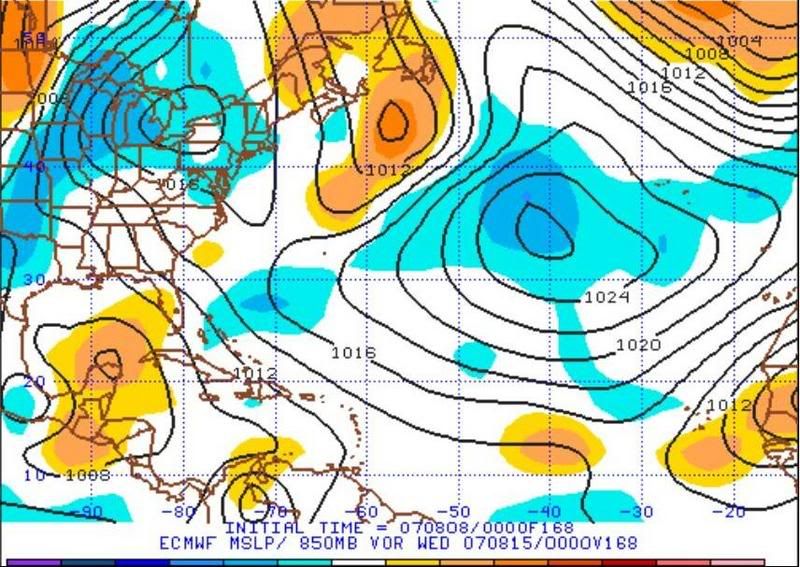
If you will notice that the area we are watching, that is indicated by the long range GFS to develop in the Eastern Atl. and move westward, is coming up on the 850mb Vorticity. It is sitting under a 500mb ridge at that time, according to the Euro, which would probably end up being pretty favorable for development.
Euro

GFS

CMC

UKMET

Euro
GFS
CMC
UKMET
0 likes
-
flwxwatcher
- Category 4

- Posts: 926
- Joined: Wed May 16, 2007 3:35 pm
- Location: Central Florida

-
storms in NC

- S2K Supporter
- Posts: 2338
- Joined: Thu Jul 28, 2005 2:58 pm
- Location: Wallace,NC 40 miles NE of Wilm
- Contact:
-
Stormcenter
- S2K Supporter
- Posts: 6689
- Joined: Wed Sep 03, 2003 11:27 am
- Location: Houston, TX
Re: All Long-Term Model Runs
For those who like to read his daily blogs Jeff Masters doesn't see
anything in the GOM or anywhere else for the next 7 days.
The Tropical Atlantic is exceptionally quiet, with very little thunderstorm activity anywhere. There are no threat areas to discuss, and none of the reliable models are forecasting development of a tropical storm over the next seven days.
anything in the GOM or anywhere else for the next 7 days.
The Tropical Atlantic is exceptionally quiet, with very little thunderstorm activity anywhere. There are no threat areas to discuss, and none of the reliable models are forecasting development of a tropical storm over the next seven days.
0 likes


Re: All Long-Term Model Runs
I prepared this composite image this morning, included are the GFS, CMC and NOGAPS forecast for the next Monday (August 13), also the possible wave in the center of Africa that the models maybe develop the next week in the eastern Atlantic.

Something to watch.
Something to watch.
Last edited by Dynamic on Wed Aug 08, 2007 12:18 pm, edited 1 time in total.
0 likes
Re: All Long-Term Model Runs
Looks like it will get sucked up over Mauritania like the last one. I think the models are not detecting the SAL monster out there.
By the way - when a website spells "beginning" -'beggining' it loses credibility.
By the way - when a website spells "beginning" -'beggining' it loses credibility.
0 likes
-
Wx_Warrior
- Category 5
- Posts: 2718
- Joined: Thu Aug 03, 2006 3:58 pm
- Location: Beaumont, TX
Re: All Long-Term Model Runs
Here we go....strike up the band peeps:
My brother (KFDM_Met) said it could be a southern GOM problem.
My brother (KFDM_Met) said it could be a southern GOM problem.
0 likes
Re: All Long-Term Model Runs
Thanks x-y. I'll take that.
>>From the looks of the maps here the east coast needs bear watching than the gulf. JIMO
Location: Wallace,NC 40 miles NE of Wilm

But anyway, both areas should always be watched during tropical season, because things can spin up without much warning. As for the East Coast, that's typical unsubstantiated bias courtesy of the GFS. It gets a few runs right (building ridges and such) before returning to its known bias of simply having to put a trough off the east coast of North America. It can't help it. It's like a shark at feeding frenzy or a dog that's just got to run when you open the door knowing it's going to get scolded or swatted upon its return. When in doubt, bet on the European Model to more properly handle Western Atlantic pressures in the mid-range absent some other factor that's out of whack with it. What the GFS can't figure out is how it is supposed to handle heat moving out of the tropical and subtropical latitudes into the temperate regions/horse latitudes. It just can't see it in the mid-long term (most of the time).
Couple the Atlantic ridge the ECMWF is showing with the latest graphic on TD Pabuk (See TC Warning Grahpics in link below) which actually curves kind of to the WSW or Tropical Storm Wutip which also stays weak, but after hitting Taiwan, its tradjectory also curves more to the south, and you've got a very strong indication that 7-10 days later, there will be a monster ridge in the Western Atlantic.
https://metocph.nmci.navy.mil/jtwc.php
We'll have to wait and see. As it is, when we started the discussion last Thursday or Friday on another thread, we would expect to see a flat ridge just nosing/squeezing into the Southeast this weekend.
Like I said, we're just going to have to wait and see what next week brings in terms of what's happening in the western Atlantic. If there is a pretty strong ridge in the Wed-Saturday time frame, the Asian teleconnections are working pretty well. And if so, look for some southern Gulf action if there is tropical energy in the area (talking Mexico/South Texas).
Steve
>>From the looks of the maps here the east coast needs bear watching than the gulf. JIMO
Location: Wallace,NC 40 miles NE of Wilm
But anyway, both areas should always be watched during tropical season, because things can spin up without much warning. As for the East Coast, that's typical unsubstantiated bias courtesy of the GFS. It gets a few runs right (building ridges and such) before returning to its known bias of simply having to put a trough off the east coast of North America. It can't help it. It's like a shark at feeding frenzy or a dog that's just got to run when you open the door knowing it's going to get scolded or swatted upon its return. When in doubt, bet on the European Model to more properly handle Western Atlantic pressures in the mid-range absent some other factor that's out of whack with it. What the GFS can't figure out is how it is supposed to handle heat moving out of the tropical and subtropical latitudes into the temperate regions/horse latitudes. It just can't see it in the mid-long term (most of the time).
Couple the Atlantic ridge the ECMWF is showing with the latest graphic on TD Pabuk (See TC Warning Grahpics in link below) which actually curves kind of to the WSW or Tropical Storm Wutip which also stays weak, but after hitting Taiwan, its tradjectory also curves more to the south, and you've got a very strong indication that 7-10 days later, there will be a monster ridge in the Western Atlantic.
https://metocph.nmci.navy.mil/jtwc.php
We'll have to wait and see. As it is, when we started the discussion last Thursday or Friday on another thread, we would expect to see a flat ridge just nosing/squeezing into the Southeast this weekend.
Like I said, we're just going to have to wait and see what next week brings in terms of what's happening in the western Atlantic. If there is a pretty strong ridge in the Wed-Saturday time frame, the Asian teleconnections are working pretty well. And if so, look for some southern Gulf action if there is tropical energy in the area (talking Mexico/South Texas).
Steve
0 likes
-
Extremeweatherguy

- Category 5
- Posts: 11095
- Joined: Mon Oct 10, 2005 8:13 pm
- Location: Florida
Re: All Long-Term Model Runs
He wrote that on August 5th...2 days ago. At that time the models did not show anything like this, and he may decide to change his mind. Even if he doesn't though, his prediction of a "week" now lasts for just 5 more days (not the next 7), so beyond this Sunday he has not predicted anything so far.Stormcenter wrote:For those who like to read his daily blogs Jeff Masters doesn't see
anything in the GOM or anywhere else for the next 7 days.
The Tropical Atlantic is exceptionally quiet, with very little thunderstorm activity anywhere. There are no threat areas to discuss, and none of the reliable models are forecasting development of a tropical storm over the next seven days.
http://www.weatherunderground.com/blog/ ... amp=200708
0 likes

Re: All Long-Term Model Runs
Not so sure that it isn't the upper-low over the Madeira Is. that is "sucking" large waves north and east .... rather than the SAL .....
0 likes
-
Extremeweatherguy
- Category 5
- Posts: 11095
- Joined: Mon Oct 10, 2005 8:13 pm
- Location: Florida
I just watched JBs latest video and he is thinking that something very well could develop in the GOM over the next week and possibly then try to head off in a westward direction. On his video he drew a line toward TX, but until something actually forms I am not going to buy into that right now. Let's just hope that if something does spin up that it remains weak and hits an unpopulated area.
BTW, JB then went on to make this somewhat comical remark at the end of the video...
"We're gonna have to see if something comes for the Texas coast, 'cause I think now that is the place to really start watching. ok. It's not because I want to destroy Houston, it's because this is the way the weather pattern is setting up."
Obviously that Houston statement stems from some criticism he must have recieved in the past. lol.
0 likes
-
x-y-no
- Category 5
- Posts: 8359
- Age: 65
- Joined: Wed Aug 11, 2004 12:14 pm
- Location: Fort Lauderdale, FL
Re:
Meso wrote:12z Run Still moving the low off the coast in 3-4 days as scheduled,will edit this post as the run comes out
So far pretty consistent with earlier runs. So far (6 days,) it has strong low-level ridging and moderate mid to upper level ridging over the top of it.
0 likes
-
Weatherfreak14

- Category 5
- Posts: 1381
- Joined: Sat Sep 24, 2005 3:40 pm
- Location: Beaufort, SC
- Contact:
Re: All Long-Term Model Runs
With the SAL out there right now, is this tropicial wave due off the coast of africia in couple of days, can it even devlop with all the SAL to its north?
0 likes
Who is online
Users browsing this forum: dexterlabio and 207 guests