Vigorous tropical wave in Eastern Atlantic

This is the general tropical discussion area. Anyone can take their shot at predicting a storms path.

Moderator: S2k Moderators

Forum rules

The posts in this forum are NOT official forecasts and should not be used as such. They are just the opinion of the poster and may or may not be backed by sound meteorological data. They are NOT endorsed by any professional institution or STORM2K. For official information, please refer to products from the National Hurricane Center and National Weather Service.

Help Support Storm2K
Message
Author
User avatar
storms in NC
S2K Supporter
S2K Supporter
Posts: 2338
Joined: Thu Jul 28, 2005 2:58 pm
Location: Wallace,NC 40 miles NE of Wilm
Contact:

Re: Strong tropical wave over western Africa

#61 Postby storms in NC » Fri Aug 10, 2007 4:19 pm

Image


I was thinking of Floyd today and it's path. They had him going into Fl too. So you can't trust any thing right now till it comes about and when it get closer to land.
0 likes   

User avatar
Weathermaster
Tropical Depression
Tropical Depression
Posts: 79
Joined: Thu Sep 04, 2003 10:33 am
Location: Carolina, PR

Re: Strong tropical wave over western Africa

#62 Postby Weathermaster » Fri Aug 10, 2007 4:31 pm

Abstract from the NWS office in San Juan, PR. Make your own conclusions:

"THE REMAINDER OF THE FORECAST WILL DEPEND GREATLY ON A LOW
PRESSURE OVER WESTERN AFRICA. THE GFS HAS BECOME VERY AGGRESSIVE
WITH THIS LOW AND DEVELOPS IT INTO A HURRICANE AND PLACES IT OVER
PUERTO RICO BY SATURDAY NIGHT ON 18 AUGUST. BUT A NUMBER OF THINGS
SUGGEST THAT THIS MAY NOT BE THE SCENARIO WE EXPERIENCE. FIRST
THERE IS A CONSIDERABLE AMOUNT OF DRY SURFACE AND SAHARAN AIR
LAYER BEING ADVECTED INTO THE SOUTHWEST QUADRANT OF THE SYSTEM
JUST BEGINNING TO SHOW ON THE COAST OF AFRICA AROUND 12 DEGREES
NORTH. SECOND...THE STRONGEST CONVECTION HAS FORMED A LINE WHICH
IS SOUTH OF 10 NORTH OFF THE AFRICAN COAST. THIRD...PRECIPITABLE
WATER IMAGERY SHOWS DRIER AIR FORCING THE MOISTURE SOUTH.
FOURTH...THIS SYSTEM DOES NOT LOOK AS STRONG NOW AS IT WAS 24
HOURS AGO. AND FINALLY THE PATH WHICH THE GFS PROJECTS THIS SYSTEM
TO MOVE OVER HAS NOT BEEN PARTICULARLY FAVORABLE TO CONVECTION.
THERE IS VERY LITTLE CONVECTION BETWEEN 24 AND 48 DEGREES WEST IN
THE TROPICS AND A SUBSTANTIAL SAHARAN AIR LAYER NORTH OF IT.
THEREFORE AM VERY WARY OF PLACING ANY CREDENCE IN THE GFS SOLUTION
OF NEARLY 110 KNOT WINDS AT 850 MB ON THE EASTERN SIDE OF THE LOW
PRESSURE TO BE LOCATED NEAR 17 NORTH 60 WEST AT 00Z ON SATURDAY 18
AUGUST...AND HAVE REMOVED ANY UNUSUAL WINDS FROM THE LOCAL
FORECAST AND KEPT POPS TO A SLIGHTLY LOWER THAN CLIMATOLOGY LEVEL.
IF THE FORECAST IS TO VERIFY IT SHOULD BE MUCH MORE EVIDENT ON
SUNDAY WHEN THE LOW HAS MOVED ENTIRELY OFFSHORE AND WE WILL BE
ABLE TO BETTER EVALUATE WHETHER IT CAN DEVELOP VERY MUCH. UNTIL
THEN WE WILL CONTINUE TO MONITOR THIS SYSTEM CAREFULLY."
0 likes   

User avatar
cycloneye
Admin
Admin
Posts: 145883
Age: 69
Joined: Thu Oct 10, 2002 10:54 am
Location: San Juan, Puerto Rico

Re: Strong tropical wave over western Africa

#63 Postby cycloneye » Fri Aug 10, 2007 4:37 pm

Weathermaster wrote:Abstract from the NWS office in San Juan, PR. Make your own conclusions:

"THE REMAINDER OF THE FORECAST WILL DEPEND GREATLY ON A LOW
PRESSURE OVER WESTERN AFRICA. THE GFS HAS BECOME VERY AGGRESSIVE
WITH THIS LOW AND DEVELOPS IT INTO A HURRICANE AND PLACES IT OVER
PUERTO RICO BY SATURDAY NIGHT ON 18 AUGUST. BUT A NUMBER OF THINGS
SUGGEST THAT THIS MAY NOT BE THE SCENARIO WE EXPERIENCE. FIRST
THERE IS A CONSIDERABLE AMOUNT OF DRY SURFACE AND SAHARAN AIR
LAYER BEING ADVECTED INTO THE SOUTHWEST QUADRANT OF THE SYSTEM
JUST BEGINNING TO SHOW ON THE COAST OF AFRICA AROUND 12 DEGREES
NORTH. SECOND...THE STRONGEST CONVECTION HAS FORMED A LINE WHICH
IS SOUTH OF 10 NORTH OFF THE AFRICAN COAST. THIRD...PRECIPITABLE
WATER IMAGERY SHOWS DRIER AIR FORCING THE MOISTURE SOUTH.
FOURTH...THIS SYSTEM DOES NOT LOOK AS STRONG NOW AS IT WAS 24
HOURS AGO. AND FINALLY THE PATH WHICH THE GFS PROJECTS THIS SYSTEM
TO MOVE OVER HAS NOT BEEN PARTICULARLY FAVORABLE TO CONVECTION.
THERE IS VERY LITTLE CONVECTION BETWEEN 24 AND 48 DEGREES WEST IN
THE TROPICS AND A SUBSTANTIAL SAHARAN AIR LAYER NORTH OF IT.
THEREFORE AM VERY WARY OF PLACING ANY CREDENCE IN THE GFS SOLUTION
OF NEARLY 110 KNOT WINDS AT 850 MB ON THE EASTERN SIDE OF THE LOW
PRESSURE TO BE LOCATED NEAR 17 NORTH 60 WEST AT 00Z ON SATURDAY 18
AUGUST...AND HAVE REMOVED ANY UNUSUAL WINDS FROM THE LOCAL
FORECAST AND KEPT POPS TO A SLIGHTLY LOWER THAN CLIMATOLOGY LEVEL.
IF THE FORECAST IS TO VERIFY IT SHOULD BE MUCH MORE EVIDENT ON
SUNDAY WHEN THE LOW HAS MOVED ENTIRELY OFFSHORE AND WE WILL BE
ABLE TO BETTER EVALUATE WHETHER IT CAN DEVELOP VERY MUCH. UNTIL
THEN WE WILL CONTINUE TO MONITOR THIS SYSTEM CAREFULLY."


As always the San Juan NWS does excellent discussions and this one for sure was made this way to not sound the alarms early on.
0 likes   

User avatar
msbee
S2K Supporter
S2K Supporter
Posts: 3027
Joined: Wed Jun 11, 2003 10:11 am
Location: St. Maarten

Re: Strong tropical wave over western Africa

#64 Postby msbee » Fri Aug 10, 2007 5:29 pm

as always, we must wait and see..... and watch
0 likes   

MiamiensisWx

Re: Strong tropical wave over western Africa

#65 Postby MiamiensisWx » Fri Aug 10, 2007 6:30 pm

Bon voyage - the wave axis is departing from the coast!

Latest IR imagery
0 likes   

User avatar
Fego
S2K Supporter
S2K Supporter
Posts: 767
Age: 65
Joined: Sun Apr 18, 2004 7:58 pm
Location: San Juan, Puerto Rico
Contact:

Re: Strong tropical wave over western Africa

#66 Postby Fego » Fri Aug 10, 2007 6:34 pm

Our meteorologist said (6:00p.m.) that dry air got into the wave and disrupted the north side, weakening it a little. She also said that as soon as the wave get over water it will gain convection.
0 likes   

User avatar
Fego
S2K Supporter
S2K Supporter
Posts: 767
Age: 65
Joined: Sun Apr 18, 2004 7:58 pm
Location: San Juan, Puerto Rico
Contact:

Re: Strong tropical wave over western Africa

#67 Postby Fego » Fri Aug 10, 2007 6:51 pm

TDW 8:00p.m.

...THE ITCZ...
ITCZ AXIS IS CENTERED ALONG 11N15W 11N27W 10N42W 12N61W.
SCATTERED MODERATE TO STRONG CONVECTION IS NEAR AND OVER W
AFRICA FROM 9N-13N E OF 18W...ASSOCIATED WITH A LARGE TROPICAL
WAVE MAKING ITS WAY TO THE COAST. SCATTERED MODERATE IS WITHIN
150 NM S OF THE AXIS BETWEEN 20W-23W AND WITHIN 90 NM EITHER
SIDE W OF 49W.
0 likes   

User avatar
cycloneye
Admin
Admin
Posts: 145883
Age: 69
Joined: Thu Oct 10, 2002 10:54 am
Location: San Juan, Puerto Rico

Re: Strong tropical wave over western Africa

#68 Postby cycloneye » Fri Aug 10, 2007 6:51 pm

Wave axis almost over water

:uarrow: :uarrow: :uarrow: :uarrow: :uarrow:

Image of wave about to splash into the water.
0 likes   

User avatar
HurricaneMaster_PR
Category 2
Category 2
Posts: 795
Joined: Tue Jul 22, 2003 6:23 pm
Location: San Juan, Puerto Rico

Re: Strong tropical wave over western Africa

#69 Postby HurricaneMaster_PR » Fri Aug 10, 2007 6:59 pm

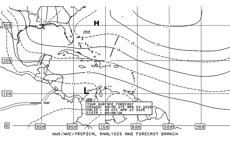
TAFB latest surface analysis, forecasts the system to be near 36W during the next 72 hours accompanied by a 1008mb low...

Image
0 likes   

User avatar
vaffie
Category 3
Category 3
Posts: 898
Joined: Sat Sep 11, 2004 5:11 pm
Location: Houston, Texas

Re: Strong tropical wave over western Africa

#70 Postby vaffie » Fri Aug 10, 2007 7:05 pm

Ominous indeed. One can see a distinct circulation on satellite. Dry air or not, it has a distinct chance to become our first Cape Verde storm. And every global model supporting intensification is indeed something to be worried about. I remember when all of the globals started wrapping around the idea of the wave in the Bahamas developing into Rita and heading towards Texas how I jumped out of my chair and started making preparations. For all of their individual flaws, when all the globals, each with their own variable understandings of how the weather evolves, say the same thing, and in a big way, one should really pay attention. As the circulation center emerged off the coast, pressures on the Gambian coast dropped down to 1009 mb and have since started rising. I'll be watching.
0 likes   

User avatar
cycloneye
Admin
Admin
Posts: 145883
Age: 69
Joined: Thu Oct 10, 2002 10:54 am
Location: San Juan, Puerto Rico

Re: Strong tropical wave over western Africa

#71 Postby cycloneye » Fri Aug 10, 2007 7:21 pm

Image

This is the full disk on 8/11/07 at 00:00 UTC.Looking more convective now.

For those who haved not registered to get the images from this site its for free.

http://www.sat.dundee.ac.uk/registerql.html
0 likes   

User avatar
cycloneye
Admin
Admin
Posts: 145883
Age: 69
Joined: Thu Oct 10, 2002 10:54 am
Location: San Juan, Puerto Rico

Re: Strong tropical wave about to emerge Western Africa

#72 Postby cycloneye » Fri Aug 10, 2007 8:01 pm

Thunderstorm activity has picked up on the west coast of Africa, and it appears that one or two strong African waves will push off the coast over the coming week. Most of the computer models forecast that one of these waves will develop into a tropical depression. We are into mid-August, when these waves traditionally start to develop, and the dry air and dust associated with the Saharan Air Layer (SAL) does not appear to be a major impediment at present. Thus, I think it likely a tropical depression will form off the coast of Africa 3-7 days from now.

The above is from Jeff Masters of Weatherunderground.
0 likes   

User avatar
benny
Category 2
Category 2
Posts: 593
Joined: Sun Mar 19, 2006 8:09 am
Location: Miami

Re: Strong tropical wave over western Africa

#73 Postby benny » Fri Aug 10, 2007 8:07 pm

Weathermaster wrote:Abstract from the NWS office in San Juan, PR. Make your own conclusions:

"THE REMAINDER OF THE FORECAST WILL DEPEND GREATLY ON A LOW
PRESSURE OVER WESTERN AFRICA. THE GFS HAS BECOME VERY AGGRESSIVE
WITH THIS LOW AND DEVELOPS IT INTO A HURRICANE AND PLACES IT OVER
PUERTO RICO BY SATURDAY NIGHT ON 18 AUGUST. BUT A NUMBER OF THINGS
SUGGEST THAT THIS MAY NOT BE THE SCENARIO WE EXPERIENCE. FIRST
THERE IS A CONSIDERABLE AMOUNT OF DRY SURFACE AND SAHARAN AIR
LAYER BEING ADVECTED INTO THE SOUTHWEST QUADRANT OF THE SYSTEM
JUST BEGINNING TO SHOW ON THE COAST OF AFRICA AROUND 12 DEGREES
NORTH. SECOND...THE STRONGEST CONVECTION HAS FORMED A LINE WHICH
IS SOUTH OF 10 NORTH OFF THE AFRICAN COAST. THIRD...PRECIPITABLE
WATER IMAGERY SHOWS DRIER AIR FORCING THE MOISTURE SOUTH.
FOURTH...THIS SYSTEM DOES NOT LOOK AS STRONG NOW AS IT WAS 24
HOURS AGO. AND FINALLY THE PATH WHICH THE GFS PROJECTS THIS SYSTEM
TO MOVE OVER HAS NOT BEEN PARTICULARLY FAVORABLE TO CONVECTION.
THERE IS VERY LITTLE CONVECTION BETWEEN 24 AND 48 DEGREES WEST IN
THE TROPICS AND A SUBSTANTIAL SAHARAN AIR LAYER NORTH OF IT.
THEREFORE AM VERY WARY OF PLACING ANY CREDENCE IN THE GFS SOLUTION
OF NEARLY 110 KNOT WINDS AT 850 MB ON THE EASTERN SIDE OF THE LOW
PRESSURE TO BE LOCATED NEAR 17 NORTH 60 WEST AT 00Z ON SATURDAY 18
AUGUST...AND HAVE REMOVED ANY UNUSUAL WINDS FROM THE LOCAL
FORECAST AND KEPT POPS TO A SLIGHTLY LOWER THAN CLIMATOLOGY LEVEL.
IF THE FORECAST IS TO VERIFY IT SHOULD BE MUCH MORE EVIDENT ON
SUNDAY WHEN THE LOW HAS MOVED ENTIRELY OFFSHORE AND WE WILL BE
ABLE TO BETTER EVALUATE WHETHER IT CAN DEVELOP VERY MUCH. UNTIL
THEN WE WILL CONTINUE TO MONITOR THIS SYSTEM CAREFULLY."

Although it may sound relevant, I don't think the discussion is very good at all. Of course it isn't wise to believe a 7 day model forecast to the letter, but removing it entirely from the grids seems odd. Not even a wave?

First of all, I see no evidence of dry air being advected into the system at present. Looks pretty moist within a few hundred miles of the "center":
http://cimss.ssec.wisc.edu/tropic/real- ... inTPW.html

The drier air that is there is now over the Atlantic will just move westward away from it with time. All that dry stuff will moisten up with time. What has happened in the past doesn't mean it will continue in the future. We'll see what happens, but if it doesn't develop, i doubt it will be for any reasons mentioned in that AFD.
0 likes   

User avatar
weatherman21
Tropical Depression
Tropical Depression
Posts: 67
Joined: Mon Apr 23, 2007 11:07 am

Re: Strong tropical wave about to emerge Western Africa

#74 Postby weatherman21 » Fri Aug 10, 2007 8:37 pm

MeteoSat IR from 0Z Tonight:

Image

MeteoSat Water Vapor from 0Z Tonight:

Image
0 likes   

User avatar
Blown Away
S2K Supporter
S2K Supporter
Posts: 10160
Joined: Wed May 26, 2004 6:17 am

Re: Strong tropical wave about to emerge Western Africa

#75 Postby Blown Away » Fri Aug 10, 2007 9:04 pm

Ok, is this wave officially off the coast?
0 likes   

User avatar
Hyperstorm
Category 5
Category 5
Posts: 1500
Joined: Sun Sep 07, 2003 3:48 am
Location: Ocala, FL

Re: Strong tropical wave about to emerge Western Africa

#76 Postby Hyperstorm » Fri Aug 10, 2007 9:20 pm

Folks, I think we've arrived to the beginning of the peak of the season...

The powerful tropical low moving off Africa at this time has all my support for development. This system has all it takes, IMO, to be a significant tropical cyclone over the next week.

This system has exited Africa at a very good latitude for development. SSTs near that latitude are more than plenty warm for persistence and growth. Upper-level winds are strong out of the east, but that should slow and not inhibit development as the system is moving at a brisk pace. If you look at satellite imagery, you'll notice that the dry air has slowed its move southward toward the ITCZ. This indicates that the high pressure is not as strong and is not having as much of an influence as time goes on. The system has also a broad scope with convection refiring as it moves offshore which usually gives it a kick to maintain itself over the water (remember the transition from land to water tends to weaken convection for a time). There is also a broad, but defined circulation which doesn't dissipate easily.

If we take all these factors into consideration, plus the extra bonus that almost every major model has been honking on development for a while, we can be sure that this one is one to watch. If it develops right off the coast or takes a week, is anyone's bet. But it looks like it's sooner rather than later...
0 likes   

Anthonyl
Tropical Depression
Tropical Depression
Posts: 97
Joined: Wed Apr 20, 2005 4:20 pm

Re: Strong tropical wave about to emerge Western Africa

#77 Postby Anthonyl » Fri Aug 10, 2007 9:28 pm

Hyperstorm, this one is for you. Do you see this accute northern component that the modles are showing or could we see a more southerly track through the isalnds. I do know it is a great ask to survey the dynamics at this point,but you seem to surely know your tropical weather.
0 likes   

User avatar
benny
Category 2
Category 2
Posts: 593
Joined: Sun Mar 19, 2006 8:09 am
Location: Miami

Re: Strong tropical wave about to emerge Western Africa

#78 Postby benny » Fri Aug 10, 2007 9:38 pm

Convection is increasing tonight with the wave... a small vortex is seen in the mid-levels too at around 11n16w at 0200 utc or so. i have high hopes when i wake up tomorrow... :)
0 likes   

Brent
S2K Supporter
S2K Supporter
Posts: 38106
Age: 37
Joined: Sun May 16, 2004 10:30 pm
Location: Tulsa Oklahoma
Contact:

Re: Strong tropical wave about to emerge Western Africa

#79 Postby Brent » Fri Aug 10, 2007 9:39 pm

benny wrote:Convection is increasing tonight with the wave... a small vortex is seen in the mid-levels too at around 11n16w at 0200 utc or so. i have high hopes when i wake up tomorrow... :)


I do too but I'm TRYING hard to stay cautious, just based on history. I believe this one looks better than the previous ones though.

:D
0 likes   

jinftl
Category 5
Category 5
Posts: 4312
Joined: Tue Aug 31, 2004 4:47 pm
Location: fort lauderdale, fl

#80 Postby jinftl » Fri Aug 10, 2007 9:42 pm

What is the general accuracy of 1) development and 2) path/direction of systems like this when there is consistent model agreement?
0 likes   


Return to “Talkin' Tropics”

Who is online

Users browsing this forum: No registered users and 22 guests