Invest 90L: East Atlantic-Discussions,Analysis,Sat Pics
Moderator: S2k Moderators
Forum rules
The posts in this forum are NOT official forecasts and should not be used as such. They are just the opinion of the poster and may or may not be backed by sound meteorological data. They are NOT endorsed by any professional institution or STORM2K. For official information, please refer to products from the National Hurricane Center and National Weather Service.
-
DrewFL
Re: INVEST 90L over East Atlantic: Discussions and Anaylisis
Is this a weather forum/thread? Yacking about strikes in the US right now are totally unrealistic and frankly......insensitive. Many others are in the path of anything that rolls out of the EATL before the US is ever involved.
0 likes
Re: INVEST 90L over East Atlantic: Discussions and Anaylisis
weatherguru18 wrote:Forgive me if I strike a nerve...but A: New Orleans is still a wreck. IF** it hit there, it's not like it would cause that much more damage. Most of the property is still in ruins there or have since been torn down. B: The people that are back in the city are more than likely able to get themselves out this time as most of the less fortunate have since moved permanetly to other places. C: The city is hurricane weary. It would take even a depression seriously. D: It's only been two years since the hurricane. It would be one thing if it had been 30 years and the city be completely rebuilt.
As a disclaimer, I don't wish misfortune on N.O. AT ALL. I understand that people are trying to get there lives together there again and some already have. I pray it spares them.
I'm sorry but what a riduculous post. The hurricane will come wherever it goes. To say it's better to hit some area becuz it's already been devestated is pure
nonsense.
0 likes
- HarlequinBoy
- Category 5

- Posts: 1400
- Age: 35
- Joined: Wed Nov 29, 2006 1:57 am
- Location: Memphis
Re:
CrazyC83 wrote:What the models say:
CMC - Strong tropical storm, 994mb (at least), N of Leewards (also develops a separate ~982mb hurricane near the east coast of FL)
GFDL - Cat 2 hurricane, 959mb (at least), N of Leewards
GFS - Tropical storm, 999mb (at least), slowly E of Leewards
HWRF - Cat 3 hurricane, 946mb (at least), N of Leewards
NOGAPS - fails to develop
UKMET - Tropical storm, 1002mb (only shows through 48hrs)
I really appreciate this post. Thanks!
0 likes
-
chadtm80
-
weatherguru18
Re: INVEST 90L over East Atlantic: Discussions and Anaylisis
ronjon wrote:weatherguru18 wrote:Forgive me if I strike a nerve...but A: New Orleans is still a wreck. IF** it hit there, it's not like it would cause that much more damage. Most of the property is still in ruins there or have since been torn down. B: The people that are back in the city are more than likely able to get themselves out this time as most of the less fortunate have since moved permanetly to other places. C: The city is hurricane weary. It would take even a depression seriously. D: It's only been two years since the hurricane. It would be one thing if it had been 30 years and the city be completely rebuilt.
As a disclaimer, I don't wish misfortune on N.O. AT ALL. I understand that people are trying to get there lives together there again and some already have. I pray it spares them.
I'm sorry but what a riduculous post. The hurricane will come wherever it goes. To say it's better to hit some area becuz it's already been devestated is pure
nonsense.
What a riduculous post? I don't think that I made any remark about it hitting them. However you'd be lieing to yourself to think that a direct hit on Houston or Miami would be better than hitting N.O...from a casualty and economic point of view.
0 likes
-
Wx_Warrior
- Category 5

- Posts: 2718
- Joined: Thu Aug 03, 2006 3:58 pm
- Location: Beaumont, TX
-
weatherguru18
Re: INVEST 90L over East Atlantic: Discussions and Analysis
I apologize if it came across that way. Let's hope for a fish.
0 likes
Re: INVEST 90L over East Atlantic: Discussions and Analysis
90L is losing convection. It has a good dry 'curl' of convection to its SW, but the main convection mass is drying out right on time. Could be diurnal.
The fast forward speed works in 90L's favor. That straight west low-track will keep it in warm water and moist air. The fast forward speed should transit it through the SAL airmass quickly allowing it to potentially reconvect nearer to the formation longitudes...
The fast forward speed works in 90L's favor. That straight west low-track will keep it in warm water and moist air. The fast forward speed should transit it through the SAL airmass quickly allowing it to potentially reconvect nearer to the formation longitudes...
0 likes
- HurricaneMaster_PR
- Category 2

- Posts: 795
- Joined: Tue Jul 22, 2003 6:23 pm
- Location: San Juan, Puerto Rico
TROPICAL WEATHER OUTLOOK
NWS TPC/NATIONAL HURRICANE CENTER MIAMI FL
1030 PM EDT SAT AUG 11 2007
FOR THE NORTH ATLANTIC...CARIBBEAN SEA AND THE GULF OF MEXICO...
A BROAD AREA OF LOW PRESSURE OVER THE WESTERN CARIBBEAN SEA IS
PRODUCING DISORGANIZED SHOWERS AND THUNDERSTORMS NEAR JAMAICA...THE
CAYMAN ISLANDS...AND CUBA. DEVELOPMENT OF THIS SYSTEM...IF
ANY...IS EXPECTED TO BE SLOW TO OCCUR AT IT MOVES WESTWARD INTO THE
YUCATAN PENINSULA AT ABOUT 10 MPH.
A VIGOROUS TROPICAL WAVE IS LOCATED OVER THE FAR EASTERN ATLANTIC
OCEAN ABOUT 300 MILES SOUTHEAST OF THE SOUTHERNMOST CAPE VERDE
ISLANDS. SHOWERS AND THUNDERSTORMS HAVE CHANGED LITTLE IN
ORGANIZATION THIS EVENING. HOWEVER...CONDITIONS APPEAR FAVORABLE
FOR GRADUAL DEVELOPMENT OF THIS SYSTEM...AND A TROPICAL DEPRESSION
COULD FORM DURING THE NEXT DAY OR TWO AS IT MOVES WESTWARD AT 15 TO
20 MPH.
ELSEWHERE...TROPICAL CYCLONE FORMATION IS NOT EXPECTED DURING THE
NEXT 48 HOURS.
$$
FORECASTER RHOME
0 likes
Re: INVEST 90L over East Atlantic: 10:30 PM TWO Posted
Earlier there were a couple of posts stating that if it develops faster it has a better chance of recurving. Could someone explain this please?
0 likes
-
weatherguru18
Re: INVEST 90L over East Atlantic: 10:30 PM TWO Posted
shannon wrote:Earlier there were a couple of posts stating that if it develops faster it has a better chance of recurving. Could someone explain this please?
The stronger it gets the more likely it is to be affected by upper-level winds. It would begin to feel the tug of the Bermuda high.
0 likes
- wxmann_91
- Category 5

- Posts: 8007
- Age: 34
- Joined: Fri Jul 15, 2005 2:49 pm
- Location: Southern California
- Contact:
Re: INVEST 90L over East Atlantic: 10:30 PM TWO Posted
shannon wrote:Earlier there were a couple of posts stating that if it develops faster it has a better chance of recurving. Could someone explain this please?
Beta drift. A strong storm has a tendency to move poleward. There is a weakness in the ridge in the ctrl Atlantic that would catch the storm if the storm wandered far enough north.
0 likes
- HurricaneMaster_PR
- Category 2

- Posts: 795
- Joined: Tue Jul 22, 2003 6:23 pm
- Location: San Juan, Puerto Rico
Re: INVEST 90L over East Atlantic: 10:30 PM TWO Posted
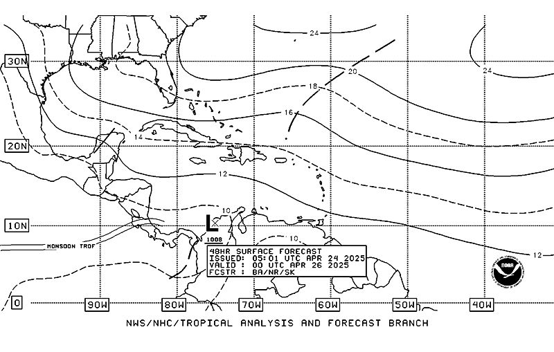
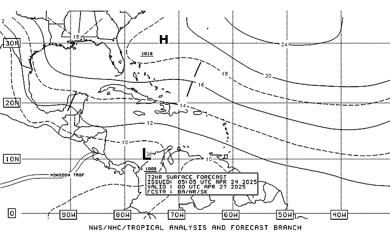
Latest TAFB foreast calls for a Tropical Cyclone within 48 hours:


0 likes
Re: INVEST 90L over East Atlantic: 10:30 PM TWO Posted
Thanks weatherguru18 and wxman_91 Makes perfect sense now. I didn't want to draw my own inaccurate conclusions.
0 likes
Re: INVEST 90L over East Atlantic: 10:30 PM TWO Posted
I expect 90L to become TD4 as early as tomorrow or by Tuesday. The earlier it develops, more likely, it will curve and become a fish. It's really too early to tell what this blob will do. The later it develops, more likely we will have to watch. They key is to keep an eye on this blob.
0 likes
- ts_kakolina
- Tropical Depression

- Posts: 58
- Joined: Wed Jul 13, 2005 8:27 am
- Location: Carolina, Puerto Rico
Re: INVEST 90L over East Atlantic: 10:30 PM TWO Posted
wxmann_91 wrote:Beta drift. A strong storm has a tendency to move poleward. There is a weakness in the ridge in the ctrl Atlantic that would catch the storm if the storm wandered far enough north.
I remember in 2005 when TS Bret formed, if it did not develop, the wave would end up in Texas. Since the wave became Bret, it stayed further south and hit Mexico.
0 likes
- SouthFloridawx
- S2K Supporter

- Posts: 8346
- Age: 47
- Joined: Tue Jul 26, 2005 1:16 am
- Location: Sarasota, FL
- Contact:
Re: INVEST 90L over East Atlantic: 10:30 PM TWO Posted
With a system moving at 15 to 20mph westward, we'll probably see it move more quickly than depicted by the models. This may also cause it to develop a little more slowly.
0 likes
Who is online
Users browsing this forum: No registered users and 354 guests


