


Chetumal, southeastern Mexico in the Yucatan peninsula, Tuesday, Aug. 21, 2007. Hurricane Dean (Fox news)

Chetumal (Henry Romero/Reuters/Yahoo)

Moderator: S2k Moderators


otowntiger wrote:
I didn't realize that. Now I guess I should not take it for granted that its always correct, if just anybody can do the updating without some kind of oversite.
BC-Tropical Weather, 19th Ld-Writethru,1244
Weakened Hurricane Dean races toward Mexico’s Gulf, heart of oil industry
Eds: Recasts description of Chetumal winds. AP Video.
AP Photo MOIL101, XGB101, MOIL103, MOEV103
By MARK STEVENSON
Associated Press Writer
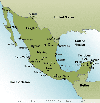
FELIPE CARRILLO PUERTO, Mexico (AP) — Hurricane Dean slammed into the Caribbean coast of Mexico on Tuesday as a roaring Category 5 hurricane, the most intense Atlantic storm to make landfall in two decades. It lashed remote Mayan villages as it raced across the Yucatan Peninsula to the heart of Mexico's oil industry.
Dean's path was a stroke of luck for Mexico: After killing 13 people in the Caribbean, it made landfall along a sparsely populated coastline, well to the south of the major resorts where 50,000 tourists had been evacuated.
It weakened to a Category 1 storm, with maximum sustained winds of 85 mph, but was expected to grow back into a powerful hurricane as it draws fuel from the warm waters of the lower Gulf of Mexico, where more than 100 offshore oil platforms were evacuated ahead of the storm.
"We often see that when a storm weakens, people let down their guard completely. You shouldn't do that," said Jamie Rhome, a hurricane specialist. "This storm probably won't become a Category 5 again, but it will still be powerful."
When Dean first struck land near the cruise port of Majahual, it had sustained winds near 165 mph and gusts that reached 200 mph — faster than the takeoff speed of many passenger jets. It had an expected storm surge of 12 to 18 feet above normal tides and dumped huge amounts of rain on low-lying areas where thousands of Mayan Indians live in stick huts in isolated communities.
With the storm still screaming, there were no immediate reports of deaths, injuries or major damage, Quintana Roo Gov. Felix Gonzalez told Mexico's Televisa network, though officials had not been able to survey the area.
Soldiers evacuated more than 250 small communities, but some turned away soldiers with machetes and refused to leave or hid when the army evacuated the area, said Jorge Acevedo, a spokesman for the state of Quintana Roo. Their fate was unknown.
Some of the storm's strongest winds raked the state capital of Chetumal, where residents were ordered to stay home until 10 a.m. Tuesday after a harrowing night with windows shattering and heavy water tanks flying off of rooftops. Sirens wailed constantly as the storm battered the city for hours, hurling billboards down streets. All electricity was down.
Just across the border in Belize, trees fell and debris flew through the air. The government evacuated Caye Caulker and Ambergris Caye — both popular with American tourists — and ordered a dusk-to-dawn curfew from Belize City north to the Mexican border.
In the largely Mayan town of Felipe Carrillo Puerto, about 30 miles north of the eye's westward path, people stared from their porches at broken tree limbs and electrical cables crisscrossing streets flooded with ankle-deep water.
Tin roofing ripped from houses clunked hollowly as it bounced in the wind whistling through town.
"We began to feel the strong winds about 2 in the morning and you could hear that the trees were breaking and some tin roofs were coming off," said Miguel Colli, a 36-year-old store employee. "Everyone holed up in their houses. Thank God that the worst is over."
In the Belizean town of Corozal, about nine miles south of Chetumal, Dean flipped over a residential trailer, detached roofs from houses, ripped plywood off windows and spread floodwaters as high as 3 feet. No deaths or major injuries were reported there or in Belize City, where thousands evacuated to higher ground.
By 1 p.m. EDT, Dean had weakened to a Category 1 hurricane with winds of 85 mph. It was about 45 miles southeast of Campeche and was moving west at 18 mph, according to the National Hurricane Center.
Dean's path takes it directly through the Cantarell oil field, Mexico's most productive, with dozens of oil rigs and three major ports. All were shut down just ahead of the storm, resulting in a production loss of 2.7 million barrels of oil and 2.6 billion cubic feet of natural gas a day. The path also veers toward Mexico's only nuclear plant, where a state official said 2,000 buses were brought in to evacuate personnel if necessary.
The Laguna Verde nuclear plant, which is more than 20 years old and has endured other severe weather with no problems, implemented emergency procedures and remains online, said Estefano Conde, spokesman for Mexico's Federal Electricity Commission. "I can assure you that everything is well taken care of," he said.
Dean was to expected slam into the central Mexican coast as a major hurricane Wednesday afternoon about 400 miles south of the Texas border. The United States was expected to see few effects from the storm.
President Felipe Calderon was cutting short his trip in Canada where he met with President Bush and Canadian Prime Minister Stephen Harper so that he could travel Tuesday to the hardest-hit areas. Bush offered U.S. assistance and expressed his concern for the citizens of Mexico and elsewhere whose lives were effected.
"We stand ready to help," Bush said with Calderon at his side. "The American people care a lot about the human condition in our neighborhood and when we see human suffering we want to do what we can."
The U.S. space shuttle Endeavour landed a day early Tuesday, its mission cut short by the initial possibility that Dean could pose a threat to Mission Control in Houston.
The storm picked up strength after brushing Jamaica and the Cayman Islands and became a monstrous Category 5 hurricane Monday. Jamaica postponed Aug. 27 general elections in order to survey damage, which was extensive in the capital and the island's east.
Dean is the first Category 5 to make landfall in the Atlantic region since Hurricane Andrew hit south Florida in 1992.
Insured losses from the storm are likely to range between $750 million and $1.5 billion, most of it Jamaica, according to latest estimates by Risk Management Solutions, which calculates hurricane damage for the insurance industry.
Cancun's tourist strip is still marked with cranes used to repair the damage from 2005's Hurricane Wilma, which caused $3 billion in losses.
— — —
Associated Press writers contributing to this report included John Pain and Jennifer Kay in Miami; Karla Heusner Vernon in Ladyville, Belize; Greg Bull in Campeche, Mexico; Lisa Adams in Mexico City.
AP-ES-08-21-07 1442EDT
by Jennifer Gonzalez
15 minutes ago
Hurricane Dean Tuesday pounded the Yucatan Peninsula on its way to the oil-rich Gulf of Mexico after slamming onto Mexico's Caribbean coast as a monstrous category five storm.
The ferocious hurricane uprooted trees and downed power lines, but there were no immediate reports of casualties in Mexico following Dean's rampage across the Caribbean that left nine people dead.
The hurricane lost much of its punch as it swirled over land but could regain strength when it hits the warm Gulf of Mexico waters, probably late Tuesday.
During a summit in Canada Tuesday, US President George W. Bush told his Mexican counterpart Felipe Calderon the United States was ready to assist in recovery efforts.
"I want you to know that US agencies are in close touch with the proper Mexican authorities, and if you so desire help, we stand ready to help," Bush said.
At the same news conference, Calderon announced he would leave Montebello, Canada on Tuesday to tour affected areas.
The killer hurricane hit land in a sparsely populated area near Puerto Bravo, about 280 kilometers (175 miles) south of Cancun, packing sustained winds of 270 kilometers (165 miles) per hour, with higher gusts.
That made it the first Atlantic hurricane to make landfall at the topmost category five on the Saffir-Simpson scale since Andrew rampaged in south Florida in 1992.
While Cancun and other popular resorts were spared a direct hit, tens of thousands of tourists had fled ahead of the storm, and residents in low-lying areas headed to safer ground.
State-run Petroleos de Mexico (PEMEX) earlier evacuated all 18,000 personnel from its offshore oil installations in the Gulf of Mexico.
A curfew was declared in the Quintana Roo state capital Chetumal, located just south of Puerto Bravo.
The local airport was closed, and electricity was shut down in the city, which has a population of 450,000, in addition to about 20,000 people who sought refuge thee ahead of the storm.
"I was very scared, the wind made a horrible sound and it hit the corrugated metal roof," said Rosa Ramirez, 16, who spent the night huddled in a small house with 14 family members. At one stage the family also feared they had lost 10 sheep who had run away, but the animals were later rounded up unharmed.
Chetumal feared comparatively well, and the worst damages reported were smashed windows, uprooted trees, downed power lines. Police official Arturo Campeche said floodwaters were as deep as two meters (6,6 feet) in a low-lying part of town.
Meanwhile world oil prices continued to drop on Tuesday as the storm remained on course to spare key energy facilities in the United States, the world's biggest consumer of crude.
A few offshore rigs and platforms on the US side of the Gulf were nevertheless evacuated.
At 10:00 am (1500 GMT) Dean's center was located over the Yucatan Peninsula 140 kilometers (90 miles) southeast of the city of Campeche on the shores of the Gulf of Mexico, according to the US National Hurricane Center.
It packed sustained winds of 165 kilometers (105 miles) per hour, with higher gusts. While it continued weakening over land, it was expected to remain at hurricane strength when it reaches water again, the Miami-based NHC said.
Forecasters expect Dean to make landfall again on Wednesday, in the Mexican state of Veracruz.
Mexican President Felipe Calderon announced he would cut short a trip to Canada where he held talks with US President George W. Bush and Canadian Prime Minister Stephen Harper, in order to return to Mexico "as soon as possible." He was expected to tour affected areas.
Before it hit Mexico, Hurricane Dean was blamed for four deaths in Haiti, two in the Dominican Republic, two in Martinique and one in Jamaica.
BC-STORM-DEAN/ (UPDATE 6, PICTURE)
UPDATE 6-Giant Hurricane Dean punches Mexico, no deaths
(Updates with storm approaching oil wells, weakening)
By Manuel Carrillo
CHETUMAL, Mexico (Reuters) - Hurricane Dean punched its way across Mexico's Yucatan Peninsula Tuesday, flooding streets, toppling trees and blowing roofs off houses before heading for oil platforms in the Gulf of Mexico.
There were no immediate reports of deaths in Mexico from the storm, a potentially disastrous Category 5 hurricane which lashed beach resorts on the "Mayan Riviera" where thousands of tourists had crammed into shelters.
Water surged down a main street at thigh level in Chetumal, a city of about 150,000 people near where Dean made landfall. Broken trees and street lights lay strewn around.
Dean killed 11 people elsewhere on its rampage through the Caribbean but lost power as it moved inland over Mexico and was downgraded to a Category 1 storm.
"No human losses have been reported until now," President Felipe Calderon said.
But forecasters warned that roaring winds and rains could pick up again as Dean crosses the Yucatan Peninsula and heads out into the southern Gulf of Mexico Tuesday evening, threatening Mexico's oil installations in the area
Mexico's state oil company has closed and evacuated 407 oil and gas wells, meaning lost production of 2.65 million barrels of crude per day.
Resorts like Playa del Carmen and Cancun, devastated by Hurricane Wilma in 2005, appeared to escape major damage this time. Tens of thousands of tourists fled over the weekend before Dean crashed into the area, famous for white beaches, crystal clear waters and Mayan ruins at Chichen Itza.
Litter and leaves were scattered on the streets in Playa del Carmen, where tired tourists emerged at first light after an uncomfortable night in a hotel converted to a shelter for 400 people.
"I didn't sleep, I had backache," said Italian tourist Massimiani Luca, 31. "There were nine of us in this room, eight in that room," he said.
POWER OUT
Chetumal was left without power when the hurricane's sustained winds of 165 miles per hour and gusts of up to 200 mph knocked over dozens of power poles and trees. The aluminum roofs of some houses were blown off.
Dean swiped Jamaica at the weekend with fierce winds and pelting rain, killing two people and taking the storm death toll to eleven. Haiti was worst hit with four people dead.
Dean is likely to cost insurers up to $1.5 billion with the majority of claims coming from damage caused in Jamaica, disaster-modelling firm Risk Management Solution said.
Heavy rain drenched Belize, a former British colony that is home to some 250,000 people and a famous barrier reef. Sugar canes fields were flattened in the north of the country.
In Belize City, Chyla Gill was evacuated with her family from her wooden house and sent to a concrete school shelter.
"We packed for a week because after the hurricane there is always flooding and we can't go back to our houses," she said. "We live near a swamp and the crocodiles come out."
Category 5 hurricanes are rare but there were four in 2005, including Katrina, which devastated New Orleans.
Hurricane Wilma two years ago washed away whole beaches in Mexico, killing seven people and causing $2.6 billion in damages.
Poor local residents with badly built homes are often the worst hit by hurricanes.
Calderon cut short a visit to Canada, where he met President Bush and Canadian Prime Minister Stephen Harper, to oversee the emergency effort.
(Additional reporting by Mica Rosenberg in Belize and Ed Stoddard in Cozumel)
REUTERS Reut15:23 08-21-07


gtalum wrote:otowntiger wrote:
I didn't realize that. Now I guess I should not take it for granted that its always correct, if just anybody can do the updating without some kind of oversite.
That's right. It's a good place to do some initial research, but it's not an authoritative source. I think they do have a small staff that does some factual checking, but you should never consider Wikipedia to be authoritative.


Users browsing this forum: No registered users and 50 guests


