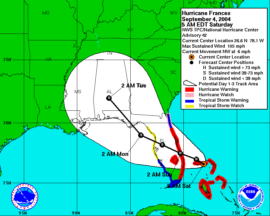
ronjon wrote:Interesting little feature. Lack of convection probably means it will die out over time. I noticed that pressure dropped 3 mb over the last 24 hrs at the buoy east of the Cape. It apparently is not moving so the longer it sits the better chances it can pop some convection. Does anyone remember the CMC model several days ago brought low pressure to almost this exact position and every so slowly drifted it W-NW across to Tampa - but it took it a couple of days. Maybe the CMC was on to something but just had the intensity wrong?
Actually today was D-DAY for the models to bring Dean here; so it said about 2 weeks aho.
It is also D-DAY that the CMC had to bring the system formally know as 92L as a Hurricane here too.
LOL!!!!
And for those who on Monday thought that 92L would be a TS coming here today or tomorrow