Per Hurricane City:
North Nicaragua - Hurricane once every 34 years.
Honduras - Hurricane once every 19.42 years.
Models and the forum's experts seem pretty confident on this due west track for >2000 miles, if 94L develops and this track verifies it will be a rare event for those areas.
I guess I should add:
Punta Allen Mexico area: Hurricane once every 27.20 years (Dean passed within 45 miles)
Invest 94L,Near Windwards-Discussions
Moderator: S2k Moderators
-
Blown Away

- S2K Supporter

- Posts: 10253
- Joined: Wed May 26, 2004 6:17 am
Re: Invest 94L,East of Windwards-Discussions-Analysis & Imagery
Last edited by Blown Away on Thu Aug 30, 2007 8:47 pm, edited 1 time in total.
0 likes

Re: Invest 94L,East of Windwards-Discussions-Analysis & Imagery
wxman57 wrote:Well, I'm still not impressed. There is no "center", just a very large and broad area of low pressure. And I think that the "center" is now passing 55W out ahead of the convection. All the convection is firing on the eastern side of this broad area of low pressure because an upper trof is digging southwestward over 94L producing westerly wind shear (look at the WV loops). And the air in front of it for the next few days is still quite dry. I don't think it will develop over the next 2-3 days. May have a fair shot in 4-5 days when it approaches Nicaragua/Honduras. ECMWF still forecasts a very strong ridge building over the Bahamas this weekend then extending west across the Gulf next Mon/Tue. That should keep this system on a track very similar to Dean's, but possibly a bit farther to the south.
I wasn't either until this afternoon...got to admit though its trying its hardest to spin up given the conditions around it......
0 likes
-
wxman57

- Moderator-Pro Met

- Posts: 23172
- Age: 68
- Joined: Sat Jun 21, 2003 8:06 pm
- Location: Houston, TX (southwest)
Re: Invest 94L,East of Windwards-Discussions-Analysis & Imagery
ROCK wrote:wxman57 wrote:Well, I'm still not impressed. There is no "center", just a very large and broad area of low pressure. And I think that the "center" is now passing 55W out ahead of the convection. All the convection is firing on the eastern side of this broad area of low pressure because an upper trof is digging southwestward over 94L producing westerly wind shear (look at the WV loops). And the air in front of it for the next few days is still quite dry. I don't think it will develop over the next 2-3 days. May have a fair shot in 4-5 days when it approaches Nicaragua/Honduras. ECMWF still forecasts a very strong ridge building over the Bahamas this weekend then extending west across the Gulf next Mon/Tue. That should keep this system on a track very similar to Dean's, but possibly a bit farther to the south.
I wasn't either until this afternoon...got to admit though its trying its hardest to spin up given the conditions around it......
Perhaps it's trying to spin up, but it isn't succeeding. Conditions aloft are just too unfavorable. That won't improve until it reaches the central Caribbean, most likely. Of all the disturbances out there, though, this one does have the best shot at developing in the long term, just probably not until Monday at the earliest.
0 likes
Re: Invest 94L,East of Windwards-Discussions-Analysis & Imagery
wxman57 wrote:ROCK wrote:wxman57 wrote:Well, I'm still not impressed. There is no "center", just a very large and broad area of low pressure. And I think that the "center" is now passing 55W out ahead of the convection. All the convection is firing on the eastern side of this broad area of low pressure because an upper trof is digging southwestward over 94L producing westerly wind shear (look at the WV loops). And the air in front of it for the next few days is still quite dry. I don't think it will develop over the next 2-3 days. May have a fair shot in 4-5 days when it approaches Nicaragua/Honduras. ECMWF still forecasts a very strong ridge building over the Bahamas this weekend then extending west across the Gulf next Mon/Tue. That should keep this system on a track very similar to Dean's, but possibly a bit farther to the south.
I wasn't either until this afternoon...got to admit though its trying its hardest to spin up given the conditions around it......
Perhaps it's trying to spin up, but it isn't succeeding. Conditions aloft are just too unfavorable. That won't improve until it reaches the central Caribbean, most likely. Of all the disturbances out there, though, this one does have the best shot at developing in the long term, just probably not until Monday at the earliest.
if it will stop spitting out outflow boundaries it might fair better. Dry air taking a toll no doubt. We will see. I was thinking more along the line of late Saturday before developement. I will PM you when it does so I can rub it in....
0 likes
-
windstorm99

- S2K Supporter
- Posts: 1578
- Age: 48
- Joined: Sat May 26, 2007 8:10 am
- Location: Miami, Florida
- Contact:
Re: Invest 94L,East of Windwards-Discussions-Analysis & Imagery
wxman57 do you see any capeverde development in the coming days.....
0 likes


Re: Invest 94L,East of Windwards-Discussions-Analysis & Imagery
It looks to me like convection is on the increase with this low. The easter area continues to expand, and for the first time I see reds in an area to the west of the swirl (though it is impossible to tell if there is actually a circulation, and if so, where exactly it is at night). The NHC seems to think this thing has a legitimate shot in the short term (they are considering sending a plane in, and they describe upper level conditions as "expected to be favorable) and I tend to see the logic. I dont think it will become anything huge quickly, but it looks like it is s l o w l y getting better organized.
0 likes
-
Blown Away
- S2K Supporter
- Posts: 10253
- Joined: Wed May 26, 2004 6:17 am
Re: Invest 94L,East of Windwards-Discussions-Analysis & Imagery
The NHC seems to think development possible within next 48 hours, they have to be considering Tropical Storm watches for the islands. Most of the Pro's on this forum, whom I respect, think development won't happen until the EC, wouldn't the NHC error on the conservative side with 94L's convection growing and issue watches for the islands?
0 likes
-
wxman57
- Moderator-Pro Met
- Posts: 23172
- Age: 68
- Joined: Sat Jun 21, 2003 8:06 pm
- Location: Houston, TX (southwest)
Re: Invest 94L,East of Windwards-Discussions-Analysis & Imagery
windstorm99 wrote:wxman57 do you see any capeverde development in the coming days.....
The east Atlantic looks like a death zone. Too much low-level shear. Systems moving off Africa aren't surviving long. Might not see much development out there east of 40W this season. Of course, the farther west they develop, the greater the threat to the Caribbean, Gulf, and SE U.S. Coast.
0 likes
-
windstorm99
- S2K Supporter
- Posts: 1578
- Age: 48
- Joined: Sat May 26, 2007 8:10 am
- Location: Miami, Florida
- Contact:
Re: Invest 94L,East of Windwards-Discussions-Analysis & Imagery
wxman57 wrote:windstorm99 wrote:wxman57 do you see any capeverde development in the coming days.....
The east Atlantic looks like a death zone. Too much low-level shear. Systems moving off Africa aren't surviving long. Might not see much development out there east of 40W this season. Of course, the farther west they develop, the greater the threat to the Caribbean, Gulf, and SE U.S. Coast.
Thanks
0 likes
-
cycloneye

- Admin

- Posts: 149291
- Age: 69
- Joined: Thu Oct 10, 2002 10:54 am
- Location: San Juan, Puerto Rico
Re: Invest 94L,-Discussions-10:30 PM TWO Posted at page 31
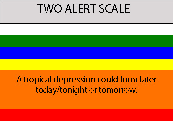
ABNT20 KNHC 310227
TWOAT
TROPICAL WEATHER OUTLOOK
NWS TPC/NATIONAL HURRICANE CENTER MIAMI FL
1030 PM EDT THU AUG 30 2007
FOR THE NORTH ATLANTIC...CARIBBEAN SEA AND THE GULF OF MEXICO...
SHOWER ACTIVITY ASSOCIATED WITH A TROPICAL WAVE LOCATED ABOUT
480 MILES EAST OF THE WINDWARD ISLANDS IS SLOWLY BECOMING BETTER
ORGANIZED. IF CURRENT TRENDS CONTINUE...A TROPICAL DEPRESSION
COULD FORM FROM THIS SYSTEM ON FRIDAY. INTERESTS IN THE WINDWARD
ISLANDS SHOULD MONITOR THE PROGRESS OF THIS SYSTEM. AN AIR FORCE
RESERVE HURRICANE HUNTER AIRCRAFT IS SCHEDULED TO INVESTIGATE THE
SYSTEM ON FRIDAY...IF NECESSARY.
$$
FORECASTER BEVEN
10:30 PM TWO.
0 likes
Re: Invest 94L,-Discussions-10:30 PM TWO Posted at page 31
You are watching a system in obvious slow cyclogenesis. The west band now has light convection popping up in the west part of the classic "S" shape that is taking place with the bands. The low level thin bands are getting thicker too. SST's are forcing the issue despite the dry air.
0 likes
-
wxman57
- Moderator-Pro Met
- Posts: 23172
- Age: 68
- Joined: Sat Jun 21, 2003 8:06 pm
- Location: Houston, TX (southwest)
Re: Invest 94L,-Discussions-10:30 PM TWO Posted at page 31
In the last few hours, convection is firing west between 55W-57W, on the western side of the broad center. This could be a sign that shear is letting up a bit. Let's hope it decreases overnight. Don't need another storm in the Caribbean.
0 likes
-
Brent
- S2K Supporter
- Posts: 38729
- Age: 37
- Joined: Sun May 16, 2004 10:30 pm
- Location: Tulsa Oklahoma
- Contact:
Re: Invest 94L,-Discussions-10:30 PM TWO Posted at page 31
If the current trend continues, I fully expect recon to find a TD tomorrow afternoon, and Labor Day will be complete with something to track!
0 likes
-
Weatherfreak14

- Category 5

- Posts: 1381
- Joined: Sat Sep 24, 2005 3:40 pm
- Location: Beaufort, SC
- Contact:
Re: Invest 94L,-Discussions-10:30 PM TWO Posted at page 31
I think I agree with the TWO although it was suppriseing they said by tommrow, i think along the side of saturday it becoming a depreesson, anyone agree?
0 likes
Re: Invest 94L,-Discussions-10:30 PM TWO Posted at page 31
Don't need another storm in the Caribbean.
Too late for that from the looks of it.
0 likes
-
Extremeweatherguy

- Category 5
- Posts: 11095
- Joined: Mon Oct 10, 2005 8:13 pm
- Location: Florida

Re: Invest 94L,-Discussions-10:30 PM TWO Posted at page 31
wxman57 wrote:In the last few hours, convection is firing west between 55W-57W, on the western side of the broad center. This could be a sign that shear is letting up a bit. Let's hope it decreases overnight. Don't need another storm in the Caribbean.
Yes, lets hope for the shear to decrease. But if you don't want another storm in the Caribbean, decreasing shear won't help that thought.
0 likes
-
Blown Away
- S2K Supporter
- Posts: 10253
- Joined: Wed May 26, 2004 6:17 am
Re: Invest 94L,-Discussions-10:30 PM TWO Posted at page 31
Does early development have an effect on the long term track? Wouldn't the invests along the EC have an effect on the ridge creating a weakness?
0 likes
Who is online
Users browsing this forum: No registered users and 21 guests