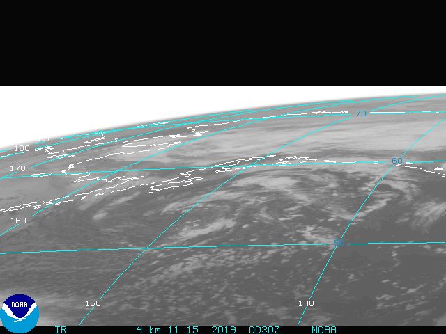
yep, I was just about to post that. If you use a ruler to connect the 11am points, you can see that Felix is currently traveling along the northern edge of that line.HouTXmetro wrote:unless Felix jogs west he is going North of the next forecated position point.
http://www.ssd.noaa.gov/goes/flt/t1/loop-avn.html
Hurricane FELIX: Caribbean-Discussions
Moderator: S2k Moderators
-
Extremeweatherguy

- Category 5

- Posts: 11095
- Joined: Mon Oct 10, 2005 8:13 pm
- Location: Florida
Re:
0 likes


-
JonathanBelles
- Professional-Met

- Posts: 11430
- Age: 35
- Joined: Sat Dec 24, 2005 9:00 pm
- Location: School: Florida State University (Tallahassee, FL) Home: St. Petersburg, Florida
- Contact:

-
southerngale

- Retired Staff

- Posts: 27418
- Joined: Thu Oct 10, 2002 1:27 am
- Location: Southeast Texas (Beaumont area)
Re:
Aric Dunn wrote:i wish people would use image shack for there pictures ... some of these others sites just dont work .. for me
I agree. I have asked several times for people to use Imageshack or a similar site for the sfwmd model maps because that site doesn't work for a lot of people. But everyone keeps posting the direct link, so many of us can't see the maps.
0 likes
-
Extremeweatherguy
- Category 5
- Posts: 11095
- Joined: Mon Oct 10, 2005 8:13 pm
- Location: Florida
-
wxman57

- Moderator-Pro Met

- Posts: 23172
- Age: 68
- Joined: Sat Jun 21, 2003 8:06 pm
- Location: Houston, TX (southwest)
Re: Re:
Extremeweatherguy wrote:yep, I was just about to post that. If you use a ruler to connect the 11am points, you can see that Felix is currently traveling along the northern edge of that line.HouTXmetro wrote:unless Felix jogs west he is going North of the next forecated position point.
http://www.ssd.noaa.gov/goes/flt/t1/loop-avn.html
Not by much. I have the center at 13.6N/71.7W at 1945Z. Movement now 286 deg. at 17.3 kts past 3 hours. The 286 degrees is due to a recent trochoidal wobble. Long-term (7hr) motion is 279 deg.
Oh, and the low-level center is near the bottom (southern part) of the eye (parallax).
0 likes
-
jlauderdal
- S2K Supporter

- Posts: 7240
- Joined: Wed May 19, 2004 5:46 am
- Location: NE Fort Lauderdale
- Contact:
Re:
HouTXmetro wrote:unless Felix jogs west he is going North of the next forecated position point.
http://www.ssd.noaa.gov/goes/flt/t1/loop-avn.html
yep but they never move in straight lines, eveyone in the us of a should be thanking this big ridge that has been in place for a few weeks now. texas is in good shape as their chances of taking a hit this season lessens each day as the season moves on.
0 likes
-
windstorm99

- S2K Supporter
- Posts: 1578
- Age: 48
- Joined: Sat May 26, 2007 8:10 am
- Location: Miami, Florida
- Contact:
Re: Hurricane FELIX:Caribbean-Discussions & Imagery 2 PM pag 34
Incredible look on SSD rainbow imagery....

0 likes


Re: Hurricane FELIX:Caribbean-Discussions & Imagery 2 PM pag 34
Keep in mind that Felix's track is about to take it over the first of three deep regions (minimal 100m 26ºC isotherm) of high oceanic heat content over 80 to 100 kJ/cm2. I have labeled and circled these regions in black. I now believe Felix will be a category five hurricane based on it organizing so quickly before reaching these regions:

Last edited by Windspeed on Sun Sep 02, 2007 3:34 pm, edited 1 time in total.
0 likes


Re: Re:
jlauderdal wrote:HouTXmetro wrote:unless Felix jogs west he is going North of the next forecated position point.
http://www.ssd.noaa.gov/goes/flt/t1/loop-avn.html
yep but they never move in straight lines, eveyone in the us of a should be thanking this big ridge that has been in place for a few weeks now. texas is in good shape as their chances of taking a hit this season lessens each day as the season moves on.
how do you figure? i thought the ridge had a better chance to retreat the later in the season we get which means texas would be more vulnerable.
0 likes
-
El Nino

- Category 1

- Posts: 454
- Age: 48
- Joined: Sun Oct 16, 2005 3:18 pm
- Location: Lima - Miraflores (Peru)
- Contact:
Re: Hurricane FELIX:Caribbean-Discussions & Imagery 2 PM pag 34
windstorm99 wrote:Incredible look on SSD rainbow imagery....
Just leaving S-America right when banding convection will wrap around the center. I think it will bomb in the next 24h. I expect a rapid deepening and it will get bigger and bigger.
0 likes
-
Extremeweatherguy
- Category 5
- Posts: 11095
- Joined: Mon Oct 10, 2005 8:13 pm
- Location: Florida
winds now 140mph! << 5pm advisory
Also, the movement is currently WNW near 20mph.
Also, the movement is currently WNW near 20mph.
Last edited by Extremeweatherguy on Sun Sep 02, 2007 3:40 pm, edited 1 time in total.
0 likes
-
vacanechaser

- Category 5
- Posts: 1461
- Joined: Wed Dec 03, 2003 9:34 pm
- Location: Portsmouth, Va
- Contact:
WTNT31 KNHC 022039
TCPAT1
BULLETIN
HURRICANE FELIX ADVISORY NUMBER 9
NWS TPC/NATIONAL HURRICANE CENTER MIAMI FL AL062007
500 PM EDT SUN SEP 02 2007
...FELIX CONTINUES TO STRENGTHEN...NOW A CATEGORY FOUR HURRICANE...
A TROPICAL STORM WATCH REMAINS IN EFFECT FOR JAMAICA AND FOR GRAND
CAYMAN. A TROPICAL STORM WATCH MEANS THAT TROPICAL STORM
CONDITIONS ARE POSSIBLE WITHIN THE WATCH AREA...GENERALLY WITHIN 36
HOURS.
INTERESTS ELSEWHERE IN THE CENTRAL AND WESTERN CARIBBEAN SEA SHOULD
CLOSELY MONITOR THE PROGRESS OF THIS SYSTEM.
FOR STORM INFORMATION SPECIFIC TO YOUR AREA...INCLUDING POSSIBLE
INLAND WATCHES AND WARNINGS...PLEASE MONITOR PRODUCTS ISSUED
BY YOUR LOCAL WEATHER OFFICE.
AT 500 PM EDT...2100Z...THE CENTER OF HURRICANE FELIX WAS LOCATED
NEAR LATITUDE 13.6 NORTH...LONGITUDE 72.0 WEST OR ABOUT 440 MILES...
710 KM...SOUTHEAST OF KINGSTON JAMAICA.
FELIX IS MOVING TOWARD THE WEST-NORTHWEST NEAR 20 MPH...32 KM/HR...
AND THIS GENERAL MOTION IS EXPECTED TO CONTINUE FOR THE NEXT 24
HOURS.
REPORTS FROM AN AIR FORCE HURRICANE HUNTER PLANE INDICATE THAT THE
MAXIMUM SUSTAINED WINDS HAVE INCREASED TO NEAR 140 MPH...220
KM/HR...WITH HIGHER GUSTS. FELIX IS A CATEGORY FOUR HURRICANE ON
THE SAFFIR-SIMPSON SCALE. ADDITIONAL STRENGTHENING IS FORECAST
DURING THE NEXT 24 HOURS.
HURRICANE FORCE WINDS EXTEND OUTWARD UP TO 25 MILES...35 KM...FROM
THE CENTER...AND TROPICAL STORM FORCE WINDS EXTEND OUTWARD UP TO 115
MILES...185 KM.
THE MINIMUM CENTRAL PRESSURE ESTIMATED FROM THE AIRCRAFT DATA IS 956
MB...28.23 INCHES.
FELIX IS EXPECTED TO PRODUCE TOTAL RAINFALL AMOUNTS OF 2 TO 4 INCHES
OVER THE GUAJIRA PENINSULA OF NORTHERN COLOMBIA.
REPEATING THE 500 PM EDT POSITION...13.6 N...72.0 W. MOVEMENT
TOWARD...WEST-NORTHWEST NEAR 20 MPH. MAXIMUM SUSTAINED WINDS...140
MPH. MINIMUM CENTRAL PRESSURE...956 MB.
AN INTERMEDIATE ADVISORY WILL BE ISSUED BY THE NATIONAL HURRICANE
CENTER AT 800 PM EDT FOLLOWED BY THE NEXT COMPLETE ADVISORY AT 1100
PM EDT.
$$
FORECASTER PASCH
0 likes
-
Brent
- S2K Supporter
- Posts: 38730
- Age: 37
- Joined: Sun May 16, 2004 10:30 pm
- Location: Tulsa Oklahoma
- Contact:
Re: Hurricane FELIX:Caribbean-Discussions & Imagery 2 PM pag 34
Predicting a borderline Cat 5(Weather Underground is wrong)

Last edited by Brent on Sun Sep 02, 2007 3:44 pm, edited 1 time in total.
0 likes
-
Scorpion
-
vacanechaser
- Category 5
- Posts: 1461
- Joined: Wed Dec 03, 2003 9:34 pm
- Location: Portsmouth, Va
- Contact:
THERE HAS BEEN RAPID STRENGTHENING OF THE HURRICANE TODAY. FELIX
HAS A SPECTACULAR PRESENTATION ON SATELLITE IMAGES WITH A WELL-
DEFINED EYE EMBEDDED IN A CIRCULAR CENTRAL DENSE OVERCAST. THE
HURRICANE HUNTER CREW REPORTED A STADIUM EFFECT IN THE EYE AND THAT
THE EYE DIAMETER HAD SHRUNK TO 12 N MI. THE AIR FORCE PLANE ALSO
MEASURED A PEAK 700 MB FLIGHT LEVEL WIND OF 132 KT AND...FOR A
SYSTEM OF SUCH CONVECTIVE VIGOR...THE 90 PER CENT RATIO OF SURFACE
TO FLIGHT LEVEL WINDS SHOULD CERTAINLY APPLY HERE. THIS WOULD
EQUATE TO PEAK SURFACE WINDS OF ABOUT 120 KT. A GPS DROPSONDE IN
THE NORTHERN EYEWALL MEASURED A SURFACE WIND OF 128 KT BUT THIS IS
A SPOT WIND THAT IS NOT NECESSARILY REPRESENTATIVE OF A 1-MINUTE
AVERAGE. THUS THE CURRENT INTENSITY IS SET AT 120 KT. A CENTRAL
PRESSURE OF 957 MB WAS MEASURED BY DROPSONDE...WITH 15 KT WINDS AT
THE SURFACE. SO THE MINIMUM PRESSURE IS ESTIMATED TO BE SLIGHTLY
LOWER OR 956 MB. THIS CORRESPONDS TO A FALL IN CENTRAL PRESSURE AT
A RATE OF 3.4 MB PER HOUR OVER THE PAST 7 HOURS OR SO...WHICH IS
ONE OF THE MORE RAPID DEEPENING RATES WE HAVE OBSERVED. FELIX WILL
REMAIN IN A VERY LOW SHEAR TROPOSPHERIC ENVIRONMENT AND WILL BE
PASSING OVER WATERS OF EXTREMELY HIGH OCEANIC HEAT CONTENT OVER THE
NEXT COUPLE OF DAYS. IN ADDITION...TO EXACERBATE THE SITUATION...
THERE IS A WARM EDDY OVER THE CENTRAL CARIBBEAN THAT FELIX IS
PROJECTED TO MOVE OVER IN 12 HOURS OR SO. THE OFFICIAL INTENSITY
FORECAST COULD BE CONSERVATIVE AND THERE IS CERTAINLY THE POTENTIAL
FOR US TO HAVE ANOTHER CATEGORY FIVE HURRICANE ON OUR HANDS BEFORE
ALL IS SAID AND DONE.
A SWIFT WEST-NORTHWESTWARD MOTION...285/17...CONTINUES. I HAVE MADE
ESSENTIALLY NO CHANGE TO THE TRACK FORECAST AND THE REASONING
BEHIND IT. A WELL-ESTABLISHED DEEP LAYER RIDGE TO THE NORTH OF
FELIX SHOULD MORE OR LESS MAINTAIN THE CURRENT MOTION FOR THE NEXT
DAY OR TWO. SOME SLOWING OF THE FORWARD SPEED IS CALLED FOR BY DAY
3 AS THE RIDGE WEAKENS. THE EXACT FATE OF FELIX OVER THE GULF OF
MEXICO REMAINS SOMEWHAT UNCERTAIN SINCE THERE IS SOME POSSIBILITY
THAT A TROUGH OVER THE CENTRAL U.S. COULD ERODE THE RIDGE MORE THAN
CURRENTLY ANTICIPATED. HOWEVER IT SHOULD BE NOTED THAT NONE OF THE
DYNAMICAL TRACK GUIDANCE MODELS TURN FELIX SIGNIFICANTLY TO THE
RIGHT THROUGH 120 HOURS. IN FACT...THE LATEST GFDL MODEL RUN HAS
SHIFTED WELL TO THE SOUTH OF THE OTHER GUIDANCE. AGAIN...BECAUSE
OF THE UNCERTAINTIES...WE ADVISE AGAINST PUTTING TOO MUCH EMPHASIS
ON THE EXACT NHC FORECAST TRACK AT 4 AND 5 DAYS.
FORECAST POSITIONS AND MAX WINDS
INITIAL 02/2100Z 13.6N 72.0W 120 KT
12HR VT 03/0600Z 14.1N 74.5W 125 KT
24HR VT 03/1800Z 14.8N 78.0W 130 KT
36HR VT 04/0600Z 15.4N 81.1W 135 KT
48HR VT 04/1800Z 16.0N 83.5W 135 KT
72HR VT 05/1800Z 17.3N 87.7W 135 KT
96HR VT 06/1800Z 19.5N 91.5W 80 KT
120HR VT 07/1800Z 21.5N 95.0W 90 KT
$$
FORECASTER PASCH
0 likes
-
storms in NC

- S2K Supporter
- Posts: 2338
- Joined: Thu Jul 28, 2005 2:58 pm
- Location: Wallace,NC 40 miles NE of Wilm
- Contact:
-
Portastorm

- Storm2k Moderator

- Posts: 9955
- Age: 63
- Joined: Fri Jul 11, 2003 9:16 am
- Location: Round Rock, TX
- Contact:
Re:
Scorpion wrote:Felix will have gone from an TD to a Cat 4 in just over 36 hours. Does anyone know the record for this deepening? This is 1935 Labor Day stuff.
Very good question. I was wondering the same. All in all, you just look at this beast on satellite and how its exploded in a day and a half ... talk about jaw-dropping, shock-n-awe type stuff!
I sure hope the folks in Belize are preparing for a major disaster.
0 likes
Who is online
Users browsing this forum: No registered users and 53 guests