
Hi anyways wheres this huge trough you guys are talking about? is it the one 99L is connected too? or is it something else.tropicsPR wrote:cycloneye wrote::uarrow: The big question TropicsPR,is if the big trough in the north Atlantic will pickup this and send it as a fish.
cycloneye my good friend, this huge trough, if remains stationary, likely will pick up the wave if it develops.
Strong Wave with low in Eastern Atlantic
Moderator: S2k Moderators
Forum rules

The posts in this forum are NOT official forecasts and should not be used as such. They are just the opinion of the poster and may or may not be backed by sound meteorological data. They are NOT endorsed by any professional institution or STORM2K. For official information, please refer to products from the National Hurricane Center and National Weather Service.
Re: Well Organized Wave in Eastern Atlantic
0 likes

Re: Well Organized Wave in Eastern Atlantic
punkyg wrote:Hi anyways wheres this huge trough you guys are talking about? is it the one 99L is connected too? or is it something else.tropicsPR wrote:cycloneye wrote::uarrow: The big question TropicsPR,is if the big trough in the north Atlantic will pickup this and send it as a fish.
cycloneye my good friend, this huge trough, if remains stationary, likely will pick up the wave if it develops.
It is the big convective swirl (low) in the North Atlantic that can be seen in the Weather Channel satellite.
0 likes
-
Gustywind

- Category 5

- Posts: 12334
- Joined: Mon Sep 03, 2007 7:29 am
- Location: Baie-Mahault, GUADELOUPE
Hé my friends i've put this this morning, did you read it ? Whereas concerning the trend of the future path...according to AREA FORECAST DISCUSSION
NATIONAL WEATHER SERVICE SAN JUAN PR
525 AM AST FRI SEP 7 2007 all these waves should be fish-storm , seems that we will see a fish storm if the new upper level pattern occur
"GLOBAL MODELS STILL INTENSIFYING MID ATLC UPPER TROF AND DIGGING
SSW INTO THE CENTRAL SUBTROPICAL ATLC THIS WEEKEND...WHICH WILL
ACT TO GREATLY INFLUENCE THE STEERING FLOW OF LOW AND MID LEVEL
FEATURES...INCLUDING TROPICAL WAVES...MOVING ACROSS THE CENTRAL
TROPICAL AND SUBTROPICAL ATLC NEXT WEEK...AND PULL THEM TO THE NW AND
N WELL BEFORE REACHING THE LESSER ANTILLES. LETS SEE HOW THIS
EVOLVES AND HOW LONG THIS ALTERED FLOW PERSISTS".
So , should it verifies but we have to see if this scenario can be confirmed it will break the record " for a passing wave at 15N" We have to wait and see....
0 likes

Re: Well Organized Wave in Eastern Atlantic
I don't know about the trof picking this one up. 12z NOGAPS keeps it as a weak system west ala Dean / Felix.......18z GFS wants to take it north at 40W but to me the high builds back in rather quickly however the GFS still insist on plowing it right into the ridge....UKMET seems to keep it west or WNW close to PR.....so alot of diversity with the models right now....should be fun to watch though...
0 likes
-
windstorm99

- S2K Supporter

- Posts: 1578
- Age: 48
- Joined: Sat May 26, 2007 8:10 am
- Location: Miami, Florida
- Contact:
Re: Well Organized Wave in Eastern Atlantic
Convection is now increasing with this wave and froms the looks of things if this continues it wont be to long before this is tagged by NRL.

0 likes
Re: Well Organized Wave in Eastern Atlantic
A lot of curvature to the southern ITCZ "band". Something is likely to spin from that.
0 likes
-
Gustywind
- Category 5
- Posts: 12334
- Joined: Mon Sep 03, 2007 7:29 am
- Location: Baie-Mahault, GUADELOUPE
TROPICAL WEATHER DISCUSSION
NWS TPC/NATIONAL HURRICANE CENTER MIAMI FL
805 PM EDT FRI SEP 07 2007
TROPICAL WEATHER DISCUSSION FOR NORTH AMERICA...CENTRAL
AMERICA...THE GULF OF MEXICO...THE CARIBBEAN SEA...NORTHERN
SECTIONS OF SOUTH AMERICA...AND THE ATLANTIC OCEAN TO THE
AFRICAN COAST FROM THE EQUATOR TO 32N. THE FOLLOWING INFORMATION
IS BASED ON SATELLITE IMAGERY...METEOROLOGICAL ANALYSIS...
WEATHER OBSERVATIONS...AND RADAR.
...TROPICAL WAVES...
AN ATLANTIC OCEAN TROPICAL WAVE IS ALONG 23W S OF 20N MOVING
WEST 10-15 KT. THIS WAVE COVERS A BROKEN TO OVERCAST
MULTILAYERED CLOUD ENVELOPE FROM 6N-20N BETWEEN 20W-30W. AN
AREA OF SCATTERED MODERATE TO ISOLATED STRONG CONVECTION HAS
DEVELOPED N OF THE ITCZ FROM 10N-13N BETWEEN 23W-26W.
0 likes
-
fasterdisaster
- Category 5
- Posts: 1868
- Joined: Mon Sep 19, 2005 4:41 pm
- Location: Miami, Florida
Re:
Gustywind wrote:Hé my friends i've put this this morning, did you read it ? Whereas concerning the trend of the future path...according to AREA FORECAST DISCUSSION
NATIONAL WEATHER SERVICE SAN JUAN PR
525 AM AST FRI SEP 7 2007 all these waves should be fish-storm , seems that we will see a fish storm if the new upper level pattern occur
"GLOBAL MODELS STILL INTENSIFYING MID ATLC UPPER TROF AND DIGGING
SSW INTO THE CENTRAL SUBTROPICAL ATLC THIS WEEKEND...WHICH WILL
ACT TO GREATLY INFLUENCE THE STEERING FLOW OF LOW AND MID LEVEL
FEATURES...INCLUDING TROPICAL WAVES...MOVING ACROSS THE CENTRAL
TROPICAL AND SUBTROPICAL ATLC NEXT WEEK...AND PULL THEM TO THE NW AND
N WELL BEFORE REACHING THE LESSER ANTILLES. LETS SEE HOW THIS
EVOLVES AND HOW LONG THIS ALTERED FLOW PERSISTS".
So , should it verifies but we have to see if this scenario can be confirmed it will break the record " for a passing wave at 15N" We have to wait and see....
LOL I just love how overoptimistic you get with every unimportant wave that comes off Africa. And then you say we have to wait and see even when it's become nothing but a few scattered clouds unable to even produce rain. I guess this one which looks way better than than the one earlier this week which this thread was actually started for and could develop, but lol no way that record is broken.
0 likes

Re: Well Organized Wave in Eastern Atlantic
Becoming much better organized by the hour....Convection consolidating and banding form on the south side. Also, the upper-air pattern is ideal for development. The sat image I have is the latest from 245 utc and continues to show improvement...This will be an invest by tomorrow morning!!
http://oiswww.eumetsat.org/SDDI/cgi/lis ... v=400,pp=0
http://oiswww.eumetsat.org/SDDI/cgi/lis ... v=400,pp=0
0 likes
-
HurricaneMaster_PR

- Category 2

- Posts: 795
- Joined: Tue Jul 22, 2003 6:23 pm
- Location: San Juan, Puerto Rico
Re: Well Organized Wave in Eastern Atlantic
TROPICAL WEATHER OUTLOOK
NWS TPC/NATIONAL HURRICANE CENTER MIAMI FL
1030 PM EDT FRI SEP 7 2007
FOR THE NORTH ATLANTIC...CARIBBEAN SEA AND THE GULF OF MEXICO...
SHOWER ACTIVITY HAS INCREASED THIS EVENING IN ASSOCIATION WITH A
TROPICAL WAVE LOCATED A FEW HUNDRED MILES SOUTH OF THE CAPE VERDE
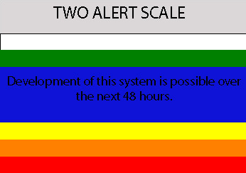
ISLANDS. SLOW DEVELOPMENT OF THIS SYSTEM IS POSSIBLE OVER THE NEXT
COUPLE DAYS AS IT MOVED WESTWARD AT ABOUT 15 MPH.
ELSEWHERE...TROPICAL CYCLONE FORMATION IS NOT EXPECTED DURING THE
NEXT 48 HOURS.
$$
FORECASTER BEVEN
NWS TPC/NATIONAL HURRICANE CENTER MIAMI FL
1030 PM EDT FRI SEP 7 2007
FOR THE NORTH ATLANTIC...CARIBBEAN SEA AND THE GULF OF MEXICO...
SHOWER ACTIVITY HAS INCREASED THIS EVENING IN ASSOCIATION WITH A
TROPICAL WAVE LOCATED A FEW HUNDRED MILES SOUTH OF THE CAPE VERDE
ISLANDS. SLOW DEVELOPMENT OF THIS SYSTEM IS POSSIBLE OVER THE NEXT
COUPLE DAYS AS IT MOVED WESTWARD AT ABOUT 15 MPH.
ELSEWHERE...TROPICAL CYCLONE FORMATION IS NOT EXPECTED DURING THE
NEXT 48 HOURS.
$$
FORECASTER BEVEN
0 likes


-
HurricaneMaster_PR
- Category 2
- Posts: 795
- Joined: Tue Jul 22, 2003 6:23 pm
- Location: San Juan, Puerto Rico
Guy i'm starting to see the wave in the CATL.
Am i seeing, because its moving fast or is it, because its expanding?
http://www.ssd.noaa.gov/goes/east/catl/avn-l.jpg
Am i seeing, because its moving fast or is it, because its expanding?
http://www.ssd.noaa.gov/goes/east/catl/avn-l.jpg
0 likes

 if the hole doesn't close up...


Re: Wave in Eastern Atlantic=10:30 PM TWO Posted at page 12
Ah, see what happens tomorrow. Plenty of ocean ahead of this one. Looks to be curling up.
0 likes
Who is online
Users browsing this forum: No registered users and 105 guests