Wave E of the Leewards
Moderator: S2k Moderators
Forum rules

The posts in this forum are NOT official forecasts and should not be used as such. They are just the opinion of the poster and may or may not be backed by sound meteorological data. They are NOT endorsed by any professional institution or STORM2K. For official information, please refer to products from the National Hurricane Center and National Weather Service.

Re: Interesting developments E of the Leewards
How come none of the models are picking this up and why isn't this an invest yet. When we had 98L it looked more disorganized then this and it was called an invest.
0 likes
-
windstorm99

- S2K Supporter

- Posts: 1578
- Age: 48
- Joined: Sat May 26, 2007 8:10 am
- Location: Miami, Florida
- Contact:
Re: Interesting developments E of the Leewards
boca wrote:How come none of the models are picking this up and why isn't this an invest yet. When we had 98L it looked more disorganized then this and it was called an invest.
Boca my best guess right now is remember persistence is key and if convection can persist through tommorow into monday i think NRL might want to tag it.
Right now its been on and off the past day or two.
0 likes
-
HURAKAN

- Professional-Met

- Posts: 46084
- Age: 39
- Joined: Thu May 20, 2004 4:34 pm
- Location: Key West, FL
- Contact:
For the "poof" posts:
Disturbances and poorly-organized systems usually increase in convection in the morning and decrease in convection in the late hours of the afternoon due to diurnal maximum and minimum. This happens because without a well-defined area of low pressure it's very difficult to have convergence in the lower levels of the atmosphere to continually feed the system with thermal energy.
It's also true that if a system encounters hostile conditions may not be able to continue producing convection and will "poof." Nonetheless, throughout this thread the enviromental conditions ahead of the disturbance seem to be mostly favorable for the area of diturbed weather to organize.
Pro-Mets may want to add more.
0 likes
-
windstorm99
- S2K Supporter
- Posts: 1578
- Age: 48
- Joined: Sat May 26, 2007 8:10 am
- Location: Miami, Florida
- Contact:
Re: Interesting developments E of the Leewards
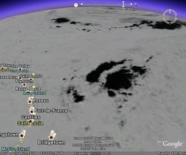
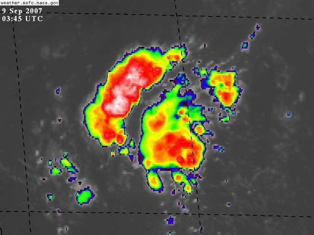
Infrared view....We'll see what happens tommorow if this area trys to organize futher.

0 likes
-
HurricaneMaster_PR

- Category 2

- Posts: 795
- Joined: Tue Jul 22, 2003 6:23 pm
- Location: San Juan, Puerto Rico

Re: Interesting developments E of the Leewards
My instinct on this is that it won't develop because of what is coming up behind it on the ITCZ, but also because it is located at the "point" of a large synoptic airmass similar to those which carried the SAL across the Atlantic earlier. We'll see if I'm wrong. I'll grant you this does have some hints of tendency that I cited before.
0 likes
-
fasterdisaster
- Category 5

- Posts: 1868
- Joined: Mon Sep 19, 2005 4:41 pm
- Location: Miami, Florida
-
HURAKAN
- Professional-Met
- Posts: 46084
- Age: 39
- Joined: Thu May 20, 2004 4:34 pm
- Location: Key West, FL
- Contact:
twd 205:
AN ATLANTIC OCEAN TROPICAL WAVE IS ALONG 54W/55W SOUTH OF 21N
MOVING WEST 10-15 KT. THIS WAVE CONTINUES TO SHOW UP WELL IN
SATELLITE IMAGERY AND THE SURROUNDING BUOY OBS...WITH A BROAD
INVERTED V PATTERN NOTED. SCATTERED MODERATE CONVECTION IS OVER
THE N PORTION OF THE AXIS FROM 14N-19N BETWEEN 54W-59W. THIS
ACTIVITY IS EXPECTED TO AFFECT THE NRN LESSER ANTILLES/LEEWARD
ISLANDS LATE SUN INTO MON.
0 likes

Quite a lot of convection present with this system at the moment and it needs watching simply because of its position. The wave from Africa at least at the moment is far enough away to not really be an issue for this system for the next few days and the set-up doesn't look all that bad for development either at first glance.
0 likes
-
windstorm99
- S2K Supporter
- Posts: 1578
- Age: 48
- Joined: Sat May 26, 2007 8:10 am
- Location: Miami, Florida
- Contact:
Re: Interesting developments E of the Leewards
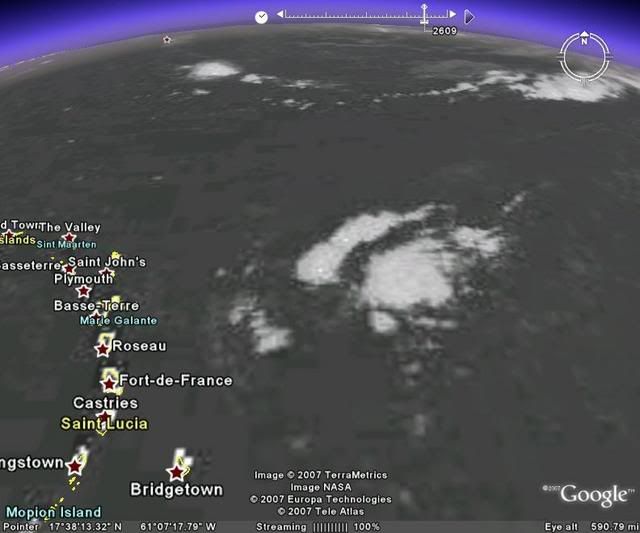
wow this system is looking very impressive this morning....If convection persists we may very well see this get tagged soon. 
0 likes

Re: Interesting developments E of the Leewards
With each diurnal max the convection is increasing. Yesterday it appeared there might be some rotation in the clouds. Looks like the area has moved NW overnight possibly in response to the ULL to its north. The ridge will trap this north of the islands so it could be a threat to the SE US. They may wait till Monday to upgrade it to an invest since it has not been organizing very quickly.
0 likes
-
cycloneye

- Admin

- Posts: 149276
- Age: 69
- Joined: Thu Oct 10, 2002 10:54 am
- Location: San Juan, Puerto Rico
Re: Interesting developments E of the Leewards
AN ATLANTIC OCEAN TROPICAL WAVE IS ALONG 56W SOUTH OF 21N
MOVING WEST 10-15 KT. THIS WAVE CONTINUES TO SHOW UP WELL IN
SATELLITE IMAGERY WITH A BROAD INVERTED V PATTERN NOTED. A 1011
MB LOW WAS ADDED TO THE AXIS NEAR 14N BASED ON THE APPEARANCE IN
SHORTWAVE IR IMAGERY IN ADDITION TO THE OBSERVATIONS FROM THE
METEO FRANCE BUOY 41101. SCATTERED MODERATE CONVECTION IS OVER
THE N PORTION OF THE AXIS FROM 14N-20N BETWEEN 54W-61W. THIS
ACTIVITY IS EXPECTED TO AFFECT THE NRN LESSER ANTILLES/LEEWARD
ISLANDS LATER TODAY AND MON.
$$
WILLIS/WALLACE
8 AM discussion.A low has been added.
0 likes
-
Gustywind

- Category 5
- Posts: 12334
- Joined: Mon Sep 03, 2007 7:29 am
- Location: Baie-Mahault, GUADELOUPE
000
AXNT20 KNHC 091146
TWDAT
TROPICAL WEATHER DISCUSSION
NWS TPC/NATIONAL HURRICANE CENTER MIAMI FL
805 AM EDT SUN SEP 09 2007
TROPICAL WEATHER DISCUSSION FOR NORTH AMERICA...CENTRAL
AMERICA...THE GULF OF MEXICO...THE CARIBBEAN SEA...NORTHERN
SECTIONS OF SOUTH AMERICA...AND THE ATLANTIC OCEAN TO THE
AFRICAN COAST FROM THE EQUATOR TO 32N. THE FOLLOWING INFORMATION
IS BASED ON SATELLITE IMAGERY...METEOROLOGICAL ANALYSIS...
WEATHER OBSERVATIONS...AND RADAR.
BASED ON 0600 UTC SURFACE ANALYSIS AND SATELLITE IMAGERY THROUGH
1015 UTC.
AN ATLANTIC OCEAN TROPICAL WAVE IS ALONG 56W SOUTH OF 21N
MOVING WEST 10-15 KT. THIS WAVE CONTINUES TO SHOW UP WELL IN
SATELLITE IMAGERY WITH A BROAD INVERTED V PATTERN NOTED. A 1011
MB LOW WAS ADDED TO THE AXIS NEAR 14N BASED ON THE APPEARANCE IN
SHORTWAVE IR IMAGERY IN ADDITION TO THE OBSERVATIONS FROM THE
METEO FRANCE BUOY 41101. SCATTERED MODERATE CONVECTION IS OVER
THE N PORTION OF THE AXIS FROM 14N-20N BETWEEN 54W-61W. THIS
ACTIVITY IS EXPECTED TO AFFECT THE NRN LESSER ANTILLES/LEEWARD
ISLANDS LATER TODAY AND MON.
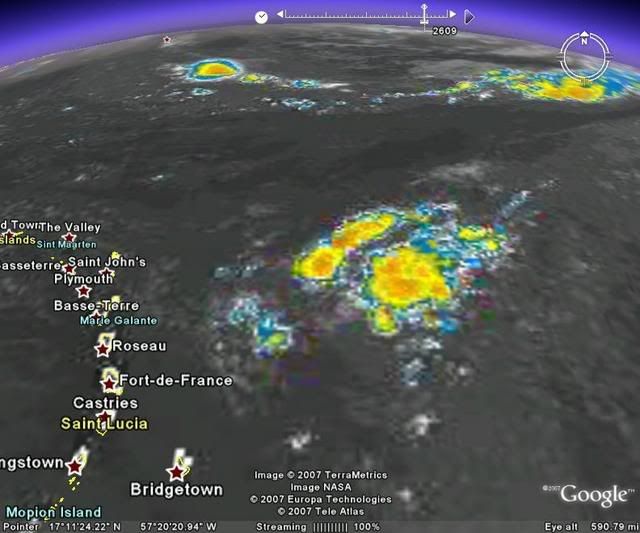
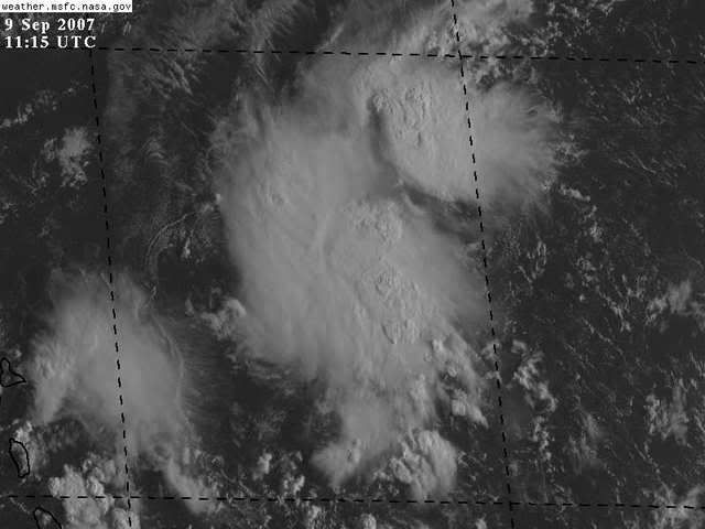
Very nice system, convection is increasing nicely since yesterday....with a big bulk of convection father east and another close to Guadeloupe.....something to watch in the next couple of hours!:eek:
Latest sat pic on this bursting system near Guadeloupe and the Leewards Islands:
http://www.meteo.fr/temps/domtom/antill ... Tagant.jpg
AXNT20 KNHC 091146
TWDAT
TROPICAL WEATHER DISCUSSION
NWS TPC/NATIONAL HURRICANE CENTER MIAMI FL
805 AM EDT SUN SEP 09 2007
TROPICAL WEATHER DISCUSSION FOR NORTH AMERICA...CENTRAL
AMERICA...THE GULF OF MEXICO...THE CARIBBEAN SEA...NORTHERN
SECTIONS OF SOUTH AMERICA...AND THE ATLANTIC OCEAN TO THE
AFRICAN COAST FROM THE EQUATOR TO 32N. THE FOLLOWING INFORMATION
IS BASED ON SATELLITE IMAGERY...METEOROLOGICAL ANALYSIS...
WEATHER OBSERVATIONS...AND RADAR.
BASED ON 0600 UTC SURFACE ANALYSIS AND SATELLITE IMAGERY THROUGH
1015 UTC.
AN ATLANTIC OCEAN TROPICAL WAVE IS ALONG 56W SOUTH OF 21N
MOVING WEST 10-15 KT. THIS WAVE CONTINUES TO SHOW UP WELL IN
SATELLITE IMAGERY WITH A BROAD INVERTED V PATTERN NOTED. A 1011
MB LOW WAS ADDED TO THE AXIS NEAR 14N BASED ON THE APPEARANCE IN
SHORTWAVE IR IMAGERY IN ADDITION TO THE OBSERVATIONS FROM THE
METEO FRANCE BUOY 41101. SCATTERED MODERATE CONVECTION IS OVER
THE N PORTION OF THE AXIS FROM 14N-20N BETWEEN 54W-61W. THIS
ACTIVITY IS EXPECTED TO AFFECT THE NRN LESSER ANTILLES/LEEWARD
ISLANDS LATER TODAY AND MON.
Very nice system, convection is increasing nicely since yesterday....with a big bulk of convection father east and another close to Guadeloupe.....something to watch in the next couple of hours!:eek:
Latest sat pic on this bursting system near Guadeloupe and the Leewards Islands:
http://www.meteo.fr/temps/domtom/antill ... Tagant.jpg
0 likes

http://www.ssd.noaa.gov/goes/east/catl/avn-l.jpg
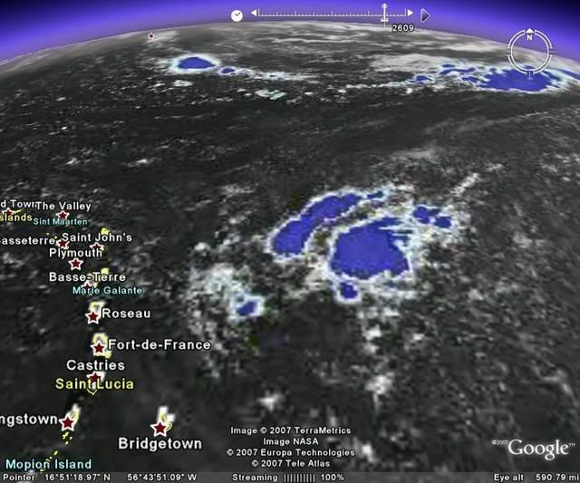
Hmmm do you think this wave looks better organized, then yesterday morning? i actually think it is.
Hmmm do you think this wave looks better organized, then yesterday morning? i actually think it is.
0 likes
-
Gustywind
- Category 5
- Posts: 12334
- Joined: Mon Sep 03, 2007 7:29 am
- Location: Baie-Mahault, GUADELOUPE
Good Morning punkyg:D !
Yeah absolutely that's this trend since yesterday night.
punkyg i've to admit that...the big bulk of convection is very nice this morning and the other close to my island too..so chances to see more bursting activity is higher than yesterday as a low has been added 1011 at 14n56w, very very interresting to see what will happen with this system today
0 likes
Who is online
Users browsing this forum: hcane27 and 266 guests