Storm2k Tropical Outlook
Cuba and surrounding Radars
Moderator: S2k Moderators


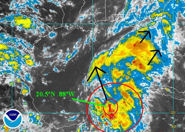
Rainband wrote:Yes TONI..especially if you listen to BAYNEWS9..Just what we need!!! NOT :o
Just that its gonna be wet and we need to watch this closelyToni - 574 wrote:Rainband wrote:Yes TONI..especially if you listen to BAYNEWS9..Just what we need!!! NOT :o
No rainband I don't . I wish I did, I have verizon and they do not carry Baynews 9.
What are they saying? Keep me updated if you would please!
I will be out for a while today, but will check in as soon as I can.


 my Cowboys my Rockets my Astros


Users browsing this forum: No registered users and 110 guests