Tropical Depression TEN Threat Area: North Gulf Coast
Moderator: S2k Moderators
-
jasons2k

- Storm2k Executive

- Posts: 8290
- Age: 52
- Joined: Wed Jul 06, 2005 12:32 pm
- Location: The Woodlands, TX
Tropical Depression TEN Threat Area: North Gulf Coast
Discuss conditions in threatened areas.
0 likes
-
Evil Jeremy

- S2K Supporter

- Posts: 5463
- Age: 32
- Joined: Mon Apr 10, 2006 2:10 pm
- Location: Los Angeles, CA
Re: INVEST 93L (ATL): Threat Area: Florida (for now)
I live in Plantation, Broward County and will be reporting on the rain threat. I am currently in Boca Raton, and we had a strong, but not severe thunderstorm pass by about 45 Minutes ago.
0 likes
-
Weatherboy1

- Category 5

- Posts: 1190
- Age: 50
- Joined: Mon Jul 05, 2004 1:50 pm
- Location: Jupiter/Sarasota, FL
-
Jinkers

- Category 1

- Posts: 471
- Joined: Wed May 23, 2007 10:34 pm
- Location: Pembroke Pines, Florida
- Contact:
Re: INVEST 93L (ATL): Threat Area: Florida (for now)
I live in Hollywood FL, we just a strong thunderstorm pass thru here too, still raining a little. Had some pretty decent wind gusts.
0 likes
-
flwxwatcher
- Category 4

- Posts: 926
- Joined: Wed May 16, 2007 3:35 pm
- Location: Central Florida
Re: INVEST 93L (ATL): Threat Area: Florida (for now)
West Central Florida here between Tampa and Orlando. Sun is out( I expect that to change in the next 24 Hrs) but it is starting to become breezy.
0 likes
-
MiamiensisWx
Re: INVEST 93L (ATL): Threat Area: Florida (for now)
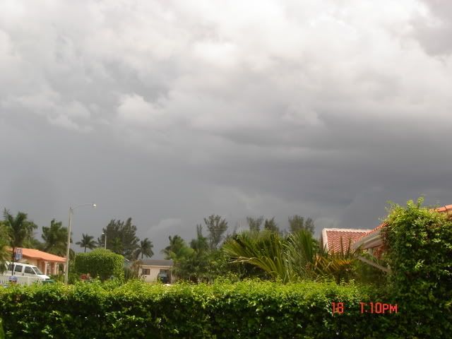
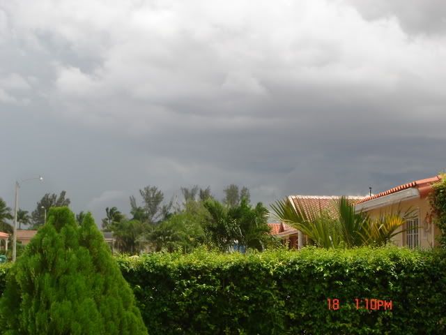
Conditions are overcast here in Boca Raton, FL (Palm Beach County). Winds picked up during the passage of some heavier thunderstorms. Currently, it's breezy at my location with an outflow boundary (visible to the N) related to an adjacent thunderstorm. An "anvil" is quite evident near my area.
0 likes


-
JonathanBelles
- Professional-Met

- Posts: 11430
- Age: 35
- Joined: Sat Dec 24, 2005 9:00 pm
- Location: School: Florida State University (Tallahassee, FL) Home: St. Petersburg, Florida
- Contact:
Re: INVEST 93L (ATL): Threat Area: Florida (for now)
St. Pete, Florida (extreme west coast)
87°F
DP:78
Humidity:58%
Wind: NE@12mph
mostly sunny to partly cloudy
29.98"
87°F
DP:78
Humidity:58%
Wind: NE@12mph
mostly sunny to partly cloudy
29.98"
0 likes

Re: INVEST 93L (ATL): Threat Area: Florida (for now)
my post from the other thread -
I had noticed today that it is wonderfully cooler here and a fantastic steady breeze coming in from out of the east here in northern palm beach county. A lot less clouds than yesterday though. Yesterday afternoon we got very strong rains and then it rained off and on all evening. Lightning lit up the sky all night. The temp is currently 79. It has been running around 85 to 86 this time of day for months now. What a relief this is! Humidity is somewhat higher but the breeze is compensating for that.
79°F
(26°C) Humidity: 82 %
Wind Speed: NE 15 MPH
Barometer: 29.96" (1014.5 mb)
Dewpoint: 73°F (23°C)
Heat Index: 82°F (28°C)
Visibility: 10.00 mi.
More Local Wx: 3 Day History:
0 likes

Re: INVEST 93L (ATL): Threat Area: Florida (for now)
near-tropical conditions here in NE Florida.
noticeable NE to SW movement of rain bands.
noticeable NE to SW movement of rain bands.
0 likes

-
serenityjp
- Tropical Wave

- Posts: 8
- Age: 67
- Joined: Tue Jul 31, 2007 10:20 am
- Location: Titusville, FL
Re: INVEST 93L (ATL): Threat Area: Florida (for now)
Northern Brevard here, on and off showers moving to the SW.
0 likes
-
JonathanBelles
- Professional-Met
- Posts: 11430
- Age: 35
- Joined: Sat Dec 24, 2005 9:00 pm
- Location: School: Florida State University (Tallahassee, FL) Home: St. Petersburg, Florida
- Contact:
Re: INVEST 93L (ATL): Threat Area: Florida (for now)
St. Pete, Fl
89.5°
DP:71°
RH:55%
29.96" and falling
winds ENE at 13mph
mostly cloudy
89.5°
DP:71°
RH:55%
29.96" and falling
winds ENE at 13mph
mostly cloudy
0 likes
-
chadtm80

JACKSONVILLE, Fla. -- Nor'easter-like conditions that developed overnight dropped up to 7 inches of rain across a portion of Duval County in less than 12 hours Monday, causing street flooding in downtown Jacksonville, Riverside, San Marco, and on Jacksonville's beaches and at Ponte Vedra.
http://www.news4jax.com/weather/14131085/detail.html
0 likes
-
DanKellFla

- Category 5
- Posts: 1291
- Joined: Fri Mar 17, 2006 12:02 pm
- Location: Lake Worth, Florida
Palm Beach Gardens, Florida here,
Overcast and Breezy around 80 F. The Dewpoint is 72. It is very nice outside. It looks like we are getting rain soon. Actually, the weather reminds me a day before a hurricane, except that it is cloudy.
Hopefully, all we will get is rain. That last satellite loop I looked at showed a circulation with the center already over land.
0 likes

-
gatorcane

- S2K Supporter
- Posts: 23708
- Age: 48
- Joined: Sun Mar 13, 2005 3:54 pm
- Location: Boca Raton, FL
Florida Report Your Conditions
Okay its time folks -- I think conditions are going downhill as our invest looks to be getting its act together offshore Palm Beach....
This invest may just catch alot of us offguard as the squalls could get ugly as they move in off the Gulf Stream.
Current radar suggest heavy squalls are building up over the Gulf stream very quickly today and some could move onshore later today and tonight.
I wouldn't be surprised if we see tornado watches and warnings for parts of the peninsula as this invest moves onshore.
NAPLES MOSUNNY 93 70 46 N12 29.90F HX 99
W PALM BEACH PTSUNNY 82 71 69 NE17 29.93F
FT LAUDER-EXEC LGT RAIN 81 71 71 NE15 29.92S
FT LAUDERDALE CLOUDY 83 72 69 NE24 29.91R
POMPANO BEACH CLOUDY 84 72 67 NE20 29.92S
PEMBROKE PINES PTSUNNY 82 73 74 NE14G20 29.93S
OPA LOCKA PTSUNNY 85 74 69 N13 29.91F
MIAMI PTSUNNY 84 70 62 NE12 29.91F
MIAMI BEACH N/A 81 75 80 NE21G26 29.91F
WEST KENDALL MOSUNNY 86 71 60 NE12G20 29.89F
HOMESTEAD PTSUNNY 81 71 72 E8 29.90F
Last edited by gatorcane on Tue Sep 18, 2007 2:44 pm, edited 1 time in total.
0 likes
Cyclone1 reporting from Polk County, Central Florida:
Well, gatorcane, although I'm not on the coast, I might as well report, eh? It seems that the low level edges of 93 are just beginning to arrive.
Conditions are fair right now, set aside a few brief showers, and low, fast moving clouds. The locals here are taking no precautions with the developing storm, because well, GC, no one really seems to know about it. I'll be back with periodic updates as the weather in Central Florida begins to deteriorate. This is Cyclone1 reporting for Polk County.
0 likes
-
gatorcane
- S2K Supporter
- Posts: 23708
- Age: 48
- Joined: Sun Mar 13, 2005 3:54 pm
- Location: Boca Raton, FL
Re: Florida Report Your Conditions
As I suspected already tornado watches are being issued by some of the NWSs across Florida....
Ruskin just issued one.
I just stepped outside and it is very eerie out to the east with N to NE winds gusting to 20 mph here in Boca Raton.
Ruskin just issued one.
I just stepped outside and it is very eerie out to the east with N to NE winds gusting to 20 mph here in Boca Raton.
0 likes
Who is online
Users browsing this forum: No registered users and 52 guests