the low is not developing in spite of shear
This is simple mass continuity... upper diveregence means more convection
Tropical Depression TEN: Discussions & Images
Moderator: S2k Moderators
-
mattpetre
- Category 2

- Posts: 510
- Age: 54
- Joined: Mon Sep 19, 2005 3:20 pm
- Location: Missouri City,TX & Galleria
- Contact:
Re:
Steve wrote:>>AFM, wxman57, or other mets.... it's hard to believe this could trek west all the way across the GOM and hit Texas (as the Euro shows), without finding a weakness. It's getting late in the season for us. I know Rita did it, so it keeps my guard up, but that was considered pretty late in the season.... surely not another one just 2 years later. I know you can change your mind, but what odds do you put on it doing that? Everyone is asking me questions since I'm the weather geek of the crowd.... can I ease their minds a little?
Gale,
Don't be surprised if Texas doesn't get the all clear for a couple of more weeks. We have to wait to see what the setup is post-93L, but ridging doesn't appear to be going anywhere soon.
Steve
Another thing about this year... The Dean / Felix combo on Central America / Yucatan was a first for a single year Cat 5s so I wouldn't be surprised by much about differences in this season at this point.
0 likes


Re: INVEST 93L (ATL): Discussion & Images=5:30 PM TWO Shortly
http://www.srh.noaa.gov/jax/text.php?sid=JAX&pil=AFD
AREA FORECAST DISCUSSION
NATIONAL WEATHER SERVICE JACKSONVILLE FL
235 PM EDT TUE SEP 18 2007
...HEAVY RAINFALL EVENT TO INCREASE AREAL FLOOD POTENTIAL...
...INCREASING WINDS WILL RESULT IN OCCASIONAL GUST TO GALE OVER
THE COASTAL WATERS AND HIGH SURF ALONG THE COAST...
...WINDY CONDITIONS TO CONTINUE THROUGH AT LEAST WEDNESDAY...
.SHORT TERM...CURRENT SOUTHEAST SCALE MSAS ANALYSIS SHOWS HINTS OF
A WEAK CIRCULATION OFF THE SOUTHEAST FLORIDA COAST WITH STREAMLINE
ANALYSIS INFERRING AN INVERTED TROUGH ALL THE WAY UP TO NORTHEAST
FLORIDA. THETA-E AND SURFACE DEWPOINTS SHOW THE RICHEST AIRMASS
OVER THE SOUTHEAST ZONES AND NORTHEAST INTO THE COASTAL WATERS.
THIS IS IN ADDITION TO THE GREATEST SURFACE CONVERGENCE IN THESE
AREAS AS WELL WITH RESULTANT NUMEROUS SHOWERS FOR SOUTHERN COASTAL
SECTIONS. MODELS SHOW DEEPEST MOISTURE ONLY EXTENDS UP TO 900MB-
800MB BUT THIS IS STILL ENOUGH IN CONVERGENT FLOW TO KEEP SHOWERS
GOING WELL INTO THE EVENING HOURS. CURRENT LAKE WIND ADVISORY
LOOKS ON TRACK AND WILL LET IT RIDE THROUGH 00Z.
MANY OF THE DETAILS OF THE UPCOMING FORECAST WILL DEPEND LARGELY
ON ANY SUB-TROPICAL EVOLUTION IN THE WESTERN ATLANTIC. THIS IS
PLAYED OUT BY THE TWO MAIN MODEL SUITES AS DIFFERENCES IN THEIR
SOLUTIONS RESULT IN A MULTITUDE OF POSSIBILITIES FOR OUR SENSIBLE
WEATHER. GIVEN THAT...IT LOOKS AS THOUGH THE MODELS AGREE FAIRLY
WELL THROUGH WED ALTHOUGH THEY BOTH LOOK TO ANALYZE CIRCULATION
CENTERS TO FAR WEST. SO BY WED 12Z...WE ARE EXPECTING A LOW TO
FORM SOMEWHERE BETWEEN THE WESTERN BAHAMAS AND THE SOUTHEAST
FLORIDA COAST. THIS WILL SHARPEN UP THE MAIN RAIN BAND
SUBSTANTIALLY AS IT PROGRESSES TOWARD OUR COASTLINE. WOULD EXPECT
SOUTH COASTAL SECTIONS TO HAVE PASSING SHOWERS BY 12Z BU THE BRUNT
OF THE ACTIVITY WILL HOLD OFF UNTIL THE EARLY AFTERNOON HOURS.
UNFORTUNATELY...IT LOOKS AS THOUGH WE WILL BE DEALING WITH A
STRONG BAND WITH SOME AREAS OF NORTHEAST FLORIDA SEEING ANOTHER
TRAINING SCENARIO. ALTHOUGH A BIT MORE TRANSIENT THAN THE PREVIOUS
EVENT...EXPECT SOME AREAS TO SEE SOME ADDITIONAL FLOODING PROBLEMS
WHERE MAIN BANDS SET UP. WILL THEREFORE EXTEND CURRENT FLOOD WATCH
THROUGH 12Z THU TO COVER THE ENTIRE EVENT.
THIS IS WHERE THE MAIN DIFFERENCES IN THE MODELS CREEP IN WITH THE
NAM12 SHOWING A SLOWER PROGRESSION WESTWARD AND CONSEQUENTLY KEEPS
RAIN BAND IN OUR AREA LONGER. WILL USE A BLEND FOR NOW BUT FAVOR A
DECREASING TREND IN POPS FOR COASTAL SECTIONS WITH INLAND AREAS
BECOMING FAVORED. SO FOR THU...GRID POPS SHOW LIKELY POPS FOR
SOUTHERN INLAND ZONES AND HIGH END CHANCE ELSEWHERE.
WITH LOW TO THE WEST ON FRIDAY...WE WILL BE IN A MOIST SOUTH
SOUTHEAST FLOW WITH ADDITIONAL RAIN BANDS TO AFFECT THE AREA. THE
POSITION OF THIS BAND WILL BE FULLY DEPENDENT ON THE STRENGTH OF
THE GULF LOW BY THIS TIME BUT AT LEAST HIGH END CHANCE POPS STILL
LOOK WARRANTED.
.LONG TERM...LOOKS LIKE A PERIOD OF ABOVE CLIMO POPS AS RESIDUAL
DEEP MOISTURE AXIS REMAINS ENTRENCHED OVER THE AREA. CURRENT HIGH
END CHANCE POPS IN THE GRIDS LOOK ON TRACK AND NO CHANGES PLANNED.
&&
.AVIATION...
MVFR CIGS/VSBYS WILL REMAIN LIKELY AS ATLC COASTAL SHOWERS CONTINUE
TO TRACK ONSHORE...MAINLY AT KCRG AND KJAX. HIGHER GUSTS UP TO 30
KNOTS PSBL IN STRONGER SHOWER ACTIVITY.
&&
.MARINE...
VERY CLOSE TO FREQUENT GALE FORCE GUSTS CONDITIONS FROM THE GRADIENT
NE WINDS AND FROM ISOLD STRONG TSTM ACTIVITY OVER THE COASTAL
WATERS. AFTER COLLAB WITH MLB/CHS OFFICES HAVE DECIDED TO HOLD OFF
FOR ANY GALE WARNINGS AT THIS TIME AND HANDLE WITH STATEMENTS OF
OCCASIONAL GUSTS TO GALE FORCE. SEAS HAVE PUSHED UP TO 7 TO 10 FT
AND WILL CONTINUE THROUGH WEDNESDAY NIGHT. WINDS WILL SHIFT TO THE
E/SE ON THURSDAY AND SLOWLY DECREASE INTO THE WEEKEND.
SURF ZONE...BREAKERS HAVE INCREASED A BIT INTO THE 4 TO 6 FT RANGE
AND A FURTHER INCREASE INTO THE 5 TO 7 FT RANGE IS LIKELY TONIGHT
AND CONTINUING THROUGH WEDNESDAY AND HAVE EXTENDED HIGH SURF
ADVISORY THROUGH THURSDAY MORNING WITH THE UPDATE. TIDAL DEPARTURES
CONTINUE AT 1 TO 2 FT ABOVE NORMAL BUT REMAIN BELOW ANY SIGNIFICANT
FLOODING LEVELS ALONG THE COAST DUE TO FAVORABLE ASTRONOMICAL TIDAL
LEVELS. HIGH RISK OF RIP CURRENTS WILL REMAIN IN PLACE THROUGH
THURSDAY.
&&
0 likes
-
Derek Ortt
-
Stormcenter
- S2K Supporter

- Posts: 6689
- Joined: Wed Sep 03, 2003 11:27 am
- Location: Houston, TX
Re:
bwhorton2007 wrote:Well all i can say is something is developing off florida despite shearing and a ULL and has a real chance to be a big time weathermaker this week.
I believe it will be a big weathermaker (heavy rain,stong but not severe winds,high seas and tides)but not to the extent that some are predicting on this board.
0 likes
-
HarlequinBoy

- Category 5

- Posts: 1400
- Age: 35
- Joined: Wed Nov 29, 2006 1:57 am
- Location: Memphis
It's kind of interesting that offices all the way up in Memphis are mentioning this system. In fact, they mentioned it a day or two ago.
Excerpt from Memphis Afternoon Disco
Excerpt from Memphis Afternoon Disco
EXTENDED...A DISTURBANCE IS EXPECTED TO DEVELOP OVER THE EASTERN
GULF OF MEXICO AND MOVE WEST ACROSS THE GULF AND INTO LOUISIANA OR
TEXAS THIS WEEKEND. EXTENDED MODELS INDICATE THAT THIS SYSTEM
COULD IMPACT THE MID SOUTH BY EARLY NEXT WEEK. HOWEVER THERE IS QUITE
A BIT OF UNCERTAINTY OF THE TRACK AND EVOLUTION OF THIS SYSTEM SO
WILL CONTINUE THE CURRENT FORECAST OF 20-30 PERCENT POPS.
0 likes


-
ConvergenceZone
.gif)
- Category 5
- Posts: 5241
- Joined: Fri Jul 29, 2005 1:40 am
- Location: Northern California
Re: Re:
Stormcenter wrote:bwhorton2007 wrote:Well all i can say is something is developing off florida despite shearing and a ULL and has a real chance to be a big time weathermaker this week.
I believe it will be a big weathermaker (heavy rain,stong but not severe winds,high seas and tides)but not to the extent that some are predicting on this board.
that sounds about right for Florida but not for the gulf coast....Should be much more eventful for them.
0 likes
-
Emmett_Brown

- Category 5
- Posts: 1433
- Joined: Wed Aug 24, 2005 9:10 pm
- Location: Sarasota FL
Re: INVEST 93L (ATL): Discussion & Images=5:30 PM TWO Shortly
Air Force Met wrote:alienstorm wrote:It seems that the ULL is now more pronounce and there is no LLC that I can see in the High Resolution Visible Loop. All the coluds are being sheared to the North and East, development of a tropical nature is not likely for another 24-48 hours. A sub-tropical system is more likely to develop and move to the north and then cross across the state. It is now looking more like all the related weather will be from the lake north.
We have cleared out in Southeast Florida which is another indication of the system consolidating and moving off to the north and east.
Hi-Res Sat
Do you see the low clouds moving east at 25N? Just north of there is your closed low.
Thanks for posting that... dont see it though. Aprox what longitude at 25N?
0 likes
-
gatorcane

- S2K Supporter
- Posts: 23708
- Age: 48
- Joined: Sun Mar 13, 2005 3:54 pm
- Location: Boca Raton, FL
convection continues to blowup more east now with huge bursts in the central bahamas.
I don't think the LLC is "fixed" it could form farther east.
http://www.ssd.noaa.gov/goes/east/tatl/loop-avn.html
I don't think the LLC is "fixed" it could form farther east.
http://www.ssd.noaa.gov/goes/east/tatl/loop-avn.html
0 likes
-
bwhorton2007
- Tropical Storm

- Posts: 115
- Joined: Thu Sep 13, 2007 11:17 pm
Re: INVEST 93L (ATL): Discussion & Images=5:30 PM TWO Shortly
one thing else we need to remember humberto was tiny when you look at the overall scale of tropical cyclone size hense the quick spinnup,
this system is gigantic when compared to humberto so slower developement is likely.
this system is gigantic when compared to humberto so slower developement is likely.
0 likes

Re: INVEST 93L (ATL): Discussion & Images=5:30 PM TWO Shortly
Local N.O. station WWLTV at bottom of TV screen during Oprah, "Tropical Disturbance Bears Watching"
0 likes
-
Stormcenter
- S2K Supporter
- Posts: 6689
- Joined: Wed Sep 03, 2003 11:27 am
- Location: Houston, TX
Re: Re:
ConvergenceZone wrote:Stormcenter wrote:bwhorton2007 wrote:Well all i can say is something is developing off florida despite shearing and a ULL and has a real chance to be a big time weathermaker this week.
I believe it will be a big weathermaker (heavy rain,stong but not severe winds,high seas and tides)but not to the extent that some are predicting on this board.
that sounds about right for Florida but not for the gulf coast....Should be much more eventful for them.
I don't understand what the difference is then what I described. Unless you believe "eventful"
means a major hurricane. If so, then I don't agree based I what is out there.
Last edited by Stormcenter on Tue Sep 18, 2007 4:25 pm, edited 1 time in total.
0 likes
-
Air Force Met
- Military Met

- Posts: 4372
- Age: 57
- Joined: Tue Jul 08, 2003 9:30 am
- Location: Roan Mountain, TN
Re: INVEST 93L (ATL): Discussion & Images=5:30 PM TWO Shortly
Emmett_Brown wrote: Thanks for posting that... dont see it though. Aprox what longitude at 25N?
Look at 79W.
You really don't see the low level CU moving west?
Pretty obvious from about 24N - 25.5N and 80W - 79W.
0 likes
-
Emmett_Brown
- Category 5
- Posts: 1433
- Joined: Wed Aug 24, 2005 9:10 pm
- Location: Sarasota FL
Re:
gatorcane wrote:convection continues to blowup more east now with huge bursts in the central bahamas.
I don't think the LLC is "fixed" it could form farther east.
http://www.ssd.noaa.gov/goes/east/tatl/loop-avn.html
I agree with you. I am thinking central Bahamas. I cant remember the storm, perhaps it was Tammy, but i remember watching a storm in the past few years, and being fooled by the ULL into thinking that the center was closer to the main convection. Later, the system developed well SE of where i was looking, and was quite feeble in the beginning. Here is my guess: Center forms in the central Bahamas, moves NW (ULL influences short term motion with a N component), then turns more W as the ULL moves away. I would think possible landfall near Titusville, as a minimal TS at best. Real action would begin in the gulf, but N FL could see some gusty winds due to the gradient.
0 likes
-
Brent
- S2K Supporter
- Posts: 38729
- Age: 37
- Joined: Sun May 16, 2004 10:30 pm
- Location: Tulsa Oklahoma
- Contact:
Re: INVEST 93L (ATL): Discussion & Images=5:30 PM TWO Shortly
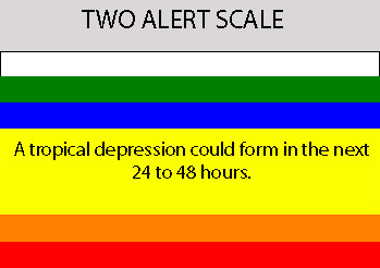
TROPICAL WEATHER OUTLOOK
NWS TPC/NATIONAL HURRICANE CENTER MIAMI FL
530 PM EDT TUE SEP 18 2007
FOR THE NORTH ATLANTIC...CARIBBEAN SEA AND THE GULF OF MEXICO...
A LARGE AREA OF DISTURBED WEATHER ALONG THE EAST COAST OF
FLORIDA...PORTIONS OF THE BAHAMAS AND THE ADJACENT ATLANTIC IS
ASSOCIATED WITH A TROPICAL WAVE INTERACTING WITH AN UPPER-LEVEL
LOW. SURFACE PRESSURES ARE GRADUALLY FALLING IN THE AREA AND
CONDITIONS APPEAR TO BE FAVORABLE FOR A SUBTROPICAL OR A TROPICAL
CYCLONE TO FORM OVER THE NEXT DAY OR TWO...AS THE SYSTEM MOVES
WESTWARD INTO THE GULF OF MEXICO. REGARDLESS OF DEVELOPMENT...THIS
SYSTEM WILL LIKELY BRING SHOWERS...SQUALLS AND LOCALLY HEAVY RAIN
OVER PORTION OF FLORIDA DURING THE NEXT DAY OR TWO.
DISORGANIZED CLOUDINESS AND THUNDERSTORMS FROM THE LEEWARD ISLANDS
NORTHWARD FOR SEVERAL HUNDRED MILES ARE ASSOCIATED WITH THE
REMNANTS OF INGRID. UPPER-LEVEL WINDS REMAIN HIGHLY UNFAVORABLE FOR
REGENERATION.
SHOWER ACTIVITY REMAINS LIMITED IN ASSOCIATION WITH THE TROPICAL
WAVE LOCATED ABOUT 650 MILES EAST OF THE LESSER ANTILLES.
UPPER-LEVEL WINDS HAVE BECOME UNFAVORABLE FOR DEVELOPMENT OVER THE
TROPICAL ATLANTIC.
ELSEWHERE...TROPICAL CYCLONE FORMATION IS NOT EXPECTED DURING THE
NEXT 48 HOURS.
$$
FORECASTER AVILA
0 likes
-
Emmett_Brown
- Category 5
- Posts: 1433
- Joined: Wed Aug 24, 2005 9:10 pm
- Location: Sarasota FL
Re: INVEST 93L (ATL): Discussion & Images=5:30 PM TWO Shortly
Air Force Met wrote:Emmett_Brown wrote: Thanks for posting that... dont see it though. Aprox what longitude at 25N?
Look at 79W.
You really don't see the low level CU moving west?
Pretty obvious from about 24N - 25.5N and 80W - 79W.
Yup, I see it, thanks. To be honest though, there are several areas in the whole gyre that look similar. Hard for me to tell if a real center is there, or if these are just transient features.
0 likes

Who is online
Users browsing this forum: No registered users and 82 guests