Tropical Depression TEN: Discussions & Images

Moderator: S2k Moderators

Message
Author
Zardoz
Category 1
Category 1
Posts: 309
Joined: Fri Aug 25, 2006 9:48 am
Location: Severe weather-challenged Southern California

Re: INVEST 93L: Florida: Discussions & Images

#781 Postby Zardoz » Wed Sep 19, 2007 2:00 pm

HURAKAN wrote:
Zardoz wrote:What is going on at 25.5N 84W?

GOM AVN Loop

The ULL. Look at a WV loop.

Okay, thanks.

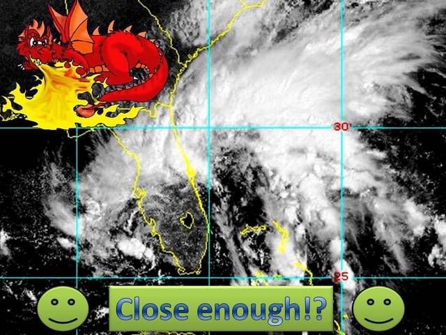
What do you think of this? :

AccuWeather

We expect the upper-level low and surface low to become more vertically stacked on Thursday, putting this system into a process that will allow it to become an organized tropical system just west of Florida. The low will then move west as an organizing tropical system Thursday night and Friday.
0 likes   

User avatar
weatherwoman
Category 1
Category 1
Posts: 364
Joined: Sun Sep 05, 2004 9:09 pm
Location: Newport North Carolina
Contact:

Re: INVEST 93L: Florida: Discussions & Images

#782 Postby weatherwoman » Wed Sep 19, 2007 2:03 pm

is there a low on both sides of florida? i see something e/c and w/c of florida whats going on
0 likes   

jhamps10

#783 Postby jhamps10 » Wed Sep 19, 2007 2:04 pm

0 likes   

k4sdi
Tropical Low
Tropical Low
Posts: 40
Joined: Thu Jun 21, 2007 11:56 am

Re: INVEST 93L: Florida: Discussions & Images

#784 Postby k4sdi » Wed Sep 19, 2007 2:04 pm

OK, here's the view from Melbourne
Image
0 likes   

mattpetre
Category 2
Category 2
Posts: 510
Age: 53
Joined: Mon Sep 19, 2005 3:20 pm
Location: Missouri City,TX & Galleria
Contact:

Re: INVEST 93L: Florida: Discussions & Images

#785 Postby mattpetre » Wed Sep 19, 2007 2:05 pm

weatherwoman wrote:is there a low on both sides of florida? i see something e/c and w/c of florida whats going on


There was not a surface low on the west coast of Florida as of a couple hours ago. I'm not sure what they think now...
0 likes   

redstick
Tropical Wave
Tropical Wave
Posts: 5
Joined: Tue Aug 14, 2007 2:23 pm

Re: INVEST 93L: Florida: Discussions & Images

#786 Postby redstick » Wed Sep 19, 2007 2:17 pm

mattpetre wrote:
weatherwoman wrote:is there a low on both sides of florida? i see something e/c and w/c of florida whats going on


There was not a surface low on the west coast of Florida as of a couple hours ago. I'm not sure what they think now...


Upper Level Low - Western side of Florida Pennisula. Could dig down and become low level warm core.

Possible surface low-Eastern side of Florida Pennisula. Hard to detect on a hourly basis.
0 likes   

User avatar
HURAKAN
Professional-Met
Professional-Met
Posts: 46086
Age: 38
Joined: Thu May 20, 2004 4:34 pm
Location: Key West, FL
Contact:

#787 Postby HURAKAN » Wed Sep 19, 2007 2:36 pm

Image
0 likes   

User avatar
jasons2k
Storm2k Executive
Storm2k Executive
Posts: 8245
Age: 51
Joined: Wed Jul 06, 2005 12:32 pm
Location: The Woodlands, TX

#788 Postby jasons2k » Wed Sep 19, 2007 2:36 pm

The circulation near MLB is very apparent on radar but I cannot find a LLC based on surface obs. Pressures are down but there is not apparent surface reflection based on winds. Winds from MLB down to Palm Beach are consistently out of the NE - the complete wrong direction if a surface low were present @ MLB.
0 likes   

sevenleft
Category 1
Category 1
Posts: 315
Joined: Sat Aug 05, 2006 2:36 pm

Re:

#789 Postby sevenleft » Wed Sep 19, 2007 2:43 pm

jschlitz wrote:The circulation near MLB is very apparent on radar but I cannot find a LLC based on surface obs. Pressures are down but there is not apparent surface reflection based on winds. Winds from MLB down to Palm Beach are consistently out of the NE - the complete wrong direction if a surface low were present @ MLB.
Buoy 41009 has SE winds. It is located on the eastern side of the circulation.

Station TRDF1, located on the cape is now reporting WNW winds.
0 likes   

User avatar
AJC3
Admin
Admin
Posts: 3999
Age: 61
Joined: Tue Aug 31, 2004 7:04 pm
Location: Ballston Spa, New York
Contact:

Re:

#790 Postby AJC3 » Wed Sep 19, 2007 2:51 pm

jschlitz wrote:The circulation near MLB is very apparent on radar but I cannot find a LLC based on surface obs. Pressures are down but there is not apparent surface reflection based on winds. Winds from MLB down to Palm Beach are consistently out of the NE - the complete wrong direction if a surface low were present @ MLB.


Winds here at the office are out of the west, and just shifted to northwest at the airport. The feature is small and weak, but there is a low out there...trust me.
0 likes   

User avatar
dizzyfish
S2K Supporter
S2K Supporter
Posts: 1519
Joined: Fri Sep 16, 2005 7:56 am
Location: New Port Richey, FL

Re: INVEST 93L: Florida: Discussions & Images

#791 Postby dizzyfish » Wed Sep 19, 2007 2:52 pm

Question here, hopefully not too off topic.

Is all the weather that I see here http://www.goes.noaa.gov/ECIR4.html
off shore going to eventually make it's way across Florida?

Asking 'cause I would like some rain. :D
0 likes   

User avatar
GeneratorPower
S2K Supporter
S2K Supporter
Posts: 1648
Age: 45
Joined: Sun Dec 18, 2005 11:48 pm
Location: Huntsville, AL

#792 Postby GeneratorPower » Wed Sep 19, 2007 2:52 pm

Looks like Ingrid is back on the NRL and SSD floater. What is up with that? Sorry for the off-topic but it looks like breaking news.
0 likes   

User avatar
jasons2k
Storm2k Executive
Storm2k Executive
Posts: 8245
Age: 51
Joined: Wed Jul 06, 2005 12:32 pm
Location: The Woodlands, TX

Re:

#793 Postby jasons2k » Wed Sep 19, 2007 2:56 pm

GeneratorPower wrote:Looks like Ingrid is back on the NRL and SSD floater. What is up with that? Sorry for the off-topic but it looks like breaking news.


Sorry, it's not, that's why the Ingrid thread was moved to the active storms forum this AM. :wink:
0 likes   

User avatar
dizzyfish
S2K Supporter
S2K Supporter
Posts: 1519
Joined: Fri Sep 16, 2005 7:56 am
Location: New Port Richey, FL

Re: INVEST 93L: Florida: Discussions & Images

#794 Postby dizzyfish » Wed Sep 19, 2007 2:58 pm

Snippet from the local disco this afternoon:

AREA FORECAST DISCUSSION
NATIONAL WEATHER SERVICE TAMPA BAY RUSKIN FL
127 PM EDT WED SEP 19 2007

.SHORT TERM (TONIGHT-FRI)...UPPER LOW CURRENTLY IN PLACE OFFSHORE OF
SW FLORIDA WITH THE DEVELOPING SFC LOW STILL IN PLACE OFFSHORE OF SE
FL AND A SECOND LOW TRYING TO DEVELOP OFFSHORE OF NAPLES. DRY AIR
CONTINUES TO WRAP INTO THE UPPER LOW KEEPING SOUTH FL LESS CLOUDY
WITH ONLY WIDELY SCT SHOWER(S) CURRENTLY IN PLACE.

ULL and 2 surface lows = 3 lows? Am I reading that right?
0 likes   

Stormcenter
S2K Supporter
S2K Supporter
Posts: 6684
Joined: Wed Sep 03, 2003 11:27 am
Location: Houston, TX

Re: INVEST 93L: Florida: Discussions & Images

#795 Postby Stormcenter » Wed Sep 19, 2007 3:01 pm

Is this 93L or whatever actually following what "any" of the models are predicting right now in reference to track?
0 likes   

Ed Mahmoud

Re: INVEST 93L: Florida: Discussions & Images

#796 Postby Ed Mahmoud » Wed Sep 19, 2007 3:03 pm

On Melbourne radar, looks like Tropical Disturbance #93L is making landfall now near the Cape.
0 likes   

Stormcenter
S2K Supporter
S2K Supporter
Posts: 6684
Joined: Wed Sep 03, 2003 11:27 am
Location: Houston, TX

Re: INVEST 93L: Florida: Discussions & Images

#797 Postby Stormcenter » Wed Sep 19, 2007 3:03 pm

dizzyfish wrote:Snippet from the local disco this afternoon:

AREA FORECAST DISCUSSION
NATIONAL WEATHER SERVICE TAMPA BAY RUSKIN FL
127 PM EDT WED SEP 19 2007

.SHORT TERM (TONIGHT-FRI)...UPPER LOW CURRENTLY IN PLACE OFFSHORE OF
SW FLORIDA WITH THE DEVELOPING SFC LOW STILL IN PLACE OFFSHORE OF SE
FL AND A SECOND LOW TRYING TO DEVELOP OFFSHORE OF NAPLES. DRY AIR
CONTINUES TO WRAP INTO THE UPPER LOW KEEPING SOUTH FL LESS CLOUDY
WITH ONLY WIDELY SCT SHOWER(S) CURRENTLY IN PLACE.

ULL and 2 surface lows = 3 lows? Am I reading that right?


All it is right now is one big mess and until you get a warm core dominant center that
is all it will be. IMO I have my fingers crossed it stays that way.
0 likes   

User avatar
jasons2k
Storm2k Executive
Storm2k Executive
Posts: 8245
Age: 51
Joined: Wed Jul 06, 2005 12:32 pm
Location: The Woodlands, TX

Re: INVEST 93L: Florida: Discussions & Images

#798 Postby jasons2k » Wed Sep 19, 2007 3:06 pm

SECOND LOW TRYING TO DEVELOP OFFSHORE OF NAPLES.


If that is indeed the case, THIS is the area to watch IMO
0 likes   

Stormcenter
S2K Supporter
S2K Supporter
Posts: 6684
Joined: Wed Sep 03, 2003 11:27 am
Location: Houston, TX

Re: INVEST 93L: Florida: Discussions & Images

#799 Postby Stormcenter » Wed Sep 19, 2007 3:06 pm

Interesting NWS discussion excerpt out of Shreveport, LA. this afternoon.

HOWEVER...THERE IS A SUBTROPICAL...MAYBE SOON TO BECOME
TROPICAL...LOW PROGGED TO MOVE OFF OF FLORIDA AND INTO THE GULF
OF MEXICO BY THURSDAY. THIS SYSTEM SHOULD SLOWLY DRIFT WEST OVER
THE GULF OVER THE NEXT FEW DAYS...POSSIBLY REACHING THE AREA JUST
SOUTH OF NEW ORLEANS BY SATURDAY...AND BE NEAR BEAUMONT TX BY
SUNDAY MORNING.
THESE FORECASTS ARE VERY PRELIMINARY...AND THE
POTENTIAL STRENGTHENING OF THIS SYSTEM OVER THE GULF IS NOT KNOWN
AT THIS TIME. HOWEVER...A CHANCE OF SHOWERS AND THUNDERSTORMS WILL
BE IN THE FORECAST FOR NORTH LOUISIANA AND EAST TEXAS...WITH
HIGHER POPS SOUTH AND LOWER POPS NORTH...FOR THE SATURDAY THROUGH
MONDAY TIME FRAME...DUE TO THE POTENTIAL FOR RAINFALL GENERATED BY
THIS SYSTEM.
0 likes   

Matt-hurricanewatcher

Re: INVEST 93L: Florida: Discussions & Images

#800 Postby Matt-hurricanewatcher » Wed Sep 19, 2007 3:08 pm

Watch for a LLC to form just west of Fort Myers florida. Or how ever you say that. This is how I seen Barry 2001 first form.
0 likes   


Return to “2007”

Who is online

Users browsing this forum: No registered users and 1 guest