Tropical Depression TEN: Discussions & Images
Moderator: S2k Moderators
-
lrak

- S2K Supporter

- Posts: 1770
- Age: 59
- Joined: Thu Jun 21, 2007 2:48 pm
- Location: Corpus Christi, TX
Re: INVEST 93L: Florida: Discussions=10:30 PM TWO Shortly
will ingesting 93L help the ULL become a warm core system since 93L is already warm  ?
?
0 likes
-
Extremeweatherguy

- Category 5

- Posts: 11095
- Joined: Mon Oct 10, 2005 8:13 pm
- Location: Florida
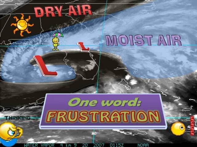
Considering JB's track record this year..I am going with him on this one. He thinks that while the LLC over Florida is strong (and is producing gale winds in one quadrant), that ultimately the center will re-organize off the SW Florida coast and head WNW. ATM he thinks the 500mb ridge to the north will be too strong to allow this system to turn NW or NNW toward New Orleans (he did say it was possible..just not likely), and the greatest threat is still along the upper TX and southwest LA coast.
0 likes
-
cinlfla

- Category 2

- Posts: 687
- Joined: Mon Aug 16, 2004 7:16 pm
- Location: Titusville, Florida on the Spacecoast
Re: INVEST 93L: Florida: Discussions=10:30 PM TWO Shortly
Tampa Bay Hurricane wrote:kissimmee is slightly north of tampa
As you can see- some 30 mph wind velocities
and a center with winds circulating around it
like a true tropical system:
http://radar.weather.gov/ridge/radar.ph ... 11&loop=no
Kissimmee is actually west of Melbourne south of Orlando and east of Lakeland Sorry (Tampa Bay Hurricane) not trying to thread jack you I just wanted to point that out so everyone is looking in the right place.
0 likes
Re: INVEST 93L: Florida: Discussions=10:30 PM TWO Shortly
It is possible overland weakening will allow the SW Florida Low to become the new center. You have to be careful with these tricky systems. But the Orlando center looks to be the main center for now.
0 likes
-
jhamps10
Ok, we think the low came on shore around the Marritt Island/KSC region, right?
Now my guess is that it's say halfway between Kissimmee and Vero beach, right now. That would mean that it has gone more of a WSW direction, than W or even WNW. Now if it follows this, and doesn't turn back West or WNW, it would come out into the gulf between Sarasota and Venice, right near where our big blob of convection is out in the GOM.
Now my guess is that it's say halfway between Kissimmee and Vero beach, right now. That would mean that it has gone more of a WSW direction, than W or even WNW. Now if it follows this, and doesn't turn back West or WNW, it would come out into the gulf between Sarasota and Venice, right near where our big blob of convection is out in the GOM.
0 likes
-
Emmett_Brown

- Category 5
- Posts: 1433
- Joined: Wed Aug 24, 2005 9:10 pm
- Location: Sarasota FL
Re: INVEST 93L: Florida: Discussions & Images
Sanibel wrote:Well after telling people it was up there by Orlando and being ignored it is nice to see NHC initialize it right on my mark. Thanks.
Yup. I am near St Augustine. Steady heavy rain and gusty wind (about 30 inland, higher near the beach). That is the best defined center at this time. Could it give way to another center, sure, but right now, this is the one. Feels like a TD, not a TS, but not far from it...
0 likes
-
jhamps10
Re: INVEST 93L: Florida: Discussions=10:30 PM TWO Shortly
cinlfla wrote:Tampa Bay Hurricane wrote:kissimmee is slightly north of tampa
As you can see- some 30 mph wind velocities
and a center with winds circulating around it
like a true tropical system:
http://radar.weather.gov/ridge/radar.ph ... 11&loop=no
Kissimmee is actually west of Melbourne south of Orlando and east of Lakeland Sorry (Tampa Bay Hurricane) not trying to thread jack you I just wanted to point that out so everyone is looking in the right place.
I think TBH was answering my question on Kissimmee being slightly north of Tampa in Latitude. That's where the north of tampa came from IMO.
0 likes
-
Tampa Bay Hurricane

- Category 5
- Posts: 5597
- Age: 38
- Joined: Fri Jul 22, 2005 7:54 pm
- Location: St. Petersburg, FL
Re: INVEST 93L: Florida: Discussions=10:30 PM TWO Shortly
Might I also add that the LLC currently over florida
has been producing sustained winds of 25-30 mph
with 40-50 mph gusts on the NE side
has been producing sustained winds of 25-30 mph
with 40-50 mph gusts on the NE side
Strong northeast flow around an area of low pressure offshore of
the Florida coast will bring windy conditions to the northeast
Florida and southeast Georgia coasts. Sustained northeast winds
of 25 to 30 mph are expected with gusts up to 40 to 50 mph
possible. Winds should decrease slowly this evening.
A Wind Advisory is issued when sustained winds of 25 to 39 mph
are expected for at least an hour... with gusts of 40 to 57 mph or
greater at any time.
Minor damage to trees... power lines... and property are possible
with wind of this magnitude.
Motorists in high profiles vehicles are advised to use caution
until the wind subsides.
Persons in the advisory area should keep abreast of the latest
weather.
http://www.wunderground.com/US/FL/Saint_Augustine.html
0 likes
-
HURAKAN

- Professional-Met

- Posts: 46084
- Age: 39
- Joined: Thu May 20, 2004 4:34 pm
- Location: Key West, FL
- Contact:
854
ABNT20 KNHC 200223
TWOAT
TROPICAL WEATHER OUTLOOK
NWS TPC/NATIONAL HURRICANE CENTER MIAMI FL
1030 PM EDT WED SEP 19 2007
FOR THE NORTH ATLANTIC...CARIBBEAN SEA AND THE GULF OF MEXICO...
SURFACE OBSERVATIONS INDICATE THAT A LOW PRESSURE SYSTEM ASSOCIATED
WITH THE LARGE AREA OF DISTURBED WEATHER IS MOVING SLOWLY WESTWARD
ACROSS NORTH CENTRAL FLORIDA. HOWEVER...SATELLITE IMAGES INDICATE
THAT THE SHOWER ACTIVITY REMAINS DISORGANIZED. SURFACE PRESSURES
ARE STILL FALLING SHARPLY AND THE ENVIRONMENT IS GRADUALLY BECOMING
FAVORABLE FOR A SUBTROPICAL OR TROPICAL CYCLONE TO FORM...AS THE
SYSTEM MOVES WESTWARD INTO THE EASTERN GULF OF MEXICO ON THURSDAY.
SHOWERS AND SQUALLS ASSOCIATED WITH THIS SYSTEM ARE EXPECTED TO
SPREAD OVER PORTIONS OF FLORIDA DURING THE NEXT DAY OR TWO. ALL
INTEREST ALONG THE NORTHERN GULF OF MEXICO COAST SHOULD MONITOR THE
PROGRESS OF THIS WEATHER DISTURBANCE.
CLOUDINESS AND THUNDERSTORMS EXTENDING FROM THE LEEWARD ISLANDS
NORTHEASTWARD FOR SEVERAL HUNDRED MILES ARE PRIMARILY ASSOCIATED
WITH THE REMNANTS OF INGRID. UPPER-LEVEL WINDS ARE NOT FAVORABLE FOR
SIGNIFICANT DEVELOPMENT OF THIS SYSTEM.
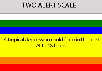
ELSEWHERE...TROPICAL CYCLONE FORMATION IS NOT EXPECTED DURING THE
NEXT 48 HOURS.
$$
FORECASTER AVILA
ABNT20 KNHC 200223
TWOAT
TROPICAL WEATHER OUTLOOK
NWS TPC/NATIONAL HURRICANE CENTER MIAMI FL
1030 PM EDT WED SEP 19 2007
FOR THE NORTH ATLANTIC...CARIBBEAN SEA AND THE GULF OF MEXICO...
SURFACE OBSERVATIONS INDICATE THAT A LOW PRESSURE SYSTEM ASSOCIATED
WITH THE LARGE AREA OF DISTURBED WEATHER IS MOVING SLOWLY WESTWARD
ACROSS NORTH CENTRAL FLORIDA. HOWEVER...SATELLITE IMAGES INDICATE
THAT THE SHOWER ACTIVITY REMAINS DISORGANIZED. SURFACE PRESSURES
ARE STILL FALLING SHARPLY AND THE ENVIRONMENT IS GRADUALLY BECOMING
FAVORABLE FOR A SUBTROPICAL OR TROPICAL CYCLONE TO FORM...AS THE
SYSTEM MOVES WESTWARD INTO THE EASTERN GULF OF MEXICO ON THURSDAY.
SHOWERS AND SQUALLS ASSOCIATED WITH THIS SYSTEM ARE EXPECTED TO
SPREAD OVER PORTIONS OF FLORIDA DURING THE NEXT DAY OR TWO. ALL
INTEREST ALONG THE NORTHERN GULF OF MEXICO COAST SHOULD MONITOR THE
PROGRESS OF THIS WEATHER DISTURBANCE.
CLOUDINESS AND THUNDERSTORMS EXTENDING FROM THE LEEWARD ISLANDS
NORTHEASTWARD FOR SEVERAL HUNDRED MILES ARE PRIMARILY ASSOCIATED
WITH THE REMNANTS OF INGRID. UPPER-LEVEL WINDS ARE NOT FAVORABLE FOR
SIGNIFICANT DEVELOPMENT OF THIS SYSTEM.
ELSEWHERE...TROPICAL CYCLONE FORMATION IS NOT EXPECTED DURING THE
NEXT 48 HOURS.
$$
FORECASTER AVILA
0 likes
-
hurricanetrack

- HurricaneTrack.com
- Posts: 1781
- Joined: Tue Dec 02, 2003 10:46 pm
- Location: Wilmington, NC
- Contact:
Re:
americanrebel wrote:Also finally the state officials are starting to take this thing seriously, they are watching this system constantly and Shell corp has decided to evacuate 700 non essential employees from the platforms out in the GOM. So this is telling me that it will become something of some concern. Oil companies don't pull people off of platforms for Tropical Storms or Cat 1 hurricanes. The platforms are able withstand large Cat 2 maybe even small Cat 3 with no problem. So they must be able to see something in models that we can't see to make them think this is going to become a major hurricane.
They "see" that Joe Bastardi is cutting his lecture short and will be back in State College tomorrow. That is a sign....
0 likes


Re: INVEST 93L: Florida: Discussions=10:30 PM TWO at page 51
Hmmm,
"ALL
INTEREST ALONG THE NORTHERN GULF OF MEXICO COAST SHOULD MONITOR THE
PROGRESS OF THIS WEATHER DISTURBANCE."
Looks like they're excluding TX Coast (Houston, Freeport, Beaumont, etc.)
"ALL
INTEREST ALONG THE NORTHERN GULF OF MEXICO COAST SHOULD MONITOR THE
PROGRESS OF THIS WEATHER DISTURBANCE."
Looks like they're excluding TX Coast (Houston, Freeport, Beaumont, etc.)
0 likes
-
Extremeweatherguy
- Category 5
- Posts: 11095
- Joined: Mon Oct 10, 2005 8:13 pm
- Location: Florida
Buoys and stations SW of Florida are showing dropping pressures and increasing winds. I think it is still a good bet that the main center will relocate down here...
Buoy 42023 = http://www.ndbc.noaa.gov/plot_wind_pres ... 2023&uom=E
Buoy 42014 = http://www.ndbc.noaa.gov/plot_met.php?s ... pres&uom=E
C-MAN station PLSF1 = http://www.ndbc.noaa.gov/plot_wind_pres ... lsf1&uom=E
NOS station NPSF1 = http://www.ndbc.noaa.gov/plot_wind_pres ... psf1&uom=E
BTW: I just checked and the pressures near these buoys/stations are just about as low as they are near the inland center in Orlando.
Last edited by Extremeweatherguy on Wed Sep 19, 2007 9:33 pm, edited 2 times in total.
0 likes

Re:
HURAKAN wrote:854
ABNT20 KNHC 200223
TWOAT
TROPICAL WEATHER OUTLOOK
NWS TPC/NATIONAL HURRICANE CENTER MIAMI FL
1030 PM EDT WED SEP 19 2007
FOR THE NORTH ATLANTIC...CARIBBEAN SEA AND THE GULF OF MEXICO...
SURFACE OBSERVATIONS INDICATE THAT A LOW PRESSURE SYSTEM ASSOCIATED
WITH THE LARGE AREA OF DISTURBED WEATHER IS MOVING SLOWLY WESTWARD
ACROSS NORTH CENTRAL FLORIDA. HOWEVER...SATELLITE IMAGES INDICATE
THAT THE SHOWER ACTIVITY REMAINS DISORGANIZED. SURFACE PRESSURES
ARE STILL FALLING SHARPLY AND THE ENVIRONMENT IS GRADUALLY BECOMING
FAVORABLE FOR A SUBTROPICAL OR TROPICAL CYCLONE TO FORM...AS THE
SYSTEM MOVES WESTWARD INTO THE EASTERN GULF OF MEXICO ON THURSDAY.
SHOWERS AND SQUALLS ASSOCIATED WITH THIS SYSTEM ARE EXPECTED TO
SPREAD OVER PORTIONS OF FLORIDA DURING THE NEXT DAY OR TWO. ALL
INTEREST ALONG THE NORTHERN GULF OF MEXICO COAST SHOULD MONITOR THE
PROGRESS OF THIS WEATHER DISTURBANCE.
Looks fairly bullish from the NHC (Thats as in bull market, not solid bull waste) I dont remember I time when they've said that the entire northern GOM coast had to watch something.
I does look like they are more focused on the center near central Florida
0 likes

-
caneman
Re: INVEST 93L: Florida: Discussions=10:30 PM TWO at page 51
Well, there you have it. The low is over central Florida and I might add a farily strong one. Producing near TD conditions. NHC Said interest along North Gulf Coast so looks to me like the NW track is favored. Case closed fow now. Even the mets get em wrong once in awhile 
0 likes
-
Emmett_Brown
- Category 5
- Posts: 1433
- Joined: Wed Aug 24, 2005 9:10 pm
- Location: Sarasota FL
Re: INVEST 93L: Florida: Discussions=10:30 PM TWO Shortly
Tampa Bay Hurricane wrote:Might I also add that the LLC currently over florida
has been producing sustained winds of 25-30 mph
with 40-50 mph gusts on the NE sideStrong northeast flow around an area of low pressure offshore of
the Florida coast will bring windy conditions to the northeast
Florida and southeast Georgia coasts. Sustained northeast winds
of 25 to 30 mph are expected with gusts up to 40 to 50 mph
possible. Winds should decrease slowly this evening.
A Wind Advisory is issued when sustained winds of 25 to 39 mph
are expected for at least an hour... with gusts of 40 to 57 mph or
greater at any time.
Minor damage to trees... power lines... and property are possible
with wind of this magnitude.
Motorists in high profiles vehicles are advised to use caution
until the wind subsides.
Persons in the advisory area should keep abreast of the latest
weather.
http://www.wunderground.com/US/FL/Saint_Augustine.html
I can vouch for that... conditions are boder line TS in my area, about 10 miles inland from St Augustine. Very blustery night with a steady moderate to heavy rain. Grass is getting tons of water at this time.
0 likes
-
Weatherfreak000
I hate to specifically inquire but, wouldn't environmental conditions greatly favor a NGOM strike and not a Texas landfall? I assumed from observations i've seen there should definitely be a weakness for this thing.
That's the last thing those poor people need where Humberto hit would be potentially another landfalling Hurricane.
That's the last thing those poor people need where Humberto hit would be potentially another landfalling Hurricane.
0 likes
-
lrak
- S2K Supporter
- Posts: 1770
- Age: 59
- Joined: Thu Jun 21, 2007 2:48 pm
- Location: Corpus Christi, TX
Re: INVEST 93L: Florida: Discussions=10:30 PM TWO at page 51
caneman wrote:Well, there you have it. The low is over central Florida and I might add a farily strong one. Producing near TD conditions. NHC Said interest along North Gulf Coast so looks to me like the NW track is favored. Case closed fow now. Even the mets get em wrong once in awhile
we may get a chance with the ULL down in the S GOM.
0 likes
Who is online
Users browsing this forum: No registered users and 43 guests