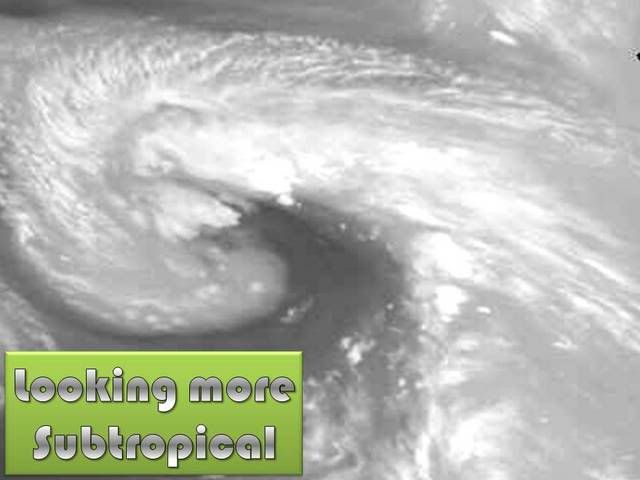
ULL in the North Central Atlantic

This is the general tropical discussion area. Anyone can take their shot at predicting a storms path.

Moderator: S2k Moderators

Forum rules

The posts in this forum are NOT official forecasts and should not be used as such. They are just the opinion of the poster and may or may not be backed by sound meteorological data. They are NOT endorsed by any professional institution or STORM2K. For official information, please refer to products from the National Hurricane Center and National Weather Service.

Help Support Storm2K
Message
Author
User avatar
HURAKAN
Professional-Met
Professional-Met
Posts: 46086
Age: 38
Joined: Thu May 20, 2004 4:34 pm
Location: Key West, FL
Contact:

ULL in the North Central Atlantic

#1 Postby HURAKAN » Thu Sep 20, 2007 6:39 am

All the images:

Image

Image

Image

Image

Image

Image

Image

TWD 805:
A WEAK 1015 MB SURFACE LOW IS
NEAR 30N50W THAT HAS A TRAILING TROUGH EXTENDING SW TO NEAR
20N55W WHERE SATELLITE IMAGERY DEPICTS A SMALL CLUSTER OF
MODERATE CONVECTION.
0 likes   

User avatar
cycloneye
Admin
Admin
Posts: 145255
Age: 68
Joined: Thu Oct 10, 2002 10:54 am
Location: San Juan, Puerto Rico

Re: Interesting System in the North Central Atlantic

#2 Postby cycloneye » Thu Sep 20, 2007 6:41 am

NHC ignored that low that you posted South of Azores last week.Will they mention this one soon in the TWOS?
0 likes   

User avatar
HURAKAN
Professional-Met
Professional-Met
Posts: 46086
Age: 38
Joined: Thu May 20, 2004 4:34 pm
Location: Key West, FL
Contact:

Re: Interesting System in the North Central Atlantic

#3 Postby HURAKAN » Thu Sep 20, 2007 6:43 am

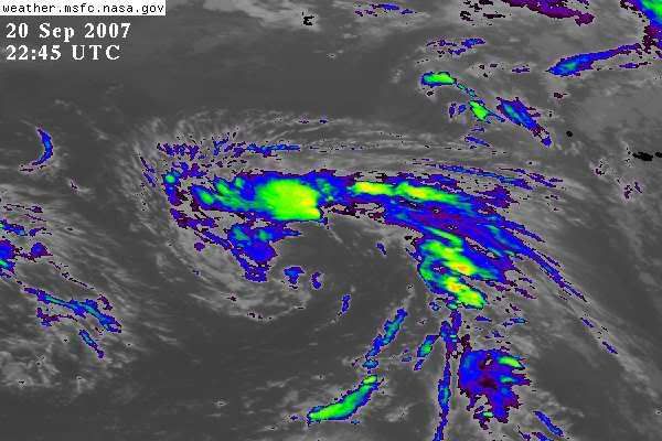
cycloneye wrote:NHC ignored that low that you posted South of Azores last week.Will they mention this one soon in the TWOS?


Don't know but this one really looks interesting.
0 likes   

User avatar
Category 5
Category 5
Category 5
Posts: 10074
Age: 35
Joined: Sun Feb 11, 2007 10:00 pm
Location: New Brunswick, NJ
Contact:

Re: Interesting System in the North Central Atlantic

#4 Postby Category 5 » Thu Sep 20, 2007 6:56 am

It's got an obvious spin to it. It surely looks better then 93L.

Suprised there is no mention in the TWO. It's IMO certainly worth looking at. Whats QUIKSCAT say?
0 likes   

User avatar
HURAKAN
Professional-Met
Professional-Met
Posts: 46086
Age: 38
Joined: Thu May 20, 2004 4:34 pm
Location: Key West, FL
Contact:

#5 Postby HURAKAN » Thu Sep 20, 2007 7:05 am

Image

There is the spin at about 30N & 50W.
0 likes   

User avatar
Category 5
Category 5
Category 5
Posts: 10074
Age: 35
Joined: Sun Feb 11, 2007 10:00 pm
Location: New Brunswick, NJ
Contact:

Re: Interesting System in the North Central Atlantic

#6 Postby Category 5 » Thu Sep 20, 2007 7:07 am

Winds look quite weak, no wonder no mention in the TWO.

However part of it looks cutoff. Quikscat got a bad habit of that lol. I'd still keep an eye on this though.
0 likes   

User avatar
HURAKAN
Professional-Met
Professional-Met
Posts: 46086
Age: 38
Joined: Thu May 20, 2004 4:34 pm
Location: Key West, FL
Contact:

#7 Postby HURAKAN » Thu Sep 20, 2007 7:18 am

Image
0 likes   

User avatar
HURAKAN
Professional-Met
Professional-Met
Posts: 46086
Age: 38
Joined: Thu May 20, 2004 4:34 pm
Location: Key West, FL
Contact:

#8 Postby HURAKAN » Thu Sep 20, 2007 7:50 am

Image
0 likes   

Sanibel
Category 5
Category 5
Posts: 10375
Joined: Mon Aug 30, 2004 11:06 pm
Location: Offshore SW Florida

Re: Interesting System in the North Central Atlantic

#9 Postby Sanibel » Thu Sep 20, 2007 9:20 am

Looks like another subtropical development 32N-48W
0 likes   

User avatar
KWT
Category 5
Category 5
Posts: 31415
Joined: Tue Aug 17, 2004 11:02 am
Location: UK!!!

#10 Postby KWT » Thu Sep 20, 2007 3:30 pm

It does look somewhat subtropical I have to admit though its NE extent will probably put the NHC, esp given 93L presently and while interesting its eastern flank is still connected to a frontal boundary which reaches NW Europe. Still it possibly isn't that far away from subtropical status IMO.
0 likes   

RL3AO
Moderator-Pro Met
Moderator-Pro Met
Posts: 16308
Joined: Thu Jun 14, 2007 10:03 pm
Location: NC

#11 Postby RL3AO » Thu Sep 20, 2007 3:32 pm

I wish the AF or NOAA would fly some flights into these to determine if they are actually (sub)tropical. But I guess if all of these CAtl systems that were actually tropical for a while were named the average would be 15-17 storms per year. :D
0 likes   

User avatar
KWT
Category 5
Category 5
Posts: 31415
Joined: Tue Aug 17, 2004 11:02 am
Location: UK!!!

#12 Postby KWT » Thu Sep 20, 2007 3:34 pm

RL3AO, yeah these sorts of system rather complicated to judge whether they are purely Baroclinc, subtropical or tropical in nature. Have to say though it does look interesting.
0 likes   

User avatar
HURAKAN
Professional-Met
Professional-Met
Posts: 46086
Age: 38
Joined: Thu May 20, 2004 4:34 pm
Location: Key West, FL
Contact:

#13 Postby HURAKAN » Thu Sep 20, 2007 4:21 pm

Image
0 likes   

User avatar
HURAKAN
Professional-Met
Professional-Met
Posts: 46086
Age: 38
Joined: Thu May 20, 2004 4:34 pm
Location: Key West, FL
Contact:

Re: Interesting System in the North Central Atlantic

#14 Postby HURAKAN » Thu Sep 20, 2007 4:25 pm

425
ABNT20 KNHC 202123
TWOAT
TROPICAL WEATHER OUTLOOK
NWS TPC/NATIONAL HURRICANE CENTER MIAMI FL
530 PM EDT THU SEP 20 2007

FOR THE NORTH ATLANTIC

A NON-TROPICAL LOW IS LOCATED OVER THE FAR NORTHEASTERN ATLANTIC
ABOUT 1000 MILES EAST OF BERMUDA. THIS LOW IS EXPECTED TO MOVE
LITTLE DURING THE NEXT 24 HOURS AND WILL BE MONITORED FOR SIGNS OF
TROPICAL DEVELOPMENT.


ELSEWHERE...TROPICAL CYCLONE FORMATION IS NOT EXPECTED DURING THE
NEXT 48 HOURS.

$$

FORECASTER AVILA
0 likes   

User avatar
cycloneye
Admin
Admin
Posts: 145255
Age: 68
Joined: Thu Oct 10, 2002 10:54 am
Location: San Juan, Puerto Rico

Re: Interesting System in the North Central Atlantic

#15 Postby cycloneye » Thu Sep 20, 2007 4:27 pm

Por fin!!!.Ya era tiempo que mencionaran esto.

Finnally!! It was about time to get the mention from NHC.
0 likes   

Brent
S2K Supporter
S2K Supporter
Posts: 38086
Age: 36
Joined: Sun May 16, 2004 10:30 pm
Location: Tulsa Oklahoma
Contact:

Re: ULL in the North Central Atlantic: 530 PM TWO on page 1

#16 Postby Brent » Thu Sep 20, 2007 4:28 pm

Very interesting...
0 likes   

User avatar
HURAKAN
Professional-Met
Professional-Met
Posts: 46086
Age: 38
Joined: Thu May 20, 2004 4:34 pm
Location: Key West, FL
Contact:

#17 Postby HURAKAN » Thu Sep 20, 2007 4:33 pm

18Z

Image

It's deepening. If you look at the first post the chart says 1015 mb at 6Z and now it's 1009 mb at 18Z.
0 likes   

User avatar
cycloneye
Admin
Admin
Posts: 145255
Age: 68
Joined: Thu Oct 10, 2002 10:54 am
Location: San Juan, Puerto Rico

#18 Postby cycloneye » Thu Sep 20, 2007 4:33 pm

The next step now is to get to invest 94L.
0 likes   

User avatar
cycloneye
Admin
Admin
Posts: 145255
Age: 68
Joined: Thu Oct 10, 2002 10:54 am
Location: San Juan, Puerto Rico

Re: ULL in the North Central Atlantic

#19 Postby cycloneye » Thu Sep 20, 2007 6:00 pm

Image

It is trying to wrap around.
0 likes   

User avatar
HURAKAN
Professional-Met
Professional-Met
Posts: 46086
Age: 38
Joined: Thu May 20, 2004 4:34 pm
Location: Key West, FL
Contact:

#20 Postby HURAKAN » Thu Sep 20, 2007 6:10 pm

Pre-Karen 2001:

Image

This disturbance:

Image
0 likes   


Return to “Talkin' Tropics”

Who is online

Users browsing this forum: No registered users and 19 guests