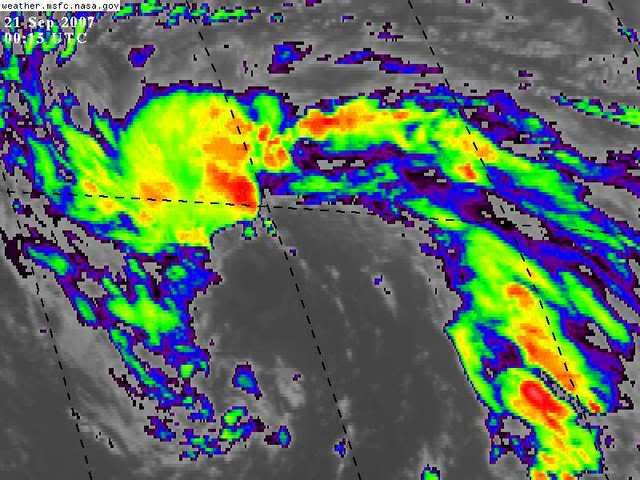
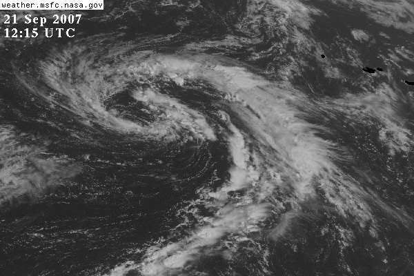
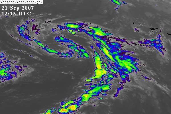
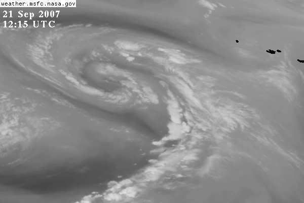
TWD 805:
THE CENTRAL
ATLC SFC PATTERN IS DOMINATED BY A 1009 MB LOW NEAR 33N48W AND
ITS LONG TRAILING TROUGH WHICH EXTENDS SSW THROUGH 28N51W
17N55W.
THE LOW PRES SYSTEM IN
THE CENTRAL ATLC IS NOT EXPECTED TO MOVE VERY MUCH KEEPING A
PRONOUNCED WEAKNESS IN THE SUBTROPICAL RIDGE.
ULL in the North Central Atlantic
Moderator: S2k Moderators
Forum rules

The posts in this forum are NOT official forecasts and should not be used as such. They are just the opinion of the poster and may or may not be backed by sound meteorological data. They are NOT endorsed by any professional institution or STORM2K. For official information, please refer to products from the National Hurricane Center and National Weather Service.
-
HURAKAN

- Professional-Met

- Posts: 46084
- Age: 39
- Joined: Thu May 20, 2004 4:34 pm
- Location: Key West, FL
- Contact:
Re: ULL in the North Central Atlantic: 1030 PM TWO Shortly
890
ABNT20 KNHC 210208
TWOAT
TROPICAL WEATHER OUTLOOK
NWS TPC/NATIONAL HURRICANE CENTER MIAMI FL
1030 PM EDT THU SEP 20 2007
FOR THE NORTH ATLANTIC
A NEARLY STATIONARY NON-TROPICAL LOW LOCATED OVER THE FAR
NORTHEASTERN ATLANTIC ABOUT 1000 MILES EAST OF BERMUDA IS BEING
MONITORED FOR SIGNS OF TROPICAL DEVELOPMENT.
ELSEWHERE...TROPICAL CYCLONE FORMATION IS NOT EXPECTED DURING THE
NEXT 48 HOURS.
$$
FORECASTER AVILA
0 likes
-
Evil Jeremy

- S2K Supporter

- Posts: 5463
- Age: 32
- Joined: Mon Apr 10, 2006 2:10 pm
- Location: Los Angeles, CA
Re: ULL in the North Central Atlantic: 1030 PM TWO on page 2
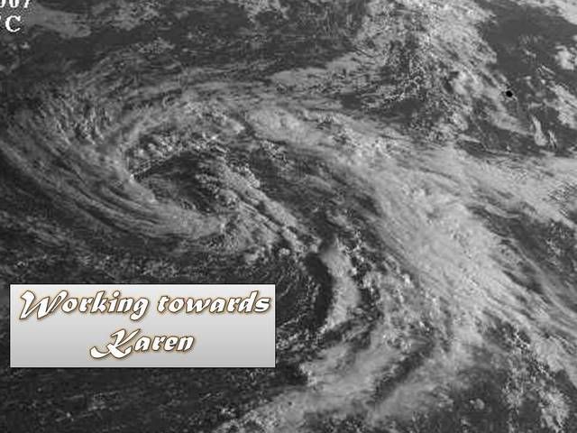
If this one forms, and it looks like it might, where would it head to?
0 likes
-
HURAKAN
- Professional-Met
- Posts: 46084
- Age: 39
- Joined: Thu May 20, 2004 4:34 pm
- Location: Key West, FL
- Contact:
Re: ULL in the North Central Atlantic
TWO 530 AM:
ABNT20 KNHC 210908
TWOAT
TROPICAL WEATHER OUTLOOK
NWS TPC/NATIONAL HURRICANE CENTER MIAMI FL
530 AM EDT THU SEP 20 2007
FOR THE NORTH ATLANTIC
A NEARLY STATIONARY NON-TROPICAL LOW LOCATED OVER THE CENTRAL
ATLANTIC ABOUT 1000 MILES EAST OF BERMUDA IS BEING MONITORED FOR
SIGNS OF TROPICAL DEVELOPMENT.
ELSEWHERE...TROPICAL CYCLONE FORMATION IS NOT EXPECTED DURING THE
NEXT 48 HOURS.
$$
FORECASTER BEVEN/ROBERTS
0 likes


-
Matt-hurricanewatcher
Re: ULL in the North Central Atlantic
That "subtropical" low pressure area southwest of the Azores a few days ago, looked a thousand times more promising then this. This should move northeastward over cold water over the next few days. I don't think it has much of a chance.
0 likes
-
cycloneye

- Admin

- Posts: 149276
- Age: 69
- Joined: Thu Oct 10, 2002 10:54 am
- Location: San Juan, Puerto Rico
Re: ULL in the North Central Atlantic
000
ABNT20 KNHC 211529
TWOAT
TROPICAL WEATHER OUTLOOK
NWS TPC/NATIONAL HURRICANE CENTER MIAMI FL
1130 AM EDT FRI SEP 21 2007
FOR THE NORTH ATLANTIC...CARIBBEAN SEA AND THE GULF OF MEXICO...
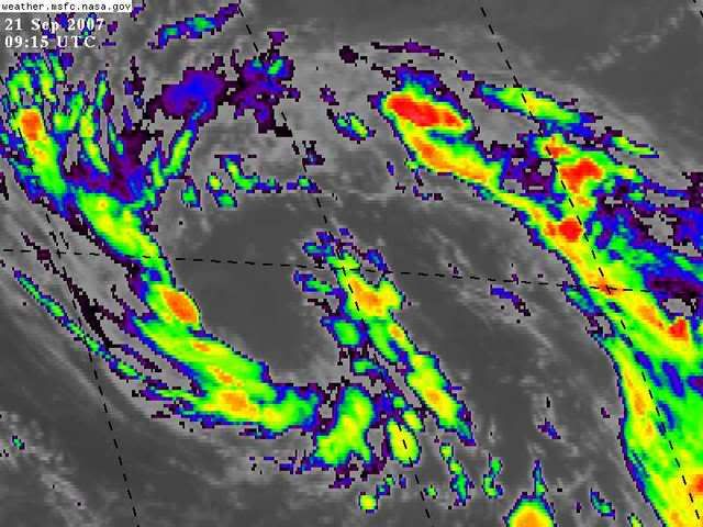
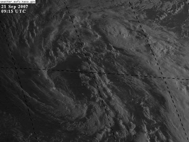
A NEARLY STATIONARY NON-TROPICAL LOW LOCATED OVER THE CENTRAL
ATLANTIC ABOUT 1100 MILES EAST OF BERMUDA HAS CHANGED LITTLE SINCE
YESTERDAY...BUT IS STILL BEING MONITORED FOR SIGNS OF TROPICAL
DEVELOPMENT.
$$
FORECASTER KNABB
ABNT20 KNHC 211529
TWOAT
TROPICAL WEATHER OUTLOOK
NWS TPC/NATIONAL HURRICANE CENTER MIAMI FL
1130 AM EDT FRI SEP 21 2007
FOR THE NORTH ATLANTIC...CARIBBEAN SEA AND THE GULF OF MEXICO...
A NEARLY STATIONARY NON-TROPICAL LOW LOCATED OVER THE CENTRAL
ATLANTIC ABOUT 1100 MILES EAST OF BERMUDA HAS CHANGED LITTLE SINCE
YESTERDAY...BUT IS STILL BEING MONITORED FOR SIGNS OF TROPICAL
DEVELOPMENT.
$$
FORECASTER KNABB
0 likes


-
HURAKAN
- Professional-Met
- Posts: 46084
- Age: 39
- Joined: Thu May 20, 2004 4:34 pm
- Location: Key West, FL
- Contact:
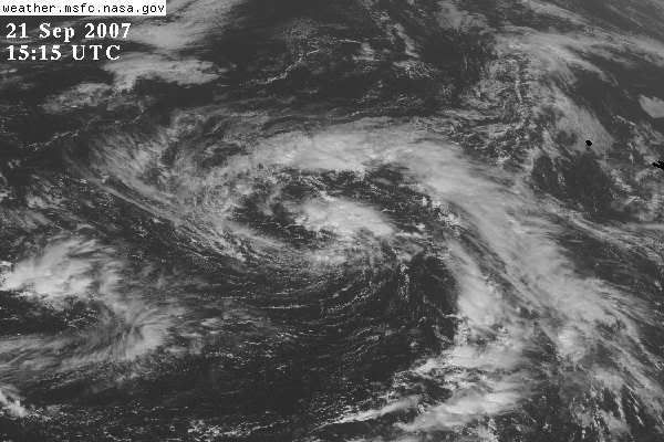
666
ABNT20 KNHC 212117
TWOAT
TROPICAL WEATHER OUTLOOK
NWS TPC/NATIONAL HURRICANE CENTER MIAMI FL
530 PM EDT FRI SEP 21 2007
FOR THE NORTH ATLANTIC
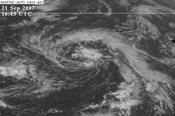
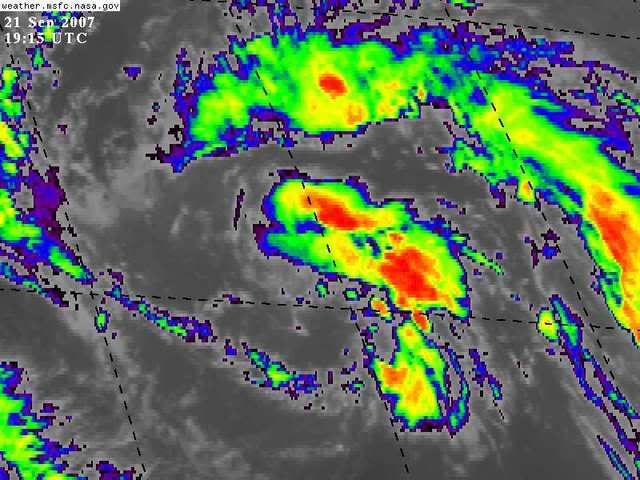
A NEARLY STATIONARY NON-TROPICAL LOW OVER THE CENTRAL ATLANTIC IS
LOCATED ABOUT 1100 MILES EAST OF BERMUDA. THERE HAS BEEN NO
SIGNIFICANT CHANGE IN ORGANIZATION SINCE YESTERDAY...BUT THE LOW IS
STILL BEING MONITORED FOR SIGNS OF TROPICAL DEVELOPMENT.
ELSEWHERE...TROPICAL CYCLONE FORMATION IS NOT EXPECTED DURING THE
NEXT 48 HOURS.
$$
FORECASTER AVILA
ABNT20 KNHC 212117
TWOAT
TROPICAL WEATHER OUTLOOK
NWS TPC/NATIONAL HURRICANE CENTER MIAMI FL
530 PM EDT FRI SEP 21 2007
FOR THE NORTH ATLANTIC
A NEARLY STATIONARY NON-TROPICAL LOW OVER THE CENTRAL ATLANTIC IS
LOCATED ABOUT 1100 MILES EAST OF BERMUDA. THERE HAS BEEN NO
SIGNIFICANT CHANGE IN ORGANIZATION SINCE YESTERDAY...BUT THE LOW IS
STILL BEING MONITORED FOR SIGNS OF TROPICAL DEVELOPMENT.
ELSEWHERE...TROPICAL CYCLONE FORMATION IS NOT EXPECTED DURING THE
NEXT 48 HOURS.
$$
FORECASTER AVILA
0 likes
Who is online
Users browsing this forum: No registered users and 169 guests