


000
AXNT20 KNHC 221028
TWDAT
TROPICAL WEATHER DISCUSSION
NWS TPC/NATIONAL HURRICANE CENTER MIAMI FL
805 AM EDT SAT SEP 22 2007
TROPICAL WEATHER DISCUSSION FOR NORTH AMERICA...CENTRAL
AMERICA...THE GULF OF MEXICO...THE CARIBBEAN SEA...NORTHERN
SECTIONS OF SOUTH AMERICA...AND THE ATLANTIC OCEAN TO THE
AFRICAN COAST FROM THE EQUATOR TO 32N. THE FOLLOWING INFORMATION
IS BASED ON SATELLITE IMAGERY...METEOROLOGICAL ANALYSIS...
WEATHER OBSERVATIONS...AND RADAR.
BASED ON 0600 UTC SURFACE ANALYSIS AND SATELLITE IMAGERY THROUGH
0945 UTC.
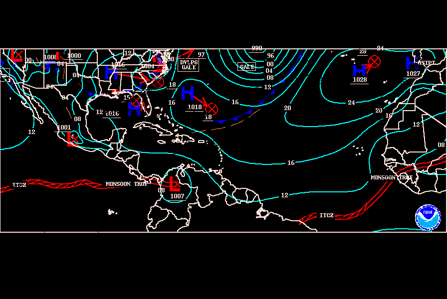
...THE ITCZ...
ITCZ AXIS IS CENTERED ALONG 12N14W 6N22W 10M40W 7N59W. A 1011 MB LOW IS CENTERED NEAR 6N19W...EMBEDDED WITHIN THE ITCZ...MOVING W NEAR 15 KT. CLUSTERS OF SCATTERED MODERATE/ISOLATED STRONG CONVECTION ARE FROM 2N-12N BETWEEN 18W-24W AND FROM 8N-14N BETWEEN 42W-53W.


