Tropical Storm JERRY- Discussion & Images
Moderator: S2k Moderators
-
Matt-hurricanewatcher
Re: Invest 95L: Northwest Atlantic: Discussion & Images
More like 45 knots and strengthing. It would not suprize me if this got up to 55 knots by tomarrow afternoon.
0 likes
-
Brent
- S2K Supporter

- Posts: 38729
- Age: 37
- Joined: Sun May 16, 2004 10:30 pm
- Location: Tulsa Oklahoma
- Contact:
Re: Invest 95L: Northwest Atlantic: Discussion & Images
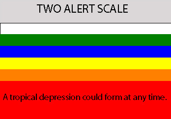
10:30pm TWO:
SATELLITE IMAGES INDICATE THAT THE NON-TROPICAL LOW LOCATED ABOUT
850 MILES WEST-SOUTHWEST OF THE AZORES IS ON THE VERGE OF BECOMING
A SUBTROPICAL OR TROPICAL CYCLONE. LITTLE MOTION IS EXPECTED
DURING THE NEXT 12 TO 24 HOURS...BUT THEREAFTER...THE SYSTEM SHOULD
BEGIN TO MOVE TOWARD THE NORTHEAST OVER THE OPEN ATLANTIC.
0 likes
-
jaxfladude
- Category 5

- Posts: 1249
- Joined: Wed Aug 24, 2005 9:36 pm
- Location: Jacksonville, Fla
Re: Invest 95L: Northwest Atlantic: Discussion & Images
75% OF BEING A "FISH STORM"!!!
25% CHANCE OF HITTING GREENLAND OR EUROPE....
25% CHANCE OF HITTING GREENLAND OR EUROPE....
0 likes
-
Matt-hurricanewatcher
Re: Invest 95L: Northwest Atlantic: Discussion & Images
"could" be a forming a eye, for one the 85h a few of them from 3-4 hours ago shown a curved banding. This could already be 45-50 knots now. Also satellite shows this quickly becoming organized and wrap.
0 likes
-
CrazyC83
- Professional-Met

- Posts: 34315
- Joined: Tue Mar 07, 2006 11:57 pm
- Location: Deep South, for the first time!
Re: Invest 95L: Northwest Atlantic: Discussion & Images
Matt-hurricanewatcher wrote:"could" be a forming a eye, for one the 85h a few of them from 3-4 hours ago shown a curved banding. This could already be 45-50 knots now. Also satellite shows this quickly becoming organized and wrap.
I agree, I think we have a storm with about 45 knots right now.
0 likes
-
CrazyC83
- Professional-Met

- Posts: 34315
- Joined: Tue Mar 07, 2006 11:57 pm
- Location: Deep South, for the first time!
Re:
RL3AO wrote:They won't issue a special advisory...not near land. Maybe an STDS.
They can and have issued special advisories to initiate far-flung storms in the past...I know Zeta was one...
0 likes
Re: Re:
CrazyC83 wrote:RL3AO wrote:They won't issue a special advisory...not near land. Maybe an STDS.
They can and have issued special advisories to initiate far-flung storms in the past...I know Zeta was one...
I guess they have with the past two EPac depressions so I withdraw my statement.
0 likes
-
Matt-hurricanewatcher
Re: Invest 95L: Northwest Atlantic: Discussion & Images
It lossed its eye, but I'm sure as the tiger at the zoo getting out in killing a man that this is a tropical storm now. Very likely to be upgraded in post season, this makes the unnamed system of last years seem weak. I don't like the banding thing that is forming on the northern side.
0 likes
- Tampa Bay Hurricane
- Category 5

- Posts: 5597
- Age: 38
- Joined: Fri Jul 22, 2005 7:54 pm
- Location: St. Petersburg, FL
Re: Invest 95L: Northwest Atlantic: Discussion & Images
Jerry might come from this if the spin and convection continues
JERRRRY!!! JERRY!!! JERRRY!!! Ooops Sorry I thought this was
Jerry Springer.
JERRRRY!!! JERRY!!! JERRRY!!! Ooops Sorry I thought this was
Jerry Springer.
0 likes
- MGC
- S2K Supporter

- Posts: 5940
- Joined: Sun Mar 23, 2003 9:05 pm
- Location: Pass Christian MS, or what is left.
Re: Invest 95L: Northwest Atlantic: Discussion & Images
Yes, Jerry likely by tomorrow.....MGC
0 likes
- cycloneye
- Admin

- Posts: 149275
- Age: 69
- Joined: Thu Oct 10, 2002 10:54 am
- Location: San Juan, Puerto Rico
Re: Invest 95L: Northwest Atlantic: Discussion & Images
http://www.nrlmry.navy.mil/tc_pages/tc_home.html
NRL changed header to NONAME.So we will have the first advisory for this system at 5 AM EDT.Tropical or Subtropical is what is left to know.
NRL changed header to NONAME.So we will have the first advisory for this system at 5 AM EDT.Tropical or Subtropical is what is left to know.
0 likes
-
Matt-hurricanewatcher
Re: Invest 95L: Northwest Atlantic: Discussion & Images
Wind data shows 35-40 knots. This looks way stronger then a depression. So I'm thinking they will upgrade to tropical storm. I've been suprized before.
0 likes
-
Matt-hurricanewatcher
Re: Invest 95L: Northwest Atlantic: Discussion & Images
23/0600 UTC 36.1N 46.3W ST2.5/2.5 95L
The wind field is fairly tight. In subtropical systems the wind field should be spread out over a large area? So this could not be subtropical. In still 2.5=35 knots.
The wind field is fairly tight. In subtropical systems the wind field should be spread out over a large area? So this could not be subtropical. In still 2.5=35 knots.
0 likes
-
Matt-hurricanewatcher
Re: Invest 95L: Northwest Atlantic: Discussion & Images
It is becoming less organized and looking more like a subtropical storm. No longer does the convection cover the center of this.
0 likes
This will be upgraded to a storm straight away, probably subtropical based on what it currently looks like though it may be upped to tropical at the end of the season.
As others have said these systems tend to be ones to watch this time of year as the upper temps drop away and the you get more instablity for your sea surface temps!
As others have said these systems tend to be ones to watch this time of year as the upper temps drop away and the you get more instablity for your sea surface temps!
0 likes
Who is online
Users browsing this forum: No registered users and 38 guests


