Ex Tropical Depression KAREN: Discussions & Images
Moderator: S2k Moderators
-
Matt-hurricanewatcher
Re: Invest 96L: East Atlantic : Discussions=5:30 PM TWO Shortly
This system looks much less centered and much more disorganized. I don't think this will have a easy time developing.
0 likes
-
jhamps10
Re: Invest 96L: East Atlantic : Discussions=5:30 PM TWO Shortly
Matt-hurricanewatcher wrote:This system looks much less centered and much more disorganized. I don't think this will have a easy time developing.
yeah not quite organized as yesterday, but it is DMIN out there now so for it being in that it looks reliatively good to be honest.
0 likes
-
Derek Ortt
-
HurricaneMaster_PR

- Category 2

- Posts: 795
- Joined: Tue Jul 22, 2003 6:23 pm
- Location: San Juan, Puerto Rico
Re: Invest 96L: East Atlantic : Discussions=5:30 PM TWO Shortly
TROPICAL WEATHER OUTLOOK
NWS TPC/NATIONAL HURRICANE CENTER MIAMI FL
530 PM EDT SUN SEP 23 2007
FOR THE NORTH ATLANTIC...CARIBBEAN SEA AND THE GULF OF MEXICO...
THE NATIONAL HURRICANE CENTER IS ISSUING ADVISORIES ON
SUBTROPICAL STORM JERRY...LOCATED ABOUT 1060 MILES WEST OF THE
AZORES.
DISORGANIZED SHOWERS AND THUNDERSTORMS EXTENDING FROM THE YUCATAN
PENINSULA NORTHWARD ACROSS THE CENTRAL GULF OF MEXICO ARE PRIMARILY
ASSOCIATED WITH A SURFACE TROUGH. THIS SYSTEM REMAINS DISORGANIZED
AND THE RECONNAISSANCE MISSION SCHEDULED TO INVESTIGATE THE AREA
THIS AFTERNOON WAS CANCELED. UPPER-LEVEL WINDS OVER THIS SYSTEM
ARE CURRENTLY VERY STRONG AND DEVELOPMENT...IF ANY...IS EXPECTED TO
BE SLOW TO OCCUR.
A BROAD AREA OF LOW PRESSURE ASSOCIATED WITH A TROPICAL WAVE IS
LOCATED ABOUT 300 MILES EAST OF THE WINDWARD ISLANDS. THIS SYSTEM
HAS CHANGED LITTLE IN ORGANIZATION TODAY...BUT COULD STILL DEVELOP
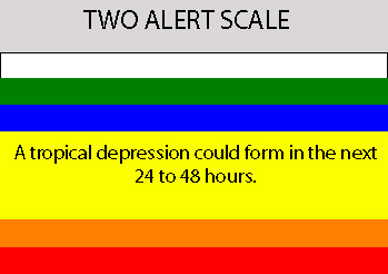
INTO A TROPICAL DEPRESSION DURING THE NEXT DAY OR SO AS IT MOVES
WEST-NORTHWESTWARD TOWARD THE WINDWARD ISLANDS.
AN AREA OF LOW PRESSURE ASSOCIATED WITH A TROPICAL WAVE IS LOCATED
ABOUT 650 MILES SOUTH-SOUTHWEST OF THE CAPE VERDE ISLANDS. THIS
SYSTEM REMAINS WELL ORGANIZED AND CONDITIONS APPEAR FAVORABLE FOR IT
TO BECOME A TROPICAL DEPRESSION DURING THE NEXT DAY OR TWO AS IT
MOVES WESTWARD AT ABOUT 15 MPH.
ELSEWHERE...TROPICAL CYCLONE FORMATION IS NOT EXPECTED DURING THE
NEXT 48 HOURS.
PUBLIC ADVISORIES ON JERRY ARE ISSUED UNDER WMO HEADER WTNT31 AND
UNDER AWIPS HEADER MIATCPAT1. FORECAST/ADVISORIES ON JERRY ARE
ISSUED UNDER WMO HEADER WTNT21 AND UNDER AWIPS HEADER MIATCMAT1.
$$
FORECASTER BROWN
NWS TPC/NATIONAL HURRICANE CENTER MIAMI FL
530 PM EDT SUN SEP 23 2007
FOR THE NORTH ATLANTIC...CARIBBEAN SEA AND THE GULF OF MEXICO...
THE NATIONAL HURRICANE CENTER IS ISSUING ADVISORIES ON
SUBTROPICAL STORM JERRY...LOCATED ABOUT 1060 MILES WEST OF THE
AZORES.
DISORGANIZED SHOWERS AND THUNDERSTORMS EXTENDING FROM THE YUCATAN
PENINSULA NORTHWARD ACROSS THE CENTRAL GULF OF MEXICO ARE PRIMARILY
ASSOCIATED WITH A SURFACE TROUGH. THIS SYSTEM REMAINS DISORGANIZED
AND THE RECONNAISSANCE MISSION SCHEDULED TO INVESTIGATE THE AREA
THIS AFTERNOON WAS CANCELED. UPPER-LEVEL WINDS OVER THIS SYSTEM
ARE CURRENTLY VERY STRONG AND DEVELOPMENT...IF ANY...IS EXPECTED TO
BE SLOW TO OCCUR.
A BROAD AREA OF LOW PRESSURE ASSOCIATED WITH A TROPICAL WAVE IS
LOCATED ABOUT 300 MILES EAST OF THE WINDWARD ISLANDS. THIS SYSTEM
HAS CHANGED LITTLE IN ORGANIZATION TODAY...BUT COULD STILL DEVELOP
INTO A TROPICAL DEPRESSION DURING THE NEXT DAY OR SO AS IT MOVES
WEST-NORTHWESTWARD TOWARD THE WINDWARD ISLANDS.
AN AREA OF LOW PRESSURE ASSOCIATED WITH A TROPICAL WAVE IS LOCATED
ABOUT 650 MILES SOUTH-SOUTHWEST OF THE CAPE VERDE ISLANDS. THIS
SYSTEM REMAINS WELL ORGANIZED AND CONDITIONS APPEAR FAVORABLE FOR IT
TO BECOME A TROPICAL DEPRESSION DURING THE NEXT DAY OR TWO AS IT
MOVES WESTWARD AT ABOUT 15 MPH.
ELSEWHERE...TROPICAL CYCLONE FORMATION IS NOT EXPECTED DURING THE
NEXT 48 HOURS.
PUBLIC ADVISORIES ON JERRY ARE ISSUED UNDER WMO HEADER WTNT31 AND
UNDER AWIPS HEADER MIATCPAT1. FORECAST/ADVISORIES ON JERRY ARE
ISSUED UNDER WMO HEADER WTNT21 AND UNDER AWIPS HEADER MIATCMAT1.
$$
FORECASTER BROWN
0 likes

-
jhamps10
Re:
Derek Ortt wrote:if this were an organizing TC, the DMIN/DMAX would not be much of an issue
Be patient, this was not supposed to be an immediate former and may not develop until it reaches 40-50W
did I say that we're gonna see it upgraded tonight??? I didn't think so. agree that it may not develop till 45-50W. I still however think it won't be a fish, or if it is, a VERY last second fish...
0 likes
-
hurricanetrack

- HurricaneTrack.com

- Posts: 1781
- Joined: Tue Dec 02, 2003 10:46 pm
- Location: Wilmington, NC
- Contact:
Re:
Derek Ortt wrote:if this were an organizing TC, the DMIN/DMAX would not be much of an issue
Be patient, this was not supposed to be an immediate former and may not develop until it reaches 40-50W
Yes- and if it does just that, then the odds of it heading out to sea would be less- generally speaking.
0 likes
Re: INVEST 96L: East Atlantic : Discussions & Images
Will be on SSD Central Atlantic visible loop tomorrow as it moves past 35W.
0 likes
-
Gustywind

- Category 5
- Posts: 12334
- Joined: Mon Sep 03, 2007 7:29 am
- Location: Baie-Mahault, GUADELOUPE
Very good looking system growing steadily on sat, beautiful !...and further east numerous multilayered
thunderstorms...meaning the strong activity near Africa, for sure we should continue to pay attention!
http://www.nrlmry.navy.mil/tc-bin/tc_ho ... rovap/dmsp
thunderstorms...meaning the strong activity near Africa, for sure we should continue to pay attention!
http://www.nrlmry.navy.mil/tc-bin/tc_ho ... rovap/dmsp
0 likes
-
cycloneye

- Admin

- Posts: 149276
- Age: 69
- Joined: Thu Oct 10, 2002 10:54 am
- Location: San Juan, Puerto Rico
Re: INVEST 96L: East Atlantic : Discussions & Images
8:05 PM TWD
A FAIRLY LARGE ACTIVE LOW PRESSURE SYSTEM IS LOCATED ABOUT 550
NM SW OF THE CAPE VERDE ISLANDS NEAR 7N29W. ESTIMATED CENTRAL
PRESSURE IS 1007 MB. THERE IS A FAIR AMOUNT OF CONVECTION NEAR
THE CENTER AND MORE TO THE N OF THE CENTER. THE SYSTEM IS
GRADUALLY BECOMING BETTER ORGANIZED AND CONDITIONS ARE FAVORABLE
FOR IT TO BECOME A TROPICAL DEPRESSION DURING THE NEXT DAY OR
TWO. WIDELY SCATTERED MODERATE CONVECTION IS FROM 4N-10N
BETWEEN 27W-33W. SCATTERED MODERATE CONVECTION IS FROM 11N-14N
BETWEEN 27W-32W.
0 likes
Re: INVEST 96L: East Atlantic : Discussions & Images
After further stat. analysis, I've just decided to raise the threat level of a direct CONUS hit from 96L from 10% to 20% due mainly to the current quite far south latitude.
0 likes

Re: INVEST 96L: East Atlantic : Discussions & Images
Looks look this week we will be monitoring Karen and her sidekick,Lorenzo 
0 likes
-
Gustywind
- Category 5
- Posts: 12334
- Joined: Mon Sep 03, 2007 7:29 am
- Location: Baie-Mahault, GUADELOUPE
Fresh news from Jeff Masters 

http://www.wunderground.com/blog/JeffMa ... amp=200709
Posted by: JeffMasters, 8:11 PM EDT on September 23, 2007
Far Atlantic disturbance 96L
I don't like the looks of this one. A tropical wave "96L" in the far eastern Atlantic, about 650 miles southwest of the Cape Verdes Islands, has gotten more organized during the past 24 hours, as seen in the latest Satellite imagery. The circulation associated with the wave is unusually large. The storm will be a little slow to get going, since the storm is so far south. At the storm's current latitude--6 degrees north of the Equator--it cannot leverage the earth's spin very much to help spin up the huge circulation it has. Despite it's close proximity to the Equator, low-level spiral bands have already formed, as seen in recent microwave satellite images (Figure 1). The wave is under about 10 knots of wind shear. The shear is forecast to remain below 10 knots through Wednesday, and there is some favorable anticyclonic outflow at high levels. There is a good chance 96L will become a hurricane late this week, as forecast by the SHIPS intensity model. The Lesser Antilles Islands should anticipate the possibility that this will be a hurricane by the time it reaches the islands seven days from now, although it could miss to the north. It is possible 96L will encounter a zone of high wind shear beginning four days from now. The HWRF model develops 96L into a 55-mph tropical storm by Tuesday, then weakens the system the remainder of the week. The GFDL model does not develop 96L at all.
0 likes


-
cycloneye
- Admin
- Posts: 149276
- Age: 69
- Joined: Thu Oct 10, 2002 10:54 am
- Location: San Juan, Puerto Rico
Re: INVEST 96L: East Atlantic : Discussions & Images

Microwave image that shows,spiral bands forming in the west side of 96L.
0 likes
-
jhamps10
http://oiswww.eumetsat.org/SDDI/cgi/lis ... 5#controls
Satellite that updates every 30 minutes, will work good until we get a floater on this thing.
and it is building more deep convection tonight.
Satellite that updates every 30 minutes, will work good until we get a floater on this thing.
and it is building more deep convection tonight.
0 likes
-
HurricaneMaster_PR
- Category 2
- Posts: 795
- Joined: Tue Jul 22, 2003 6:23 pm
- Location: San Juan, Puerto Rico
Re: INVEST 96L: East Atlantic : Discussions & Images
DATE/TIME LAT LON CLASSIFICATION STORM
23/2345 UTC 7.8N 30.3W TOO WEAK 96L
23/2345 UTC 7.8N 30.3W TOO WEAK 96L
0 likes

-
HurricaneMaster_PR
- Category 2
- Posts: 795
- Joined: Tue Jul 22, 2003 6:23 pm
- Location: San Juan, Puerto Rico
Re: INVEST 96L: Global & BAM Models
TROPICAL CYCLONE GUIDANCE MESSAGE
NWS TPC/NATIONAL HURRICANE CENTER MIAMI FL
0057 UTC MON SEP 24 2007
DISCLAIMER...NUMERICAL MODELS ARE SUBJECT TO LARGE ERRORS.
PLEASE REFER TO NHC OFFICIAL FORECASTS FOR TROPICAL CYCLONE
AND SUBTROPICAL CYCLONE INFORMATION.
ATLANTIC OBJECTIVE AIDS FOR
DISTURBANCE INVEST (AL962007) 20070924 0000 UTC
...00 HRS... ...12 HRS... ...24 HRS. .. ...36 HRS...
070924 0000 070924 1200 070925 0000 070925 1200
LAT LON LAT LON LAT LON LAT LON
BAMS 7.7N 30.2W 8.8N 32.8W 9.8N 35.4W 10.8N 38.6W
BAMD 7.7N 30.2W 8.6N 32.2W 9.6N 34.0W 10.4N 35.9W
BAMM 7.7N 30.2W 8.7N 32.8W 9.7N 35.3W 10.3N 38.0W
LBAR 7.7N 30.2W 8.8N 32.8W 10.0N 35.7W 10.9N 38.8W
SHIP 25KTS 31KTS 38KTS 45KTS
DSHP 25KTS 31KTS 38KTS 45KTS
...48 HRS... ...72 HRS... ...96 HRS. .. ..120 HRS...
070926 0000 070927 0000 070928 0000 070929 0000
LAT LON LAT LON LAT LON LAT LON
BAMS 12.0N 41.8W 14.8N 48.4W 17.9N 54.4W 19.8N 58.0W
BAMD 11.1N 37.8W 13.1N 41.7W 16.0N 44.8W 18.8N 45.9W
BAMM 11.0N 40.7W 13.2N 46.0W 16.7N 50.1W 20.1N 52.3W
LBAR 11.5N 41.7W 13.5N 46.8W 17.7N 49.8W 21.9N 49.8W
SHIP 52KTS 62KTS 63KTS 63KTS
DSHP 52KTS 62KTS 63KTS 63KTS
...INITIAL CONDITIONS...
LATCUR = 7.7N LONCUR = 30.2W DIRCUR = 290DEG SPDCUR = 14KT
LATM12 = 6.4N LONM12 = 28.0W DIRM12 = 286DEG SPDM12 = 17KT
LATM24 = 6.2N LONM24 = 24.6W
WNDCUR = 25KT RMAXWD = 45NM WNDM12 = 25KT
CENPRS = 1007MB OUTPRS = 1010MB OUTRAD = 175NM SDEPTH = D
RD34NE = 0NM RD34SE = 0NM RD34SW = 0NM RD34NW = 0NM
$$
NNNN
0 likes
-
AnnularCane

- S2K Supporter

- Posts: 2957
- Joined: Thu Jun 08, 2006 9:18 am
- Location: Wytheville, VA
Re: INVEST 96L: East Atlantic : Discussions & Images
This was probably asked already, but why is there no floater? Is it too far east?
0 likes
Who is online
Users browsing this forum: No registered users and 56 guests