Ex Tropical Depression KAREN: Discussions & Images
Moderator: S2k Moderators
- HurricaneMaster_PR
- Category 2

- Posts: 795
- Joined: Tue Jul 22, 2003 6:23 pm
- Location: San Juan, Puerto Rico
Re: INVEST 96L: East Atlantic : Discussions & Images
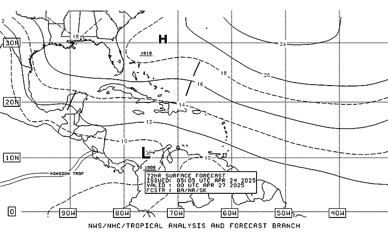
Latest TAFB 72 hour forecast doesnt take Invest 96l out to sea...Also note all the low pressures that are present in the Atlantic in the forecast period.


0 likes
Re: INVEST 96L: East Atlantic : Discussions & Images
stormchazer wrote:boca wrote:96L might have a good shot at Karen but I think it will be a fish. The only way this might make it across is if it stays weak and doesn't develop.Especially this time of year.
The fact that it is at a very low Latitude could have a bearing as well, especially if an LLC forms low, but I agree that storms forming in the East Atlantic this time of year have a good chance of recurving.
Based on an analysis of historical stats since 1851 of late season CV storms* (9/15-25), keeping in mind the very low latitude, and assuming it will become a TD east of 50 W, I'm now giving this a 20% chance to hit the CONUS. Considering the lateness in the CV season (not even one CV storm forming after 9/25 since 1851 has hit the CONUS!!), I'm sure that 20% is a higher number than some might have thought. The reason it is relatively high is the current very low latitude. If it had been, say, at 14N or higher, I would probably have given it a mere ~5%.
- From 1851-2006, there were 36 CV storms that formed within the interval of 9/15-9/25.
- Five of the 36 (13%) later hit the CONUS vs. ~19% for the entire hurricane season.
- The five that later hit the CONUS were majors at some point along their trek. So, IF 96L were to make it all the way to the CONUS, I'd fully expect it to reach major H status at some point even if it were not major when hitting the CONUS.
*CV storms (my def.): : tropical storm/hurricane that first became at least a TD east of 50W and south of 20N
0 likes
- HurricaneMaster_PR
- Category 2

- Posts: 795
- Joined: Tue Jul 22, 2003 6:23 pm
- Location: San Juan, Puerto Rico
Re: INVEST 96L: Global & BAM Models
TROPICAL CYCLONE GUIDANCE MESSAGE
NWS TPC/NATIONAL HURRICANE CENTER MIAMI FL
1259 UTC MON SEP 24 2007
DISCLAIMER...NUMERICAL MODELS ARE SUBJECT TO LARGE ERRORS.
PLEASE REFER TO NHC OFFICIAL FORECASTS FOR TROPICAL CYCLONE
AND SUBTROPICAL CYCLONE INFORMATION.
ATLANTIC OBJECTIVE AIDS FOR
DISTURBANCE INVEST (AL962007) 20070924 1200 UTC
...00 HRS... ...12 HRS... ...24 HRS. .. ...36 HRS...
070924 1200 070925 0000 070925 1200 070926 0000
LAT LON LAT LON LAT LON LAT LON
BAMS 9.4N 31.7W 10.6N 34.5W 11.7N 37.6W 12.8N 41.0W
BAMD 9.4N 31.7W 10.5N 33.6W 11.3N 35.5W 12.1N 37.4W
BAMM 9.4N 31.7W 10.5N 34.1W 11.4N 36.6W 12.3N 39.3W
LBAR 9.4N 31.7W 10.7N 33.7W 11.5N 36.2W 12.2N 38.5W
SHIP 25KTS 29KTS 34KTS 40KTS
DSHP 25KTS 29KTS 34KTS 40KTS
...48 HRS... ...72 HRS... ...96 HRS. .. ..120 HRS...
070926 1200 070927 1200 070928 1200 070929 1200
LAT LON LAT LON LAT LON LAT LON
BAMS 14.0N 44.6W 16.9N 51.2W 19.0N 56.2W 20.0N 59.3W
BAMD 13.0N 39.4W 15.6N 42.6W 18.6N 43.9W 20.2N 42.6W
BAMM 13.3N 42.1W 16.0N 47.2W 19.1N 50.5W 21.3N 52.6W
LBAR 13.1N 41.0W 15.8N 45.1W 19.3N 46.6W 21.8N 45.2W
SHIP 44KTS 45KTS 42KTS 39KTS
DSHP 44KTS 45KTS 42KTS 39KTS
...INITIAL CONDITIONS...
LATCUR = 9.4N LONCUR = 31.7W DIRCUR = 315DEG SPDCUR = 11KT
LATM12 = 7.7N LONM12 = 30.2W DIRM12 = 312DEG SPDM12 = 11KT
LATM24 = 6.4N LONM24 = 28.0W
WNDCUR = 25KT RMAXWD = 45NM WNDM12 = 25KT
CENPRS = 1007MB OUTPRS = 1010MB OUTRAD = 175NM SDEPTH = D
RD34NE = 0NM RD34SE = 0NM RD34SW = 0NM RD34NW = 0NM
$$
NNNN
0 likes
Re: INVEST 96L: East Atlantic : Discussions & Images
WHOA! Hot formation
This has really gotten it together last night and looks mean just from one look. I agree with Masters. This has gotten mean-looking form overnight and is still way over by 35W and south of 10. This would almost immediately say a recurve and out to sea - except - you can see the flat-top look to the upper bands - meaning a strong ridge is on top of it and should keep it west for now.
You better hope 96L forms and gets strong because it will then steal some of the thunder from the environment in front of this system. I haven't studied the steering scenario in front of this system, but I hope it isn't the September monster that went north of the previous west-tracking synoptic I feared earlier.
0 likes
Re: INVEST 96L: East Atlantic : Discussions & Images
HURAKAN wrote:
You can tell just by looking at 96L that it is destined to be a memorable hurricane this season. Let this one fish,please
0 likes
-
curtadams
- S2K Supporter

- Posts: 1122
- Joined: Sun Aug 28, 2005 7:57 pm
- Location: Orange, California
- Contact:
Re: INVEST 96L: East Atlantic : Discussions & Images
Actually, right now the models are forecasting only a weak TS or so - and a very likely a fish as well.
0 likes
- Evil Jeremy
- S2K Supporter

- Posts: 5463
- Age: 32
- Joined: Mon Apr 10, 2006 2:10 pm
- Location: Los Angeles, CA
Re: INVEST 96L: East Atlantic : Discussions & Images
It is nearly impossible to forecast how strong something might be or where it might go when it is this weak. Besides, not many of the models right now are showing fish.
0 likes
- marcane_1973
- Category 1

- Posts: 330
- Age: 52
- Joined: Mon Jun 26, 2006 11:01 pm
- Location: N.C.
- Contact:
Re: INVEST 96L: East Atlantic : Discussions & Images
If this system slowly intensifies and does not go into RI mode the more west this will go and chances will be less for a fish. This could be a problem not only for the Islands but possibly the U.S. later on down the road. Going to be interesting watching this one. Looks like 94L has made a comeback and is the most concerning now.
0 likes
- Fego
- S2K Supporter

- Posts: 767
- Age: 66
- Joined: Sun Apr 18, 2004 7:58 pm
- Location: San Juan, Puerto Rico
- Contact:
Re: INVEST 96L: East Atlantic : Discussions & Images
Those systems are fishing all the time, except when are crossing land  More seriously, Navy page aim to the Caribbean, or so.


0 likes
AN AREA OF LOW PRESSURE ASSOCIATED WITH A TROPICAL WAVE IS LOCATED
ABOUT 730 MILES WEST-SOUTHWEST OF THE CAPE VERDE ISLANDS. THIS
LARGE SYSTEM CONTINUES TO SHOW SIGNS OF ORGANIZATION...AND IT COULD
DEVELOP INTO A TROPICAL DEPRESSION DURING THE NEXT DAY OR SO AS IT
MOVES WEST-NORTHWESTWARD AT ABOUT 15 MPH.
$$
FORECASTER PASCH
ABOUT 730 MILES WEST-SOUTHWEST OF THE CAPE VERDE ISLANDS. THIS
LARGE SYSTEM CONTINUES TO SHOW SIGNS OF ORGANIZATION...AND IT COULD
DEVELOP INTO A TROPICAL DEPRESSION DURING THE NEXT DAY OR SO AS IT
MOVES WEST-NORTHWESTWARD AT ABOUT 15 MPH.
$$
FORECASTER PASCH
0 likes
Re: INVEST 96L: East Atlantic : 11:30 AM TWO at page 7
I think we'll have a TD by 11pm (maybe 5pm).
0 likes
Re: INVEST 96L: East Atlantic : Discussions & Images
Evil Jeremy wrote:It is nearly impossible to forecast how strong something might be or where it might go when it is this weak. Besides, not many of the models right now are showing fish.
Looks VERY fish like from this model plotter taken from the Weather Underground site:

0 likes
-
Derek Ortt
- cycloneye
- Admin

- Posts: 149275
- Age: 69
- Joined: Thu Oct 10, 2002 10:54 am
- Location: San Juan, Puerto Rico
Re: INVEST 96L: East Atlantic : Discussions & Images
Also is not moving NW as the BAMS said at 8 AM.
0 likes
- Evil Jeremy
- S2K Supporter

- Posts: 5463
- Age: 32
- Joined: Mon Apr 10, 2006 2:10 pm
- Location: Los Angeles, CA
Re: INVEST 96L: East Atlantic : Discussions & Images
I would like to add that the LBAR and BAMD are some of the least reliable models for storms.
0 likes
- Weatherboy1
- Category 5

- Posts: 1190
- Age: 50
- Joined: Mon Jul 05, 2004 1:50 pm
- Location: Jupiter/Sarasota, FL
This is definitely the best-looking CV wave I've seen in a while, if not all season. I figure they'll initiate advisories at 5 p.m. barring some dramatic downturn in convective activity. The long-term track? WNW, then a bend to the NW, judging from what I can see in the models. But a few are hinting at a possible turn back to the W or WNW at the end of the forecast period. Odds favor a fish this late in the season, but you never know.
0 likes
Re: INVEST 96L: East Atlantic : Discussions & Images
FCI,
That model map is deceiving. The global models, which are usually better at forecasting than the shallow BAMS, are not showing recurvature whereas the BAMS are. And actually I believe the latest NOGAPS is more to the left than some of the NOGAPS run yesterday.
Of course, the chances of this getting all the way across at this time of year are not great IMO but it's not a clear-cut fish. Not yet.
0 likes
- wxman57
- Moderator-Pro Met

- Posts: 23172
- Age: 68
- Joined: Sat Jun 21, 2003 8:06 pm
- Location: Houston, TX (southwest)
Re:
Derek Ortt wrote:SHIPS for some reason has high shear over the system. Has 23KT of shear in 12 hours
Probably another phantom shear thanks to model NCEP (why is that model even considered?). System does not look sheared
Derek, this could be the case of SHIPS looking way too far north for potential shear, as we've seen discussed at AMS conferences. It's the best looking non-TD I've ever seen now. The way it's going, it may be a TS by tonight.
0 likes
Who is online
Users browsing this forum: No registered users and 49 guests


