Tropical Development at Bahamas / GOM in comming days?

This is the general tropical discussion area. Anyone can take their shot at predicting a storms path.

Moderator: S2k Moderators

Forum rules

The posts in this forum are NOT official forecasts and should not be used as such. They are just the opinion of the poster and may or may not be backed by sound meteorological data. They are NOT endorsed by any professional institution or STORM2K. For official information, please refer to products from the National Hurricane Center and National Weather Service.

Help Support Storm2K
Message
Author
User avatar
Tampa Bay Hurricane
Category 5
Category 5
Posts: 5597
Age: 37
Joined: Fri Jul 22, 2005 7:54 pm
Location: St. Petersburg, FL

Re: Tropical Development at Bahamas / GOM in comming days?

#281 Postby Tampa Bay Hurricane » Sun Sep 30, 2007 10:01 am

chadtm80 wrote:The High Winds have actually been due to The High

Wind Advisory:


Issued at: 8:26 AM EDT 9/30/07, expires at: 7:00 PM EDT 9/30/07

wind advisory remains in effect until 7 pm edt this evening
A wind advisory remains in effect until 7 pm edt this evening.
A strengthening high pressure center over new england will produce strong northeast winds around 25 mph with gusts up to 35 mph.
A wind advisory means that sustained winds of 25 to 39 mph are expected. Winds this strong can make driving difficult, especially for high profile vehicles. Boating on inland lakes and the intracoastal waters will be very dangerous.


That is one strong High Pressure ridge. :eek:
But typical in October. :)
0 likes   

rockyman
Category 5
Category 5
Posts: 1967
Joined: Thu Jun 26, 2003 12:24 pm
Location: Dauphin Island, AL

#282 Postby rockyman » Sun Sep 30, 2007 10:20 am

ABC 33/40's take on this system:

http://www.alabamawx.com
0 likes   

User avatar
Chacor
Category 5
Category 5
Posts: 10229
Joined: Mon Oct 02, 2006 10:43 pm
Location: Singapore

#283 Postby Chacor » Sun Sep 30, 2007 10:20 am

A LARGE AREA OF DISORGANIZED CLOUDINESS AND THUNDERSTORMS ARE
LOCATED OVER THE WESTERN ATLANTIC...BAHAMA ISLANDS...AND PORTIONS
OF SOUTH FLORIDA. THIS ACTIVITY IS ASSOCIATED WITH A SURFACE
TROUGH AND A WEAKENING FRONTAL BOUNDARY. SOME SLOW DEVELOPMENT
OF THIS SYSTEM IS POSSIBLE DURING THE NEXT SEVERAL DAYS AS IT MOVES
SLOWLY WESTWARD.

$$

FORECASTER BROWN
0 likes   

CrazyC83
Professional-Met
Professional-Met
Posts: 34002
Joined: Tue Mar 07, 2006 11:57 pm
Location: Deep South, for the first time!

#284 Postby CrazyC83 » Sun Sep 30, 2007 10:23 am

90L soon perhaps?
0 likes   

User avatar
cycloneye
Admin
Admin
Posts: 145306
Age: 68
Joined: Thu Oct 10, 2002 10:54 am
Location: San Juan, Puerto Rico

Re: Tropical Development Bah/GOM? 11:30 AM TWO at page 15

#285 Postby cycloneye » Sun Sep 30, 2007 10:34 am

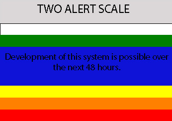
RL3AO,How would you put this TWO for this area in your blue,red.yellow,orange graphic?
0 likes   

cpdaman
Category 5
Category 5
Posts: 3131
Joined: Sat Jun 10, 2006 11:44 am
Location: SPB county (gulf stream)

Re: Tropical Development Bah/GOM? 11:30 AM TWO at page 15

#286 Postby cpdaman » Sun Sep 30, 2007 10:37 am

http://evsjupiter.netfirms.com/zoo001.jpg

pic from first high tide in this northeast cycle, tides up to the "tree line" in jupiter. could be a bit more overwash/minor flooding tonite near midnite.
0 likes   

RL3AO
Moderator-Pro Met
Moderator-Pro Met
Posts: 16308
Joined: Thu Jun 14, 2007 10:03 pm
Location: NC

#287 Postby RL3AO » Sun Sep 30, 2007 10:38 am

Image
0 likes   

User avatar
Steve
S2K Supporter
S2K Supporter
Posts: 9621
Joined: Sat Apr 05, 2003 11:41 pm
Location: Not a state-caster

Re: Tropical Development Bah/GOM? 11:30 AM TWO at page 15

#288 Postby Steve » Sun Sep 30, 2007 10:43 am

>>I have many times made the big mistake of letting my desire
to experience a tropical storm influence my science and bias it.

Here's an idea: buy a car and drive to see one. 8-) It's fairly easy to do.
0 likes   

User avatar
Tampa Bay Hurricane
Category 5
Category 5
Posts: 5597
Age: 37
Joined: Fri Jul 22, 2005 7:54 pm
Location: St. Petersburg, FL

Re: Tropical Development Bah/GOM? 11:30 AM TWO at page 15

#289 Postby Tampa Bay Hurricane » Sun Sep 30, 2007 10:58 am

Steve wrote:>>I have many times made the big mistake of letting my desire
to experience a tropical storm influence my science and bias it.

Here's an idea: buy a car and drive to see one. 8-) It's fairly easy to do.


lol i don't have enough money to make a drive.
I don't even have a car. use my parents sometimes.
0 likes   

Derek Ortt

#290 Postby Derek Ortt » Sun Sep 30, 2007 11:11 am

trust me... you do NOT want to experience anything other than a storm.

You seem like an enthusiastic teen-ager, Tampa Bay. I was that several years ago. Your first hurricane will snap you straight faster than a drill sargeant
0 likes   

User avatar
Tampa Bay Hurricane
Category 5
Category 5
Posts: 5597
Age: 37
Joined: Fri Jul 22, 2005 7:54 pm
Location: St. Petersburg, FL

Re:

#291 Postby Tampa Bay Hurricane » Sun Sep 30, 2007 11:17 am

Derek Ortt wrote:trust me... you do NOT want to experience anything other than a storm.

You seem like an enthusiastic teen-ager, Tampa Bay. I was that several years ago. Your first hurricane will snap you straight faster than a drill sargeant


I do Not want to experience anything more than a weak
tropical storm. If a hurricane comes to me I will be pretty scared
because a hurricane is much scarier than a weak TS.

I do not want damage the damage would be horrible..

My only "complaint" about barry was that it was a td instead of
the 40-50 mph TS I was hoping to capture on video...that's all...
If anything threatens that is stronger than 50 mph I would say
don't hit me...but if its less than hit me...

Now if barry had bombed to a hurricane then I would say
oh snap I'm getting out of here...

With Charley I was almost crying because if it hit tampa bay
it would have destroyed everything I have.
0 likes   

User avatar
cycloneye
Admin
Admin
Posts: 145306
Age: 68
Joined: Thu Oct 10, 2002 10:54 am
Location: San Juan, Puerto Rico

Re: Tropical Development at Bahamas / GOM in comming days?

#292 Postby cycloneye » Sun Sep 30, 2007 11:23 am

Ok,lets return to the theme in hand,the Bahamas,Gulf of Mexico possible development in comming days.
0 likes   

User avatar
Tampa Bay Hurricane
Category 5
Category 5
Posts: 5597
Age: 37
Joined: Fri Jul 22, 2005 7:54 pm
Location: St. Petersburg, FL

#293 Postby Tampa Bay Hurricane » Sun Sep 30, 2007 11:24 am

Where is the low pressure in the bahamas forming guys?
I see one rotation near miami, but the heavy
convection is 500 miles east?

Image
Last edited by Tampa Bay Hurricane on Sun Sep 30, 2007 11:26 am, edited 1 time in total.
0 likes   

Sanibel
Category 5
Category 5
Posts: 10375
Joined: Mon Aug 30, 2004 11:06 pm
Location: Offshore SW Florida

Re: Tropical Development at Bahamas / GOM in comming days?

#294 Postby Sanibel » Sun Sep 30, 2007 11:25 am

We have a strong steady 20KT straight-line wind from the NE. This is a fall-type wind and not tropical. The swirl east of Miami is an upper level Low. This could still center in the Caribbean.
0 likes   

User avatar
Tampa Bay Hurricane
Category 5
Category 5
Posts: 5597
Age: 37
Joined: Fri Jul 22, 2005 7:54 pm
Location: St. Petersburg, FL

Re: Tropical Development at Bahamas / GOM in comming days?

#295 Postby Tampa Bay Hurricane » Sun Sep 30, 2007 11:27 am

Sanibel wrote:We have a strong steady 20KT straight-line wind from the NE. This is a fall-type wind and not tropical. The swirl east of Miami is an upper level Low. This could still center in the Caribbean.


So the models are trying to bring this ULL to the surface? Just wondering :D
0 likes   

Sanibel
Category 5
Category 5
Posts: 10375
Joined: Mon Aug 30, 2004 11:06 pm
Location: Offshore SW Florida

Re: Tropical Development at Bahamas / GOM in comming days?

#296 Postby Sanibel » Sun Sep 30, 2007 11:38 am

Not really sure. Karen could even reform if it was given the right conditions.
0 likes   

User avatar
Tampa Bay Hurricane
Category 5
Category 5
Posts: 5597
Age: 37
Joined: Fri Jul 22, 2005 7:54 pm
Location: St. Petersburg, FL

#297 Postby Tampa Bay Hurricane » Sun Sep 30, 2007 11:42 am

From the infrared I posted above it appears a second
more potent low is forming furhter east
near the heaviest convection...Notice
the Semi-Circle Shape of that area of convection...

I also read on Masters blog's commentary that
Steve Lyons said a surface low would form further
east of the ULL, which is enhancing convection...
and I think that is what is happening...
0 likes   

User avatar
hurricanetrack
HurricaneTrack.com
HurricaneTrack.com
Posts: 1781
Joined: Tue Dec 02, 2003 10:46 pm
Location: Wilmington, NC
Contact:

Re:

#298 Postby hurricanetrack » Sun Sep 30, 2007 11:42 am

Derek Ortt wrote:trust me... you do NOT want to experience anything other than a storm.

You seem like an enthusiastic teen-ager, Tampa Bay. I was that several years ago. Your first hurricane will snap you straight faster than a drill sargeant


This is an interesting topic- one for another thread entirely, but I obviously disagree. Of course, it all depends on how you look at it. A hurricane that you go to that is not affecting where you live is one thing- having one roll up your city is another. I have experienced both and quite frankly can't ever get enough of the action. I do not know what it is, but hurricanes draw me from a raw power perspective that cannot be explained. I like to observe and measure them when they hit. It's not enough for me to just stand in the wind (I actually don't do that) I have to know what the power is and I use the best instruments to do so. I have a deep respect for hurricanes but am not scared of them- even Charley, which at the time did scare me, was spectacular to witness in person. But to be able to know what the wind speeds were and the air pressure was right where I was made it worth while. It's like being on another planet.

I feel like you have to know what you're dealing with and understand that it is not fun and games- it is deadly serious. We might make it look easy but it's not. There are so many things to have to watch for that can take you out (not just the hurricane- but people too) and the sleeplessness works against you as well. Anyhow, this would make for a great separate thread later down the road since so few people actually talk openly about why they wish to be a in a hurricane or tropical storm. Some people get very upset about it and think that people like me and those I work with are insane. I think that being a police officer is more dangerous than what I do- hurricanes don't shoot at me and I can see them on radar. Try that with your average social deviant. I'll pick this topic up on Talkin' Tropics later on....could be quite interesting to see what people say.
0 likes   

User avatar
ROCK
Category 5
Category 5
Posts: 9484
Age: 54
Joined: Tue Aug 17, 2004 7:30 am
Location: Kemah, Texas

Re: Tropical Development at Bahamas / GOM in comming days?

#299 Postby ROCK » Sun Sep 30, 2007 11:46 am

Ed Mahmoud wrote:
wxman57 wrote:
Ed Mahmoud wrote:wxman57- GFS would appear to show dramatic reversal in shear (6Z run) near possible Gulf system of Louisiana about Friday. Although the gradient is rather sharp with the shear, and the low would have to be positioned right...

Too soon to tell, perhaps, in my petroleum engineering opinion (ie, amateur weather opinion)

Shear loop


Ed, the shear map you posted is for next Friday - after whatever develops is nearly inland. Of course the shear maps show low shear dead center in the middle of a large upper low. But the surface low would form east of the upper low in the higher shear environment where there's enhanced lifting.

One other thing, I've noticed you're always quite "pro-development", to put it mildly. The title of one of your threads about the storms (remnants of Lorenzo) moving inland along the TX coast yesterday/today is quite revealing: "If only there was a surface feature East of Tamaulipas". Careful about letting your desires to experience a TC influence your opinion of what might happen.


Hmmm, amateurs tell me I'm too hung up on climatology when I say nothing in last seven decades has hit Texas in October coming from direction of Florida in October so nothing coming here, and the Pro Met implies I wishcast.


If I wish for anything, it is another snow event for SE Texas in 2 months.


Off to church...


I am one of those amateurs Ed....... :lol: Actually, I have always thought of you as anti- development.....
0 likes   

RL3AO
Moderator-Pro Met
Moderator-Pro Met
Posts: 16308
Joined: Thu Jun 14, 2007 10:03 pm
Location: NC

#300 Postby RL3AO » Sun Sep 30, 2007 11:48 am

I guess I should actually follow this system. I guess Humberto showed us that if something can get in the GOM it can and most likely will strengthen. This could be a serious threat. It depends how far south it goes?
0 likes   


Return to “Talkin' Tropics”

Who is online

Users browsing this forum: Europa non è lontana, HurricaneBelle and 55 guests