INVEST 90L: Gulf of Mexico : Gone from NRL
Moderator: S2k Moderators
-
bwhorton2007
- Tropical Storm

- Posts: 115
- Joined: Thu Sep 13, 2007 11:17 pm
Re: INVEST 90L : Near South Florida : Discussions & Images
yeah im gonna let it rest tailgater but im just tired of people I disagree with and there are plenty of them around.
0 likes

Re: INVEST 90L : Near South Florida : Discussions & Images
bwhorton2007 wrote:yeah im gonna let it rest tailgater but im just tired of people I disagree with and there are plenty of them around.
I thought I saw last night that S2K had some kind of mechanism to not allow the use of the word w i s h c a s t e r.
But there it is in your post.
Oh, and I am glad that you are not saying it (that "ull" thing) anymore bwhorton!
0 likes

-
cycloneye

- Admin

- Posts: 149283
- Age: 69
- Joined: Thu Oct 10, 2002 10:54 am
- Location: San Juan, Puerto Rico
Re: INVEST 90L : Near South Florida : Discussions & Images

As the TWD says,is a messy pattern.The image speaks for itself as a mess.
0 likes
-
bwhorton2007
- Tropical Storm
- Posts: 115
- Joined: Thu Sep 13, 2007 11:17 pm

-
bwhorton2007
- Tropical Storm
- Posts: 115
- Joined: Thu Sep 13, 2007 11:17 pm


-
jlauderdal
- S2K Supporter

- Posts: 7240
- Joined: Wed May 19, 2004 5:46 am
- Location: NE Fort Lauderdale
- Contact:
Re: INVEST 90L : Near South Florida : Discussions & Images
wxman57 wrote:ROCK wrote:Blown_away wrote:Dr. Lyons from TWC just said the low was near the Keys and was moving W, he said there is alot of dry air in the Gulf and maybe a Subtropical system will form or dissipation due to the dry air. He seemed alot more interested in the weak low down in the SW Caribbean that was forecast to move into the Gulf in a few days.
Yep, Maybe the NAM and CMC were not doing drugs today.....We shall see...judging by the WV loop of the GOM the dry air does not seem as dry as earlier today.....
No, the CMC is definitely on drugs. If you'll notice, the Canadian model develops most upper-level lows into TCs. There are two upper low centers in the Gulf predicted, thus, 2 TCs. Just garbage. Never use the Canadian or NAM for tropics.
life has become easier the last day..you say don't use cmc and nam and yesterday ortt said he never uses euro..if we can eliminate a few more we will be in great shape
0 likes
-
Ed Mahmoud
Re: INVEST 90L : Near South Florida : Discussions & Images
Kinda weirod. The GFDL fine grid stops tracking 90L almost immediately, but the outer grid carries what might be a depression strength low (no idea what kind) towards New Orleans.
Link
Link
0 likes
-
Extremeweatherguy

- Category 5

- Posts: 11095
- Joined: Mon Oct 10, 2005 8:13 pm
- Location: Florida
Thanks wxman57 for your toughts..but this time I am going to have to disagree. Jeff Masters, JB and the models all seem to point toward a decent chance of a developing system and I am going to stick with them for right now. You are an excellent met though, so may be you will be right. Time will tell. I think we will have a much better idea come Wednesday once this is in the Gulf.
0 likes
-
bwhorton2007
- Tropical Storm
- Posts: 115
- Joined: Thu Sep 13, 2007 11:17 pm
Re: INVEST 90L : Near South Florida : Discussions & Images
no model is perfect but overall they are pretty reliable. 
0 likes
-
Ed Mahmoud
Re: INVEST 90L : Near South Florida : Discussions & Images
OK, call me a slave to climatology (some of you already have) but the two October hurricanes in 60 years rule looks like it will hold for Texas again. I guess we might be due again around 2019, but I don't operate that far into the future. Hmmm, with luck, my two oldest will be done with college by then.

0 likes
-
Blown Away

- S2K Supporter
- Posts: 10253
- Joined: Wed May 26, 2004 6:17 am
Re: INVEST 90L : Near South Florida : Discussions & Images
IMHO, climatology is usually more accurate than a model. That's why I say no to 90L and a possible yes to the SW Caribbean later this week.
0 likes
-
skysummit

- S2K Supporter
- Posts: 5305
- Age: 50
- Joined: Tue Aug 31, 2004 11:09 pm
- Location: Ponchatoula, LA
- Contact:
Re: INVEST 90L : Near South Florida : Discussions & Images
Blown_away wrote:IMHO, climatology is usually more accurate than a model. That's why I say no to 90L and a possible yes to the SW Caribbean later this week.
You know...you may have a point. Remember for TD10, models first of all were all agreeing on a Caribbean system then jumped to the area east of Florida. Maybe these will all eventually jump to the Caribbean
0 likes
-
Ed Mahmoud
Re: INVEST 90L : Near South Florida : Discussions & Images
Blown_away wrote:IMHO, climatology is usually more accurate than a model. That's why I say no to 90L and a possible yes to the SW Caribbean later this week.
This was Texas last shot. Just checking, 18Z GFS shows morning lows below 15º (from PPV AccuWx site) in HOU Monday through Wednesday. Game, set, match.
Just for grins, out beyond 360 hours, no snowcover in Texas, but GFS has a snowpack Upstate NY and Northern New England.
I wouldn't say I wishcast snow, but I'd like a good winter event this season. But not too cold for the orange tree. Fruit still green for some reason.
Looking at IR2, I know where low is supposed to be from above HPC map, but no clue of anything other than the ULL no matter how long I stare.
0 likes
-
wxman57

- Moderator-Pro Met

- Posts: 23172
- Age: 68
- Joined: Sat Jun 21, 2003 8:06 pm
- Location: Houston, TX (southwest)
Re:
Extremeweatherguy wrote:Thanks wxman57 for your toughts..but this time I am going to have to disagree. Jeff Masters, JB and the models all seem to point toward a decent chance of a developing system and I am going to stick with them for right now. You are an excellent met though, so may be you will be right. Time will tell. I think we will have a much better idea come Wednesday once this is in the Gulf.
Dr. Masters' memory may be failing on what happened with TD 10. He says "It took two days for Subtropical Depression Ten to become Tropical Depression Ten, and the storm ran out of time to intensify into a tropical storm before moving ashore over the Florida Panhandle. This time, the GFS model is supporting formation of a subtropical depression to the northeast of the upper low. This situation would potentially allow a faster conversion of the subtropical storm to a tropical storm."
I just spent the last 5 hours preparing a presentation for tomorrow on the timeline of TD 10 from when it was first identified as a potential threat on Saturday, Sept. 15th to its landfall in FL. In fact, STD 10 was designated at 15Z Friday, Sept. 21. Six hours later, it was TD 10 at 21Z. It didn't take 2 days (not that it really was much of a TD). The whole system was gone in less than 24 hours. And the low center of 10 formed NE of the upper low, where it typically would. It's a nearly identical setup. I don't think he really looked at the situation that well because he's not too concerned about it.
But I don't see any favorable conditions out there this week. Should be inland by Thursday, probably east of the mid LA coast. Possibly could become a subtropical depression before moving ashore, but won't be a big deal. As for JB, he always talks like everything could become a hurricane. 47 mph wind (that he mentioned) occurring in cool air behind a cold front doesn't constitute a TD or TS. It's just a cold front.
I'll hold my ground and we'll see what happens.
Last edited by wxman57 on Mon Oct 01, 2007 9:16 pm, edited 1 time in total.
0 likes
-
Ed Mahmoud
Re: INVEST 90L : South Florida :Discussions:10:30 PM TWO Shorty
One caveat on climatology, the CLIPER should be close at least sometimes, and this season, I haven't seen a climatology track for an existing storm come close yet.
0 likes
-
Ed Mahmoud
Re: INVEST 90L : South Florida :Discussions:10:30 PM TWO Shorty
Sort of OT, is there a winter weather forum, because 18Z GFS from AccuWx PPV site shows freezing or frozen precip late Sunday night in the Northern suburbs of MCI.?.?
Yup, check out PSU e-Wall 18Z GFS
Precip falling behind the 850 mb freezing line, and heights right under the upper low below 540 dm.
Edit to add
YES, THERE IS A WINTER FORUM, AND I STARTED AN MCI SNOW THREAD!
Yup, check out PSU e-Wall 18Z GFS
Precip falling behind the 850 mb freezing line, and heights right under the upper low below 540 dm.
Edit to add
YES, THERE IS A WINTER FORUM, AND I STARTED AN MCI SNOW THREAD!
Last edited by Ed Mahmoud on Mon Oct 01, 2007 9:28 pm, edited 1 time in total.
0 likes
-
cycloneye
- Admin
- Posts: 149283
- Age: 69
- Joined: Thu Oct 10, 2002 10:54 am
- Location: San Juan, Puerto Rico
Re: INVEST 90L : South Florida :Discussions:10:30 PM TWO Shorty
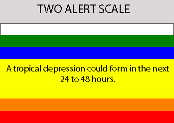
ABNT20 KNHC 020224
TWOAT
TROPICAL WEATHER OUTLOOK
NWS TPC/NATIONAL HURRICANE CENTER MIAMI FL
1030 PM EDT MON OCT 1 2007
FOR THE NORTH ATLANTIC...CARIBBEAN SEA AND THE GULF OF MEXICO...
AN UPPER-LEVEL LOW OVER THE SOUTHEASTERN GULF OF MEXICO...AND A WEAK
SURFACE LOW BETWEEN SOUTHEASTERN FLORIDA AND THE NORTHWESTERN
BAHAMAS...ARE PRODUCING SQUALLY WEATHER OVER PORTIONS OF CENTRAL
AND SOUTH FLORIDA...THE BAHAMAS...CUBA...AND THE ADJACENT WATERS OF
THE WESTERN ATLANTIC AND SOUTHEASTERN GULF. THIS SYSTEM HAS SOME
POTENTIAL FOR SUBTROPICAL OR TROPICAL CYCLONE FORMATION OVER THE
GULF OF MEXICO DURING THE NEXT COUPLE OF DAYS AS IT MOVES GENERALLY
WESTWARD AT 10 TO 15 MPH.
THUNDERSTORM ACTIVITY EAST OF THE LEEWARD ISLANDS...ASSOCIATED WITH
THE REMNANTS OF KAREN...HAS MOSTLY DIMINISHED AND DEVELOPMENT OF
THIS SYSTEM IS NOT EXPECTED.
ELSEWHERE...TROPICAL CYCLONE FORMATION IS NOT EXPECTED DURING THE
NEXT 48 HOURS.
$$
FORECASTER KNABB
0 likes
Who is online
Users browsing this forum: No registered users and 28 guests