INVEST 99L : Gulf of Mexico : Discussions & Images
Moderator: S2k Moderators
-
MiamiensisWx
INVEST 99L : Gulf of Mexico : Discussions & Images
http://www.nrlmry.navy.mil/tc_pages/tc_home.html
It's listed on NRL. Satellite imagery should arrive within the next 30 minutes.
Link to thread in Talking Tropics forum.
viewtopic.php?f=31&t=98576&start=0
It's listed on NRL. Satellite imagery should arrive within the next 30 minutes.
Link to thread in Talking Tropics forum.
viewtopic.php?f=31&t=98576&start=0
0 likes
- Blown Away
- S2K Supporter

- Posts: 10253
- Joined: Wed May 26, 2004 6:17 am
Re: INVEST 99L : NW Caribbean : Discussions & Images
Ha, ha, ha! We got 99L out of the 94L remnant. Maybe the two Lows will merge!
Now all we need is some convection and movement NE to relieve our drought.
Now all we need is some convection and movement NE to relieve our drought.
0 likes
- Blown Away
- S2K Supporter

- Posts: 10253
- Joined: Wed May 26, 2004 6:17 am
Re: INVEST 99L : NW Caribbean : Discussions & Images
Interesting how 94L's remnants now 99L have been spinning down there for days hardly moving and 98L is less than 500 miles away and is flying across the Caribbean.
0 likes
Re: INVEST 99L : NW Caribbean : 11:30 AM TWO Shortly
The NHC this morning didn't schedule or task any flights into this invest or 98L for the next two days, so I don't think they are very concerned about significant development.
Last edited by Thunder44 on Sun Oct 14, 2007 10:21 am, edited 1 time in total.
0 likes
Re: INVEST 99L : NW Caribbean : 11:30 AM TWO Shortly
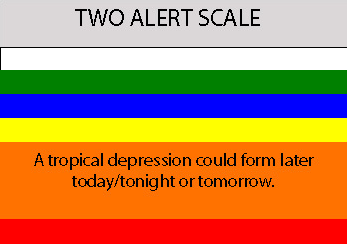
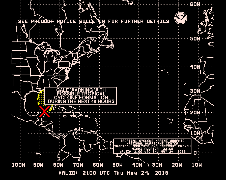
From the 11:30am TWO:
AN AREA OF LOW PRESSURE IS CENTERED ABOUT 100 MILES EAST OF THE
BORDER BETWEEN MEXICO AND BELIZE ALONG THE EAST COAST OF THE
YUCATAN PENINSULA. THE LOW IS EXPECTED TO MOVE SLOWLY
WEST-NORTHWESTWARD OVER THE YUCATAN PENINSULA AND INTO THE
SOUTHWESTERN GULF OF MEXICO DURING THE NEXT COUPLE OF DAYS.
THUNDERSTORM ACTIVITY HAS INCREASED THIS MORNING NEAR THE CENTER OF
THIS LOW. ATMOSPHERIC CONDITIONS APPEAR FAVORABLE FOR ADDITIONAL
DEVELOPMENT...AND THERE IS SOME POTENTIAL FOR THIS SYSTEM TO BECOME
A TROPICAL DEPRESSION LATER TODAY OR TONIGHT BEFORE IT REACHES THE
YUCATAN PENINSULA. DEVELOPMENT POTENTIAL WILL BE LIMITED...
HOWEVER...DURING THE NEXT COUPLE OF DAYS DUE TO INTERACTION WITH
LAND. HEAVY RAINS ARE STILL POSSIBLE OVER PORTIONS OF CENTRAL
AMERICA AND SOUTHEASTERN MEXICO TODAY AND TOMORROW.
0 likes
- cycloneye
- Admin

- Posts: 149843
- Age: 69
- Joined: Thu Oct 10, 2002 10:54 am
- Location: San Juan, Puerto Rico
Re: INVEST 99L : NW Caribbean : 11:30 AM TWO Shortly
Thunder44 wrote:The NHC this morning didn't schedule or task any flights into this invest or 98L for the next two days, so I don't they are very concerned about development.
That is because it will be overland and they dont do missions over land areas.
0 likes
Re: INVEST 99L : NW Caribbean : 11:30 AM TWO Shortly
cycloneye wrote:Thunder44 wrote:The NHC this morning didn't schedule or task any flights into this invest or 98L for the next two days, so I don't they are very concerned about development.
That is because it will be overland and they dont do missions over land areas.
I see from the TWO they expect to be overland by tomorrow. I edited my post to say they aren't expecting "significant" development.
0 likes
-
flwxwatcher
- Category 4

- Posts: 926
- Joined: Wed May 16, 2007 3:35 pm
- Location: Central Florida
Re: INVEST 99L : NW Caribbean : Discussions & Images
If 99L gets into the Gulf it will have to do battler with some dry Air.
http://www.ssd.noaa.gov/goes/east/tatl/wv-l.jpg

http://www.ssd.noaa.gov/goes/east/tatl/wv-l.jpg

0 likes
- alan1961
- Category 2

- Posts: 771
- Joined: Mon Mar 20, 2006 11:58 am
- Location: Derby, Derbyshire, England
- Contact:
Re: INVEST 99L : NW Caribbean : Discussions & Images
flwxwatcher wrote:If 99L gets into the Gulf it will have to do battler with some dry Air.
http://www.ssd.noaa.gov/goes/east/tatl/wv-l.jpg
Do battle with some dry air?..more like the saharan desert on that image
0 likes
Who is online
Users browsing this forum: No registered users and 53 guests


