INVEST 99L : Gulf of Mexico : Discussions & Images
Moderator: S2k Moderators
-
vbhoutex

- Storm2k Executive

- Posts: 29145
- Age: 74
- Joined: Wed Oct 09, 2002 11:31 pm
- Location: Cypress, TX
- Contact:
Re: INVEST 99L : Gulf of Mexico : Discussions & Images
Yep, it is definitely on at least a North track at this point. It definitely was a NW track earlier today.
0 likes
-
HURRICANE ILM

- Tropical Low

- Posts: 13
- Joined: Tue Sep 05, 2006 7:51 pm
- Location: WILMINGTON NC
- Contact:
-
cycloneye

- Admin
- Posts: 149275
- Age: 69
- Joined: Thu Oct 10, 2002 10:54 am
- Location: San Juan, Puerto Rico
Re: INVEST 99L Models Thread
Code: Select all
TROPICAL CYCLONE GUIDANCE MESSAGE
NWS TPC/NATIONAL HURRICANE CENTER MIAMI FL
0050 UTC WED OCT 17 2007

DISCLAIMER...NUMERICAL MODELS ARE SUBJECT TO LARGE ERRORS.
PLEASE REFER TO NHC OFFICIAL FORECASTS FOR TROPICAL CYCLONE
AND SUBTROPICAL CYCLONE INFORMATION.

ATLANTIC OBJECTIVE AIDS FOR

DISTURBANCE INVEST (AL992007) 20071017 0000 UTC

        ...00 HRS...   ...12 HRS...   ...24 HRS. ..   ...36 HRS...
        071017  0000   071017  1200   071018  0000   071018  1200

         LAT    LON     LAT    LON     LAT    LON     LAT    LON
BAMS    25.2N  94.3W   27.1N  94.7W   30.1N  93.4W   33.6N  89.1W
BAMD    25.2N  94.3W   27.5N  93.2W   31.1N  89.9W   35.3N  83.7W
BAMM    25.2N  94.3W   27.4N  94.1W   31.0N  91.7W   35.2N  85.9W
LBAR    25.2N  94.3W   27.8N  93.4W   31.2N  90.9W   35.7N  86.6W
SHIP        25KTS          29KTS          34KTS          38KTS
DSHP        25KTS          29KTS          28KTS          27KTS

        ...48 HRS...   ...72 HRS...   ...96 HRS. ..   ..120 HRS...
        071019  0000   071020  0000   071021  0000   071022  0000

         LAT    LON     LAT    LON     LAT    LON     LAT    LON
BAMS    37.6N  83.8W   46.0N  77.3W   51.2N  73.1W   48.9N  64.2W
BAMD    38.5N  75.1W   34.7N  62.4W   30.3N  61.3W   28.6N  59.8W
BAMM    39.3N  79.4W   46.4N  70.1W   54.0N  65.5W   55.2N  66.5W
LBAR    40.1N  80.7W   44.3N  67.8W     .0N    .0W     .0N    .0W
SHIP        37KTS          30KTS          29KTS           0KTS
DSHP        28KTS          30KTS          30KTS           0KTS

         ...INITIAL CONDITIONS...
LATCUR =  25.2N LONCUR =  94.3W DIRCUR =   0DEG SPDCUR =  11KT
LATM12 =  22.9N LONM12 =  94.3W DIRM12 = 348DEG SPDM12 =  11KT
LATM24 =  21.5N LONM24 =  93.0W
WNDCUR =   25KT RMAXWD =  120NM WNDM12 =   20KT
CENPRS = 1006MB OUTPRS = 1009MB OUTRAD =  150NM SDEPTH =   S
RD34NE =    0NM RD34SE =    0NM RD34SW =    0NM RD34NW =   0NM
0 likes

-
cycloneye
- Admin
- Posts: 149275
- Age: 69
- Joined: Thu Oct 10, 2002 10:54 am
- Location: San Juan, Puerto Rico
Re: INVEST 99L : Gulf of Mexico : Discussions & Images
ABNT20 KNHC 170156
TWOAT
TROPICAL WEATHER OUTLOOK
NWS TPC/NATIONAL HURRICANE CENTER MIAMI FL
1030 PM EDT TUE OCT 16 2007
FOR THE NORTH ATLANTIC...CARIBBEAN SEA AND THE GULF OF MEXICO...
SHOWER ACTIVITY REMAINS LIMITED AND DISORGANIZED WITH THE BROAD AREA
OF LOW PRESSURE IN THE WESTERN GULF OF MEXICO. UPPER-LEVEL WINDS
ARE EXPECTED TO REMAIN UNFAVORABLE FOR TROPICAL CYCLONE
FORMATION...AND THE LOW IS EXPECTED TO MOVE GENERALLY NORTHWARD
OVER THE NEXT DAY OR SO WITHOUT SIGNIFICANT DEVELOPMENT.
ELSEWHERE...TROPICAL CYCLONE FORMATION IS NOT EXPECTED DURING THE
NEXT 48 HOURS.
$$
FORECASTER FRANKLIN
0 likes

-
Ed Mahmoud
Re: INVEST 99L : Gulf of Mexico : Discussions & Images
Sanibel wrote:Naked spiral headed for Texas.
I see one naked spiral sort of headed for Texas, rotating around a larger naked spiral that is barely drifting North. Kind of like a Rorschatt (sp?) test. Or looking for bunnies in clouds.
Unimpressive looking rain bands on satellite do have some weather with them, per LCH WSR-88D.
0 likes
-
Ed Mahmoud
Re: INVEST 99L : Gulf of Mexico : Discussions & Images
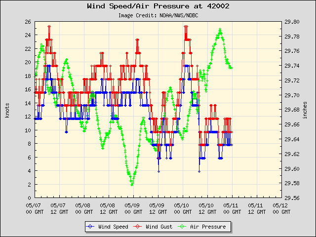
No idea if the anenometer at Shell's Auger platform is feeling ok. 50 knots plus. I know that is probably about 40 meters above the surface, and my gut tells me that winds aren't really that strong, even at platform elevation.
OT: I was on the crew that ran instrumentation in the Serrano #2 well for Shell (I think it was the #2) onboard the rig Ocean Worker.
The Mariner platform, not too far away, has a more reasonable 20 knots.
At the databuoy ESE of BRO/SPI the winds have shifted from NE to ENE to SE in last 2 hours, and pressure is rising.
0 likes
-
Ed Mahmoud
Re: INVEST 99L : Gulf of Mexico : Discussions & Images
Ed Mahmoud wrote:No idea if the anenometer at Shell's Auger platform is feeling ok. 50 knots plus. I know that is probably about 40 meters above the surface, and my gut tells me that winds aren't really that strong, even at platform elevation.
OT: I was on the crew that ran instrumentation in the Serrano #2 well for Shell (I think it was the #2) onboard the rig Ocean Worker.
The Mariner platform, not too far away, has a more reasonable 20 knots.
At the databuoy ESE of BRO/SPI the winds have shifted from NE to ENE to SE in last 2 hours, and pressure is rising.
Does JB read S2K- his post update mentioned Auger (not by name) winds, but he calls it offshore Texas. Auger is, of course, offshore Louisiana.
0 likes
-
vbhoutex
- Storm2k Executive
- Posts: 29145
- Age: 74
- Joined: Wed Oct 09, 2002 11:31 pm
- Location: Cypress, TX
- Contact:
Re: INVEST 99L : Gulf of Mexico : Discussions & Images
I do know JB knows about this site. I told him about it a few times and we do have at least two members from Accuweather, both Senior Mets there.
0 likes
-
wxman57

- Moderator-Pro Met

- Posts: 23172
- Age: 68
- Joined: Sat Jun 21, 2003 8:06 pm
- Location: Houston, TX (southwest)
Re: INVEST 99L : Gulf of Mexico : Discussions & Images
That Shell platform's anemometer is located a good 150 feet up. But it may not be calibrated correctly. Its readings are a good 20-30 kts higher than all surrounding reports (45-50 at Auger vs 15-25 kts everywhere else). The wind direction on that platform also appears to be way off.
There isn't much evidence of an LLC in the northern Gulf this morning. Lowest pressures (1004.1mb) are at the mid Texas coast buoy. But winds from Brownsville to Louisiana are southeasterly. Development chances are about zero. There will be no recon, as there's nothing to investigate. Just some rain moving ashore.
Here's a new surface plot with satellite:
0 likes
-
wxman57
- Moderator-Pro Met
- Posts: 23172
- Age: 68
- Joined: Sat Jun 21, 2003 8:06 pm
- Location: Houston, TX (southwest)
Re:
chadtm80 wrote:http://www.storm2k.org/wx/buoy/buoy-datawgulf.php
I see the station data for Auger lists the anemometer height at 122 meters. That's at the top of the derrick, 400 feet up. But it still looks like it's not calibrated properly, and it's probably not properly oriented as far as its azimuth.
http://www.ndbc.noaa.gov/station_page.p ... 361&unit=E
0 likes
-
wxman57
- Moderator-Pro Met
- Posts: 23172
- Age: 68
- Joined: Sat Jun 21, 2003 8:06 pm
- Location: Houston, TX (southwest)
Re: INVEST 99L RECON
Recon cancelled. Weak low center is inland near Freeport, TX.
NOUS42 KNHC 171330
WEATHER RECONNAISSANCE FLIGHTS
CARCAH, NATIONAL HURRICANE CENTER, MIAMI, FL.
0930 AM EDT WED 17 OCTOBER 2007
SUBJECT: TROPICAL CYCLONE PLAN OF THE DAY (TCPOD)
VALID 18/1100Z TO 19/1100Z OCTOBER 2007
TCPOD NUMBER.....07-145
I. ATLANTIC REQUIREMENTS
1. NEGATIVE RECONNAISSANCE REQUIREMENTS.
2. OUTLOOK FOR SUCCEEDING DAY.....NEGATIVE.
3. REMARKS: TASKING IN THE NW GULF OF MEXICO FOR 17/1800Z
AND 18/0600Z CANCELED BY NHC AT 17/1200Z.
II.PACIFIC REQUIREMENTS
1. NEGATIVE RECONNAISSANCE REQUIREMENTS.
2. SUCCEEDING DAY OUTLOOK.....NEGATIVE.
JWP
0 likes
-
Ed Mahmoud
Re: INVEST 99L : Gulf of Mexico : Discussions & Images
Drove through some tropical showers on the way to work, brief heavy rain, no thunder or lightning. Looks like area of greatest spin is about to Galveston, although it looks to be so embedded in the Southeast flow into the big storm it probably doesn't have a closed circulation.
Currently, out the office window of the Galleria, a stratus deck that is starting to break revealing blue skies, racing off to the Northwest.
Whatever remains of that remnant bit of vorticity should be in Arklatex this afternoon, wonder if that plays a role in evolution of severe weather there.
Currently, out the office window of the Galleria, a stratus deck that is starting to break revealing blue skies, racing off to the Northwest.
Whatever remains of that remnant bit of vorticity should be in Arklatex this afternoon, wonder if that plays a role in evolution of severe weather there.
0 likes
Re: INVEST 99L : Gulf of Mexico : Discussions & Images
A naked spiral into Houston. The great storm of 2007 (I'm being sarcastic in case anyone just looked at this for the first time).
0 likes
-
Ed Mahmoud
Re: INVEST 99L : Gulf of Mexico : Discussions & Images
Sanibel wrote:A naked spiral into Houston. The great storm of 2007 (I'm being sarcastic in case anyone just looked at this for the first time).
Solid overcast again.
0 likes
Re: INVEST 99L : Gulf of Mexico : Discussions & Images
The rain has really dried up with this thing.
0 likes
-
Ed Mahmoud
Re: INVEST 99L : Gulf of Mexico : Discussions & Images
Sanibel wrote:The rain has really dried up with this thing.
Yes, but it is the subject of the latest SPC MCD

MESOSCALE DISCUSSION 2091
NWS STORM PREDICTION CENTER NORMAN OK
0936 AM CDT WED OCT 17 2007
AREAS AFFECTED...FAR SERN TX...LA...SRN AR
CONCERNING...SEVERE POTENTIAL...WATCH POSSIBLE
VALID 171436Z - 171630Z
STORMS SHOULD INCREASE IN INTENSITY AND COVERAGE THROUGH THE DAY AND
A TORNADO WATCH MAY BECOME NECESSARY.
SURFACE ANALYSIS SHOWS AN EXTREMELY MOIST AIR MASS ADVECTING NWD OUT
OF THE WRN GULF OF MEXICO WITH DEWPOINTS IN THE MID TO UPPER 70S F.
A WEAK MESO LOW WAS NOTED AS WELL AND COULD BE SEEN ON VISIBLE
IMAGERY OVER SERN TX. VAD WIND PROFILES ACROSS LA WERE INDICATING
MODERATE LOW LEVEL SHEAR WITH 0-1 SRH VALUES OF 150-250 M2/S2.
HOWEVER...SOME WEAKNESS IN THE WIND FIELDS/HODOGRAPHS WAS NOTED IN
THE 2-4 KM LAYER.
OVER THE NEXT SEVERAL HOURS...AXIS OF LOW LEVEL
CONVERGENCE...PERSISTENT WARM/MOIST ADVECTION AND SOME POCKETS OF
HEATING SHOULD ALLOW FOR A GRADUAL INCREASE IN STORMS ACROSS SE
TX/LA AND SPREADING NWD INTO SRN AR. TORNADO THREAT WILL NOT BE HIGH
INITIALLY...BUT WILL INCREASE AS UPPER TROUGH APPROACHES FROM THE W.
AS THIS OCCURS...WIND FIELDS AT ALL LEVELS WILL INCREASE AND BECOME
MORE FAVORABLE FOR SUSTAINED UPDRAFTS AND SUPERCELLS WITH THREAT OF
TORNADOES.
..JEWELL.. 10/17/2007
0 likes
-
chadtm80

Who is online
Users browsing this forum: No registered users and 25 guests