Low Pressure near Northern Leewards
Moderator: S2k Moderators
Forum rules

The posts in this forum are NOT official forecasts and should not be used as such. They are just the opinion of the poster and may or may not be backed by sound meteorological data. They are NOT endorsed by any professional institution or STORM2K. For official information, please refer to products from the National Hurricane Center and National Weather Service.


Re: Models hinting at Tropical Development Near PR
There is definitely a low level spin near 15N-60W. Convection on the increase east of the LA. Upper level winds not favorable for much development at this point but who knows in 3 or 4 days. Lots of model support for something to spin up though - hey, the way this years gone, if they put a Invest Tag on it that will surely spell its doom. 
http://www.ssd.noaa.gov/goes/east/watl/loop-vis.html
http://www.ssd.noaa.gov/goes/east/watl/loop-vis.html
0 likes
-
wxman57

- Moderator-Pro Met

- Posts: 23172
- Age: 68
- Joined: Sat Jun 21, 2003 8:06 pm
- Location: Houston, TX (southwest)
Re: Models hinting at Tropical Development Near PR
Yep, I see the rotation there. Westerly winds aloft are about 30-35 kts over it, making for 40-45 kts of shear.
ronjon wrote:There is definitely a low level spin near 15N-60W. Convection on the increase east of the LA. Upper level winds not favorable for much development at this point but who knows in 3 or 4 days. Lots of model support for something to spin up though - hey, the way this years gone, if they put a Invest Tag on it that will surely spell its doom.
http://www.ssd.noaa.gov/goes/east/watl/loop-vis.html
0 likes

Re: Models hinting at Tropical Development Near PR
should decrease to 20kts or so on Tuesday and less on Wednesday...Excellent model support!
0 likes
-
Derek Ortt
Re: Models hinting at Tropical Development Near PR
Derek,
Will this be an out to sea scenario or more like Kate?
12Z Canadian(out to sea) vs 12Z Nogaps(Kate)?
Will this be an out to sea scenario or more like Kate?
12Z Canadian(out to sea) vs 12Z Nogaps(Kate)?
Last edited by Vortex on Mon Oct 22, 2007 4:51 pm, edited 1 time in total.
0 likes
-
cycloneye

- Admin

- Posts: 149275
- Age: 69
- Joined: Thu Oct 10, 2002 10:54 am
- Location: San Juan, Puerto Rico
Re: Models hinting at Tropical Development Near PR
I will post the 18z GFS timeframes in this post.
18z GFS at 36 hours
18z GFS at 48 hours
18z GFS at 66 Hours
18z GFS at 78 hours
18z GFS at 90 hours 18z GFS 200mb at 90 hours
Shear is at 30kts in 90 hours
18z GFS at 102 hours 18z GFS 200mb at 102 hours
Shear decreases in Western Caribbean,but continues around 30kts in Eastern Caribbean.
18z GFS at 120 hours
18z GFS at 132 hours 18z GFS 200mb at 132 hours
Shear continues at 30kts in Eastern Caribbean.
18z GFS at 144 hours
18z GFS at 156 hours
I will stop here.
0 likes
-
Derek Ortt
no model is indicating out to sea. CMC has what looks like a repeat of the terrible 1780 hurricane (which was strong than what Lenny was at St Martin (though over Martinique instead and moving from the east) and much slower moving). NOGAPS has a Kate type storm
Remember, the fronts have yet to reach the subtropical western Atlantic. In that respect, this season is somewhat similar to 1985 when the fronts also took their sweet time clearing Florida
Remember, the fronts have yet to reach the subtropical western Atlantic. In that respect, this season is somewhat similar to 1985 when the fronts also took their sweet time clearing Florida
0 likes
-
Derek Ortt

-
Blown Away

- S2K Supporter

- Posts: 10253
- Joined: Wed May 26, 2004 6:17 am
Re: Models hinting at tropical development near PR
18z GFS at 156 hours - Which low is it, the one N of PR or the one in the NE Gulf?
0 likes
-
cycloneye
- Admin
- Posts: 149275
- Age: 69
- Joined: Thu Oct 10, 2002 10:54 am
- Location: San Juan, Puerto Rico
Re: Models hinting at tropical development near PR


This is a complex area with a tropical wave interacting with an upper trough.The question is if it can develop with the upper level winds being strong.
0 likes
-
AJC3

- Admin
- Posts: 4153
- Age: 62
- Joined: Tue Aug 31, 2004 7:04 pm
- Location: Ballston Spa, New York
- Contact:
Re: Models hinting at tropical development near PR
cycloneye wrote: This is a complex area with a tropical wave interacting with an upper trough.The question is if it can develop with the upper level winds being strong.
Here's my take, based on what I see in water vapor imagery and from the ECM/GFS H25 wind/divergence forecasts over the next couple of days.
There is a well defined H25 shear axis running ENE from the Mona Passage into the central ATLC, separating a strong 50-70KT ENE jet streak (running from 25N60W into eastern Cuba/Hispanola) from a 40-50kt WSW jet streak (strecthing ENE-ward from the northern Leewards). Water Vapor imagery shows an ULL forming in the north and NE of PR/USVI, which should do two things:
1) As H25 winds become more out of the SW and weaken slighly, shear should weaken as a result (from "extremely hostile" to "pretty unfavorable, but not ridiculously prohibitive", if you get my drift).
2) Create an area of strong H25 divergence near and near and to the east/northeast of the LA.
What I expect over the next day or two is for the wave to become even more convectively active, owing to increasing divergence/forced ascent. If there is enough of a convective burst over the wave, there may be enough pressure falls to spin up a weak vortex, given the T-wave in that area was already showing some broad cyclonic turning. However, after any ULL that forms near/north of PR is progged to be weak/transient, and thus H25 winds are forecast to veer around to NW at about 15kt, give or take. Given the wave will be embedded in low level E-ESE flow of at least 10-15kt, that would translate into ~25-30kt of shear.
I'd give it about a 50/50 shot at becoming an invest over the next 2 days, but only about a 5% chance to actually become a TC.
0 likes
-
cycloneye
- Admin
- Posts: 149275
- Age: 69
- Joined: Thu Oct 10, 2002 10:54 am
- Location: San Juan, Puerto Rico
Re: Models hinting at tropical development near PR
0 likes

Re: Models hinting at tropical development near PR
Actually, it looks like an ULL is already starting to form NE of PR as shown on the 200-700mb CIMMS Steering Layer .
http://cimss.ssec.wisc.edu/tropic/real- ... 8dlm6.html

That should help to pull up high Theta-E air from the ITCZ to the area east of the Leewards.
That in turn should keep the convection around 15N 56W firing for a while.

Of particular note, the 850mb vorticity signature in this area has been strengthening to past 15 hours.
http://cimss.ssec.wisc.edu/tropic/real- ... 8vor4.html
Of couse, shear is still problamatic as this time:


http://cimss.ssec.wisc.edu/tropic/real- ... 8dlm6.html
That should help to pull up high Theta-E air from the ITCZ to the area east of the Leewards.
That in turn should keep the convection around 15N 56W firing for a while.
Of particular note, the 850mb vorticity signature in this area has been strengthening to past 15 hours.
http://cimss.ssec.wisc.edu/tropic/real- ... 8vor4.html
Of couse, shear is still problamatic as this time:
0 likes
Of Note, Hurricane Kate in '85 formed in this region in November and went on to become a cat3....It's late but it can happen even this far east.
http://en.wikipedia.org/wiki/Hurricane_Kate_(1985)#Storm_history
http://en.wikipedia.org/wiki/Hurricane_Kate_(1985)#Storm_history
0 likes

Re: Models hinting at tropical development near PR
NHC mentions the area this morning:
CLOUDINESS AND SHOWERS EXTENDING FROM THE LESSER ANTILLES
NORTHEASTWARD INTO THE ATLANTIC FOR SEVERAL HUNDRED MILES ARE
ASSOCIATED WITH A WEST-MOVING TROPICAL WAVE AND AN UPPER-LEVEL AREA
OF LOW PRESSURE. UPPER-LEVEL WINDS ARE CURRENTLY NOT FAVORABLE FOR
TROPICAL CYCLONE DEVELOPMENT.
CLOUDINESS AND SHOWERS EXTENDING FROM THE LESSER ANTILLES
NORTHEASTWARD INTO THE ATLANTIC FOR SEVERAL HUNDRED MILES ARE
ASSOCIATED WITH A WEST-MOVING TROPICAL WAVE AND AN UPPER-LEVEL AREA
OF LOW PRESSURE. UPPER-LEVEL WINDS ARE CURRENTLY NOT FAVORABLE FOR
TROPICAL CYCLONE DEVELOPMENT.
0 likes
Re: Models hinting at tropical development near PR
Based on this morning models, a shift in attention toward the western caribbean for this weekend may be warranted. Nearly all the global models show low pressure either moving into or developing in the western caribbean in 4-5 days, namely the 00Z CMC, NOGAPs, UKMET, FSU MM5, GFS, and Euro. The Euro and GFS keep low pressure rather borad and weak. The NOGAPs is the strongest model solution. The NOGAPs and Euro develop the low north of PR and generally move it west toward south of Cuba in 5-7 days.
http://moe.met.fsu.edu/cgi-bin/cmctc2.cgi?time=2007102300&field=Sea+Level+Pressure&hour=Animation
http://moe.met.fsu.edu/cgi-bin/ngptc2.cgi?time=2007102300&field=Sea+Level+Pressure&hour=Animation
http://moe.met.fsu.edu/cgi-bin/ukmtc2.cgi?time=2007102300&field=Sea+Level+Pressure&hour=Animation
http://moe.met.fsu.edu/cgi-bin/mm5fsu45atc2.cgi?time=2007102300&field=Sea+Level+Pressure&hour=Animation
0 likes
I think we should be seeing an Invest come from this shortly.
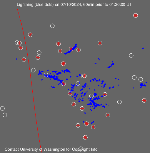
Convection has held up well over-night aided by the ULL that has formed at 21N 63W. That has pulled up high Theta-E air from the ITCZ over the Antilles. That has fueled the convection which is roughly at 15N 57W. The ULL has also aided UL Divergence on the east-flank of the convection. UL winds appear to be running about 20 knots over the tops of the thunderstorms. Lightning activity appears to have increased.
http://www.ssd.noaa.gov/goes/east/tatl/loop-wv.html
http://wwlln.net/WWLLN_movies/Movie_of_ ... as_BIG.gif
Two ULL's (21N 63W) & (29N 37W) have formed a TUTT axis. The convection firing at 15N 57W exists in the Sub-Equatorial Ridge (SER) formed by the TUTT axis. Right now, the 21N 63W ULL appears to be stationary.
http://cimss.ssec.wisc.edu/tropic/real- ... 8dlm6.html
Shear has dropped from 40 knots to about 20 knots in the area of convection east of the Antilles.
http://cimss.ssec.wisc.edu/tropic/real- ... g8sht.html
Shear is forecast to decrease even more in the next 48 hours:
http://moe.met.fsu.edu/cgi-bin/cmctc2.c ... =Animation
It looks like high Theta-E air will continue to come up from the ITCZ during this time, right around the Antilles.
http://moe.met.fsu.edu/cgi-bin/cmctc2.c ... =Animation
GFS has the system remaining stationary and strengthening at 18N 59W during the next 48 hours. This looks very probable given the forecasted shear drop and continued feed of high Theta-E air. After that, it looks like the system will go out to sea, maybe as a TD.
http://moe.met.fsu.edu/cgi-bin/gfstc2.c ... =Animation
http://moe.met.fsu.edu/cgi-bin/gfstc2.c ... =Animation
0 likes
Who is online
Users browsing this forum: bird, Google [Bot] and 93 guests