Hurricane NOEL : Discussions & Images
Moderator: S2k Moderators
-
SouthFloridawx

- S2K Supporter

- Posts: 8346
- Age: 47
- Joined: Tue Jul 26, 2005 1:16 am
- Location: Sarasota, FL
- Contact:
Re: Tropical Storm NOEL : Discussions & Images
Any chance of a new center forming under the convection to the north of Cuba?
0 likes
-
Tampa Bay Hurricane

- Category 5

- Posts: 5597
- Age: 38
- Joined: Fri Jul 22, 2005 7:54 pm
- Location: St. Petersburg, FL

Re: Tropical Storm NOEL : Discussions & Images
yes i understand that as long as this weak cyclone stay away from us our winds will actually be higher due to the increased gradient
what i was wondering is wether the LLC was relocating further to the NE under the deeper convection or if this was possible
also if noel were to strengthen a bit more and stay east would this increase the gradient and thus the winds on the coast, THIS IS MY ONLY CONCERN.
what i was wondering is wether the LLC was relocating further to the NE under the deeper convection or if this was possible
also if noel were to strengthen a bit more and stay east would this increase the gradient and thus the winds on the coast, THIS IS MY ONLY CONCERN.
0 likes
-
JonathanBelles
- Professional-Met

- Posts: 11430
- Age: 35
- Joined: Sat Dec 24, 2005 9:00 pm
- Location: School: Florida State University (Tallahassee, FL) Home: St. Petersburg, Florida
- Contact:
Re: Tropical Storm NOEL : Discussions & Images
The posts in this forum are NOT official forecast and should not be used as such. They are just the opinion of the poster and may or may not be backed by sound meteorological data. They are NOT endorsed by any professional institution or storm2k.org. For official information, please refer to the NHC and NWS products.
Forecast 103007
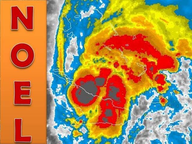
Tropical Storm Noel is holding its own over Cuba. Noel is causing catastrophic beach erosion on Florida's east coast.

Over Central Cuba...Tropical Storm Noel...under Serious Advisory Mode (personal advisory for those who do not read my journal) and a Tropical Storm Warning.
The Tropical Storm Warning concerns the eastern half of Cuba and the northern two-thirds of the Bahamas. Those in this area should expect Tropical Storm Force winds for the next 48 hours. Any preparations should have already taken place in the areas under the TS warning.
Catastrophic beach erosion is occurring on the east coast of Florida, Georgia, SC and likely in the Bahamas. It will be worst tomorrow as Noel approaches the US. The worst affects will be felt south of Daytona Beach and north of WPB. The damage that occurs in the US will likely come for the most part from erosion and the associated wind. Winds will likely be 20+ mph on the West Coast of Florida and 30-40+ on the East Coast with highest winds in the area of highest erosion possibility described above.
Heavy rain will continue to fall in the mountains of Cuba and Hispaniola. Up to 15" of rain are possible in both places. Rainfall totals will likely be less than 15", that number is only a max. Rainfall in Florida will be intermittent, but heaviest on Wednesday and Thursday closest to Noel.
Track: Noel is beginning to make the transition to the NW, N, and NE. There is a small, diminishing possibilitiy that Noel could move back into the Caribbean. In either case Noel will move back into the Atlantic sometime late tomorrow. The track that I predict is that Noel will move 10-20 miles to the west of Andros Island, Bahamas. It likely will not matter how close Noel gets to Florida, the effect will be the same except for a direct impact, which I do not expect. I do expect a direct impact in Canada's NS however. Ill discuss that later.
I am offering to do personal forecasts upon request for those in the area of Noel.
Dynamics may change, and if they do I will change my forecast. I will not flip flop unless dynamics do the same.
Fact789
0 likes


-
SouthFLTropics

- Category 5
- Posts: 4258
- Age: 50
- Joined: Thu Aug 14, 2003 8:04 am
- Location: Port St. Lucie, Florida
Re: Tropical Storm NOEL : Discussions & Images
Well one thing we can say for Noel is that he might be remembered as the Energizer Bunny or the Little Engine that Could. It just keeps going despite being on land for so long. But that being said it appears that the west side of the convection has begun to flatten out and Noel has hit a brick wall. I would think that Noel will be heading off to the NE by tomorrow night...stay tuned but it looks like the NHC track will verify...
SFT
SFT
0 likes


Re:
HURAKAN wrote:I don't see what we need to celebrate when the rain is needed desperately.
Sorry, it never was going to happen with Noel.
Even if it had passed right over us, the rain is well to the east of the system.
The map that was linked from the SFWMD is really telling in that we really are not short on rainfall but due to miss-management the Lake is so low.
Having said that, we always can use the rain during "rainy" season especially with the Lake level miss-management.
It is a shame that Noel was never going to give us the beneficial rain.
But it DID provide us the only "excitement" we got in the 2007 season in South Florida and, in deference to Boca Steve; WE MADE THE CONE.

0 likes
-
x-y-no

- Category 5
- Posts: 8359
- Age: 65
- Joined: Wed Aug 11, 2004 12:14 pm
- Location: Fort Lauderdale, FL
Just took about an hour long walk on Hollywood Beach. Don't think the wind ever dropped below 20 knots, mostly the sustained wind was probably closer to 23 - 25 knots. Some gusts over 30 knots during the occasional showers.
Breezy enough to be really bracing and keep a constant salt spray in the air but not so windy as to make the rain really sting.
(All the above are estimates based on years of sailing experience - I'm usually right within a couple of knots)
Breezy enough to be really bracing and keep a constant salt spray in the air but not so windy as to make the rain really sting.
(All the above are estimates based on years of sailing experience - I'm usually right within a couple of knots)
0 likes
-
bocadude86
- Tropical Depression

- Posts: 52
- Joined: Wed Sep 12, 2007 3:29 pm
- Location: Boca Raton, Fl
-
AtlanticWind

- S2K Supporter
- Posts: 1898
- Age: 67
- Joined: Sun Aug 08, 2004 9:57 pm
- Location: Plantation,Fla
Re: Tropical Storm NOEL : Discussions & Images
http://www.ssd.noaa.gov/goes/flt/t1/loop-ir2.html
I could be wrong but looking at the shortwave loop it looks like Noel is entering the carribean.
I could be wrong but looking at the shortwave loop it looks like Noel is entering the carribean.
0 likes
-
hurricanetrack

- HurricaneTrack.com
- Posts: 1781
- Joined: Tue Dec 02, 2003 10:46 pm
- Location: Wilmington, NC
- Contact:
-
CourierPR

- Category 5
- Posts: 1336
- Age: 72
- Joined: Tue Aug 31, 2004 7:53 pm
- Location: Pompano Beach, Florida
Re: Tropical Storm NOEL : Discussions & Images
The northward turn has begun? I sure don't see it yet.AtlanticWind wrote:http://www.ssd.noaa.gov/goes/flt/t1/loop-ir2.html
I could be wrong but looking at the shortwave loop it looks like Noel is entering the carribean.
0 likes
-
hurricanetrack
- HurricaneTrack.com
- Posts: 1781
- Joined: Tue Dec 02, 2003 10:46 pm
- Location: Wilmington, NC
- Contact:
I realize that your comment about the GFS may be a bit sarcastic and one should not take it too seriously, but it would be interesting to learn why you think it is so worthless when it is so often refered to in so many NWS products. In other words, if it is so terrible, why have it? What is wrong with it? I understand some basic issues with feedback problems, but to say that it is not worth the paper its printed on is quite a bold statement. And if so, then perhaps a move should be made to discard it and go with something better, if there is anything.
I bring this up because it seems that you always have nothing but ill feelings towards the GFS and I, and others I am sure, would like to know why. If you can convince me (us) then great- provide some evidence of it. Otherwise I think this is an attack on the people of NCEP in Camp Springs. People totally bash the Canadian model as if the people who run it are drunken fools, I would think a board such as storm2k would be more respectful of people who put out such mathematical models to predict the weather. But to slam the American model of choice- wow. That really is concerning and if the GFS is really as bad as you claim it is, then something ought to be done about it, right? Why let the people at NCEP continue to put out such a horrible model 4 times a day? I am serious, this beef of mine is about the comments concerning the GFS and not you personally as I do not know you personally. So when time permits, I invite you to post arguments as to why the GFS is worthless. It is one thing to state your opinion, but if you have some proof of such consistent "badness" in the model, then we would all benefit from having a look too. Then, we can contact our elected officials and get the thing changed so it is worth the paper its printed on and much more.
I bring this up because it seems that you always have nothing but ill feelings towards the GFS and I, and others I am sure, would like to know why. If you can convince me (us) then great- provide some evidence of it. Otherwise I think this is an attack on the people of NCEP in Camp Springs. People totally bash the Canadian model as if the people who run it are drunken fools, I would think a board such as storm2k would be more respectful of people who put out such mathematical models to predict the weather. But to slam the American model of choice- wow. That really is concerning and if the GFS is really as bad as you claim it is, then something ought to be done about it, right? Why let the people at NCEP continue to put out such a horrible model 4 times a day? I am serious, this beef of mine is about the comments concerning the GFS and not you personally as I do not know you personally. So when time permits, I invite you to post arguments as to why the GFS is worthless. It is one thing to state your opinion, but if you have some proof of such consistent "badness" in the model, then we would all benefit from having a look too. Then, we can contact our elected officials and get the thing changed so it is worth the paper its printed on and much more.
0 likes
Who is online
Users browsing this forum: No registered users and 63 guests