JB sees (sub)tropical development that can affect Caribbean

This is the general tropical discussion area. Anyone can take their shot at predicting a storms path.

Moderator: S2k Moderators

Forum rules

The posts in this forum are NOT official forecasts and should not be used as such. They are just the opinion of the poster and may or may not be backed by sound meteorological data. They are NOT endorsed by any professional institution or STORM2K. For official information, please refer to products from the National Hurricane Center and National Weather Service.

Help Support Storm2K
Message
Author
User avatar
GCANE
S2K Supporter
S2K Supporter
Posts: 11453
Joined: Mon Oct 22, 2007 8:03 am

Re: JB sees (sub)tropical development that can affect Caribbean

#61 Postby GCANE » Sun Dec 09, 2007 9:12 am

This is strarting to look interesting with some organization:

Image

Image

Image
0 likes   

Squarethecircle
Category 5
Category 5
Posts: 2165
Joined: Fri Oct 19, 2007 4:00 pm
Location: Fairfax, VA

#62 Postby Squarethecircle » Sun Dec 09, 2007 9:25 am

:uarrow: Around last night, when it started to look good, I was beginning to be suspicious of my conviction that the storm had no chance. It seems that, however small, it has a shot now.
0 likes   

User avatar
cycloneye
Admin
Admin
Posts: 143863
Age: 68
Joined: Thu Oct 10, 2002 10:54 am
Location: San Juan, Puerto Rico

Re: JB sees (sub)tropical development that can affect Caribbean

#63 Postby cycloneye » Sun Dec 09, 2007 9:30 am

After all,JB was right about this being at least something to watch.Any new word from him?
0 likes   

Ed Mahmoud

Re: JB sees (sub)tropical development that can affect Caribbean

#64 Postby Ed Mahmoud » Sun Dec 09, 2007 9:53 am

cycloneye wrote:After all,JB was right about this being at least something to watch.Any new word from him?


No post since yesterday afternoon.


He mentioned a gymnastics meet yesterday for his daughter. I think he also mentioned A&M vs PSU game in San Antonio after Christmas, and whether he can/will attend, but that is a different subject, I guess.


He was probably the earliest pro-met to predict Humberto, so while he is oft bashed here, I always pay attention to him.
0 likes   

User avatar
GCANE
S2K Supporter
S2K Supporter
Posts: 11453
Joined: Mon Oct 22, 2007 8:03 am

Re: JB sees (sub)tropical development that can affect Caribbean

#65 Postby GCANE » Sun Dec 09, 2007 10:04 am

Right now this looks like it is concentrated in the mid levels. Watching buoys to see if it makes it to the surface. Will be rare if it does.

Image

http://www.ndbc.noaa.gov/maps/Caribbean.shtml
0 likes   

Squarethecircle
Category 5
Category 5
Posts: 2165
Joined: Fri Oct 19, 2007 4:00 pm
Location: Fairfax, VA

#66 Postby Squarethecircle » Sun Dec 09, 2007 10:17 am

:uarrow: Well, of course, it'll have to if it has any chance. Wait, it's mid-level? Cool.
0 likes   

RL3AO
Moderator-Pro Met
Moderator-Pro Met
Posts: 16308
Joined: Thu Jun 14, 2007 10:03 pm
Location: NC

#67 Postby RL3AO » Sun Dec 09, 2007 10:22 am

Now a special feature

...SPECIAL FEATURE...
A SUBTROPICAL CLASSIFICATION OF ST1.5 WAS ASSIGNED TO A LOW TO
MIDDLE LEVEL CYCLONIC CIRCULATION NEAR 18N54W. A SURFACE TROUGH
IS ALONG 53W/54W FROM 14N TO 23N. LARGE-SCALE MIDDLE TO UPPER
LEVEL CYCLONIC FLOW AROUND THIS FEATURE ON WATER VAPOR IMAGERY
COVERS THE ATLANTIC OCEAN AND CARIBBEAN SEA FROM COLOMBIA
AND VENEZUELA ALONG 8N TO 25N BETWEEN 47W AND 80W. A MIDDLE
TO UPPER LEVEL TROUGH GOES FROM 22N52W TO 12N63W TO THE
SOUTHWESTERN CORNER OF THE CARIBBEAN SEA. ISOLATED TO WIDELY
SCATTERED MODERATE SHOWERS/LOCALLY STRONG THUNDERSTORMS FROM
FROM 18N TO 23N BETWEEN 50W AND 60W. ISOLATED MODERATE SHOWERS
FROM 20N TO 22N BETWEEN 60W AND 65W. ISOLATED MODERATE SHOWERS
FROM 14N TO 17N BETWEEN 46W AND 48W. ISOLATED MODERATE SHOWERS
ARE IN THE CARIBBEAN SEA FROM 10N TO 16N BETWEEN 64W AND 72W.
0 likes   

Ed Mahmoud

Re: JB sees (sub)tropical development that can affect Caribbean

#68 Postby Ed Mahmoud » Sun Dec 09, 2007 10:32 am

JB just updated, said gales for PR and VI, not closed or tropical, at least not yet.
0 likes   

User avatar
cycloneye
Admin
Admin
Posts: 143863
Age: 68
Joined: Thu Oct 10, 2002 10:54 am
Location: San Juan, Puerto Rico

Re: JB sees (sub)tropical development that can affect Caribbean

#69 Postby cycloneye » Sun Dec 09, 2007 11:37 am

Image
0 likes   

User avatar
HURAKAN
Professional-Met
Professional-Met
Posts: 46086
Age: 38
Joined: Thu May 20, 2004 4:34 pm
Location: Key West, FL
Contact:

#70 Postby HURAKAN » Sun Dec 09, 2007 11:52 am

Image

Image

Image

Very interesting system indeed.
0 likes   

User avatar
cycloneye
Admin
Admin
Posts: 143863
Age: 68
Joined: Thu Oct 10, 2002 10:54 am
Location: San Juan, Puerto Rico

Re: JB sees (sub)tropical development that can affect Caribbean

#71 Postby cycloneye » Sun Dec 09, 2007 11:54 am

The latest from the San Juan NWS.

000
FXCA62 TJSJ 091539
AFDSJU

AREA FORECAST DISCUSSION
NATIONAL WEATHER SERVICE SAN JUAN PR
1139 AM AST SUN DEC 9 2007

.UPDATE...VARIABLY CLOUDY SKIES PREVAILED THIS MORNING ACROSS THE
FA. THE DOPPLER WEATHER RADAR INDICATED SCATTERED PASSING SHOWERS
AND ISOLATED THUNDERSTORMS MOVING TO THE SOUTHWEST FROM THE ATLANTIC
WATERS ACROSS THE NORTHERN HALF OF PUERTO RICO AS WELL ACROSS
VIEQUES...CULEBRA AND THE U.S. VIRGIN ISLANDS. DUE TO THE RAPID
MOVEMENT OF THIS ACTIVITY THE TOTAL RAINFALL AMOUNTS WERE GENERALLY
LESS THAN ONE INCH. LATEST SATELLITE IMAGES THIS MORNING...DEPICTED
A DEEP LAYERED LOW PRESSURE TROUGH...EAST OF THE NORTHERN LEEWARD
ISLANDS. THIS FEATURE IN COMBINATION WITH STRONG HIGH PRESSURE
ACROSS THE WESTERN ATLANTIC...WILL MAINTAIN A STRONG NORTHEAST
WIND FLOW ACROSS THE LOCAL ISLANDS AND COASTAL WATERS THROUGH AT
LEAST TOMORROW MORNING. THIS TROUGH WILL CONTINUE TO SHIFT
WESTWARD AND MOVE ACROSS THE LEEWARD ISLANDS TONIGHT...AND THEN
ACROSS THE LOCAL AREA TOMORROW MORNING. AS THE TROUGH MOVES CLOSER
TO THE FA THIS EVENING AND OVERNIGHT...THE LOCAL PRESSURE GRADIENT
WILL INCREASE...WHICH WILL INDUCE WINDY CONDITIONS ACROSS THE
AREA...AS WELL AS INCREASE THE FREQUENCY OF PASSING SHOWERS AND
THUNDERSTORMS. A SMALL CRAFT ADVISORY IS NOW IN EFFECT THROUGH
TUESDAY MORNING FOR ALL LOCAL ATLANTIC AND CARIBBEAN WATERS.
SMALL CRAFT OPERATOR SHOULD EXERCISE CAUTION ACROSS THE NEARSHORE
WATERS OF WESTERN PUERTO RICO. ONLY MINOR CHANGES WERE DONE TO THE
SHORT TERM GRIDS PACKAGE.

&&

.AVIATION...NORTHEASTERLY LLVL FLOW OF 15 TO 25 KNOTS WILL CONTINUE
THIS AFTERNOON ACROSS THE REGION...WITH INTERMITTENT PASSING
CLUSTERS OF SHOWERS AND THUNDERSTORMS...WITH TOPS OF 15K-30K FEET.
MOUNTAIN OBSCURATIONS ARE EXPECTED ACROSS THE INTERIOR OF PR THIS
AFTERNOON...BUT WILL BE MOST PREVALENT FROM LATE THIS EVENING AND
TOMORROW. FOR THIS AFTERNOON...LOOK FOR BRIEF PERIODS OF MVFR
CIGS TO PERSIST AT ALL STATIONS ESPECIALLY FROM 19Z-22Z. MORE
FREQUENT MVFR CONDS AT ALL STATIONS ARE EXPECTED FROM LATE THIS
EVENING AND TOMORROW...AS A DEEP LAYERED LOW PRESSURE TROUGH...
EAST OF THE NORTHERN LEEWARD ISLANDS...APPROACHES TO THE LOCAL TAF
SITE...INCREASING THE FREQUENCY OF SCATTERED SHOWERS...THUNDERSTORMS
AND GUSTY WINDS ACROSS THE REGION. ACCORDINGLY TO 12Z SJU SOUNDING
WINDS OF 15 TO 25 KNOTS ARE EXPECTED FROM THE SURFACE TO AROUND
20K FEET WITH VARIABLE NORTH NORTHWEST WINDS ABOVE THAT LEVEL.
0 likes   

curtadams
S2K Supporter
S2K Supporter
Posts: 1122
Joined: Sun Aug 28, 2005 7:57 pm
Location: Orange, California
Contact:

#72 Postby curtadams » Sun Dec 09, 2007 12:03 pm

Looks subtropical to me but certainly not a storm or even almost a storm. A subtropical wave, I guess. What's with the sat glitches? I've seen 3 glitched frames in the past 24 hours.
0 likes   

MiamiensisWx

Re:

#73 Postby MiamiensisWx » Sun Dec 09, 2007 12:14 pm

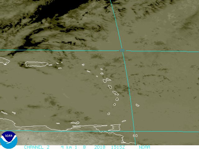
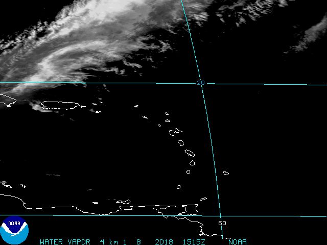
curtadams wrote:Looks subtropical to me but certainly not a storm or even almost a storm. A subtropical wave, I guess. What's with the sat glitches? I've seen 3 glitched frames in the past 24 hours.

http://www.ssd.noaa.gov/PS/SATS/SPBULL/MSG3431504.01.txt

http://www.storm2k.org/phpbb2/viewtopic.php?f=31&t=99344
0 likes   

RL3AO
Moderator-Pro Met
Moderator-Pro Met
Posts: 16308
Joined: Thu Jun 14, 2007 10:03 pm
Location: NC

#74 Postby RL3AO » Sun Dec 09, 2007 1:07 pm

...SPECIAL FEATURE...
A SURFACE TROUGH IS E OF THE LESSER ANTILLES ALONG 24N54W 15N57W
5N57W. SCATTERED MODERATE CONVECTION IS E OF THE LEEWARD
ISLANDS FROM 18N-21N BETWEEN 55W-58W. SOME OF THE GLOBAL MODELS
PREDICT A SURFACE LOW TO DEVELOP FROM THE TROUGH WITH TROPICAL
CHARACTERISTICS AND MOVE TOWARDS HISPANIOLA. THE SYSTEM WILL BE
MONITORED FOR THE NEXT FEW DAYS.
0 likes   

User avatar
cycloneye
Admin
Admin
Posts: 143863
Age: 68
Joined: Thu Oct 10, 2002 10:54 am
Location: San Juan, Puerto Rico

Re: JB sees (sub)tropical development that can affect Caribbean

#75 Postby cycloneye » Sun Dec 09, 2007 1:33 pm

From Accuweather:

A Disturbance To Track
We continue to track a tropical disturbance that has formed to the northeast of the Virgin Islands. Currently, an area of low pressure can be found at 19 north, 56 west, which is about 650 miles east of San Juan, Puerto Rico. Thunderstorms are clustering around this area of low pressure, which is tracking eastward at about 10 mph. The water in this area is still warm enough to support tropical development, and the upper-level winds are not too strong to prevent development. In fact, some computer models indicate that an out-of-season development may occur from this feature over the next couple of days as it tracks steadily westward. Residents of and those with interests in the Leeward Islands, Puerto Rico, and Hispaniola should keep close watch on on this system's progress. Even if no tropical development occurs, this low will likely bring squalls to Puerto Rico and Hispaniola through the first part of the upcoming workweek. By AccuWeather.com Meteorologist Frank Strait
0 likes   

Squarethecircle
Category 5
Category 5
Posts: 2165
Joined: Fri Oct 19, 2007 4:00 pm
Location: Fairfax, VA

#76 Postby Squarethecircle » Sun Dec 09, 2007 3:19 pm

:uarrow: Ack! Tropical disturbance?! What are they THINKING?! And why can't they mention that the most RELIABLE major global models hardly (if at all) even close off the low?

Plus, "Even if no tropical development occurs" make it sound like it is an improbable scenario.

Ah, well, the storm is looking good, yes, but that does not mean that Accuweather's statements are not unfounded.
0 likes   

User avatar
Vortex
S2K Supporter
S2K Supporter
Posts: 4644
Age: 53
Joined: Fri Aug 01, 2003 9:34 pm
Location: Hilton Head, SC

Re: JB sees (sub)tropical development that can affect Caribbean

#77 Postby Vortex » Sun Dec 09, 2007 3:23 pm

Wow-I didn't expect to be back until 08' I must say I'm fairly impressed with this system for December. It looks like PR will get some squally weather out of this and wouldn't be surprised if you see gales. Also of interest is the model want to bring this system into the western carribean in about 3-4 days and this seems reasonable as ridging will remain in place for the next 5 days. We'll see. Keep us posted Luis as to your first in line...
0 likes   

User avatar
cycloneye
Admin
Admin
Posts: 143863
Age: 68
Joined: Thu Oct 10, 2002 10:54 am
Location: San Juan, Puerto Rico

Re: JB sees (sub)tropical development that can affect Caribbean

#78 Postby cycloneye » Sun Dec 09, 2007 3:33 pm

URGENT - WEATHER MESSAGE
NATIONAL WEATHER SERVICE SAN JUAN PR
327 PM AST SUN DEC 9 2007

...STRONG AND GUSTY WINDS EXPECTED DURING THE REST OF THE ATERNOON HOURS...
THIS EVENING AND EARLY MONDAY MORNING...

PRZ004-006-009-100800-
/O.NEW.TJSJ.WI.Y.0006.071209T2000Z-071210T0800Z/
EASTERN INTERIOR-CENTRAL INTERIOR-WESTERN INTERIOR-
327 PM AST SUN DEC 9 2007

...WIND ADVISORY IN EFFECT UNTIL 4 AM AST MONDAY...

THE NATIONAL WEATHER SERVICE IN SAN JUAN HAS ISSUED A WIND ADVISORY...
WHICH IS IN EFFECT UNTIL 4 AM AST MONDAY MORNING FOR ELEVATIONS
ABOUT 1000 FEET ACROSS PUERTO RICO.

WINDS OF 25 TO 35 MPH ARE EXPECTED ESPECIALLY ACROSS THE HIGHER
ELEVATIONS OF PUERTO RICO.

A DEVELOPING LOW PRESSURE CENTER...JUST EAST OF THE NORTHERN
LEEWARD ISLANDS THIS AFTERNOON...COMBINED WITH STRONG HIGH
PRESSURE ACROSS THE WESTERN ATLANTIC WILL MAINTAIN A STRONG
NORTHEAST WIND FLOW ACROSS THE LOCAL REGION THROUGH AT LEAST
MONDAY MORNING. THIS LOW PRESSURE CENTER WILL CONTINUE TO SHIFT
WESTWARD AND MOVE ACROSS THE LEEWARD ISLANDS LATE TONIGHT...AND
THEN ACROSS THE LOCAL AREA MONDAY AFTERNOON AND INTO EARLY
TUESDAY. AS THE LOW PRESSURE MOVES CLOSER TO THE LOCAL AREA...THE
LOCAL PRESSURE GRADIENT WILL INCREASE...WHICH WILL INDUCE WINDY
CONDITIONS ACROSS THE AREA...AS WELL AS INCREASE THE FREQUENCY OF
PASSING SHOWERS AND THUNDERSTORMS. THIS ADVISORY MAY BE EXTENDED
TO INCLUDE ELEVATIONS LOWER THAN 1000 FEET BY MONDAY MORNING.

A WIND ADVISORY MEANS THAT SUSTAINED WIND SPEEDS OF 25 MPH OR
GREATER ARE POSSIBLE ACROSS THE ADVISORY AREA. PEOPLE IN THE
ADVISORY AREA SHOULD SECURE ANY LOOSE OUTDOOR ITEMS SUCH AS
GARBAGE CANS OR LAWN FURNITURE. TRUCKS AND HIGH PROFILE VEHICLES
SHOULD BE PREPARED FOR STRONG GUSTY WINDS...ESPECIALLY ACROSS
HIGHER TERRAIN AND MOUNTAIN PASSES.

$$

FIGUEROA/MORALES
0 likes   

User avatar
punkyg
Category 2
Category 2
Posts: 770
Joined: Mon Apr 23, 2007 7:37 pm
Location: sanford florida

#79 Postby punkyg » Sun Dec 09, 2007 4:06 pm

http://www.ssd.noaa.gov/PS/TROP/float1.html
I just looked at this site :uarrow: it now says invest.
0 likes   

User avatar
Jam151
Category 1
Category 1
Posts: 276
Joined: Fri Aug 26, 2005 12:09 pm

Re: JB sees (sub)tropical development that can affect Caribbean

#80 Postby Jam151 » Sun Dec 09, 2007 4:19 pm

94L is now up on NRL. We're in business.
0 likes   


Return to “Talkin' Tropics”

Who is online

Users browsing this forum: Google Adsense [Bot], Ulf and 87 guests