OLGA'S remnants : Discussions & Images
Moderator: S2k Moderators

Re: Remnant low of Olga in West Carib : Discussions & Images
Better, to be sure. If that shear forecast that was posted above verifies, this thing will have a short window to consolidate and get a little more convection.....
0 likes
-
gatorcane

- S2K Supporter

- Posts: 23708
- Age: 48
- Joined: Sun Mar 13, 2005 3:54 pm
- Location: Boca Raton, FL
Re: Remnant low of Olga in West Carib : Discussions & Images
and finally folks, we see a burst of deeper convection on the northern side. The best burst since it was north of Puerto Rico...
Let the posting begin on this:

Let the posting begin on this:
0 likes
Re: Remnant low of Olga in West Carib : Discussions & Images
I think it looks much better than it did last night.
Feels very tropical in South Florida right now, more like late October or early May than mid-December. I wish we'd get some good rain from this.
Feels very tropical in South Florida right now, more like late October or early May than mid-December. I wish we'd get some good rain from this.
0 likes
-
MiamiensisWx
Re: Remnant low of Olga in West Carib : Discussions & Images
http://www.ssd.noaa.gov/goes/flt/t1/loop-vis.html
Diurnal convection has flared up over the remnant LLC. Although convection is improving, it is going to hit a brick wall of UL westerlies (shear). Note the UL trough moving east across the Gulf of Mexico. Additionally, a stable air mass is approaching the cyclone's remnants. Olga will likely be absorbed by the trough. Regardless, it would be excellent if the remnants enter the Gulf of Mexico and move NNE through the Southeast. A track over Cuba and west of FL would bring beneficial precipitation through GA and the Carolinas (plus FL), thus providing a small supply of drought relief over the most critically affected regions (i.e. portions of GA and SC/NC).
http://www.ssd.noaa.gov/goes/east/tatl/loop-vis.html
http://www.ssd.noaa.gov/goes/east/tatl/loop-wv.html
Ahh... I'm wading knee deep in the memories of those Miller A Gulf nor'easters (i.e. March 1993 Superstorm). Unfortunately, these beneficial precipitation events don't seem to exist today, thus providing more consternation for the Southeast.
0 likes

Re: T Depression OLGA in West Carib : Discussions & Images
AnnularCane wrote:wxman57 wrote:2. I'm on vacation tomorrow (probably the bigger of the two reasons). Every time I plan a vacation day when there's a disturbance in the tropics - it develops.
You just need to try and confine your vacations to the off-season...oops.
Good one
Post more evil J
0 likes

Re: Remnant low of Olga in West Carib : Discussions & Images
it has been raining here in north palm beach for the lsat 3 or 4 hours off and on. Mostly on and several very good downpours.
0 likes
-
tolakram
- Admin

- Posts: 20179
- Age: 62
- Joined: Sun Aug 27, 2006 8:23 pm
- Location: Florence, KY (name is Mark)
Re: Remnant low of Olga in West Carib : Discussions & Images
Based on sat loops it appears the convections is being sheared off again.
http://www.ssd.noaa.gov/goes/flt/t1/loop-wv.html
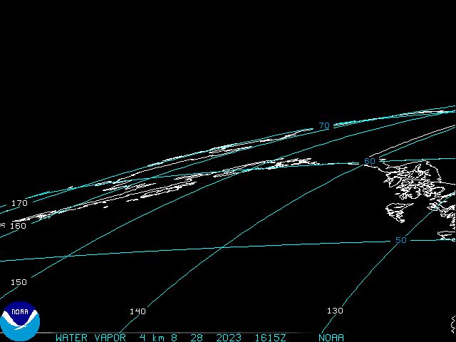
The water vapor loop clearly shows that moisture ahead of the system is increasing.

and shear has dropped to < 30 kts, so if Olga is going to do anything now is the time.
http://www.ssd.noaa.gov/goes/flt/t1/loop-wv.html
The water vapor loop clearly shows that moisture ahead of the system is increasing.
and shear has dropped to < 30 kts, so if Olga is going to do anything now is the time.
0 likes
-
Tampa Bay Hurricane

- Category 5

- Posts: 5597
- Age: 38
- Joined: Fri Jul 22, 2005 7:54 pm
- Location: St. Petersburg, FL
http://www.ssd.noaa.gov/goes/east/watl/loop-ir2.html
WHOOHOOOO!!! LOOK how BEAUTIFUL IT LOOKS!!!!!
NICE banding!!!!!!!!!!!!!
HOLY SMOKES common olga regenerate!!!!!!!!\
I so hope this blows up over the heat content of the
western caribbean even though dry air might KILL it
But Come on Olga blow up and give me some west coast
florida action along the front!! I hope the lows combine and
explode like the March 1993 Superstorm Man gusts of
50-60 would totally rock!!!!
Whoever mentioned the 93 superstorm thanks for pumping me up!!!!!!!
Man I DREAM of seeing something like that!!!!
0 likes
-
Tampa Bay Hurricane
- Category 5
- Posts: 5597
- Age: 38
- Joined: Fri Jul 22, 2005 7:54 pm
- Location: St. Petersburg, FL
-
Tampa Bay Hurricane
- Category 5
- Posts: 5597
- Age: 38
- Joined: Fri Jul 22, 2005 7:54 pm
- Location: St. Petersburg, FL
****THE FOLLOWING IS NOT OFFICIAL****
http://www.ssd.noaa.gov/goes/east/watl/loop-ir2.html
This HAS to be a tropical storm look how it LOOKS!!!!
This really does look like a True tropical storm with the banding
intensive and many banding layers. Look how it comes into the
center, the banding is very tropical looking!!
http://www.ssd.noaa.gov/goes/east/watl/loop-ir2.html
This HAS to be a tropical storm look how it LOOKS!!!!
This really does look like a True tropical storm with the banding
intensive and many banding layers. Look how it comes into the
center, the banding is very tropical looking!!
0 likes


Re: Remnant low of Olga in West Carib : Discussions & Images
Appearance is one thing, but the convection isn't there. It's not exactly a naked swirl, but it might as well be. The banding appearance doesn't necessarily mean that there's organized convection.....the last NHC TW discussion says it best:
"THE REMNANT LOW OF T.D. OLGA CONTINUES TO SPIN ACROSS THE
CARIBBEAN SEA BETWEEN THE ISLE OF YOUTH CUBA AND THE CAYMAN
ISLANDS. AS OF 2100 UTC...A 1010 MB LOW WAS ANALYZED NEAR
19.5N81.5W. THE LAST FEW VIS SATELLITE IMAGERY FOR THE DAY SHOWS
VERY CLEAR THE LOW LEVEL CYCLONIC CIRCULATION...BUT CONVECTION
IS CONFINED TO A FEW SMALL BANDS N AND NE OF THE CENTER. "
0 likes
-
Tampa Bay Hurricane
- Category 5
- Posts: 5597
- Age: 38
- Joined: Fri Jul 22, 2005 7:54 pm
- Location: St. Petersburg, FL
-
cycloneye

- Admin
- Posts: 149275
- Age: 69
- Joined: Thu Oct 10, 2002 10:54 am
- Location: San Juan, Puerto Rico
Re:
Tampa Bay Hurricane wrote:****THE FOLLOWING IS NOT OFFICIAL****
http://www.ssd.noaa.gov/goes/east/watl/loop-ir2.html
This HAS to be a tropical storm look how it LOOKS!!!!
This really does look like a True tropical storm with the banding
intensive and many banding layers. Look how it comes into the
center, the banding is very tropical looking!!
There is nothing that suggests,this is getting organized at all.I can say that for December standards it looks interesting.
0 likes
-
wxman57

- Moderator-Pro Met

- Posts: 23172
- Age: 68
- Joined: Sat Jun 21, 2003 8:06 pm
- Location: Houston, TX (southwest)
Re: Remnant low of Olga in West Carib : Discussions & Images
After studying a 6-hr loop, I have measured a distance covered of 51nm toward 269 degrees. But in the last hour I notice more south of west movement. This is consistent with the GFS 700-400mb steering flow. There was a thunderstorm near the center earlier, but all convection is gone now. The banding is quite easy to see on IR imagery. It appears that the LLC is opening up a bit, a sign of decreasing convergence and decreasing organization. There are a few obs in the area. Highest wind was 20 kts well NW of the LLC. Closer to the center winds drop to 5-15 kts.
GFS indicates a general westerly flow for 48 hours toward the northern Yucatan. Beyond then, an approaching cold front should sweep it up and shoot it off to the northeast. Development chances look remote without convergence and considering the shear and dry air it has to compete with.
GFS indicates a general westerly flow for 48 hours toward the northern Yucatan. Beyond then, an approaching cold front should sweep it up and shoot it off to the northeast. Development chances look remote without convergence and considering the shear and dry air it has to compete with.
0 likes
-
Coredesat
Re:
Tampa Bay Hurricane wrote:http://www.ssd.noaa.gov/goes/east/watl/loop-ir2.html
WHOOHOOOO!!! LOOK how BEAUTIFUL IT LOOKS!!!!!
NICE banding!!!!!!!!!!!!!
HOLY SMOKES common olga regenerate!!!!!!!!\
I so hope this blows up over the heat content of the
western caribbean even though dry air might KILL it
But Come on Olga blow up and give me some west coast
florida action along the front!! I hope the lows combine and
explode like the March 1993 Superstorm Man gusts of
50-60 would totally rock!!!!
Whoever mentioned the 93 superstorm thanks for pumping me up!!!!!!!
Man I DREAM of seeing something like that!!!!
Are you nuts? Just wondering. At any rate, the circulation is almost completely indiscernible in the dry air. Any chance of regeneration has gone out the window.

0 likes
-
Category 5

- Category 5
- Posts: 10074
- Age: 36
- Joined: Sun Feb 11, 2007 10:00 pm
- Location: New Brunswick, NJ
- Contact:
Re:
Tampa Bay Hurricane wrote:http://www.ssd.noaa.gov/goes/east/watl/loop-ir2.html
WHOOHOOOO!!! LOOK how BEAUTIFUL IT LOOKS!!!!!
NICE banding!!!!!!!!!!!!!
HOLY SMOKES common olga regenerate!!!!!!!!\
I so hope this blows up over the heat content of the
western caribbean even though dry air might KILL it
But Come on Olga blow up and give me some west coast
florida action along the front!! I hope the lows combine and
explode like the March 1993 Superstorm Man gusts of
50-60 would totally rock!!!!
Whoever mentioned the 93 superstorm thanks for pumping me up!!!!!!!
Man I DREAM of seeing something like that!!!!
Dude, are you crazy? Have you read up on what that storm did?
0 likes
Who is online
Users browsing this forum: No registered users and 59 guests