
Some reports of minor damage from wind/possible waterspout/possible tornado in the Seagrove Beach area west of Panama City Beach.
It was part of the first wave of storms today. Is it related to the remnants of Olga?
OLGA'S remnants : Discussions & Images
Moderator: S2k Moderators

Re: GOM: Olga's remnants : Discussions & Images
No matter what some think...The remnants of Olga are going to be a Significant weather event for FL! Tornadoes, rain, and wind...it will deepen on the way in and should be around 1002 mb or lower before hitting the coast.
0 likes
-
Blown Away

- S2K Supporter

- Posts: 10253
- Joined: Wed May 26, 2004 6:17 am
Re: GOM: Olga's remnants : Discussions & Images
Coredesat wrote:Blown_away wrote:I will, thanks. What's left of Olga's center looks to be moving more ENE and speeding up!
...wow. Just. Wow. I have no words for how I reacted when I saw that comment.
?????
0 likes
-
Rainband
Re: GOM: Olga's remnants : Discussions & Images
drezee wrote:No matter what some think...The remnants of Olga are going to be a Significant weather event for FL! Tornadoes, rain, and wind...it will deepen on the way in and should be around 1002 mb or lower before hitting the coast.
0 likes
Re: GOM: Olga's remnants : Discussions & Images
yes there will be very heavy squalls possible as olga's remnants hit land
bet ya the effects will be worse than that named storm that hit the same area olga ghost is headed for
Olga's specatular death? i thought she was pronounced dead two days ago
bet ya the effects will be worse than that named storm that hit the same area olga ghost is headed for
Olga's specatular death? i thought she was pronounced dead two days ago
0 likes
-
Coredesat
Re: GOM: Olga's remnants : Discussions & Images
Rainband wrote:drezee wrote:No matter what some think...The remnants of Olga are going to be a Significant weather event for FL! Tornadoes, rain, and wind...it will deepen on the way in and should be around 1002 mb or lower before hitting the coast.

Um, if it's not a closed low anymore, it can't deepen. I know you all want rain, but use some common sense already!
0 likes
-
Coredesat
Re: GOM: Olga's remnants : Discussions & Images
cpdaman wrote:yes there will be very heavy squalls possible as olga's remnants hit land
bet ya the effects will be worse than that named storm that hit the same area olga ghost is headed for
Olga's specatular death? i thought she was pronounced dead two days ago
Well, now the remnant low is dead. I meant to say ex-Olga.
0 likes
-
Blown Away
- S2K Supporter
- Posts: 10253
- Joined: Wed May 26, 2004 6:17 am
Re: GOM: Olga's remnants : Discussions & Images
Coredesat wrote:cpdaman wrote:yes there will be very heavy squalls possible as olga's remnants hit land
bet ya the effects will be worse than that named storm that hit the same area olga ghost is headed for
Olga's specatular death? i thought she was pronounced dead two days ago
Well, now the remnant low is dead. I meant to say ex-Olga.
Man, you sure are slinging the mud tonight!
0 likes
-
Tampa Bay Hurricane

- Category 5

- Posts: 5597
- Age: 38
- Joined: Fri Jul 22, 2005 7:54 pm
- Location: St. Petersburg, FL
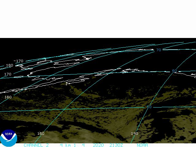
This looks severe. With the latest tornado watch i am afraid of tornadoes.
This low is bombing out it went from 1011 to 1009 now 1007 mb.
Olga's circulation is being accelerated eastbound and will make
landfall around fort myers or just north of there...Olga's circulation
will make landfall between sarasota and naples IMO looking
at the circulation. The circulation has contracted as convection,
baroclinically enhanced by the front, and further enhanced by the
high shear profiles induced by the jet stream, has intensified
significantly. Cloud tops of -70 C that is a powerful extratropical
storm.
This squall line may produce a derecho with very strong 30-60+ mph winds
and buoys in the GOM according to Fox 13 weather are reporting sustained
winds of 30-35 mph..
As the low continues to rapidly intensify, the winds will increase, and
the strongest cells will likely blast florida's west coast with 60-70 mph winds
and dangerous surf. The NATIONAL WEATHER SERVICE mentions 60 knot winds
possible with the squall- read the tornado watch.
As you can see, I have backed up my forecast with the analysis of atmospheric
parameters. This will be a rough night. "TORNADO WATCH" means get ready
for Old Olga's Circulation's Northeast Quadrant Convection, and the blasting
punch it will pack as it roars in tonight. This will NOT be as bad as the
March 1993 superstorm, but high winds gusting to hurricane force are
likely in the strongest storm cells. Florida prepare to get walloped.
I am afraid of tornadoes, so this is going to be a pretty scary night.
Pay attention to your weather radios folks.
Also I did a velocity scan analysis and found that large areas of 30+ mph
winds are occuring along the squall line. Go to http://www.srh.noaa.gov/tbw
click the radar, click the NW arrow on the left column to go to talahassee radar
and click velocity (base velocity) and you will see those strong winds. The
strongest cells on the velocity analysis appear to contain wind gusts of 50+ mph,
as denoted by the brighter red or brighter green colors pocketed within
the large section of convection.
Blown away is stating the facts. Look at the loop. Olga's center is accelerating ENE
and this is very clear. Zoom in on the circulation. The vector sum of the northward
motion established by the prefrontal trough and the eastward acceleration of the
prefrontal trough yield a vector heading of ENE. This has resulted, combined with
jet forcing, in a net acceleration on olga's remnants.
This low is bombing out it went from 1011 to 1009 now 1007 mb.
Olga's circulation is being accelerated eastbound and will make
landfall around fort myers or just north of there...Olga's circulation
will make landfall between sarasota and naples IMO looking
at the circulation. The circulation has contracted as convection,
baroclinically enhanced by the front, and further enhanced by the
high shear profiles induced by the jet stream, has intensified
significantly. Cloud tops of -70 C that is a powerful extratropical
storm.
This squall line may produce a derecho with very strong 30-60+ mph winds
and buoys in the GOM according to Fox 13 weather are reporting sustained
winds of 30-35 mph..
As the low continues to rapidly intensify, the winds will increase, and
the strongest cells will likely blast florida's west coast with 60-70 mph winds
and dangerous surf. The NATIONAL WEATHER SERVICE mentions 60 knot winds
possible with the squall- read the tornado watch.
As you can see, I have backed up my forecast with the analysis of atmospheric
parameters. This will be a rough night. "TORNADO WATCH" means get ready
for Old Olga's Circulation's Northeast Quadrant Convection, and the blasting
punch it will pack as it roars in tonight. This will NOT be as bad as the
March 1993 superstorm, but high winds gusting to hurricane force are
likely in the strongest storm cells. Florida prepare to get walloped.
I am afraid of tornadoes, so this is going to be a pretty scary night.
Pay attention to your weather radios folks.
Also I did a velocity scan analysis and found that large areas of 30+ mph
winds are occuring along the squall line. Go to http://www.srh.noaa.gov/tbw
click the radar, click the NW arrow on the left column to go to talahassee radar
and click velocity (base velocity) and you will see those strong winds. The
strongest cells on the velocity analysis appear to contain wind gusts of 50+ mph,
as denoted by the brighter red or brighter green colors pocketed within
the large section of convection.
Coredesat wrote:Blown_away wrote:I will, thanks. What's left of Olga's center looks to be moving more ENE and speeding up!
...wow. Just. Wow. I have no words for how I reacted when I saw that comment.
Blown away is stating the facts. Look at the loop. Olga's center is accelerating ENE
and this is very clear. Zoom in on the circulation. The vector sum of the northward
motion established by the prefrontal trough and the eastward acceleration of the
prefrontal trough yield a vector heading of ENE. This has resulted, combined with
jet forcing, in a net acceleration on olga's remnants.
Last edited by Tampa Bay Hurricane on Sat Dec 15, 2007 11:01 pm, edited 1 time in total.
0 likes
-
Coredesat
Re: GOM: Olga's remnants : Discussions & Images
Coredesat wrote:cpdaman wrote:yes there will be very heavy squalls possible as olga's remnants hit land
bet ya the effects will be worse than that named storm that hit the same area olga ghost is headed for
Olga's specatular death? i thought she was pronounced dead two days ago
Well, now the remnant low is dead. I meant to say ex-Olga.
The low is not dead...it is under the edge of the convection. You do not have a system structure that looks like that without low level support...a coma head with the highest convection near the remnant center not a trough....if it was only a trough you would see a line of heavy convectgion not a coma head
Last edited by drezee on Sat Dec 15, 2007 11:12 pm, edited 2 times in total.
0 likes
-
Tampa Bay Hurricane
- Category 5
- Posts: 5597
- Age: 38
- Joined: Fri Jul 22, 2005 7:54 pm
- Location: St. Petersburg, FL
Re:
Coredesat wrote:ex-Olga has no circulation and is no longer a closed low, it is a surface trough being absorbed into the front. I don't know why I waste my time with people I disagree with, really...
Yes it has no well defined circulation or closed low, but it still has sort of a remnant center...because
you see on the loop in the northeast quadrant the burst of new convection as enhanced by
baroclinic factors and shear.
0 likes
-
Blown Away
- S2K Supporter
- Posts: 10253
- Joined: Wed May 26, 2004 6:17 am
Re:
Coredesat wrote:ex-Olga has no circulation and is no longer a closed low, it is a surface trough being absorbed into the front. I don't know why I waste my time with people I disagree with, really...
Curious, what do think FL people are -removed- for here?? Olga remnants/low are merging with a front that will bring nasty weather to FL. Gusty winds, rain, and tornado's are possible for FL. Look at the satellite.
Last edited by Blown Away on Sun Dec 16, 2007 12:10 am, edited 1 time in total.
0 likes
-
Ed Mahmoud
Re: GOM: Olga's remnants : Discussions & Images
I'd say that Olga might have qualified as a tropical depression again when it was approaching the Cancun area.
But that was yesterday.
The remnants are certainly contributing to the big blow up, but there is no 'there' there, if that makes any sense. Looks like the heaviest rains are missing Northwest Georgia.
But that was yesterday.
The remnants are certainly contributing to the big blow up, but there is no 'there' there, if that makes any sense. Looks like the heaviest rains are missing Northwest Georgia.
0 likes

Re: GOM: Olga's remnants : Discussions & Images
I'm not -removed- but I think Olga circulation is still there and is embedded into the cold front. I think well get some rough weather out of this. Tampa Bay I do agree with you on this weather event. Maybe it will do the Lake O area some good.
0 likes
-
NcentralFlaguy
- Tropical Storm

- Posts: 136
- Joined: Sun Jun 17, 2007 9:36 am
Re: GOM: Olga's remnants : Discussions & Images
from the NWS JAX:
850 MB JET IS PROGGED TO INCREASE OVERNIGHT...WITH VALUES OF AROUND
50 KTS LIKELY. IN ADDITION...WARM AIR ADVECTION WILL CONTINUE FROM
THE S. WITH SIMILAR PATTERNS...STRONGEST STORMS WOULD LIKELY FOCUS
OVER THE SUWANNEE VALLEY AND PERHAPS EXTREME S ZONES OVERNIGHT.
HOWEVER...AM CONCERNED THAT THE REMNANT OLGA CIRCULATION WHICH STILL
SHOWS UP QUITE PROMINENTLY ON SAT PIX WILL BOTH AID CONVERGENCE
ALONG THE PRE-FRONTAL TROF THAT IS ABSORBING IT...AS WELL AS BACK
WINDS TO MORE S OR EVEN SSE DIRECTION AHEAD OF THE SQUALL LINE.
ALTHO THE GREATEST IMPACT FROM THIS SCENARIO WILL LIKELY AFFECT THE
W COAST OF CENTRAL FL...THE 18Z NAM DRAGS AN IMPRESSIVE AREA OF
DIFFERENTIAL POSITIVE VORTICITY ADVECTION ACROSS NE FL AND EXTREME
SE GA AROUND 09Z TONIGHT...WHICH IS COINCIDENT WITH STRONGEST
LOW-LEVEL JET. AS A RESULT...MAY SEE THE SQUALL LINE INTENSIFY OVER
THE AREA LATER TONIGHT. WILL ALSO CONTINUE TO MONITOR ANY ISOLD FAST
MOVING CONVECTION FROM THE S.
0 likes
-
Tampa Bay Hurricane
- Category 5
- Posts: 5597
- Age: 38
- Joined: Fri Jul 22, 2005 7:54 pm
- Location: St. Petersburg, FL


Who is online
Users browsing this forum: No registered users and 21 guests