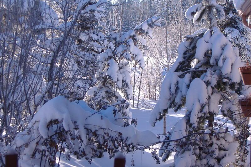
Still have 16" of snow on the ground, temps this past week have BARELY climbed above 32° and now.....
This system is going to verify, along with a possibility of SNOW on CHRISTMAS!! Should the Christmas snow verify, this will be the FIRST snow on Christmas Day since 1992
http://www.wrh.noaa.gov/fgz
THE SNOW LEVEL WILL START AT
ABOUT 7000 FEET EARLY THIS EVENING BUT LOWER THROUGH THE NIGHT WITH
SNOW LEVELS IN THE 3500-4000 FOOT RANGE BY FRIDAY MORNING ACROSS
WESTERN ARIZONA AND AROUND 6000 FEET ACROSS THE EAST CENTRAL
MOUNTAINS. SNOW TOTALS OF 2 TO 5 INCHES ACROSS THE MOGOLLON RIM WILL
BE POSSIBLE TONIGHT INTO EARLY FRIDAY WITH A SNOW ADVISORY A
POSSIBILITY.
ON FRIDAY...EXPECT SHOWERY CONDITIONS TO CONTINUE BUT GRADUALLY
ENDING FROM WEST TO EAST DURING THE AFTERNOON AND EVENING. IT SHOULD
BE MUCH COLDER WITH HIGH TEMPERATURES IN THE UPPER 20S TO MID 30S
ACROSS THE HIGHER TERRAIN LOCATIONS....MAINLY IN THE 40S AT
ELEVATIONS BELOW 6000 FEET. BREEZY CONDITIONS WILL CONTINUE.
FOR SATURDAY AND BEYOND...SATURDAY SHOULD BE DRY AND COLD BUT BEYOND
SATURDAY...UNSETTLED CONDITIONS WILL LIKELY CONTINUE. AT THE VERY LEAST
THERE WILL BE PERIODS OF STRONGER WINDS...INCREASED CLOUDS AND BELOW
NORMAL TEMPERATURES. MODEL SOLUTIONS CONTINUE TO SUGGEST A FEW OF
THESE DISTURBANCES WILL BRING PRECIPITATION...PRIMARILY IN THE FORM
OF SNOW.
More snow and SNOW on CHRISTMAS DAY!
Moderator: S2k Moderators
Forum rules
 The posts in this forum are NOT official forecast and should not be used as such. They are just the opinion of the poster and may or may not be backed by sound meteorological data. They are NOT endorsed by any professional institution or STORM2K.

The posts in this forum are NOT official forecast and should not be used as such. They are just the opinion of the poster and may or may not be backed by sound meteorological data. They are NOT endorsed by any professional institution or STORM2K.
-
azsnowman

- Category 5

- Posts: 8591
- Joined: Wed Feb 05, 2003 8:56 pm
- Location: Pinetop Arizona. Elevation 7102' (54 miles west of NM border)
http://www.wrh.noaa.gov/fgz
Tonight: A chance of rain showers, mainly after 11pm. Mostly cloudy, with a low around 31. South southwest wind between 13 and 15 mph, with gusts as high as 22 mph. Chance of precipitation is 30%.
Friday: Snow showers likely, mainly after 11am. Cloudy, with a temperature falling to around 29 by 5pm. South southwest wind 8 to 14 mph becoming west northwest. Winds could gust as high as 18 mph. Chance of precipitation is 70%. New snow accumulation of 1 to 2 inches possible.
Friday Night: A 40 percent chance of snow showers. Mostly cloudy, with a low around 16. West northwest wind between 5 and 8 mph becoming calm.
Saturday: Sunny, with a high near 32. Northeast wind between 6 and 9 mph.
Saturday Night: Partly cloudy, with a low around 16.
Sunday: Mostly sunny, with a high near 40.
Sunday Night: A slight chance of snow showers. Partly cloudy, with a low around 22.
Monday: Mostly sunny, with a high near 38.
Monday Night: A slight chance of snow showers. Mostly cloudy, with a low around 25.
Christmas Day: A chance of snow showers. Partly sunny, with a high near 37.
Tuesday Night: A slight chance of snow showers. Mostly cloudy, with a low around 24.
0 likes
-
azsnowman
- Category 5
- Posts: 8591
- Joined: Wed Feb 05, 2003 8:56 pm
- Location: Pinetop Arizona. Elevation 7102' (54 miles west of NM border)
Guess this system is starting to dig deeper west than originally thought and now NWS is not commiting to a snowfall total...could see 1-6", 3-7" but who knows...I've seen this before and I've woken up to 2 FEET of snow over night!! LET'S HOPE SO! But the TEMPS with a BLUE NORTH WIND...
Needless to say, "Ye Ole Brass Monkey" has it's wool jockey shorts on

Needless to say, "Ye Ole Brass Monkey" has it's wool jockey shorts on
0 likes
-
Scott Patterson
- Category 2

- Posts: 796
- Age: 51
- Joined: Wed Mar 22, 2006 6:52 pm
- Location: Near Craig Colorado
- Contact:
Re: More snow and SNOW on CHRISTMAS DAY!
Dang and I have to drive to AZ tomorrow. The weather looks bad (for driving) here too.
http://forecast.weather.gov/MapClick.ph ... 107.55&e=1
http://forecast.weather.gov/showsigwx.p ... er+Outlook
Looks like continuous snow all the way from here to AZ with 600 miles on mostly rural highways.
Eek. I hope it hurries up and snows before we have to leave and then clears up. Probably won't happen and it will be a nasty drive.
Anyway, I hope you enjoy your white Christmas, but AZ just had to snow when we're coming.
We're coming to escape the snow and cold, but we'll have to hike to the bottom of the Grand Canyon to escape it.
0 likes
-
azsnowman
- Category 5
- Posts: 8591
- Joined: Wed Feb 05, 2003 8:56 pm
- Location: Pinetop Arizona. Elevation 7102' (54 miles west of NM border)
If this current pattern continues and it appears it will....this December will go down in the books with the most consistent days below normal in over 40 yrs! I have averaged 16-22° below normal for the past 2.5 weeks with the best snowpack since 1996!
Another system comes in tonight with 5" expected which will bring the Dec. snowfall total to 39", that's 26" above normal! Could this be the end of the 13 yr. drought?
Another system comes in tonight with 5" expected which will bring the Dec. snowfall total to 39", that's 26" above normal! Could this be the end of the 13 yr. drought?
0 likes
-
azsnowman
- Category 5
- Posts: 8591
- Joined: Wed Feb 05, 2003 8:56 pm
- Location: Pinetop Arizona. Elevation 7102' (54 miles west of NM border)
Here we go!
http://www.wrh.noaa.gov/fgz
THE SNOW LEVEL WILL START AT
ABOUT 7000 FEET EARLY THIS EVENING BUT LOWER THROUGH THE NIGHT WITH
SNOW LEVELS IN THE 3500-4000 FOOT RANGE BY FRIDAY MORNING ACROSS
WESTERN ARIZONA AND AROUND 6000 FEET ACROSS THE EAST CENTRAL
MOUNTAINS. SNOW TOTALS OF 2 TO 5 INCHES ACROSS THE MOGOLLON RIM WILL
BE POSSIBLE TONIGHT INTO EARLY FRIDAY WITH A SNOW ADVISORY A
POSSIBILITY.
0 likes
-
vbhoutex

- Storm2k Executive

- Posts: 29151
- Age: 74
- Joined: Wed Oct 09, 2002 11:31 pm
- Location: Cypress, TX
- Contact:
Re:
azsnowman wrote:If this current pattern continues and it appears it will....this December will go down in the books with the most consistent days below normal in over 40 yrs! I have averaged 16-22° below normal for the past 2.5 weeks with the best snowpack since 1996!
Another system comes in tonight with 5" expected which will bring the Dec. snowfall total to 39", that's 26" above normal! Could this be the end of the 13 yr. drought?
WE SURE HOPE SO!!! It is about time you guys get a break from the drought!!!!
0 likes
-
azsnowman
- Category 5
- Posts: 8591
- Joined: Wed Feb 05, 2003 8:56 pm
- Location: Pinetop Arizona. Elevation 7102' (54 miles west of NM border)
Re: Re:
vbhoutex wrote:azsnowman wrote:If this current pattern continues and it appears it will....this December will go down in the books with the most consistent days below normal in over 40 yrs! I have averaged 16-22° below normal for the past 2.5 weeks with the best snowpack since 1996!
Another system comes in tonight with 5" expected which will bring the Dec. snowfall total to 39", that's 26" above normal! Could this be the end of the 13 yr. drought?
WE SURE HOPE SO!!! It is about time you guys get a break from the drought!!!!
I hope so too Brother! It's been SO long since we've had *normal* conditions, it's odd!
With us being 13 years in the rears with precip, it's going to take years to make up the deficet, if ever! But at least this is a DARN good start
0 likes
-
Scott Patterson
- Category 2
- Posts: 796
- Age: 51
- Joined: Wed Mar 22, 2006 6:52 pm
- Location: Near Craig Colorado
- Contact:
Re: More snow and SNOW on CHRISTMAS DAY!
Hey Scott...GOOD LUCK Brother!
I just got SLAMMED and I DO mean SLAMMED!!! Received over 4" of snow in, are you ready?
Weather at the Grand Canyon was nice if a bit colder than usual. We came to get out of the cold, but when we left on our hike it was 1F. Even in the bottom of the Canyon, Indian Gardens was 17 and Phantom Ranch in the upper 20's! Still pleasant in the day. The kids had a good time.
Anyway we just got home and have a really white Christmas (there's always a white Christmas here). Here's our forecast:
http://forecast.weather.gov/MapClick.ph ... 107.55&e=1
Tonight: Snow likely. Cloudy, with a low around -5. Wind chill values as low as -20. Southwest wind 5 to 10 mph becoming north northwest. Chance of precipitation is 60%. Total nighttime snow accumulation of 1 to 2 inches possible.
Thursday: Snow likely, mainly before 11am. Mostly cloudy, with a high near 11. Wind chill values as low as -20. North northwest wind between 10 and 15 mph. Chance of precipitation is 60%. New snow accumulation of around an inch possible.
Thursday Night: Mostly cloudy, with a low around -15. Wind chill values as low as -30. North northwest wind 5 to 10 mph becoming south southwest.
Friday: A 50 percent chance of snow, mainly after 11am. Mostly cloudy and cold, with a high near 10. Wind chill values as low as -25. South southwest wind between 5 and 15 mph. New snow accumulation of less than one inch possible.
Friday Night: A 40 percent chance of snow. Mostly cloudy, with a low around -7. West southwest wind between 5 and 10 mph.
We've ready to head back to Arizona! Should have stayed a few more days. The Grand Canyon is always spectacular no matter the weather.
0 likes
-
azsnowman
- Category 5
- Posts: 8591
- Joined: Wed Feb 05, 2003 8:56 pm
- Location: Pinetop Arizona. Elevation 7102' (54 miles west of NM border)
WoooHoooo....hit a high of 21.2° just a few seconds ago and the sun has gone behind the trees (I'm down in a valley here) and the temp is starting to drop like a rock! NWS has a low of -1° to 5 above forecast for tonight, so that means I'll be at -4 to -6°F tonight....I swear, this has been, without a DOUBT, the COLDEST, WETTEST December in recent memory....anyone good any wood for sale
0 likes

-
azsnowman
- Category 5
- Posts: 8591
- Joined: Wed Feb 05, 2003 8:56 pm
- Location: Pinetop Arizona. Elevation 7102' (54 miles west of NM border)
HA....I've already hit the forecast LOW for tomorrow MORNING
http://www.wrh.noaa.gov/fgz
Tonight: Partly cloudy, with a low around 9. Wind chill values between -2 and 3. North northwest wind at 10 mph becoming east northeast. Winds could gust as high as 22 mph.
Friday: A 10 percent chance of snow showers after 11am. Partly cloudy, with a high near 32. Wind chill values between -3 and 7. East northeast wind 5 to 8 mph becoming southwest. Winds could gust as high as 20 mph.
Friday Night: A 20 percent chance of snow showers. Partly cloudy, with a low around 11. South southwest wind between 5 and 8 mph, with gusts as high as 20 mph.
Saturday: A 10 percent chance of snow showers. Partly cloudy, with a high near 37. Wind chill values between zero and 10. Southwest wind between 7 and 11 mph, with gusts as high as 23 mph.
NORTHERN ARIZONA WILL BE PLAGUED BY SEVERAL WEAK WEATHER SYSTEMS PASSING THROUGH ON FRIDAY AND INTO THE WEEKEND. THIS WILL KEEP AFTERNOON TEMPERATURES ON THE COOL SIDE WITH BREEZY CONDITIONS AND PARTLY TO MOSTLY CLOUDY SKIES. HAVE KEPT THE LOW POPS IN FOR THIS TIMEFRAME. BY SUNDAY AND MONDAY A RIDGE DEVELOPS OVER THE REGION. HOWEVER...STRONG SURFACE HIGH PRESSURE OVER COLORADO WILL ALLOW FOR A NORTHEASTERLY FLOW REGIME OVER THE FORECAST AREA...THUS KEEPING OUR TEMPERATURES ON THE COOL SIDE.
0 likes
Who is online
Users browsing this forum: No registered users and 102 guests