Mackay has already been declared a disaster area.
SW Pacific Ocean: Invest 91P
Moderator: S2k Moderators
-
Coredesat
TROPICAL CYCLONE OUTLOOK
for the Coral Sea West of Longitude 160 East
Issued at 2:59pm on Saturday the 16th of February 2008
A weak low near Townsville is embedded within an active monsoon trough. The low
is expected to move slowly east away from the Burdekin coast during Sunday and
then turn ESE during the following few days and slowly intensify as it moves
into the Coral Sea. The low is expected to be near 19S 150E Monday night and 20S
155E on Tuesday night.
The likelihood for Tropical cyclone development for the next few days are:
Sunday - Low
Monday - Low
Tuesday - Moderate
0 likes
- HURAKAN
- Professional-Met

- Posts: 46086
- Age: 38
- Joined: Thu May 20, 2004 4:34 pm
- Location: Key West, FL
- Contact:
Australian Government Bureau of Meteorology
Queensland
Tropical Cyclone Warning Centre
Media: This message is issued daily for the information of interested parties.
Media are NOT required to broadcast this message.
TROPICAL CYCLONE OUTLOOK
for the Coral Sea West of Longitude 160 East
Issued at 2:39pm on Monday the 18th of February 2008
An active monsoon trough extends across the Coral Sea roughly from Cardwell to
New Caledonia. There are two main lows embedded within this trough. The first is
located about 120 km northeast of Townsville and near stationary. This system is
expected to move slowly northeast away from the coast and is unlikely to deepen
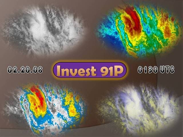
significantly.
A second low located further southeast along the trough, about 450 km east of
Mackay, is forecast to deepen while moving south as it interacts with an upper
trough on Tuesday. This system has a low probability of developing into a
tropical cyclone within the outlook period.
The likelihood for tropical cyclone development during the next few days is:
Tuesday - Low
Wednesday - Low
Thursday - Low
Tropical Cyclone outlooks issued by Brisbane can be accessed through the
Bureau's Home Page http://www.bom.gov.au.
Please note that the Darwin Regional Forecasting Centre issues Tropical
Cyclone Outlooks that cover the Gulf of Carpentaria. See
http:/www.bom.gov.au/weather/nt/cyclone/ or to subscribe to this service
call Darwin 08 8920 3820.
0 likes
- Tampa_God
- Category 1

- Posts: 333
- Age: 35
- Joined: Wed May 31, 2006 7:27 pm
- Location: New Port Richey/Trinity, FL
Re: Queensland Australia: Invest 91P
Yeah, it doesn't look like anything is gonna form from these two, they both seem to be getting ripped apart by the time they get a burst of convention.
Now, I know this is off topic, but is there anything on the convention West of Darwin? It has a great deal of convention to it, I just can't see if there is a circulation to it.
0 likes
Re: Queensland Australia: Invest 91P
Tampa_God wrote:Yeah, it doesn't look like anything is gonna form from these two, they both seem to be getting ripped apart by the time they get a burst of convention.
Now, I know this is off topic, but is there anything on the convention West of Darwin? It has a great deal of convention to it, I just can't see if there is a circulation to it.
IDW10800
Australian Government Bureau of Meteorology
Western Australia
TROPICAL CYCLONE OUTLOOK FOR NORTHWESTERN AUSTRALIA
Issued at 2:16pm WDT on Tuesday the 19th of February 2008
For the area south of LATITUDE 10 SOUTH between LONGITUDES 110 - 125 EAST
A Cyclone Advice is current for Tropical Cyclone Nicholas, located at 2pm off
the North West Cape, please refer to latest advice. No other significant
tropical low are expected to develop in the next three days however a slow
moving low over the Top End of the Northern Territory may drift into the Timor
Sea by Friday and then approach 125E.
The likelihood of a tropical cyclone occurring in the region in the next three
days.
Wednesday : High
Thursday : Moderate
Friday : Low
** NOTE: Development potential is an estimate of the probability of **
** tropical cyclone development within a 24 hour period. **
** LOW = 10% or less MODERATE = 20-40% HIGH = 50% or more **
0 likes
On 91P:
THE AREA OF CONVECTION PREVIOUSLY LOCATED NEAR 18.3S
150.0E, IS NOW LOCATED NEAR 18.5S 150.4E, APPROXIMATELY 280 NM EAST-
SOUTHEAST OF CAIRNS, AUSTRALIA. RECENT METSAT IMAGERY AND A 190831Z
SSMI MICROWAVE IMAGE INDICATE A NEWLY DEVELOPED CENTRAL DENSE
OVERCAST FEATURE ASSOCIATE WITH AN ASYMMETRICAL LOW LEVEL
CIRCULATION CENTER. THE DISTURBANCE IS CURRENTLY UNDER WEAK TO
MODERATE VERTICAL WIND SHEAR AND IS EXPECTED TO TRACK ALONG THE
MONSOON TROUGH TO SOUTHEAST. MAXIMUM SUSTAINED SURFACE WINDS ARE
ESTIMATED AT 20 TO 25 KNOTS. MINIMUM SEA LEVEL PRESSURE IS ESTIMATED
TO BE NEAR 1000 MB. THE POTENTIAL FOR THE DEVELOPMENT OF A
SIGNIFICANT TROPICAL CYCLONE WITHIN THE NEXT 24 HOURS IS UPGRADED TO
FAIR.
One gets the feeling Brisbane disagrees, though:
SITUATION
At 190900 UTC.
Monsoon trough from 15S 145E to first low 1000 hPa near 18S 152E then to second
low 995 hPa near 24S 157E then to 26S160E.
The first low will weaken during the next 12 hours and is expected to be near
21S156E at 200000UTC.
0 likes
-
Squarethecircle
- Category 5

- Posts: 2165
- Joined: Fri Oct 19, 2007 4:00 pm
- Location: Fairfax, VA
-
Coredesat
This has had a TCFA out for it for a while now.
(1) THE AREA OF CONVECTION PREVIOUSLY LOCATED NEAR 19.5S
155.0E, IS NOW LOCATED NEAR 21.1S 157.2E, APPROXIMATELY 450 NM
NORTH-NORTHEAST OF BRISBANE, AUSTRALIA. PREVIOUS ANIMATED MULTI-
SPECTRAL IMAGERY AND A 191944Z SSMI MICROWAVE IMAGE SHOW IMPROVED
CONSOLIDATION OF THE LOW LEVEL CIRCULATION CENTER (LLCC) OVER THE
PAST 18 HOURS WITH DEEP CONVECTIVE BANDING WRAPPING INTO THE LLCC.
UPPER-LEVEL ANALYSIS INDICATES THAT THE LLCC IS LOCATED WITHIN A
FAVORABLE ENVIRONMENT, UNDER THE RIDGE AXIS, WITH WEAK TO MODERATE
VERTICAL WIND SHEAR AND GOOD DIFFLUENCE ALOFT. ANIMATED WATER
VAPOR IMAGERY SHOWS GOOD OUTFLOW ENHANCED BY A BROAD MIDLATITUDE
TROUGH OVER EASTERN AUSTRALIA. MAXIMUM SUSTAINED SURFACE WINDS
ARE ESTIMATED AT 25 TO 30 KNOTS. MINIMUM SEA LEVEL PRESSURE IS
ESTIMATED TO BE NEAR 1000 MB. SEE REF A (WTPS21 PGTW 200000) FOR
FURTHER DETAILS. THE POTENTIAL FOR THE DEVELOPMENT OF A SIGNIFICANT
TROPICAL CYCLONE WITHIN THE NEXT 24 HOURS REMAINS GOOD.
0 likes
-
Squarethecircle
- Category 5

- Posts: 2165
- Joined: Fri Oct 19, 2007 4:00 pm
- Location: Fairfax, VA
It appears Brisbane made the right call when it forecast no intensification.
THE AREA OF CONVECTION PREVIOUSLY LOCATED NEAR
21.1S 157.2E IS NOW LOCATED NEAR 25.7S 162.7E, APPROXIMATELY
535 NM EAST OF BRISBANE, AUSTRALIA. RECENT ANIMATED INFRARED
AND WATER VAPOR IMAGERY DEPICT WEAK CONVECTION SHEARED TO THE
EAST BY MODERATE VERTICAL WIND SHEAR. UPPER LEVEL ANALYSIS
DEPICTS A DEEPENING TROUGH TO THE WEST OF THIS DISTURBANCE,
WHICH HAS LIMITED ANY FURTHER DEVELOPMENT. THE DISTURBANCE IS
BEGINNING TO INTERACT WITH THE BAROCLINIC ZONE AND IS TRACKING
RAPIDLY TO THE SOUTHEAST. MAXIMUM SUSTAINED WINDS ARE ESTIMATED
AT 20 TO 25 KNOTS. MINIMUM SEA LEVEL PRESSURE IS ESTIMATED TO
BE NEAR 1002 MB. SEE REF A (WTPS21 PGTW 201430) FOR FURTHER
DETAILS. DUE TO THE DECREASE IN ORGANIZATION AND INCREASING
INTERACTION WITH THE MIDLATITUDE FLOW, THE POTENTIAL FOR THE
DEVELOPMENT OF A SIGNIFICANT TROPICAL CYCLONE WITHIN THE NEXT
24 HOURS IS DOWNGRADED TO POOR.
0 likes
Who is online
Users browsing this forum: No registered users and 37 guests


