Australian Government Bureau of Meteorology
Queensland
Tropical Cyclone Warning Centre
Media: This message is issued daily for the information of interested parties.
Media are NOT required to broadcast this message.
TROPICAL CYCLONE OUTLOOK
for the Coral Sea West of Longitude 160 East
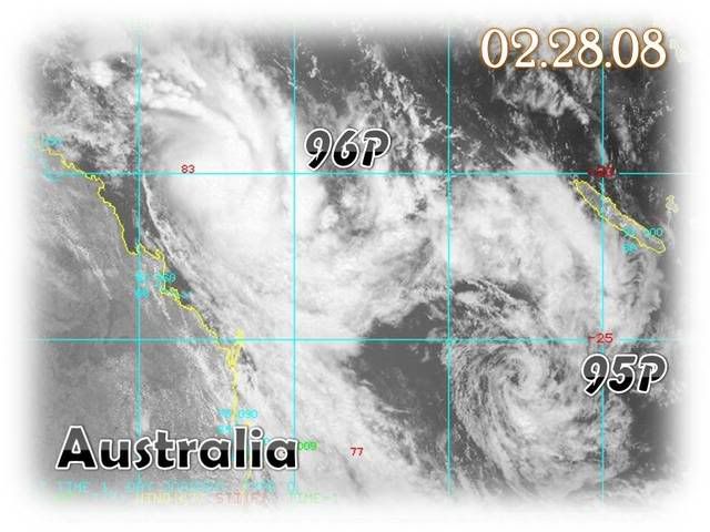
Issued at 2:30pm on Wednesday the 27th of February 2008
A small low is situated off the North Tropical Coast about 210 km east of
Innisfail. This low will remain near stationary until Thursday morning, when it
should adopt a southeasterly track, parallel to the coast to be about 200 to 300
km off the Central Coast on Friday. Interaction with an approaching upper level
trough may lead to a strengthening of the low as it begins to move to the
southeast, however the system has a low probability of developing into a
tropical cyclone.
A second tropical low situated on the monsoon trough near 17S 160E. This low is
expected to move in a southerly direction to be roughly near 25S 160E by Friday.
This system will gradually intensify as it moves south but is not expected to
develop into a tropical cyclone within the next three days.
Tropical Cyclone outlooks issued by Brisbane can be accessed through the
Bureau's Home Page http://www.bom.gov.au.
Please note that the Darwin Regional Forecasting Centre issues Tropical
Cyclone Outlooks that cover the Gulf of Carpentaria. See
http:/www.bom.gov.au/weather/nt/cyclone/ or to subscribe to this service
call Darwin 08 8920 3820.