2008 Severe Weather Thread
Moderator: S2k Moderators
Forum rules

The posts in this forum are NOT official forecast and should not be used as such. They are just the opinion of the poster and may or may not be backed by sound meteorological data. They are NOT endorsed by any professional institution or STORM2K.

-
Ed Mahmoud
Re: 2008 SVR WX Thread: SVR PSBL Sun/Mon/Tue
0Z GFS seems to suggest most precip is along and behind the front in SE Texas, which would minimize the severe threat here.

If, and this is a strong if, the 0Z GFS is correct, and the storms are post-frontal, than marginally severe hail would be the main threat, and this would be a lower end severe weather threat.
6Z GFS is similar in showing most-precip being post-frontal, but does suggests some happy winter weather rather far South for March in places like Arkansas and Mississippi.
And if I lived in, say, Tupelo, MS, I'd much rather see snow and sleet than tornadoes.
0 likes
-
Ed Mahmoud
Re: 2008 SVR WX Thread: SVR PSBL Sun/Mon/Tue
12Z Canadian shows severe weather Tuesday, Alabama, Southern Georgia and Florida Panhandle. Storms ahead of the cold front suggests some tornado potential.
I don't see a suggestion of a big tornado outbreak anywhere on the 12Z GFS
Except, maybe Tuesday, along the warm front, East of the surface low. Otherwise, just the 'run of the mill' squall line, which can produce scattered severe weather incidents, but isn't the real threat to cause mass casualties or property damage.
0 likes
-
Brent
- S2K Supporter

- Posts: 38735
- Age: 37
- Joined: Sun May 16, 2004 10:30 pm
- Location: Tulsa Oklahoma
- Contact:
Re: 2008 Severe Weather thread
wbug1 wrote::uarrow:
Hi Brent,
I did notice a 65 dbz echo on the thunderstorm that was in a line directly west from downtown Atlanta, I was watching the peachtree radar during the time the one strong ts cell moved through just west of carrollton to after it moved through Atlanta. The thunderstorm line weakened somewhat just as it passed near carrollton and the 65 dbz echo was replaced with 60 dbz max. There was also hi shear, with a sharp dilineation green to red transition ( high velocity red to high velocity green, velocity base on the radar) as the line approached Carrollton, the line weakened considerably approaching Atlanta (fortunately for Atlanta).
As the line passed Carrollton, I lost the radar.
I never saw any hook in the velocity and base radar images, but high shear was present, est at least 150-170 knots.
I drove through the area today and it was very unreal. I've never seen damage from anything over an F1 on the old scale in person, so this was quite a shock. A well-built house was completely destroyed and debris swept into the woods and many others heavily damaged. It was very freaky to look at. I'm really surprised no one was killed considering A. The extent of the damage, B. The fact it struck at 5:55am, and C. The fact there was no tornado warning.
It would have been much worse had it continued another few miles, where Carrollton is which is a moderately-sized city.
Some pictures here(I was going to take some but there were people all over the place and media crews in front of the worst-damaged house)
http://www.srh.noaa.gov/ffc/html/torfotos22608.shtml
The NWS confirmed elsewhere a wide swath of 80-100 mph winds. I saw trees and roofs damaged all over the place outside of the tornado track. We got very lucky down here, just 30 miles from the wind damage swath and the tornado.
0 likes
-
wbug1
Re: 2008 SVR WX Thread: SVR PSBL Sun/Mon/Tue
That house was obliterated. Fortunately that thing didn't last long, and was in a narrow swath.
Ed Mahmoud wrote:12Z Canadian shows severe weather Tuesday, Alabama, Southern Georgia and Florida Panhandle. Storms ahead of the cold front suggests some tornado potential.
I don't see a suggestion of a big tornado outbreak anywhere on the 12Z GFS
Except, maybe Tuesday, along the warm front, East of the surface low. Otherwise, just the 'run of the mill' squall line, which can produce scattered severe weather incidents, but isn't the real threat to cause mass casualties or property damage.
I looked at the GFS: 130-150 kt 300 mbar, 60-70 kt 850 mbar, 70-80 kt 700 mbar, low sitting in N Georgia with associated precipitation most intense on or near March 4th, 6 am UTC. The precipitation, high 300 mbar, 700 mbar, and 850 mbar winds area do all overlap.
Looks set to most affect southeast Lousiana, Alabama, Mississipi, Georgia, NW Florida if that GFS model run comes true. The GFS increased 300 mbar speed noticeably during the time I was looking at it. Do the other models not look as far ahead as GFS?
0 likes
-
PurdueWx80
- Professional-Met

- Posts: 2720
- Joined: Fri Aug 13, 2004 8:33 pm
- Location: Madison, WI
- Contact:
Re: 2008 SVR WX Thread: SVR PSBL Sun/Mon/Tue
the JMA (japanese global model) has a starkly different forecast from the rest of the global models. i bring this up, because it's track has been relatively similar over the last 3 days (unlike the rest of 'em). also, it absolutely NAILED a similar storm we had up here a couple of weekends ago (freezing rain, rain and heavy snow here while the rest of the models played catchup up until the storm hit). it's also interesting to note the other globals are trending toward it's solution, and some of the ensemble members even mimic it. also, this has been the preferred storm track for much of the winter.
because of this, i have to believe a synoptic solution similar to the 12z JMA is most reasonable.

that would mean a 2-3 day event would start monday in the central/southern plains. tuesday's would stretch from the great lakes to the gulf coast (and probably would be the most widespread event - not dissimilar to what happened feb. 5th). wednesday there could still be some action on the east coast, though the storm is in a weakening phase and the jets are weakening.
i can't wait to see what happens, because here in madison the difference is drastic. the JMA gives us 2+" of rain, while most of the rest of the models/ensembles suggest either snow or nothing at all. 2" of rain would mean horrific flooding in the upper midwest (both smaller scale and bigger, such as on the mississippi river) because of the deep snow cover and ice-clogged waterways. and more snow, well, we don't really need more of that, but it would help put us closer to 100" for the winter (our average is ~44").
either way you dice it, a large part of the eastern half of the country will be affected by nasty weather yet again early next week.
because of this, i have to believe a synoptic solution similar to the 12z JMA is most reasonable.
that would mean a 2-3 day event would start monday in the central/southern plains. tuesday's would stretch from the great lakes to the gulf coast (and probably would be the most widespread event - not dissimilar to what happened feb. 5th). wednesday there could still be some action on the east coast, though the storm is in a weakening phase and the jets are weakening.
i can't wait to see what happens, because here in madison the difference is drastic. the JMA gives us 2+" of rain, while most of the rest of the models/ensembles suggest either snow or nothing at all. 2" of rain would mean horrific flooding in the upper midwest (both smaller scale and bigger, such as on the mississippi river) because of the deep snow cover and ice-clogged waterways. and more snow, well, we don't really need more of that, but it would help put us closer to 100" for the winter (our average is ~44").
either way you dice it, a large part of the eastern half of the country will be affected by nasty weather yet again early next week.
Last edited by PurdueWx80 on Thu Feb 28, 2008 6:41 pm, edited 1 time in total.
0 likes
-
JonathanBelles
- Professional-Met
- Posts: 11430
- Age: 35
- Joined: Sat Dec 24, 2005 9:00 pm
- Location: School: Florida State University (Tallahassee, FL) Home: St. Petersburg, Florida
- Contact:
-
PurdueWx80
- Professional-Met
- Posts: 2720
- Joined: Fri Aug 13, 2004 8:33 pm
- Location: Madison, WI
- Contact:
Re:
fact789 wrote:These words open my eyes: "not dissimilar to what happened in january"
If that were to occur, I would be shocked and stunned. It would be awesome for that to occur. I'll be watching this system.
actually, i meant early february. sorry. the northern extent of the ~tuesday outbreak may mimic the early january one (which came into the great lakes). but what i meant is that the tuesday event could be as widespread as what happened on feb. 5th.
0 likes
Re: 2008 SVR WX Thread: SVR PSBL Sun/Mon/Tue
PurdueWx80 wrote:and more snow, well, we don't really need more of that, but it would help put us closer to 100" for the winter (our average is ~44").
Feel free to send any winter storms west. MPX hasn't had a 2" snowfall since Christmas day (which may be broken today).
0 likes
-
jaxfladude
- Category 5

- Posts: 1249
- Joined: Wed Aug 24, 2005 9:36 pm
- Location: Jacksonville, Fla
Re: 2008 SVR WX Thread: SVR PSBL Sun/Mon/Tue
So what does the forecast say, for now, about the Jacksonville, Florida area for some nasty weather next week...?
0 likes
-
HarlequinBoy

- Category 5
- Posts: 1400
- Age: 35
- Joined: Wed Nov 29, 2006 1:57 am
- Location: Memphis
Memphs doesn't mention any severe potential yet..
LONG TERM...(MONDAY THROUGH THURSDAY)...LONG RANGE MODELS
(ECMWF/GFS) INDICATE A CLOSED UPPER LEVEL LOW WILL DEVELOP AT THE
BASE OF THE UPPER LEVEL TROUGH ACROSS THE REGION MONDAY INTO
TUESDAY. AS THE UPPER LEVEL LOW MOVES ACROSS THE LOWER MISSISSIPPI
VALLEY MODEL PARTIAL THICKNESSES AND MODEL SOUNDINGS INDICATE THE
POTENTIAL FOR WINTER PRECIPITATION ACROSS PORTIONS OF THE MID
SOUTH...ESPECIALLY NORTH OF I-40 MONDAY NIGHT INTO TUESDAY. ITS
STILL TO EARLY TO ASSESS POTENTIAL PRECIPITATION TYPES AND
AMOUNTS...BUT STAY TUNED TO LATER FORECASTS. HIGH PRESSURE WILL
RETURN TUESDAY NIGHT AND WEDNESDAY WITH ANOTHER COLD FRONT MOVING
THROUGH THE REGION WEDNESDAY NIGHT INTO THURSDAY.
0 likes
-
wbug1
Re: 2008 SVR WX Thread: SVR PSBL Sun/Mon/Tue
PurdueWx80 wrote:the JMA (japanese global model) has a starkly different forecast from the rest of the global models. i bring this up, because it's track has been relatively similar over the last 3 days (unlike the rest of 'em). also, it absolutely NAILED a similar storm we had up here a couple of weekends ago (freezing rain, rain and heavy snow here while the rest of the models played catchup up until the storm hit). it's also interesting to note the other globals are trending toward it's solution, and some of the ensemble members even mimic it. also, this has been the preferred storm track for much of the winter.
The JMA/AVN show high vorticity values moving in along with the other factors mentioned already. The high vorticity area (500 mbar, March 3rd, 12z) will be in mid to north Texas and extend from south Al and E TX to the south end of Indiana/Illinois/Ohio according to AVN on March 4th 12Z , so if JMA/AVN is right states north of the south states could also get hit by tornados. GFS show much smaller areas of precip while JMA/AVN show a very large area. This is probably why SPC expanded the day 5 convective watch yesterday.
AMATEUR ANALYSIS - models don't seem to show much happening in Texas, or am I reading them right?
0 likes
-
brunota2003

- S2K Supporter
- Posts: 9476
- Age: 35
- Joined: Sat Jul 30, 2005 9:56 pm
- Location: Stanton, KY...formerly Havelock, NC
- Contact:
Discussion from MHX (Newport, NC) NWS:
.LONG TERM /MONDAY THROUGH THURSDAY/...
MAIN STORY IN THE LONG TERM WILL BE THE DEVELOPING STRONG STORM
SYSTEM OVER THE LOWER MISS VALLEY MON/MON NIGHT MOVING NE ACROSS
THE AREA TUE/TUE NIGHT. THE GFS CONTINUES TO BE DEEPER AND FURTHER
EAST WITH THE UPPER LOW AS IT EJECTS NE ACROSS THE TENN VALLEY ON
TUE AND INTO THE NE STATES BY WED MORNING. HPC FAVORING A 50/50
BLEND BETWEEN THE TWO MODELS AND CURRENT FORECAST REFLECTS THIS
THINKING. S/SE RETURN FLOW DEVELOPS IN EARNEST MON/MON NIGHT AHEAD
OF THE DEEPENING SFC LOW WITH MIN TEMPS MON NIGHT LIKELY OCCURRING
EARLY WITH RISING TEMPS THROUGHOUT THE NIGHT. LIGHT SHOWERS WILL BE
POSSIBLE OVER THE AREA LATE MON NIGHT/TUE MORNING UNDER STRONG
WAA AND WILL KEEP SLIGHT CHANCE POPS THIS TIME FRAME. THIS SYSTEM
WILL NEED TO BE MONITORED CLOSELY THE NEXT FEW DAYS AS THE
POTENTIAL FOR SEVERE WEATHER WILL EXIST TUE/TUE EVENING. VERY
STRONG LOW/MID LEVEL SHEAR WILL BE PRESENT ACROSS THE AREA AS A
POWERFUL LLJ DEVELOPS BENEATH VERY STRONG DIFFLUENT MID/UPPER
LEVEL FLOW. STILL A LOT OF UNCERTAINTY WITH INSTABILITY THIS FAR
OUT AND CURRENT PARAMETERS ARE NOT IMPRESSIVE WITH WEAK MID LEVEL
LAPS RATES AND MINIMAL CAPE. THE POTENTIAL FOR SIGNIFICANT SEVERE
WEATHER WILL INCREASE OVER THE AREA IF A MORE UNSTABLE AIRMASS IS
ABLE TO DEVELOP. GIVEN UNCERTAINTY WITH TIMING ISSUES WILL KEEP
POPS IN THE CHANCE CATEGORY BOTH TUE/TUE NIGHT WITH THUNDER
CONFINED TO THE AFTERNOON/EVENING HOURS. HIGHS BOTH MON AND TUE
ABOVE NORMAL THEN COOLER TEMPS ON WED BEHIND DEPARTING SYSTEM.
SLIGHTLY WARMER THU WITH TEMPS NEAR SEASONAL VALUES.
0 likes
-
CrazyC83
- Professional-Met
- Posts: 34315
- Joined: Tue Mar 07, 2006 11:57 pm
- Location: Deep South, for the first time!
Re:
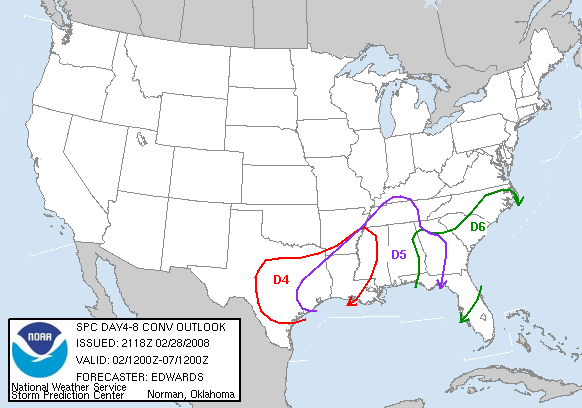
RL3AO wrote:Pretty colors.
Did you change them or did the SPC change them?
I agree the map should have different colors for each day to better show the areas for each day (especially when they overlap)...
0 likes
-
Ed Mahmoud
Re: 2008 SVR WX Thread: SVR PSBL Sun/Mon/Tue
New 12Z WRF shows precip developing ahead of the cold front in SE Texas, which increases the chance of tornadic storms, although the early hour means the lower atmosphere will be at its coolest/most stable (although, conversely, the low level jet should be near its maxima).
BTW, 850 mb freezing line passes DFW around 6 am, and about 0.25 inches (6 mm) of precip falls between 6 am and noon. Enough for a no-school day for the children of Dallas? ¿Quien Sabe?

Instability looks a little limited, but there is good shear, and pretty decent omega Monday morning, if the WRF is correct.

BTW, 850 mb freezing line passes DFW around 6 am, and about 0.25 inches (6 mm) of precip falls between 6 am and noon. Enough for a no-school day for the children of Dallas? ¿Quien Sabe?
Instability looks a little limited, but there is good shear, and pretty decent omega Monday morning, if the WRF is correct.
0 likes
-
flwxwatcher
- Category 4

- Posts: 926
- Joined: Wed May 16, 2007 3:35 pm
- Location: Central Florida
Re: 2008 SVR WX Thread: SVR PSBL Sun/Mon/Tue
This mornings Tampa AFD is starting to talk about possible rough weather Tuesday.
MONDAYS RIDGING...SURFACE AND ALOFT...WILL GIVE WAY TO A RATHER
STRONG TROUGH DIGGING INTO THE NORTHERN GULF COAST AREA LATE MONDAY
NIGHT AND TUESDAY. THIS DRIVES THE NEXT COLD FRONTAL BOUNDARY INTO
THE CENTRAL GULF BY TUESDAY MORNING...THEN ACROSS THE PENINSULA
DURING THE DAY. WHILE THE TIMING OF THE COLD FRONT AND IT`S
ASSOCIATED WEATHER MAY CHANGE FROM RUN TO RUN...WE ARE QUITE
CONFIDENT THAT A POTENT COLD FRONT WILL MOVE THROUGH IN THE FIRST
HALF OF THE WEEK AND COULD BRING A MULTITUDE OF HAZARDS INCLUDING
STRONG TO SEVERE STORMS...COASTAL HAZARDS...AND ROUGH SEAS FOR THE
MARINERS. THIS IS STILL 5 DAYS OUT SO WE HAVE TIME TO WATCH MODEL
TRENDS BEFORE GOING HOG WILD IN THE GRIDS...BUT WE WILL BEGIN TO
MENTION THE THREATS IN THE HAZARDOUS WEATHER OUTLOOK THIS MORNING.
0 likes
-
Ed Mahmoud
Re: 2008 SVR WX Thread: SVR PSBL Sun/Mon/Tue
12Z GFS still shows most of the precip forming along and behind the front, which might mean a squall line, but a reduced chance of tornadoes.
So, 12Z WRF shows precip, some fairly well ahead of the front, suggesting the possibility of discrete storms, the 12Z GFS shows the leading edge of the 6 hour precip just behind the front, suggesting the possibility of a QLMCS. The publically available web sites I can see as an amateur don't really have the resolution to tell for certain, but at 72 hours, the models are bound to change a little bit anyway.
This has a bit better time/distance resolution, still the 12Z WRF, and it seems to suggests discrete storms will form on the dry line West of San Antonio late Sunday and march Eastwards toward Houston ahead of the front.
The better resolution 12Z GFS from PSU also seems to show (the 3 hour precip intervals help) a lone supercell forming on the dryline near SAT, and moving NE towards College Station and Shreveport before merging with the frontal squall line. That cell, if the model were correct, would mean some nasty business, but most of the storms are indeed on and behind the cold front.
So, still early, but in my humble and untrained opinion, one or two discrete cells, with the greatest tornado danger may form ahead of the front, but the cap will generally hold until broken by the front, producing a squall line timed to mess up the HOU area morning commute Monday.
Hmmm, about that lone cell ahead of the front near San Antonio late Sunday afternoon forecast by the GFS- the GFS sounding for SAT looks somewhat ominous
0 likes
Return to “USA & Caribbean Weather”
Who is online
Users browsing this forum: No registered users and 93 guests