Next big severe outbreak starts Monday?
Moderator: S2k Moderators
Forum rules
The posts in this forum are NOT official forecast and should not be used as such. They are just the opinion of the poster and may or may not be backed by sound meteorological data. They are NOT endorsed by any professional institution or STORM2K.
- Dionne
- S2K Supporter

- Posts: 1616
- Age: 74
- Joined: Mon Jan 02, 2006 8:51 am
- Location: SW Mississippi....Alaska transplant via a Southern Belle.
Re: Next big severe outbreak starts Monday?
Squall line came through about 4AM. The watches/warnings we had all day yesterday of 100% severe storms with heavy rain and high winds just didn't happen. We went to extremes to button up a job in progress. Alot of man hours devoted to securing the building. The owner panicked with the ominous forecast. I guess we're better safe than sorry.
0 likes
-
Ed Mahmoud
Re:
CrazyC83 wrote:One thing is for sure - yesterday was a textbook bust. The only thing that could have made it bigger is if they pulled the trigger and went high risk.
But did the models ever look spooky the day before. Two big busts in a month.
Arkansas and Tennessee got some severe weather, and parts of Texas and Missouri received several months worth of rain, with rivers in flood as a result, so while the severe was a lot less than expected, it was still a damaging storm.
0 likes
-
Brent
- S2K Supporter

- Posts: 38755
- Age: 37
- Joined: Sun May 16, 2004 10:30 pm
- Location: Tulsa Oklahoma
- Contact:
Re: Next big severe outbreak starts Monday?
Just some lovely heavy rain here. Looks like it'll be out of here in a couple of hours.
0 likes
-
Ed Mahmoud
Re: Next big severe outbreak starts Monday?
Ed Mahmoud wrote:Both FWD and HGX discusions suggesting instability will be reduced by lack of mid-level dry air, and this will be more of a flooding threat.
The Dallas sounding isn't super-bad tornado wise, but with that combination of shear and CAPE, at least isolated tornadoes can't be ruled out.
But with this much shear/helicity Tuesday morning around HOU, any discrete cell has an excellent chance of being tornadic, in my amateur opinion.
12Z GFS shows light wintry precip in North Texas next weekend,but I'll hold off on that until the severe wx/flood threat has passed.
New GFS still suggests some wintry precip for parts of North Texas on Easter.

0 likes
-
simplykristi
- S2K Supporter

- Posts: 1220
- Joined: Sat May 10, 2003 1:59 pm
- Location: Near KCMO
- Contact:
Re: Next big severe outbreak starts Monday?
It might have been a bust as far as severe weather (damaging wind, hail, and tornadoes) goes but lots of places in OK, AR, northern TX, and southern MO received a lot of rain. Flooding is just as much of a danger as tornadoes. People don't view flooding in the same way that they view tornadoes. I rarely see any posts here about flooding events.
Kristi
Kristi
0 likes

URGENT - IMMEDIATE BROADCAST REQUESTED
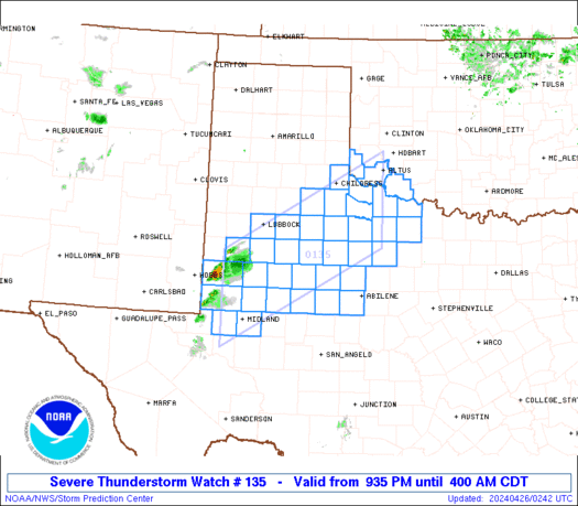
TORNADO WATCH NUMBER 135
NWS STORM PREDICTION CENTER NORMAN OK
300 PM EDT WED MAR 19 2008
THE NWS STORM PREDICTION CENTER HAS ISSUED A
TORNADO WATCH FOR PORTIONS OF
PARTS OF SOUTHEAST KENTUCKY
PARTS OF MIDDLE AND EASTERN TENNESSEE
SMALL PART OF FAR WESTERN VIRGINIA
EFFECTIVE THIS WEDNESDAY AFTERNOON AND EVENING FROM 300 PM UNTIL
900 PM EDT.
TORNADOES...HAIL TO 1.5 INCHES IN DIAMETER...THUNDERSTORM WIND
GUSTS TO 70 MPH...AND DANGEROUS LIGHTNING ARE POSSIBLE IN THESE
AREAS.
THE TORNADO WATCH AREA IS APPROXIMATELY ALONG AND 55 STATUTE
MILES EAST AND WEST OF A LINE FROM 30 MILES EAST NORTHEAST OF
JACKSON KENTUCKY TO 50 MILES WEST OF CHATTANOOGA TENNESSEE. FOR
A COMPLETE DEPICTION OF THE WATCH SEE THE ASSOCIATED WATCH
OUTLINE UPDATE (WOUS64 KWNS WOU5).
REMEMBER...A TORNADO WATCH MEANS CONDITIONS ARE FAVORABLE FOR
TORNADOES AND SEVERE THUNDERSTORMS IN AND CLOSE TO THE WATCH
AREA. PERSONS IN THESE AREAS SHOULD BE ON THE LOOKOUT FOR
THREATENING WEATHER CONDITIONS AND LISTEN FOR LATER STATEMENTS
AND POSSIBLE WARNINGS.
DISCUSSION...VERY STRONG JET MAX TRANSLATING ACROSS WATCH AREA ALONG
WITH DEVELOPING SURFACE LOW. LOW TOPPED THUNDERSTORMS ARE
DEVELOPING ALONG/AHEAD OF COLD FRONT AND WITH SHEAR SUPERCELLS ARE
POSSIBLE. IN ADDITION TO DAMAGING WINDS TORNADOES WILL BE POSSIBLE
WITH SUPERCELLS.
0 likes
-
MiamiensisWx
Re: Next big severe outbreak starts Monday?
simplykristi wrote:It might have been a bust as far as severe weather (damaging wind, hail, and tornadoes) goes but lots of places in OK, AR, northern TX, and southern MO received a lot of rain. Flooding is just as much of a danger as tornadoes. People don't view flooding in the same way that they view tornadoes. I rarely see any posts here about flooding events.
Kristi
Good point... I learned that lesson in 1994 when I drove through ~6"+ of flooding during Tropical Storm Gordon in Pompano Beach, Florida.
0 likes
- MGC
- S2K Supporter

- Posts: 5940
- Joined: Sun Mar 23, 2003 9:05 pm
- Location: Pass Christian MS, or what is left.
Re: Next big severe outbreak starts Monday?
EF1 tornado reported in Marrero La this morning. Here along the MGC, it rained hard for a short period this morning....MGC
0 likes
Return to “USA & Caribbean Weather”
Who is online
Users browsing this forum: Ntxw, Stratton23 and 144 guests


