I have seen tropical cyclones regenerate or strengthen over land but not hundreds of miles inland. Danny in 1997 regrouped over the NC coastal plain and became a TS again and the next year TS Bonnie became a hurricane again over northeast NC. It should be noted that in both these cases at least part of the circulation was over water. And much of eastern NC is either inland sounds(Albermarle and Pamlico) or swamp.
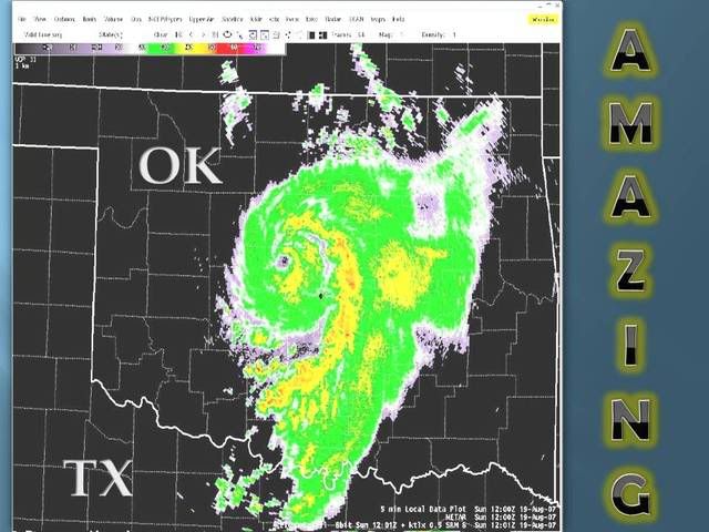
Im leaning toward Erin being an MCS over Oklahoma. It was a remnant low with enough convergence left to cause some convection. It then interacted with an upper trough and exploded. It didnt explode because it moved over warm water and under a massive ridge..as a tropical cyclone might. It exploded because it interacted with an upper feature. Not a tropical system and probably not a subtropical system either IMHO.
In short the synergic effect of the upper system and the remnant low created a monster. In my opinion it would be more proper to call this an MCS rather than a tropical or subtropical cyclone even though the remnants of a TC contributed to this event.
Although the "NC Tornadocane of 1999" did not originate from a dying TC there are a few similarities. It "looked" like a TC but certainly wasnt. And it produced a wind gust of 165 mph(possibly tornadic)
http://www.spc.noaa.gov/coolimg/nc_storm/index.htmlCheck it out